Jiangsu Province
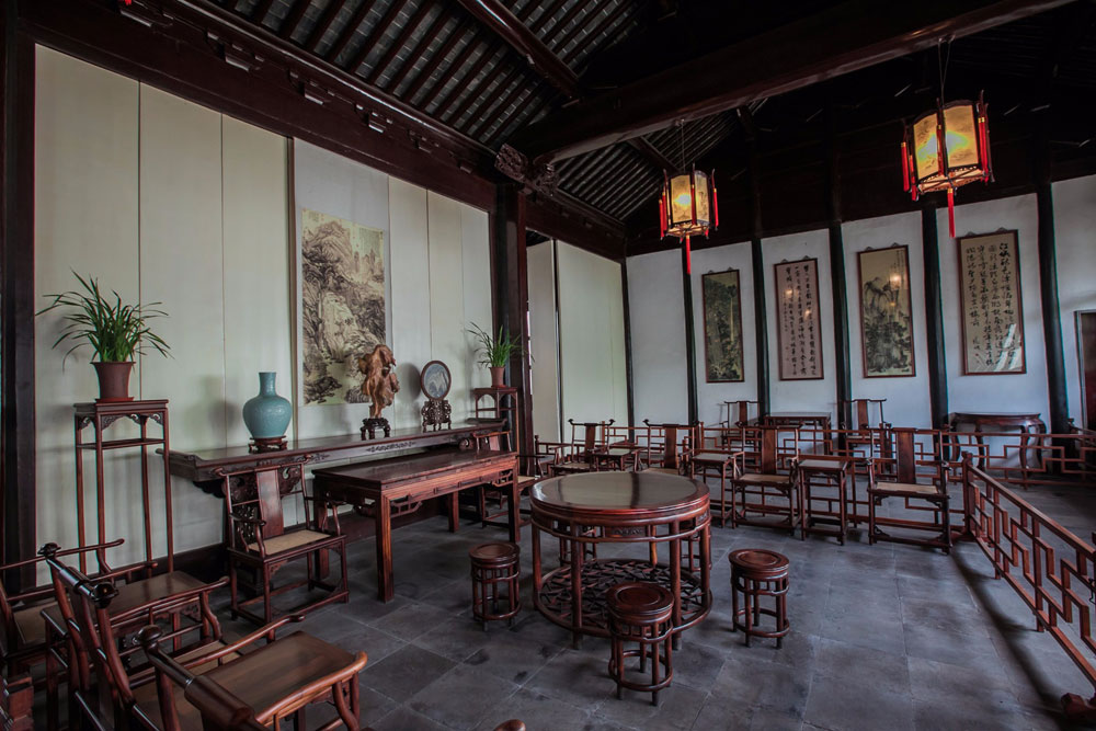
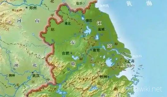
Jiangsu, referred to as "the Soviet Union", is the provincial administrative region of the people's Republic of China. The capital of Nanjing is located in the eastern coastal area of the Chinese mainland. The Jiangsu circle is 30 degrees 45'-35 degrees 20'at the north latitude, 116 degrees 18'-121 degrees east 57', east to the Yellow Sea, southeast to Zhejiang and Shanghai, and west to Anhui and Jiangsu to cross Jiang Binhai, with numerous lakes, flat terrain, You Ping, water, low mountains and hills, and two major rivers across the Yangtze River and Huaihe. Jiangsu Province is an East Asian monsoon climate zone, which is located in the transition zone of subtropical and warm temperate zone. The climate has the characteristics of the South and the north.
Jiangsu is located in the Yangtze River economic belt, under the jurisdiction of 13 districts and cities, all of which enter the top 100, and is the only province where all prefecture level cities are among the top 100. Jiangsu Province has ranked first in China in terms of per capita GDP, comprehensive competitiveness, regional development and people's livelihood index (DLI), which has become the highest level of comprehensive development in China, and has entered the level of "top-notch" developed countries.
Jiangsu Province ranks first in China in comprehensive economic competitiveness, and is one of the most active provinces in China. The Yangtze River Delta city group, which is composed of Shanghai, Zhejiang and Anhui, has become one of the six world-class urban groups in the world.
Jiangsu Province has a total area of 107200 square kilometers, which has 13 prefecture level cities, 55 municipal districts, 22 county-level cities, 19 counties, and 96 County divisions in total. 496 streets, 719 towns, 43 townships and 1 Ethnic Township, totaling 1259 township level divisions. By the end of 2018, Jiangsu Province has a permanent population of 80.507 million, with a GDP of 92.59.54 billion yuan and a per capita GDP of RMB 115000
Historical evolution
In the Xia, Shang and Wednesday dynasties, the northern part of Jiangsu was Dongyi, Huaiyi and the southern part of Jiangsu was Qiwu. Xia Dynasty belongs to Xuzhou and Yangzhou in Jiuzhou. From the late Shang Dynasty to the Western Zhou Dynasty, there were two kingdoms, Xu and Wu.
During the spring and Autumn period (770-476 years ago), it was divided into Qi, Lu, song, Wu, Chu and other countries.
In Qin Dynasty, county system was implemented, and Huiji county was in the south of the Yangtze River, and Donghai County and Sishui County in the north.
In the early Western Han Dynasty, the counties and states were parallel. Jiangsu Province was successively divided into Chu, Jing, Wu, Guangling, Sishui and other countries, including Huiji, Danyang, Donghai, linhuai, Langxie and Pei. In the fifth year of Yonghe in the Eastern Han Dynasty (140 years), the province is Yangzhou to the south of the Yangtze River and Xuzhou to the north.
During the three kingdoms' establishment, they were divided into two countries: Sun Wu and Caowei.
In the early days of the founding of the Western Jin Dynasty, Jiangnan was again Yangzhou and the north of the river was Xuzhou. In the Eastern Jin and the northern and Southern Dynasties, Jiangsu Province generally took Huaihe River as the boundary, and the South was the South and the North was north. From Yongjia period of emperor Wei to Yuan Jia period of Song Dynasty (307-453), the immigrants moved to the south, among which Jiangsu Province was the most accepting immigrants, and the most concentrated in Nanjing, Zhenjiang and Changzhou. The northern Jiangsu area was mainly Yangzhou, Huaiyin and other places. Sun Wu, Dongjin and Southern Dynasties of song, Qi, Liang, Chen Junding were all in Nanjing.
After Sui unified China, Suzhou, Changzhou, Jiangzhou (now Nanjing), Runzhou (Zhenjiang), Yangzhou, Fangzhou (now Liuhe District), Chu state (present Huai'an District), Pizhou, Sizhou, Haizhou and Xuzhou were divided into three parts.
Tang Dynasty is divided into ten roads in China, Jiangsu is divided into Henan Road, Huainan road and Jiangnan East Road.
In the Five Dynasties (907-960), Xuzhou in the north of Huaibei was successively Liang, Tang, Jin, Han and Zhou. Suzhou in the south of the Yangtze River belonged to Wu Yue Qian family, and other states were Yang Wu and Southern Tang.
In the first year of the Northern Song Dynasty (1111), it was divided into Jiangnan East Road, Liangzhe Road, Huainan East Road, Jingdong East Road and Jingdong West Road. Song Dynasty room south, Song Jin confrontation, Jin people have Huaibei, Southern Song Dynasty according to South and Huainan.
In Yuan Dynasty, Jiangsu Province was divided into two provinces: Jiangsu Province and Henan Province.
After the chaos of Jingkang, from the first year of Jingkang to Shaoxing 11 years (1126-1141), the number of people moving south to this stage was the largest, which was only ten years. The number of people living in the northwest was full. In the 11th year of Shaoxing (1141), the peace reached. The peace agreement stipulated that the Southern Song Dynasty should not accept the "fugitives" of the Jin Dynasty. The wave of south migration began to subside.
In the early Ming Dynasty, the capital of Tianfu (Nanjing) was designated as Nanjing and Beijing teacher. After the emperor of Ming Dynasty moved to Beijing, it was renamed Nanjing. It was generally under the jurisdiction of Jiangsu, Anhui and Shanghai. Compared with the northern Zhili, Nanjing was called nanzhili, which was the capital of Ming Dynasty. Nanjing should be governed by Tianfu in Jiangning and Shangyuan (the main city of Nanjing today). Jurisdiction: Jiangning (the county is in the southeast of Nanjing main city), Shangyuan (the county governs in the northwest of the main city of Nanjing), Jurong (the county governs Jurong City in Jiangsu Province), Lishui (the county governs Lishui District of Nanjing City in Jiangsu Province), Gaochun (the county governs Gaochun District of Nanjing City in Jiangsu Province), Jiangpu (the county governs in Pukou District of Nanjing city of Jiangsu Province), Liuhe (the county governs in Nanjing city of Jiangsu Province today) Liuhe District), Liyang (the county governs in Liyang City, Jiangsu Province) has 8 counties.
In the 13th year of Hongwu in Ming Dynasty (1386), the Suzhou government was under the jurisdiction of six departments of nanzhili (Nanjing). In the 19th year of Yongle in Ming Dynasty (1421), the capital of Beijing was moved to Beijing. Suzhou government was under the jurisdiction of six parts of Nanjing (South Zhili for short). Wu and Changzhou counties were under the jurisdiction of Suzhou government.
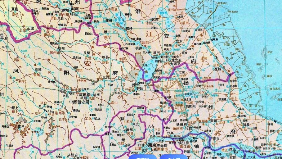
In the early Qing Dynasty, Nanming was destroyed and Nanjing was abandoned. The southern province was set up in the original area under Nanjing. In 1667, Kangxi was divided into two provinces: Jiangsu (including Shanghai today) and Anhui Province. Jiangning government (now Nanjing), Suzhou government, Xuzhou government, Changzhou government, Zhenjiang government, Songjiang mansion (now Shanghai), Yangzhou government and Huai'an government were under the jurisdiction of Jiangsu Province (governor of the governor of Jiangsu Province in Suzhou), and the Governor General of Jiangsu Province was stationed in Suzhou. This is the beginning of Jiangsu Province construction, and the name of "Jiangsu" is named after Jiangning and Suzhou, which is referred to as "Su".
By the end of Qing Dynasty, Jiangsu Province had 8 governments, 3 Zhili Prefecture and 1 Zhili hall. During the period, the Taiping Heavenly Kingdom established Nanjing, the capital of Nanjing from the third year of Xianfeng to the three years of tongzhi (1853-1864), and briefly set up Tianjing Province, Tianpu province and Sufu Province in the territory. In 1904, Guangxu was removed from Jianghuai Province in the following three decades, which was located in Jiangning, Huai'an, Yangzhou, Xuzhou, Tongzhou and Haizhou.
In the first year of the Republic of China (1912), the provisional government of the Republic of China was established in Nanjing.
In the 16th year of the Republic of China (1927), the national government established Nanjing, and Jiangning County of Jiangsu Province established Nanjing special city, Shanghai county and Baoshan County of Jiangsu Province. It was divided into Jiangsu Province, and was directly subordinate to the administrative yuan of the national government, which was called the city under the jurisdiction of the yuan.
From the 17th year of the Republic of China (1928) to 1949, Zhenjiang became the capital of Jiangsu Province.
In the twenty second year of the Republic of China (1933), an administrative supervision area was established. The system of Jiangsu province continued until the Republic of China.
On April 23, 1949, the PLA crossed the Yangtze River and liberated Nanjing. In June 1949, Jiangsu was liberated, with three provincial administrative regions, namely, Northern Jiangsu, Southern Jiangsu provincial government and Nanjing Municipality.
In 1952, in order to better control Hongze Lake, Xuyi county and Sihong County in Anhui were assigned to Jiangsu Province, and in exchange, Xiao county and Dangshan County were assigned to Anhui Province.
In January 1953, the northern Jiangsu, Southern Jiangsu provincial and Nanjing municipalities merged, and Nanjing was reduced to a provincial city, and the capital of the province was located in Nanjing. Jiangsu Province has six provinces (Nanjing, Wuxi, Xuzhou, Changzhou, Suzhou, Nantong), 8 special districts (Xuzhou, Huaiyin, Yancheng, Yangzhou, Zhenjiang, Suzhou, Songjiang and Nantong), 69 counties and 6 county-level cities.
From March 1958 to January 1959, the former nine counties of Songjiang special area in Jiangsu Province (Shanghai, Jiading, Baoshan, Songjiang, Jinshan, Chuansha, Nanhui, Fengxian and Qingpu 9 counties) and Chongming County of Nantong special area were successively under the jurisdiction of Shanghai, and the Songjiang special area was revoked. Shanghai has since expanded by 10 times.
In 1983, Jiangsu implemented the system of city management and county management, and established 11 prefecture level cities, including Nanjing, Wuxi, Xuzhou, Changzhou, Suzhou, Nantong, Lianyungang, Huaiyin, Yancheng, Yangzhou and Zhenjiang.
In 1996, Yangzhou and Taizhou were divided into three cities, Taizhou city at county level and Taizhou city at prefecture level; Huaiyin (now Huai'an) and Suqian were divided, and Suqian City was removed from county level and Suqian City at prefecture level.
In 2001, Huaiyin City was renamed Huai'an City.
administrative division
As of may2018, Jiangsu Province has 13 prefecture level cities, 22 county-level cities, 19 counties, 55 municipal districts and 767 towns. Among them, there are three pilot provinces (counties) directly under the jurisdiction of Kunshan, Taixing and Shuyang.
geographical environment
Jiangsu is located in the central part of the eastern coastal area of Chinese mainland, the Yangtze River, the lower reaches of Huaihe, the east border of the Yellow Sea, the north to Shandong, the west to Anhui, the southeast to Shanghai and Zhejiang, and is an important part of the Yangtze River Delta region. The earth span is 116 ° 18 ′~ 121 ° 57 ′ east longitude, and 30 ° 45 ′ to 35 ° 20 'north latitude. The land area is 107200 square kilometers, accounting for 1.12% of the total land area in China. Longhua formation, Zhiguang village, Zhoushan Town, Gaoyou city is determined as the geographical and geometric center of Jiangsu Province. The sea area is 37500 square kilometers, with 26 islands in total.
topographic features
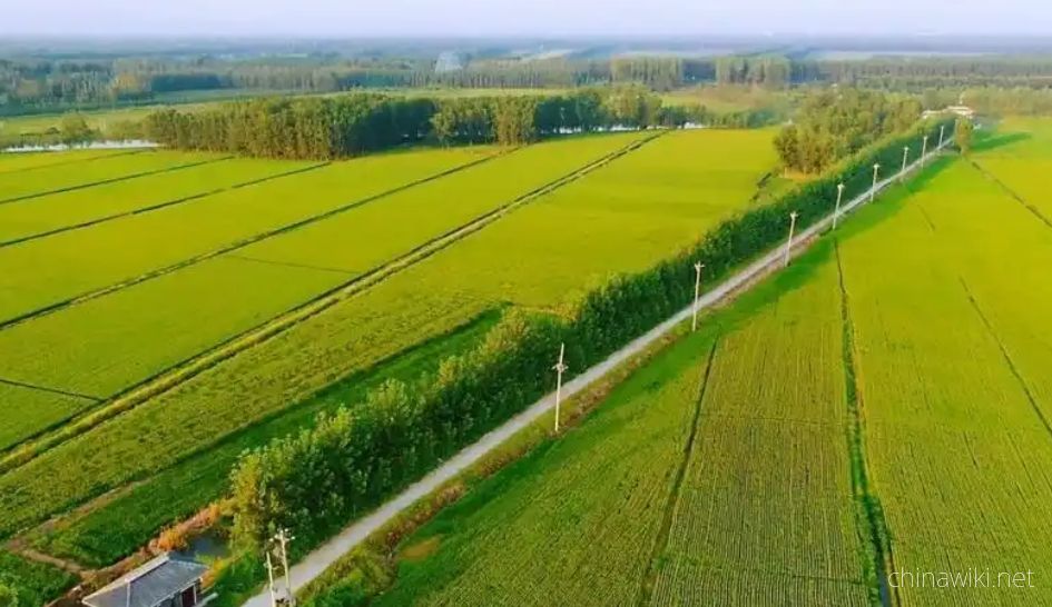
Jiangsu is mainly composed of plain, 103229.17 square kilometers of land area, of which, the plain area accounts for 86.89%, reaches 89706.03 square kilometers, hilly area is 11916.16 square kilometers, and mountainous area is 1606.98 square kilometers, ranking the first in China, mainly composed of the plain of Jiangsu beipingyuan, Huanghuai Plain, Jianghuai plain, coastal plain and Yangtze River delta plain.
Jiangsu is the lowest Province in China. Most of the areas are below 50m in altitude, and the low hills are concentrated in the southwest, accounting for 14.3% of the total area of Jiangsu Province. The main areas are Laoshan Mountain, Yuntai Mountain, Ningzhen mountain range, Maoshan mountain range and Yili mountain range. Yuntai Mountain Yunv peak is the highest peak in Jiangsu Province, with an altitude of 625 meters.
Historical evolution
-
Jiangsu Province in the Pre Qin Period
Archaeological discoveries indicate that humans existed on the land of Jiangsu as early as the Paleolithic era, and cultural sites from the New Era have also been discovered in various parts of Jiangsu. During the Xia, Shang, and Zhou dynasties, the Jiang
Time 2024-12-28 11:00:26
-
Jiangsu Province during the Qin and Han Dynasties to the Southern and Northern Dynasties
After Emperor Qin Shi Huang unified China, the system of prefectures and counties was implemented. During the Qin Dynasty, the northern part of Jiangsu Province was divided into Sishui County, Donghai County, and Langye County, while the southern part of
Time 2024-12-28 11:00:54
-
Jiangsu Province during the Sui, Tang, Song, and Yuan Dynasties
In 581 AD, Emperor Wen of Sui unified China, with the northern part of Jiangsu roughly belonging to Xuzhou and the area south of the Huai River roughly belonging to Yangzhou. In 618 AD, the Li Tang Dynasty was established. During the Tang Dynasty, Jiangsu
Time 2024-12-28 11:01:10
-
Jiangsu Province during the Ming and Qing Dynasties
In 1368, Zhu Yuanzhang established a political power in Yingtian (now Nanjing) as the capital city. Later, Yingtian changed its name to Nanjing and then to Jingshi, also known as Zhili. After Ming Chengzu established the name Yongle, he moved the capital
Time 2024-12-28 11:01:23
-
Jiangsu Province during the Republic of China period
In 1912, the Republic of China established a provisional government in Nanjing, with Sun Yat sen serving as the interim president. In April of the same year, Yuan Shikai usurped the fruits of the revolution, and Jiangsu fell into the sphere of influence o
Time 2024-12-28 11:01:39
-
After the establishment of the People's Republic of China
In June 1949, the entire Jiangsu province was liberated. The territory is divided into three provincial-level administrative regions: northern Jiangsu, southern Jiangsu Administrative District, and Nanjing City. In January 1953, three provincial-level adm
Time 2024-12-28 11:01:52
physical geography
-
Location and territory of Jiangsu Province
Jiangsu Province is located in the middle of the eastern coastal area of Chinese Mainland, at the lower reaches of the Yangtze River and Huaihe River, bordering the Yellow Sea to the east, Shandong to the north, Anhui to the west, and Shanghai and Zhejian
Time 2024-12-28 13:52:22
-
Climate situation in Jiangsu Province
Jiangsu belongs to a transitional climate from temperate to subtropical, with the Huai River and the main irrigation canal in northern Jiangsu as the boundary. To the north, it belongs to a warm temperate humid and semi humid monsoon climate, while to the
Time 2024-12-28 13:52:41
-
Geological conditions of Jiangsu Province
Jiangsu Province is located in the North China plate, the eastern section of the Qinling Dabie orogenic belt, and the Yangtze plate, which cross the Chinese Mainland. The regional geological background and tectono magmatic activity are obviously different
Time 2024-12-28 13:52:54
-
The topography and geomorphology of Jiangsu Province
The terrain of Jiangsu Province is mainly plain, with a land area of 103229.17 square kilometers. Among them, the plain area accounts for 86.89%, reaching 89706.03 square kilometers, the hilly area is 11916.16 square kilometers, and the mountainous area i
Time 2024-12-28 13:53:09
-
Hydrological and Water Conservancy Situation in Jiangsu Province
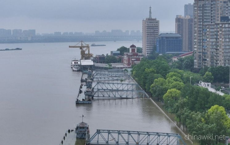
Jiangsu Province spans across rivers and coasts, with numerous lakes and a dense water network, adjacent to land and sea. It is the only province in China with large rivers, lakes, and seas. The Yangtze River spans 433 kilometers from east to west, and th
Time 2024-12-28 13:55:27
-
Soil conditions in Jiangsu Province
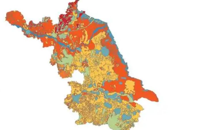
The natural factors such as climate, geological landforms, parent materials, and vegetation that contribute to the formation of soil in Jiangsu are relatively complex. Soil resources are abundant and diverse, with zonal soils mainly distributed in mountai
Time 2024-12-28 13:55:43
natural resources
-
Water Resources Situation in Jiangsu Province
Jiangsu has abundant water resources, with annual runoff depth ranging from 150-400 millimeters during rainfall. Deep Quaternary loose deposits are widely distributed in the plain areas of Jiangsu Province, with abundant groundwater sources. The total
Time 2024-12-29 17:48:00
-
Land Resources in Jiangsu Province
In December 2021, the main data bulletin of the third national land survey in Jiangsu Province showed that there were 61.4839 million mu of arable land in the province, including 42.5758 million mu of paddy fields, accounting for 69.25%; 11.2311 million a
Time 2024-12-29 17:48:37
-
Forest Resources in Jiangsu Province
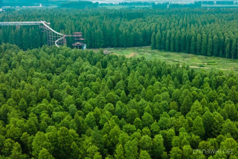
In 2017, the forest area in Jiangsu Province was 1.56 million hectares, with a forest coverage rate of 22.9% and a total standing timber volume of 96.09 million cubic meters. There are 6 national forest cities (Wuxi, Yangzhou, Xuzhou, Nanjing, Zhenjiang,
Time 2024-12-29 17:48:56
-
Wetland Resources in Jiangsu Province
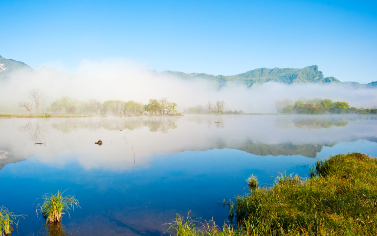
In 2017, Jiangsu Province had 2 internationally important wetlands, 5 nationally important wetlands, and 64 wetland parks at or above the provincial level, including 26 national wetland parks and pilot projects, and 38 provincial-level wetland parks
Time 2024-12-29 17:49:13
-
The situation of marine resources in Jiangsu Province
The Jiangsu sea area is located in the central northern part of China's sea area, at the center of the western Pacific coast, facing South Korea and Japan across the sea. It has a superior geographical location and an important strategic position, with a
Time 2024-12-29 17:50:42
-
Port resource situation in Jiangsu
As of the end of 2021, Jiangsu Province had 5909 productive port berths and 529 berths of over 10000 tons. The comprehensive annual throughput capacity of ports reached 2.38 billion tons, and multiple indicators such as port cargo throughput capacity and
Time 2024-12-29 17:51:02
-
Biodiversity situation in Jiangsu
On April 30, 2019, the official website of the Department of Agriculture and Rural Affairs of Jiangsu Province announced that Jiangsu Province has abundant plant resources, with over 2200 species belonging to 672 genera in 157 families of seed plants, ove
Time 2024-12-29 17:51:42
-
The situation of natural disasters in Jiangsu
Jiangsu Province has a wide range of meteorological disasters and their impact, making it one of the provinces in China where meteorological disasters occur more frequently. The main meteorological disasters include rainstorm, severe convection, flood, th
Time 2024-12-29 17:52:03
administrative division
Jiangsu Province
Jiangsu
-
SiChuan
Sichuan, or Sichuan for short, is one of China's 23 provinces, the capital of Chengdu. It is located in the interior of Southwest China, between 26 ° 03 ′ - 34 ° 19 ′, 97 ° 21 ′ - 108 ° 12 ′ e, Chongq
Views: 1078 Time 2019-12-14 -
Jiangsu Province
Jiangsu, referred to as "Su", is the provincial administrative region of the people's Republic of China. Nanjing, the capital of the province, is located in the eastern coastal area of the m
Views: 1107 Time 2019-12-16 -
Anhui
Anhui, abbreviated as "Anhui", is a provincial administrative region of the people's Republic of China. Hefei, the capital of the province. Located in East China, Anhui is bounded by 114 ° 5
Views: 391 Time 2019-12-16 -
Hubei
Hubei Province, referred to as "e", is the provincial administrative region of the people's Republic of China and the capital of Wuhan. It is located in the central region of China, adjacent
Views: 1343 Time 2019-12-16 -
Hunan
Hunan Province, referred to as Hunan, is one of the 23 provinces in China, the capital of Changsha. It is bounded between 24 ° 38 ′ - 30 ° 08 ′ n, 108 ° 47 ′ - 114 ° 15 ′ e, Jiangxi in the East
Views: 310 Time 2019-12-16 -
Guizhou
Guizhou, referred to as "Guizhou" or "Gui", is the provincial administrative region of the people's Republic of China. Guiyang, the provincial capital, is located in the hinterland
Views: 210 Time 2019-12-16 -
Yunnan
Yunnan Province, or Yunnan for short, is one of the 23 provinces in China. It is located in the southwest and the capital of Kunming. It is bounded between 21 ° 8 ′ - 29 ° 15 ′ N and 97 ° 31 ′ - 106 °
Views: 329 Time 2019-12-16 -
Tibet
Tibet, or "Tibet" for short. Lhasa, the capital of Tibet Autonomous Region, is located in the southwest border of the people's Republic of China. It is one of the five ethnic autonomous regi
Views: 237 Time 2019-12-16 -
Shaanxi
Shaanxi, referred to as "Shaanxi" or "Qin", is the provincial administrative region of the people's Republic of China and the capital of Xi'an. It is located in the hinterland of C
Views: 343 Time 2019-12-16 -
Qinghai
Qinghai Province, referred to as "Qing", is the provincial administrative region of the people's Republic of China and the capital of Xining. Located in the northwest of China, Qinghai is bo
Views: 213 Time 2019-12-16 -
Gansu
Gansu, referred to as "Gan" or "long", is a provincial administrative region of the people's Republic of China and the provincial capital Lanzhou city. It is located in Northwest China, connecting Shaanxi in the East, Xinjiang in the w
Views: 287 Time 2019-12-16 -
Xinjiang
Xinjiang Uygur Autonomous Region, referred to as "new", has its capital, Urumqi, located in Northwest China. It is one of China's five ethnic minority autonomous regions. With an area of 1664900 square kilometers, it is the largest provincial ad
Views: 540 Time 2019-12-16


