Water Resources Situation in Jiangsu Province
jiangsu has abundant water resources, with annual runoff depth ranging from 150-400 millimeters during rainfall. Deep Quaternary loose deposits are widely distributed in the plain areas of jiangsu Province, with abundant groundwater sources. The total groundwater resources in the province are 14.24 billion cubic meters, including 13.44 billion cubic meters in plain areas, 1.31 billion cubic meters in hilly areas, and 510 million cubic meters in double counting. jiangsu has numerous rivers and lakes with complex water systems. The local water resources amount to 32.1 billion cubic meters, and the average annual transit water volume is 949.2 billion cubic meters, of which the Yangtze River runoff accounts for more than 95%

Water Resources Situation in Jiangsu Province
-

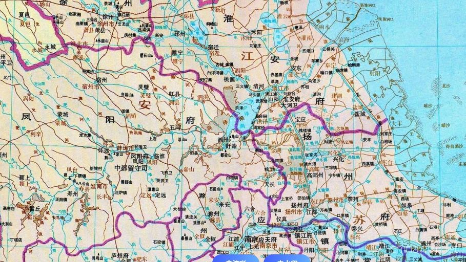
Jiangsu Province during the Qin and Han Dynasties to the Southern and Northern Dynasties
After Emperor Qin Shi Huang unified China, the system of prefectures and counties was implemented. During the Qin Dynasty, the northern part of Jiangsu Province was divided into Sishui County, Donghai County, and Langye County, while the southern part of
Views: 10 Time 2024-12-28 -

Jiangsu Province during the Sui, Tang, Song, and Yuan Dynasties
In 581 AD, Emperor Wen of Sui unified China, with the northern part of Jiangsu roughly belonging to Xuzhou and the area south of the Huai River roughly belonging to Yangzhou. In 618 AD, the Li Tang Dynasty was established. During the Tang Dynasty, Jiangsu
Views: 15 Time 2024-12-28 -
Jiangsu Province during the Ming and Qing Dynasties
In 1368, Zhu Yuanzhang established a political power in Yingtian (now Nanjing) as the capital city. Later, Yingtian changed its name to Nanjing and then to Jingshi, also known as Zhili. After Ming Chengzu established the name Yongle, he moved the capital
Views: 19 Time 2024-12-28 -

Jiangsu Province during the Republic of China period
In 1912, the Republic of China established a provisional government in Nanjing, with Sun Yat sen serving as the interim president. In April of the same year, Yuan Shikai usurped the fruits of the revolution, and Jiangsu fell into the sphere of influence o
Views: 9 Time 2024-12-28 -

Jiangsu Province after the establishment of the People's Republic of China
In June 1949, the entire Jiangsu province was liberated. The territory is divided into three provincial-level administrative regions: northern Jiangsu, southern Jiangsu Administrative District, and Nanjing City. In January 1953, three provincial-level adm
Views: 9 Time 2024-12-28 -

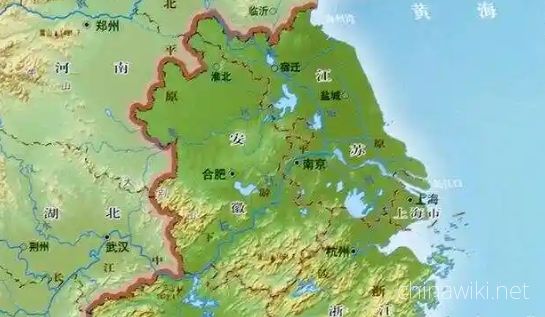
Location and territory of Jiangsu Province
Jiangsu Province is located in the middle of the eastern coastal area of Chinese Mainland, at the lower reaches of the Yangtze River and Huaihe River, bordering the Yellow Sea to the east, Shandong to the north, Anhui to the west, and Shanghai and Zhejian
Views: 13 Time 2024-12-28 -

Climate situation in Jiangsu Province
Jiangsu belongs to a transitional climate from temperate to subtropical, with the Huai River and the main irrigation canal in northern Jiangsu as the boundary. To the north, it belongs to a warm temperate humid and semi humid monsoon climate, while to the
Views: 18 Time 2024-12-28 -
Geological conditions of Jiangsu Province
Jiangsu Province is located in the North China plate, the eastern section of the Qinling Dabie orogenic belt, and the Yangtze plate, which cross the Chinese Mainland. The regional geological background and tectono magmatic activity are obviously different
Views: 11 Time 2024-12-28 -

The topography and geomorphology of Jiangsu Province
The terrain of Jiangsu Province is mainly plain, with a land area of 103229.17 square kilometers. Among them, the plain area accounts for 86.89%, reaching 89706.03 square kilometers, the hilly area is 11916.16 square kilometers, and the mountainous area i
Views: 11 Time 2024-12-28 -
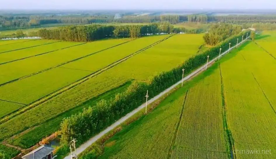
Land Resources in Jiangsu Province
In December 2021, the main data bulletin of the third national land survey in Jiangsu Province showed that there were 61.4839 million mu of arable land in the province, including 42.5758 million mu of paddy fields, accounting for 69.25%; 11.2311 million a
Views: 132 Time 2024-12-29 -

Wetland Resources in Jiangsu Province
In 2017, Jiangsu Province had 2 internationally important wetlands, 5 nationally important wetlands, and 64 wetland parks at or above the provincial level, including 26 national wetland parks and pilot projects, and 38 provincial-level wetland parks
Views: 139 Time 2024-12-29 -

The situation of natural disasters in Jiangsu
Jiangsu Province has a wide range of meteorological disasters and their impact, making it one of the provinces in China where meteorological disasters occur more frequently. The main meteorological disasters include rainstorm, severe convection, flood, th
Views: 108 Time 2024-12-29