Climate situation in Jiangsu Province
Climate type
jiangsu belongs to a transitional climate from temperate to subtropical, with the Huai River and the main irrigation canal in northern jiangsu as the boundary. To the north, it belongs to a warm temperate humid and semi humid monsoon climate, while to the south, it belongs to a subtropical humid monsoon climate.. jiangsu has a coastline of over 1000 kilometers, and the ocean has a significant impact on the climate of jiangsu. Under the comprehensive influence of solar radiation, atmospheric circulation, and the specific geographical location and geomorphic features of jiangsu, the basic climate characteristics of jiangsu are: mild climate, distinct four seasons, significant monsoon, cold winter and hot summer, variable spring temperature, high autumn air, rainy and hot seasons, abundant rainfall, concentrated precipitation, significant plum rain, and abundant light and heat
Seasonal division
jiangsu Province is affected by the monsoon, with shorter spring and autumn, longer winter and summer, and significant temperature differences between the north and south. The average start time of spring is March 31st, with an average length of about 68 days; The average start time of summer is June 7th, with an average length of 104 days; The average start time of autumn is September 19th, with an average length of 61 days; The average start time of winter is November 19th, with an average length of 134 days. There is a significant difference in the start and end time of seasons between the northern and southern parts of jiangsu, with a difference of about a week between the Huaibei and Sunan regions
Temperature
The annual average temperature in jiangsu Province ranges from 13.6 to 16.1 ℃, with a decreasing distribution from south to north. The highest annual average temperature in the province occurs in Dongshan in the south, and the lowest occurs in Ganyu in the north.. The average winter temperature in the province is 3.0 ℃, and the extreme lowest temperature in various regions usually occurs in January or February of this winter, with an extreme lowest temperature of -23.4 ℃ (Suqian, February 5, 1969); The average summer temperature in the province is 25.9 ℃, and the extreme maximum temperature in various regions usually occurs in July or August of this summer, with an extreme maximum temperature of 41.0 ℃ (Sihong, July 9, 1988); The average temperature in spring in the province is 14.9 ℃; The average temperature in autumn is 16.4 ℃, and the climate in spring and autumn is relatively mild
In 2023, the average temperature in jiangsu Province was 16.6 ℃, which was 0.9 ℃ higher than the same period in previous years (1991-2020) and the third highest since 1961, after 2021 (16.8 ℃) and 2022 (16.7 ℃). The average temperature in the Huaibei region (15.9 ℃) is the highest in history (in 2022, 15.9 ℃), while the Jianghuai region (16.5 ℃) and the southern jiangsu region (17.5 ℃) are the third highest since 1961
Precipitation
The annual precipitation in jiangsu Province is 704-1250mm, with less than 1000mm in the central Jianghuai region to the north of Hongze Lake, and over 1000mm in the southern region. The distribution of precipitation is more in the south than in the north, and more in the coastal areas than inland areas.. The area with the highest annual precipitation is in the Yili Mountain area in the southernmost part of jiangsu Province, while the area with the lowest annual precipitation is in Feng County in the northwest. The maximum annual precipitation of a single station occurred in Xinghua in 1991 at 2080.8mm, and the minimum annual precipitation occurred in Feng County in 1988 at 352.0mm. Compared with regions at the same latitude, jiangsu Province has abundant rainfall, little difference between the north and south, and small interannual variation
The seasonal distribution characteristics of annual precipitation in jiangsu Province are obvious, with summer precipitation being concentrated, accounting for almost half of the annual precipitation, winter precipitation being the least, accounting for about one tenth of the annual precipitation, and spring and autumn precipitation each accounting for about 20% of the annual precipitation.. During the summer months of June and July, influenced by the East Asian monsoon, the area south of the Huai River enters the rainy season, with an average annual precipitation of around 250mm in most regions; Generally, about a week after the beginning of the Jianghuai Meiyu, the Huaibei area in jiangsu Province enters the "Huaibei Rainy Season", which is a time when rainstorm frequently occurs and heavy rainfall is concentrated in jiangsu Province
In 2022, the annual precipitation in jiangsu Province was 813.3mm, equivalent to a total precipitation of 83.48 billion m ³. The precipitation is 31.7% less than in 2021 and 19.2% less than the annual average, indicating a dry year. Divided by basin, the precipitation in the Huai River Basin is 739.1mm, which is 22.0% less than the annual average; The precipitation in the Yangtze River Basin is 916.9mm, which is 14.8% less than the annual average; The precipitation in the the Taihu Lake Lake basin is 956.4mm, 15.5% less than the annual average. Compared with 2021, the Huaihe River Basin, the Yangtze River Basin and the the Taihu Lake Lake Basin decreased by 37.6%, 20.1% and 23.7% respectively

Climate situation in Jiangsu Province
-

Jiangsu Province in the Pre Qin Period
Archaeological discoveries indicate that humans existed on the land of Jiangsu as early as the Paleolithic era, and cultural sites from the New Era have also been discovered in various parts of Jiangsu. During the Xia, Shang, and Zhou dynasties, the Jiang
Views: 13 Time 2024-12-28 -
Jiangsu Province during the Qin and Han Dynasties to the Southern and Northern Dynasties
After Emperor Qin Shi Huang unified China, the system of prefectures and counties was implemented. During the Qin Dynasty, the northern part of Jiangsu Province was divided into Sishui County, Donghai County, and Langye County, while the southern part of
Views: 9 Time 2024-12-28 -
Jiangsu Province during the Sui, Tang, Song, and Yuan Dynasties
In 581 AD, Emperor Wen of Sui unified China, with the northern part of Jiangsu roughly belonging to Xuzhou and the area south of the Huai River roughly belonging to Yangzhou. In 618 AD, the Li Tang Dynasty was established. During the Tang Dynasty, Jiangsu
Views: 11 Time 2024-12-28 -
Jiangsu Province during the Ming and Qing Dynasties
In 1368, Zhu Yuanzhang established a political power in Yingtian (now Nanjing) as the capital city. Later, Yingtian changed its name to Nanjing and then to Jingshi, also known as Zhili. After Ming Chengzu established the name Yongle, he moved the capital
Views: 11 Time 2024-12-28 -
Jiangsu Province during the Republic of China period
In 1912, the Republic of China established a provisional government in Nanjing, with Sun Yat sen serving as the interim president. In April of the same year, Yuan Shikai usurped the fruits of the revolution, and Jiangsu fell into the sphere of influence o
Views: 9 Time 2024-12-28 -
Jiangsu Province after the establishment of the People's Republic of China
In June 1949, the entire Jiangsu province was liberated. The territory is divided into three provincial-level administrative regions: northern Jiangsu, southern Jiangsu Administrative District, and Nanjing City. In January 1953, three provincial-level adm
Views: 8 Time 2024-12-28 -
Location and territory of Jiangsu Province
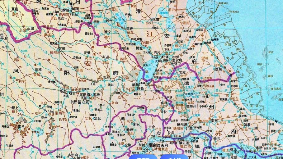
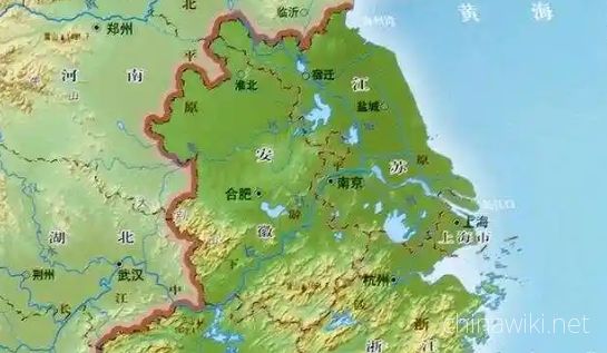
Jiangsu Province is located in the middle of the eastern coastal area of Chinese Mainland, at the lower reaches of the Yangtze River and Huaihe River, bordering the Yellow Sea to the east, Shandong to the north, Anhui to the west, and Shanghai and Zhejian
Views: 9 Time 2024-12-28 -
Climate situation in Jiangsu Province
Jiangsu belongs to a transitional climate from temperate to subtropical, with the Huai River and the main irrigation canal in northern Jiangsu as the boundary. To the north, it belongs to a warm temperate humid and semi humid monsoon climate, while to the
Views: 7 Time 2024-12-28 -
Geological conditions of Jiangsu Province
Jiangsu Province is located in the North China plate, the eastern section of the Qinling Dabie orogenic belt, and the Yangtze plate, which cross the Chinese Mainland. The regional geological background and tectono magmatic activity are obviously different
Views: 5 Time 2024-12-28 -
The topography and geomorphology of Jiangsu Province
The terrain of Jiangsu Province is mainly plain, with a land area of 103229.17 square kilometers. Among them, the plain area accounts for 86.89%, reaching 89706.03 square kilometers, the hilly area is 11916.16 square kilometers, and the mountainous area i
Views: 7 Time 2024-12-28 -
Hydrological and Water Conservancy Situation in Jiangsu Province
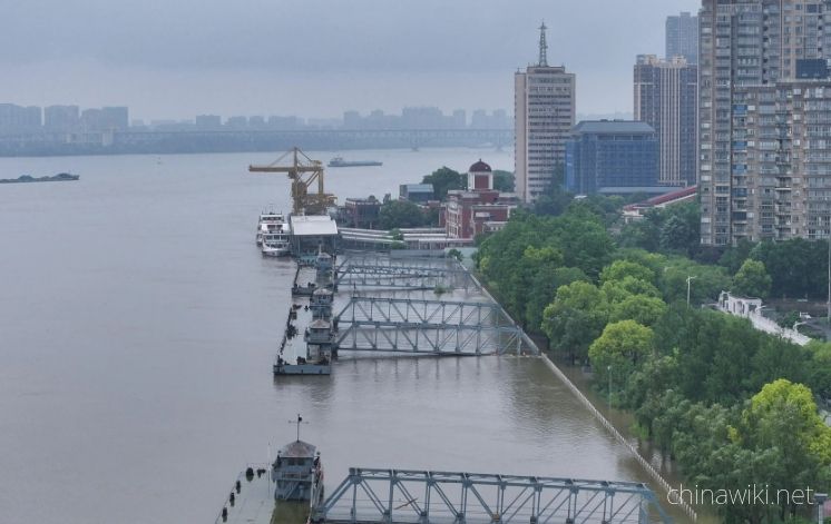
Jiangsu Province spans across rivers and coasts, with numerous lakes and a dense water network, adjacent to land and sea. It is the only province in China with large rivers, lakes, and seas. The Yangtze River spans 433 kilometers from east to west, and th
Views: 6 Time 2024-12-28 -
Soil conditions in Jiangsu Province
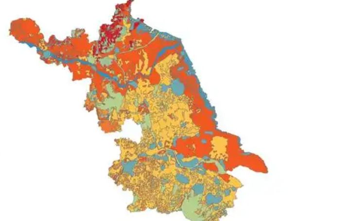
The natural factors such as climate, geological landforms, parent materials, and vegetation that contribute to the formation of soil in Jiangsu are relatively complex. Soil resources are abundant and diverse, with zonal soils mainly distributed in mountai
Views: 6 Time 2024-12-28