Hydrological and Water Conservancy Situation in Jiangsu Province
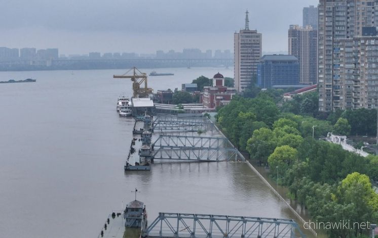
jiangsu Province spans across rivers and coasts, with numerous lakes and a dense water network, adjacent to land and sea. It is the only province in China with large rivers, lakes, and seas. The Yangtze River spans 433 kilometers from east to west, and the Grand Canal runs 718 kilometers from north to south. There are over 20000 rivers at or above the township level and more than 2000 rivers at the county level in the province, of which 723 are listed in the provincial backbone river list. jiangsu is located in the lower reaches of the Yangtze River, Huai River, Yishusi River Basin and the transitional zone between the north and south climates, with numerous rivers and lakes and a complex water system. Two of China's five largest freshwater lakes are located in jiangsu Province, and the Taihu Lake Lake is 2250 square kilometers, ranking third; Hongze Lake has an area of 2069 square kilometers, ranking fourth. In addition, there are more than 290 lakes of various sizes, including 12 lakes with an area of over 50 square kilometers. There are not only the Taihu Lake Lake, Hongze Lake, Gaoyou Lake, Luoma Lake, Baima Lake, Shijiu Lake, Weishan Lake and other large and medium-sized lakes in the territory, but also the Grand Canal, Huaishu River, Chuanchang River, Guanhe River, Yanhe River, Tongyu Canal, North jiangsu Irrigation Canal and Tongyang Canal and other tributaries. The canals are vertical and horizontal, and the water network is dense
As of May 2021, there are 952 registered reservoirs in jiangsu Province, with a total catchment area of 20900 square kilometers, accounting for about 20% of the province's total area. The total storage capacity is 3.52 billion cubic meters, the designed irrigation area is 368000 hectares, the effective irrigation area is 271000 hectares, and the annual water supply is 480 million cubic meters. There are a total of 98779 pumping stations in the province with a total installed power of 4.0148 million kilowatts, including 61 large pumping stations (71) with a total installed power of 401100 kilowatts. There are currently 51118 kilometers of embankments above level 5 in the province, of which the total length of level 1 and level 2 embankments is 5426 kilometers, mainly consisting of river basins, lake embankments, and seawalls. There are a total of 36212 water gates with a flow rate of 1 cubic meter per second or above and 51 rubber dams in the province, including 112 provincial managed water gates
Hydrological and Water Conservancy Situation in Jiangsu Province
-

Jiangsu Province in the Pre Qin Period
Archaeological discoveries indicate that humans existed on the land of Jiangsu as early as the Paleolithic era, and cultural sites from the New Era have also been discovered in various parts of Jiangsu. During the Xia, Shang, and Zhou dynasties, the Jiang
Views: 14 Time 2024-12-28 -

Jiangsu Province during the Qin and Han Dynasties to the Southern and Northern Dynasties
After Emperor Qin Shi Huang unified China, the system of prefectures and counties was implemented. During the Qin Dynasty, the northern part of Jiangsu Province was divided into Sishui County, Donghai County, and Langye County, while the southern part of
Views: 10 Time 2024-12-28 -

Jiangsu Province during the Sui, Tang, Song, and Yuan Dynasties
In 581 AD, Emperor Wen of Sui unified China, with the northern part of Jiangsu roughly belonging to Xuzhou and the area south of the Huai River roughly belonging to Yangzhou. In 618 AD, the Li Tang Dynasty was established. During the Tang Dynasty, Jiangsu
Views: 15 Time 2024-12-28 -

Jiangsu Province during the Republic of China period
In 1912, the Republic of China established a provisional government in Nanjing, with Sun Yat sen serving as the interim president. In April of the same year, Yuan Shikai usurped the fruits of the revolution, and Jiangsu fell into the sphere of influence o
Views: 9 Time 2024-12-28 -

Jiangsu Province after the establishment of the People's Republic of China
In June 1949, the entire Jiangsu province was liberated. The territory is divided into three provincial-level administrative regions: northern Jiangsu, southern Jiangsu Administrative District, and Nanjing City. In January 1953, three provincial-level adm
Views: 9 Time 2024-12-28 -

Location and territory of Jiangsu Province
Jiangsu Province is located in the middle of the eastern coastal area of Chinese Mainland, at the lower reaches of the Yangtze River and Huaihe River, bordering the Yellow Sea to the east, Shandong to the north, Anhui to the west, and Shanghai and Zhejian
Views: 13 Time 2024-12-28 -

Climate situation in Jiangsu Province
Jiangsu belongs to a transitional climate from temperate to subtropical, with the Huai River and the main irrigation canal in northern Jiangsu as the boundary. To the north, it belongs to a warm temperate humid and semi humid monsoon climate, while to the
Views: 18 Time 2024-12-28 -

The topography and geomorphology of Jiangsu Province
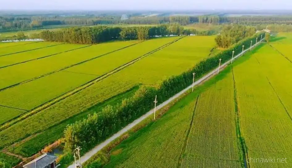
The terrain of Jiangsu Province is mainly plain, with a land area of 103229.17 square kilometers. Among them, the plain area accounts for 86.89%, reaching 89706.03 square kilometers, the hilly area is 11916.16 square kilometers, and the mountainous area i
Views: 11 Time 2024-12-28 -
Soil conditions in Jiangsu Province
The natural factors such as climate, geological landforms, parent materials, and vegetation that contribute to the formation of soil in Jiangsu are relatively complex. Soil resources are abundant and diverse, with zonal soils mainly distributed in mountai
Views: 113 Time 2024-12-28 -
Land Resources in Jiangsu Province
In December 2021, the main data bulletin of the third national land survey in Jiangsu Province showed that there were 61.4839 million mu of arable land in the province, including 42.5758 million mu of paddy fields, accounting for 69.25%; 11.2311 million a
Views: 132 Time 2024-12-29 -

Wetland Resources in Jiangsu Province
In 2017, Jiangsu Province had 2 internationally important wetlands, 5 nationally important wetlands, and 64 wetland parks at or above the provincial level, including 26 national wetland parks and pilot projects, and 38 provincial-level wetland parks
Views: 139 Time 2024-12-29 -

Biodiversity situation in Jiangsu
On April 30, 2019, the official website of the Department of Agriculture and Rural Affairs of Jiangsu Province announced that Jiangsu Province has abundant plant resources, with over 2200 species belonging to 672 genera in 157 families of seed plants, ove
Views: 123 Time 2024-12-29