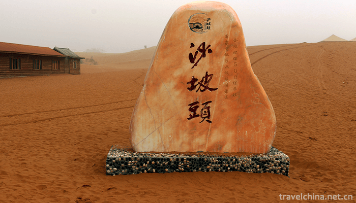
Shapotou National Nature Reserve Ningxia
Shapotou: National AAAAA class tourist attraction, national desert ecological nature reserve, global environmental protection 500 best units, national fitness 20 famous landscapes, special prize for scientific and technological progress.
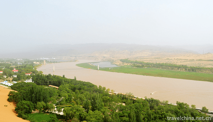
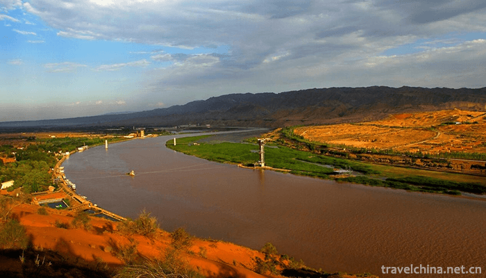
Shapotou is located in the southeastern edge of Tengger Desert in the west of Zhongwei City, Ningxia Hui Autonomous Region. From the east to the south of Erdao Shagou Forest Protection House, from the west to Toudaodun, north to the Tengger Desert, south to the Yellow River, about 38 kilometers long and 5 kilometers wide, with an altitude of 1300-1500 meters, the total area of 4599.3 hectares, accounting for 3% of the total land area of Zhongwei City. It is one of the 20 key desertification control areas in China.
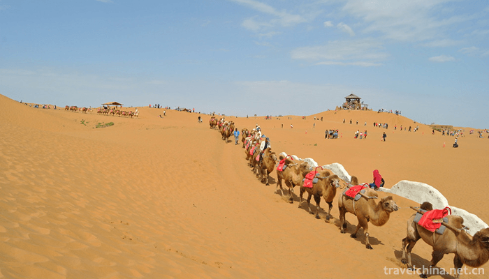
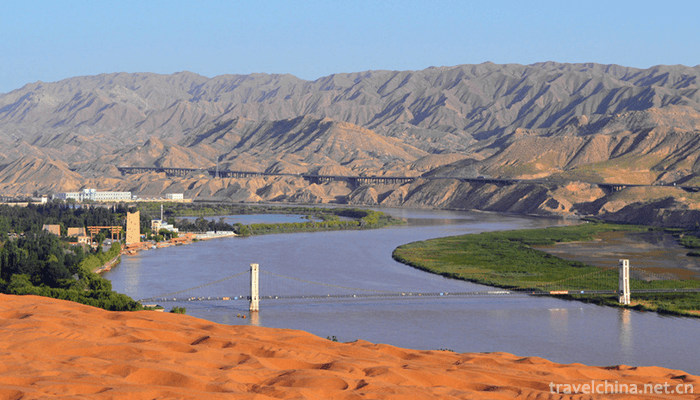
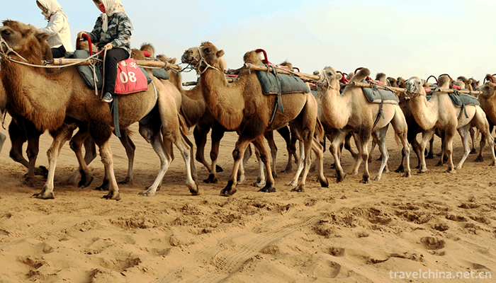
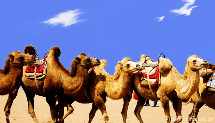
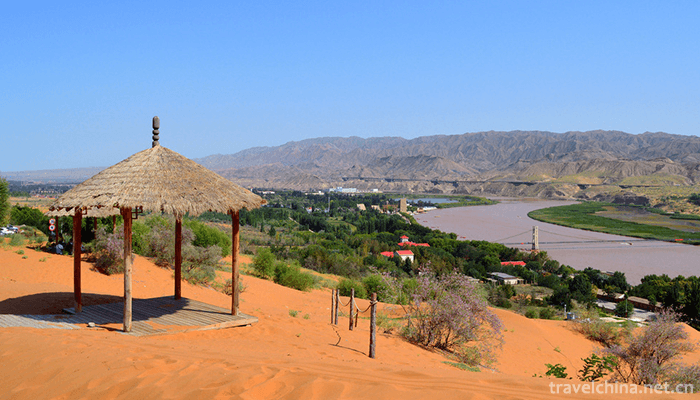
Shapotou is a place of desert, Yellow River, alpine and oasis. It has the magnificent scenery of Northwest China and the beautiful scenery of the south of the Yangtze River. There are China's largest natural sand sliding field, the "first rope of the Yellow River in the world" across the Yellow River, the ancient waterwheel represented by the Yellow River culture, the oldest transport vehicle on the Yellow River, sheepskin rafts, and mirages rarely seen in the desert. You can ride a camel across the Tengger Desert, you can ride an off-road vehicle to surf in the sand sea, and you can enjoy the spectacle of desert smoke and sunset in a long river within a short distance.
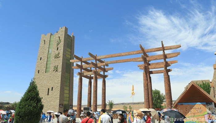
The main protected objects of Shapotou are natural desert landscape, natural desert vegetation, scientific research achievements of desert control, wildlife, ancient Great Wall of Ming Dynasty, bell ringing of Shapotou and its natural complex. In the 2008 Northwest China Tourism Marketing Conference and Tourism Equipment Exhibition, it was included in the "Magic Northwest 100 Sceneries" list. The 2008 China Yellow River Tourism Conference was named "50 Sceneries of the Yellow River in China". The Best Leisure Tourism Destination of China National Tourism in 2018.
geographical environment
position
Zhongwei City, which belongs to the nature reserve, is located at the western end of Ningxia Hui Autonomous Region and the junction of Ningxia, Gansu and Mongolia provinces. The territorial coordinates are 104 17'~105 37', 36 59'~37 43'. Located at the head of the front set of the Yellow River, Xiangshan in the south, Tengger Desert in the north, and alluvial plain in the middle of the Yellow River, the land area is 4599.3 km, which is one of the 20 key desert control areas in China.
Geology and geomorphology
The terrain of the reserve is high in the northwest and low in the southeast, inclining from the northwest to the southeast. Sand dunes are vertical and horizontal, with ups and downs. They cover the red sandstone, flood terrace and alluvial plain of the Second or Tertiary. The desert in the protected area is formed by the forward accumulation of the Tengger desert. The thickness of the sand layer is generally 20-30 m, and the thickest is up to 50 m. Most of them are ridge dunes, crescent dune chains, crescent dunes and lattice crescent dunes, which constitute typical aeolian landforms.
climate
The Nature Reserve belongs to the temperate continental climate, and belongs to the temperate arid climate zone in the National Natural regionalization. It has the characteristics of drought, less rain, strong evaporation, large temperature difference between cold and hot, abundant light, strong wind and sand, long winter, short summer heat, late spring and warm, early autumn and more meteorological disasters. The annual average solar radiation is 6.2 *10J/m, the sunshine hours are 2776.72 hours, and the annual average temperature is 9.6 C. The lowest temperature in January is -25.1 C. The highest temperature in July was 38.1 C, with an annual difference of 63.2 C, accumulated temperature of 3017 C (> 10 C), and frost-free period of 179 days (> 0 C). The annual average precipitation is 186.6 mm and the annual evaporation is 3000 mm. It is 16 times the annual average precipitation, 2.4 degree of dryness, more than 900 hours of wind-blown sand, 2.8 m/s average annual wind speed, sand days in March to June, the maximum wind power can reach grade 8. Strong winds are often accompanied by sandstorms, with an average of 5 to 19 days a year. The wind direction is mostly northwest. The main disastrous weather is drought, frost, gale, rainstorm, hail, hot and dry wind, cold damage and so on.
hydrology
The surface water in the reserve mainly includes the transit water of the Yellow River, the meteorological runoff and the spring lakes. The runoff of the Yellow River varies greatly during the flood season and the dry season. The natural ratio of water surface decreases to about 1/1300, the flow velocity in the flood season is 2.2-4.0m/s, the normal season is 1.7-3.0m/s, and the dry season is 0.77-2.0m/s. The average water depth is 1.8-8.7 m in flood period, 1.7-5.2 m in normal period and 1.6-3.7 m in dry period. The average flow rate is 1038 m/s. Controlled by the base structure, some closed inland lake basins were formed. Inland lakes, such as alkali lake, small lake, Gaodun lake, Machang lake and barren grass lake, have a total area of 721 hectares. They are habitats of various vertebrate fauna in the region.
soil
The soil types in Shapotou Nature Reserve are relatively complex, with six soil types distributed. The total area of soil is 13262.6 hectares, mainly sandy soil. In addition, there are lime-calcareous soil, tidal soil, newly accumulated soil, irrigated and silted soil and saline soil. The area of aeolian sandy soil is 10 610 hectares, accounting for about 80% of the total soil area of the reserve; the area of lime-calcareous soil is 1127 hectares, accounting for 8.5% of the total soil area of the reserve; the area of tidal soil is 1 326 hectares, accounting for 10% of the total soil area of the reserve; and the total area of newly accumulated soil, irrigation-silt soil and saline soil is only 199.6 hectares, accounting for 1.5%
Shapotou National Nature Reserve Ningxia
-
-
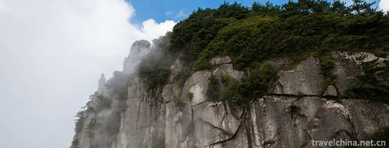
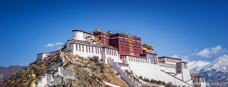
Mingyue Mountain
Mingyue Mountain: National tourist resorts, National Scenic spots, national AAAAA tourist attractions, National Forest parks, national geological parks, National Natural heritage, home of hot springs
Views: 238 Time 2018-12-08 -
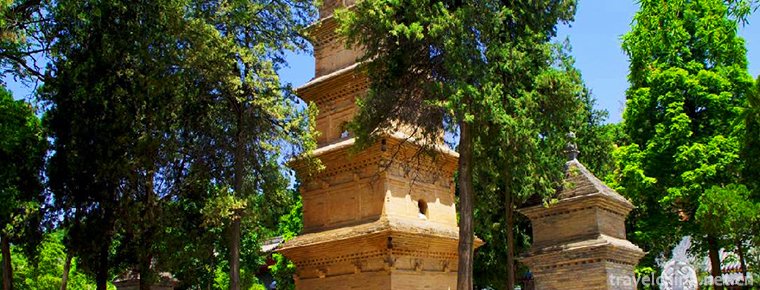
Pagoda of Xing Jiao Temple
Hingjiao Temple Pagoda is located in the original Hingjiao Temple of Shaoling, Chang'an District, Xi'an Province, Shaanxi Province. It is a famous figure in the history of Buddhist communication
Views: 138 Time 2018-12-24 -

Water splashing Festival
Dai Water-Splashing Festival is also called "Bath Buddha Festival". Dai language is called "Sangkangbimai" (meaning "New Year"). Dai people in Xishuangbanna Dai Autonomou
Views: 436 Time 2019-04-24 -

bir bala
Kazakh is a music-loving nation, known as "horses and songs are the wings of Kazakhstan". Folk songs play a very important role in Kazakh music. Where there is a felt room of Kazakh people,
Views: 128 Time 2019-05-02 -
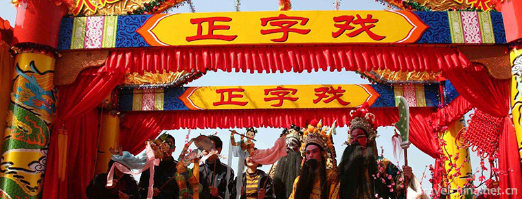
Orthographic drama
Zhengzi opera, originally known as Zhengyin opera, is singing in Zhongzhou Mandarin. It is an ancient and rare opera with many voices. In the early Ming Dynasty, one of the Southern Opera was introduc
Views: 135 Time 2019-07-25 -

Sichuan University
Sichuan University is a national key university directly under the Ministry of Education, and a high-level research-oriented comprehensive university with national layout and key construction in Weste
Views: 122 Time 2019-08-30 -

Huanglian earth forest
Huanglian earth forest, namely the earth forest in huanglianguan Town, is a geomorphic landscape developed on a set of ice water freeze-thaw debris flow deposits. Huanglian earth forest is located in huanglianguan Town
Views: 173 Time 2020-10-16 -
Jintang Yunding mountain scenic spot
Jintang Yunding mountain is located in the middle section of Longquan Mountain in Jintang County, Chengdu. The scenic spots include Yunding mountain, Hantan ancient ferry, Jintang small Three Gorges of Tuojiang River
Views: 220 Time 2020-11-05 -
Huangze Temple
Huangze temple is the only temple for Empress Wu Zetian in China. It is located on the Bank of Jialing River in Guangyuan City, Sichuan Province. In 1961, it was listed as one of the first batch of national key cultural relics protection units by the State Council; in 2006, it was rated as a national AAAA tourist attraction.
Views: 90 Time 2020-11-08 -

Ding Zhen becomes popular and half moon looks haggard
Ding Zhen became popular half moon, haggard face, eyes full of bloodshot, confessed that he liked riding and herding cattle most
Views: 116 Time 2020-12-07 -
Suining tertiary industry
In 2019, Suining achieved a total retail sales of consumer goods of 63.191 billion yuan, an increase of 10.7% over the previous year. In terms of business location, retail sales in urban areas reached 46.171 billion yuan, an increase of 10.7%; in rural areas
Views: 352 Time 2020-12-16