Huanglian earth forest
Huanglian earth forest
Huanglian earth forest, namely the earth forest in huanglianguan Town, is a geomorphic landscape developed on a set of ice water freeze-thaw debris flow deposits. Huanglian earth forest is located in huanglianguan Town, 30km south of Xichang City, Liangshan Yi Autonomous Prefecture, Sichuan Province, more than 30km away from Xichang City, Sichuan Province, and in the valley slope area on the left bank of Anning River.
Introduction to soil forest
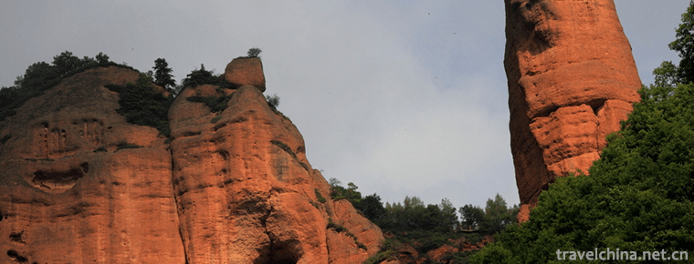
The earth forest covers an area of about 1.3km2, with an altitude of about 1500m. It is magnificent and has different shapes. Some look like ancient castles, some look like vast forests, some look like long swords against the sky, some are like galloping horses to the sky, some are charming like pandas, some are like monkeys climbing and playing, some are like lions and tigers fighting with each other according to their strength. The scenery of the whole tulin scenic spot is beautiful.
Huanglianguan town is named for the number of Coptis chinensis trees on the hillside.
Soil forest is a special geomorphic landscape formed under the specific material conditions, landform conditions, internal and external dynamic geological conditions and climatic environment conditions. The Huanglian earth forest with a certain scale has unique ornamental value and certain scientific value.
The texture of soil forest is yellow gravel. Geological experts say that the formation of earth forest can be traced back to the ice age of 80 million to 100 million years. In the period of ice water deposition, debris is brought by ice water flow and sand gravel layer is formed. After diagenesis and hardening of the sand gravel layer, cracks or cracks (known in Geology) appear due to the influence of new crustal movement. Surface water (mainly rainwater) seeps down and penetrates along the cracks. Over time, the cracks gradually expanded and deepened due to erosion, and finally divided into mounds and columns, which became today's earth forest. The sandstones at the top of the soil forest are mainly composed of colloidal calcium nodules, which are not easy to be weathered and washed away, so they are mostly mushroom shaped.
The wonder of the earth forest varies from person to person, from time to time and from feeling. This is the zoo. The horses roar up to the sky, and the panda is very naive. The monkeys climb and play, and the lions and tigers fight with each other according to their strength. The best thing about Shilin is at dusk. When the scenery is hazy and the sound stops, people will hear all kinds of strange sounds. Everything is frozen here. You need to fly your imagination.
natural environment
Huanglianguan town is located near Xichang and belongs to subtropical plateau monsoon climate with Xichang area. The annual average temperature is 17 ℃, the average temperature in July is 22.6 ℃, the average temperature in January is 9.3 ℃, the frost free period is 273 days, the annual average sunshine hours are 2431 h, the annual average precipitation is 1013 mm, the dry and wet seasons are distinct, and the rain and heat are in the same season. The study area is located in the central axis of Sichuan Yunnan uplift belt, east of ANNINGHE FAULT and northwest of Zemuhe fault. It is mainly composed of a series of folds and compressional faults with north-south strike and low order compressional shear or tension shear faults with genetic relationship. Since Cenozoic, the near tectonic activity in this area is still relatively strong. Anning River Valley, Xichang and Butuo subsidence basins have been formed along Anning River, Zemuhe and Luoxi fault respectively, resulting in small folds and faults in the tertiary and Quaternary strata. Up to now, there are still many inherited fault activities, many hot springs are exposed along the faults, and seismic activities are strong and frequent. The strata exposed in the study area are mainly freeze-thaw debris flow deposits (q4slf), which are distributed on the accumulation platform from the Piedmont slope to the Piedmont gentle slope of huanglianguan town. The surrounding bedrock is quartz sandstone of Baiguowan formation (t3bg). Huanglian earth forest is located on the left bank of Anning River Valley. The surface water is mainly supplied by atmospheric precipitation. Because the terrain slope in the soil forest distribution area is relatively low and gentle, it has a certain water catchment advantage. Therefore, the surface water in the area is rich in rainfall. The surface water is mainly discharged into the Anning River through the runoff of the valley in front of the mountain. Groundwater is mainly composed of loose accumulation pore water and bedrock fissure water, and the main source is still atmospheric precipitation, which flows into Anning River valley through underground runoff.
Cause of formation
Material composition
The soil forest development area is located on the Piedmont accumulation fan of Anning River valley slope. According to the existing data, there are different opinions on the genesis of the deposits. According to the geological survey of Luoji Mountain Glacier, the accumulation material is mainly composed of debris flow accumulation on the left bank of Anning River Valley. The accumulation material is mainly composed of yellowish brown silt silty clay, intercalated with gravel soil layer. The particle size of gravel is 2 ~ 10cm, which is angular or subangular sandstone fragments. The occurrence of gravel soil layer shows the occurrence state of debris flow accumulation fan, which is fan-shaped along the gully to the gully mouth (Fig. 3), with an inclination of about 6 °. According to the material composition of the accumulation body, it is speculated that it is ice water freeze-thaw debris flow. The accumulation body is in semi cemented state. The cementation type is iron argillaceous cementation. There are thin layers of gravel or gravel layer in the middle. The thickness is about 5cm. It is lenticular, slightly inclined to the downstream, and the dip angle is less than 8 °. The top of the accumulation body has gray black cover (weathering crust), which is mainly composed of silicon, aluminum and iron. These materials are relatively stable, not easy to be leached, and have high strength and strong weathering resistance after formation. Due to the semi cemented state of the accumulation, it is easy to be washed by rainwater. At the same time, due to the protection of the cover layer at the top, and the gravel or gravel layer in the middle of the soil column plays a similar role of "stirrup", which ensures the stability of the soil column. These provide important material basis for the formation of soil forest.
Geomorphic conditions
On both sides of the Anning River Valley, this kind of debris flow accumulation in front of the mountain can often be seen. However, not all the accumulation bodies can develop into soil forest, or the developed soil forest can reach the scale of soil forest in Xianghuang Lianguan town. This is because the formation of soil forest is also related to its geomorphic form: as the accumulation body is located in the transition zone from slope to gentle platform, gullies are often developed in such areas, and the gullies are deeply cut, which provides conditions for the leaching of surface water. Through field investigation, it is found that the development of soil columns can also be seen in the places where the gullies are relatively shallow, but the scale of these soil columns is very small and the shape is very simple. Therefore, it is not difficult to find that the formation and development of soil forest is closely related to its geomorphic position and morphology.
Neotectonic movement conditions
The formation of Huanglian tulin was completed in the process of regional neotectonic movement. The Anning River valley basin was formed in the stage of tectonic subsidence, which formed debris flow and alluvial proluvial deposits after ice water freezing and thawing, forming the material basis for geomorphic development; then, the uplift caused debris flow accumulation body to be cut into various forms of cracks, forming the landform of soil forest development; of course, on the other hand, the accumulation body in the process of sedimentation due to physical action In addition, cracks such as mud cracks may also be formed during soil shrinkage. When the neotectonic movement turned into a stable period, the water would erode and leach the accumulation, which provided favorable conditions for the formation of soil forest.
External dynamic conditions
During the development of soil forest in Huanglian, there are various external dynamic actions, such as flowing water, gravity and physical weathering. On the one hand, the surface water cuts down the surface erosion to form various forms of gullies, which crisscross each other, forming soil columns, earth walls, soil screens and other geomorphic forms on the original accumulation. On the other hand, the leaching of surface water and other physical weathering processes form a variety of landscapes in the soil forest.
climatic conditions
After the formation of soil forest, due to its material characteristics, its stability is poor, far from being compared with stone forest. The formation of soil forest is also related to its environment and climate. It needs a dry climate, the annual rainfall can not be too large, the rainfall frequency is low, and the dry season is longer than the rainy season. Huanglianguan area in Xichang belongs to subtropical plateau monsoon climate. The annual average sunshine hours are 2431 hours. The dry and wet seasons are distinct, the rain and heat are in the same season, and the dry season is long and the air is dry, which provides good climate conditions for the formation of soil forest. Under such climate conditions, the soil forest column is larger, not easy to be destroyed, and more spectacular in momentum.

Huanglian earth forest
-
Yeliguan Scenic Area
Yeliguan Scenic Area is located in Lintan County, with Yeliguan of Lintan County as the center. It is divided into four scenic areas: Lianhuashan, Xixia, Dongxia and Yehai Lake.
Views: 181 Time 2018-12-26 -
Chaoyang Bird Fossil National Geological Park
Chaoyang Bird Fossil World Geopark is located in Chaoyang City, western Liaoning Province. Chaoyang is located at the junction of Liaoning, Hebei and Mongolia provinces in the throat of Chinese cock t
Views: 136 Time 2019-01-05 -
Jinxiangshan Paradise
Jinxiang Mountain Scenic Spot in Jinan, Shandong Province, is located in the southern mountainous area of Jinan. It is endowed with unique topography, landform and rich forest resources
Views: 397 Time 2019-01-29 -
Buddhist music
Buddhist music, the music used by Chinese Buddhist temples and believers in religious ceremonies. Buddhism believes that music has the function of "offering" and "praising Buddha".
Views: 107 Time 2019-04-29 -
Two tones of Han tune
Originally known as "Shan Er-huang", "Tu Er-huang" or "Shan Er-huang", the second largest traditional opera in Shaanxi Province is one of the traditional local operas in
Views: 180 Time 2019-05-02 -
Burning Technology of Building Kiln and Building Calendula
Kiln building Calendula firing technology, the local traditional skills of Nanping City, Fujian Province, one of the national intangible cultural heritage.
Views: 320 Time 2019-05-05 -
Batik art
Miao batik technology, the traditional handicraft of Danzhai County, Guizhou Province, is one of the national intangible cultural heritage.
Views: 130 Time 2019-05-10 -
Lu Brocade Weaving Techniques
Lujin brocade weaving technology, traditional handmade brocade weaving technology in Juancheng County, Shandong Province, is one of the national intangible cultural heritage.
Views: 219 Time 2019-05-15 -
Nanxian Flower Drum
On May 20, 2006, the local flower drum of Nanxian County was listed in the first batch of national intangible cultural heritage list with the approval of the State Council.
Views: 130 Time 2019-06-07 -
Pinghu cymbal book
Cymbals are a unique form of local traditional folk art in the Wu dialect area of Jiangnan. According to the Records of Songjiang County, it was formed in the Qing Dynasty (1821-1850). It is now mainl
Views: 154 Time 2019-06-09 -
The changing style of Cheongsam
After a hundred years of evolution, with the change of people's life style and aesthetic taste, cheongsam has developed a variety of styles, which makes people dazzled. In the golden age of the development of Cheongsam in the 1930s and 1940s, the styles of cheongsam changed
Views: 333 Time 2020-12-11 -
Yibins first industry
In 2019, the total output value of agriculture, forestry, animal husbandry and fishery in Yibin is 45.084 billion yuan, up 2.8% over the previous year; the added value of agriculture, forestry, animal husbandry and fishery is 28.346 billion yuan, an increase of 3.0%.
Views: 140 Time 2020-12-18
