QomolangmaEverest
Mount Qomolangma (Mount Qomolangma) is the main peak of the Himalayas and the highest mountain in the world. It is located on the border between China and Nepal. The peak is located in China and is the highest in the world. It is the center of Mount Qomolangma nature reserve and Nepalese National Park across four counties in China.
In Tibetan, "Zhu Mu" is the meaning of goddess, "Lang Ma" is the meaning of third. Because there are four other peaks near Mount Qomolangma and Mount Qomolangma is third, it is called Mount Qomolangma.
Two heights: climbers climbed the total height, Nepal and other climbers used the snow cover height (total height) of 8848 meters (29,929 feet), in 2005 the China National Survey and Mapping Bureau measured the rock surface height (bare height is the geological height) of 8844.43 meters, since 2010 recognized the measurement data of two heights. In addition to the highest mountain peaks, it is also the fifth highest distance from the center of the earth.
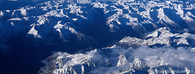
Mount Qomolangma is a huge pyramid-shaped, majestic and high-powered, extremely steep terrain, the environment is very complex. Snow line height: the north slope is 5800~6200 meters, and the south slope is 5500~6100 meters. There are three steep cliffs (north, East and southwest) between the northeastern ridge, southeastern ridge and Western ridge, and 548 Continental-type glaciers are distributed between these ridges and cliffs, covering a total area of 1457.07k, with an average thickness of 7260m. The supply of glaciers is mainly caused by snow metamorphism in the two major precipitation belts of the India Ocean monsoon zone. Glaciers have a myriad of spectacular and rare ice towers, dozens of meters of ice cliffs and cracks in the shadows of foot-trapping ice, and perilous avalanches and avalanches.
Mount Everest is not only lofty and magnificent, but also magnificent. Within 20 kilometers around it, there are peaks and mountains. There are more than 40 peaks above 7000 meters above sea level. The most famous ones are Luozi Peak (8516 meters above sea level) and Zhuo Pong Peak (7589 meters above sea level), Makaru Peak (8463 meters above sea level, the fifth highest in the world) in the southeast, Zhangzi Peak (7543 meters above sea level) in the north and Nuzi Peak in the west. (7855 meters) and pmoli peak (7145 m). Outside these giant peaks are some of the world's top-notch peaks: Zhangjiafeng, the world's third highest peak in the Southeast (8585 meters above sea level, the boundary between Nepal and India), Gezhongkang at 7998 meters above sea level, Zhuoyouyou at 8201 meters and Shishabangma at 802 meters above sea level. The formation of peaks and peaks, the surging peak of the scene.
A recent survey of Mount Qomolangma was made in 1999 by the National Geographic Society using GPS Global Positioning System (GPS). They believe that Mount Qomolangma should be 8,850 meters above sea level. The altitude of Mount Qomolangma, once recognized by all countries in the world, was measured by the People's Republic of China Mountaineering Team in 1975. It is 8848.13 meters above sea level. But the outside world also has 8848 meters, 8840 meters, 8850 meters, 8882 meters and so on many kinds of statements.
On May 22, 2005, China accurately measured the height of Mount Qomolangma. The rock surface of Mount Qomolangma was 8844.43 m (within (+0.21 m) and the ice and snow thickness of the peak was 3.5 m), while the peak was located in China, and the data of 8848.13 m in 1975 was discontinued.
Both heights make sense - total height (snow cover height) differs from bare height (rock face height): the climber ascends the total height, bare height is the geological height.
The Himalayas where Mount Everest is located is originally an ocean. During a long geological period, a large amount of debris and sediment were washed from the land and accumulated in the Himalayas, forming marine sedimentary rocks thicker than 30,000 meters. After that, the Himalayan Mountains rose violently because of the strong orogeny. According to the calculation, the average annual rise is about 20-30 meters. Up to now, the Himalayan Mountains are still on the rise, rising by 7 centimeters every 100 years.
As time goes on, the height of Mount Qomolangma will also change because of the movement of geographical plates. Interestingly, although Mount Everest is the world's highest peak, its peak is not the farthest from the center of the earth. This particular point belongs to the Mount Chimborazo in South America. The tall and majestic image of Mount Everest has exerted tremendous influence both locally and worldwide.
Located in the middle of the Himalayas at the junction of the Tibet Autonomous Region of China and Nepal, the Himalayas are 27 degrees 59'15.85 north latitude and 86 degrees 55'39.51 East longitude. The north is in Dingri County of the Tibet Autonomous Region of the People's Republic of China (the west slope is Zhaxizhong township of Dingri County, the east slope is Qudang township of Dingri County, with the Everest base camp) and the south is in Nepal. The Federal Democratic Republic.
In 1852, the India Survey Bureau measured the height of the Mount Qomolangma by 8840 meters.
In 1852, a survey team headed by an Englishman named Waffle measured 8840 meters on the Indian Plain by geodetic method. It was the first time that Mount Everest was the highest peak in the world. In the early 20th century, 8882 meters of air pressure was used as the height of Mount Everest in foreign countries and in China.
In 1949, Leonardo Clark, an American, measured Mount Animaqing 193 meters higher than Mount Everest by traditional methods. He believed that Mount Everest was not the world's highest peak, which was later overturned.
In 1951, Wang Qinyu first proposed that the name of Everest should be restored.
In 1952, the Chinese government officially restored the name of Mount Qomolangma.
In 1954, Indian geographers took different locations on the southern side of Mount Everest as a benchmark and obtained an altitude of 8,848 meters. So far, Nepal has called the Mount Qomolangma the Sacha Mata peak, with an altitude of 8848 meters above sea level.
In 1958, Lin Chao made it clear in his paper "The Discovery and Name of Everest" that "the Chinese surveyors who came to Tibet from 1715 to 1717 to survey the mountain in a scientific way were the winners and the Chu Er Bizang Buhranbenzhanba."
In 1975, under the organizational principle of Integrating Mountain climbing, surveying and scientific research, China set up a 3.5-meter mark on Mount Everest for the first time. The height of Mount Everest was 8848.13 meters through six surveying and mapping points over 6,000 meters. "The earliest discovery and naming of Mount Everest by the Chinese and the first accurate measurement in 1975" were also included in the "Centennial Discovery of Chinese Geography" co-sponsored by China National Geographic magazine and China Geographic Society in 2009.
On July 23, 1975, the Chinese government authorized the Xinhua news agency to announce to the world that Chinese surveyors accurately measured the altitude of the world's highest peak, Mount Everest, at 8848.13 meters. This data has been recognized worldwide, and Everest has since risen to 8848 or 8848.1 meters above sea level in authoritative maps and other publications.
In March 1987, the American and Italian newspapers reported an astonishing news: American astronomer Professor George Walstein from satellite transmission of information that China's Chogury Peak is 8859 meters high, 11 meters higher than Mount Everest. But in the same year, under the leadership of Italian Adito de Cio, using GPS to obtain the height of Mount Qomolangma 8872 meters, and the height of Mount Giorgio 8616 meters, the world's highest peak was determined again. Dehio himself is also known as the worst measurement in this century.
In May and October 1992, the United States and Italy respectively adopted GPS technology and photoelectric rangefinder technology to re-determine the height of Mount Everest. The data provided by Desio was 8846.10 meters, 2.03 meters less than the data provided by China.
In 1999, the National Geographic Society used GPS measurements at that time. After analyzing the measurements, the University of Colorado at Boulder calculated the elevation of Mount Everest to 8,850 meters.
On October 9, 2005, according to the Surveying and Mapping Law of the People's Republic of China, the State Bureau of Surveying and Mapping officially announced that the new data obtained from the elevation survey of Mount Qomolangma in 2005 was 8844.43 meters above sea level. Parameters: the height of the rock surface at the peak of Mount Qomolangma is 0.21 meters, and the depth of the summit is 3.50 meters. The Mount Everest elevation data released in 1975 were discontinued. This result has been recognized by UNESCO and the rest of the world. This is the first rock surface elevation survey of Mount Everest, and is arguably the most accurate measurement to date, 3.7 metres shorter than the height of 8,848.13 metres measured in 1975 (8,848 metres in Nepal based on snow cover). In order to obtain more accurate and authoritative data, the Survey Bureau adopted the technical scheme of combining the classical survey with the satellite GPS survey, and for the first time used the ice and snow depth radar detector in the survey of Mount Qomolangma, but there are many other data such as the height of Mount Qomolangma 8846.1, 8840, 8850, 8851 or 8872 meters. Because the earth is not a complete sphere, even though Mount Everest is the highest mountain in the world, its peak is not the farthest from the center of the earth. This particular point is Mount Chimbolasso in South America. From the foot of the seabed, the highest mountain in the world is the Mauna Kea volcano in Hawaii, at a height of 10,203 meters.
On June 15, 2015, the National Bureau of Surveying, Mapping and Geocommunication said that the earthquake in Nepal caused the Mt. Everest region to move 3 cm southwest, with the elevation basically unchanged. At the same time, from 2005 to 2015, the Everest region moved to the northeast at a rate of about 4 centimeters per year, rising at a rate of about 0.3 centimeters per year, shifting 40 centimeters and rising 3 centimeters per decade.
The climbers climbed the total height. The snow cover height used by Nepalese and other climbers (total height) was 8848 meters (29,929 feet), and the rock surface height (bare height, geological height) measured by the State Surveying and Mapping Bureau of China in 2005 was 8844.43 meters. The two altitude measurements have been accepted since 2010.
Snow cover height: it is conducive to studying the thickness changes of snow and ice and global atmospheric changes, and is also adopted by mountaineers. Geological Height: Useful for studying the uplift and fall of the Himalayas (Mount Everest was more than 12,000 meters before 13 million years ago).
The towering Mount Qomolangma has always been the holy land where human beings want to prove their climbing ability. Since the first successful climb of Mount Everest on May 29, 1953, many climbers around the world, including China, have left footprints on the top of Mount Everest.
In 1841, sir George Sir Alice, the governor of India, recorded the location of Mount Qomolangma.
In 1853, Mount Everest was surveyed as the world's highest peak, 8840 meters above sea level.
In 1921, the British Mountaineering Team (Captain K. Hawaldbury) first climbed Mount Everest from Tibet, China. They did not cross the top of the North Depression. They claimed to have reached an altitude of 6,985 meters. Without success, they declared it was a reconnaissance climbing.
In 1922, Britain's second Mount Qomolangma climbing team (Captain Ji Bruce), still taking the northern slope route in Tibet, China, crossed Bei'ao, but failed when they reached 8,225 meters high.
In 1924, Britain's third Everest Mountaineering Team (Captain Frederick Norton) was still climbing from the northern slopes of Mount Everest in China. When Norton and others reached 8,572 meters below the "second step" of the northern slopes, they were forced to descend because of lack of oxygen. The team members, George Mallory and Andrew Irving, insisted on moving forward. No return.
In 1933, a 16-member British mountaineering team (Captain Hugh Lutorigi), still using the northern slope route in Tibet, failed. When the team members Win Harris and Wiegel reached an altitude of 8,570 meters, they discovered a 1924 British Mount Everest climber Mallory's ice axe, confirming Mallory's success. 2 people died near this height.
In 1934, an Englishman, Mike Wilson, used a light plane to mountaineer alone. The plane was damaged near the Kombu Glacier. He himself was slightly injured. Later, he hired some Sherpas to assist in the climbing, but after a storm, he was frozen to death on the Eastern Oblast glacier.
In 1935, the British Mount Everest Mountaineering Team, composed of seven people (Captain Yi Hipton), reconnaissance only to China's Tibet Mount Everest at an altitude of 7,000 m, that is, near Beigao returned.
In 1936, the British Mount Everest Mountaineering Team, composed of 10 people (Captain Hugh Lutolegi), arrived at the top of the North Depression at an altitude of 7007 meters and returned.
In 1938, the British Mount Everest climbing team, composed of seven people (Captain Ge Dillman), still climbed from the northern slope of China, after reaching an altitude of 8,290 meters, declared failure.
In 1947, during the first Everest climb after World War II, Canadian Le Dianman hired some of the local mountain residents as porters, but still walked the northern slope of China, not more than 6,400 meters above sea level, and finally failed to return.
(Note: The above-mentioned climbs to Mount Qomolangma were all carried out in Tibet within China, and were unsuccessful.)
After 1950, the Tibetan region was liberated and located in the southwestern frontier area of Tibet. Foreign mountaineering teams were no longer allowed to mountaineer at will. Since then, foreign mountaineering teams have been climbing Mount Everest on the southern slope of Nepal.
In 1950, a climbing team of Americans, such as K. Huston, made its first attempt to climb Mount Everest from the southern slope of Nepal, and returned only after reaching the 6,100-meter-high ice-burst zone of the Kombu Glacier in Shanghai.
In 1950, the British mountaineering team, consisting of five men (Captain Ge Dillman), claimed in advance to be a reconnaissance team climbing Mount Everest from the South slope, returned after reaching an altitude of 5,480 m near the Komburg Glacier.
In 1951, the British Mountaineering Team, captained by Il Hipton, climbed only a section of the Komburg Glacier and returned near 6450 meters above sea level.
In 1951, a Danish man called Ke Baijia Larson illegally crossed the border into my Tibet area. He tried to climb Mount Everest from the north slope, but he failed even at an altitude of 6500 meters.
In May 1952, a 10-member Swiss climbing team led by Captain Le Dietmar climbed Mount Everest from South Slope to Nepal. Le Lambier and the Nepalese Porter Teng Xin, arrived at an altitude of 8,540 meters and failed because of bad weather, but they created a path from the South Slope of Mount Everest to the summit. The route.
In 1953, players Evans and bull Geelong reached the height of 8720 meters.
On May 29, 1953, Tenzing Norgay, a Sherpa guide from Nepal, and Edmund Hillary, a mountaineer from New Zealand, climbed Mount Everest for the first time.
In 1956, the Swiss Mountaineering Team (captain Albert Egel) consisted of five members, including E. Schmitt, U. Malmitt, A. Reis and G. Gonchin, who, with the support of a large number of Nepalese porters and guides, climbed Mount Everest in two groups on May 23.
In May 1960, when the Chinese mountaineering team was assaulting Mount Everest from the North slope, an Indian mountaineering team led by Indian Major Ji Singh also climbed Mount Everest from the south slope of Mount Everest in Nepal. When they reached an altitude of 8,625 meters on the South slope, they announced that they had given up the climb because the wind was too strong to move forward.
At 4:20 on May 25, 1960, the Chinese mountaineering team Wang Fuzhou, Gombo and Qu Yinhua climbed the top of Mount Everest for the first time from the North slope, and the bright five-star red flag fluttered at the highest place on the earth. The northern slope of Mount Everest is extremely harsh and the natural conditions are very complicated.
In 1962, India's second Mount Everest climbing team, led by the captain, Indian Army Lieutenant Colonel Jay Dias, climbed Mount Everest again from the south slope of Nepal, but failed because of fear of strong winds. Two of the team members reached an altitude of 8717 meters.
In the spring of 1969, the Japanese mountaineering team made its first exploratory climb from the southern slope of Mount Everest. After reaching the Kombu Glacier at an altitude of 6,450 meters, some of the glaciers and meteorological observers were left behind. They spent a whole year in Mount Everest, made long observations of the weather and glaciers, and formally climbed Mount Everest for the Japanese team in 1970. And laid the necessary foundation.
In the spring of 1971, the International Mount Everest Mountaineering Team, composed of climbers from 11 European countries, such as Britain, France, Italy, Austria, Switzerland and India, climbed the summit along the southwestern ridge of the southern slope of Mount Everest under the leadership of the captain, Swiss mountaineer En Killianfurt (basically 1963 US Mountaineering Team). Route. Because of the inconsistent pace at the beginning, the internal differences are very big, after the Indian team member Hu Guna died in an avalanche, declared defeat.
In the spring of 1972, the European Mount Everest climbing team, composed of eight European climbers (Britain, France, Italy, Austria, West Germany, Switzerland and so on), led by Siddock Heilikofel, climbed the top of the South Slope along the traditional route and failed when it reached an altitude of 8,200 meters.
In the spring of 1973 (February-May), the Italian military mountaineering team, led by Quito Monzino, the headmaster of the Italian Military Mountaineering School, formed a large mountaineering team on Mount Everest, comprising Italian land, sea and air forces, police forces, customs officers, medical, meteorological and other military and scientific personnel, on May 5, 1973. In May 7th and two times each time, one group (4 people), a total of 8 people boarded the peak of Mount Everest.
On September 24, 1975, at 6 p.m. Nepalese time, two members of the British Mountaineering Team, Heston (32) and Scott (33), climbed Mount Everest from the south slope of Mount Everest.
At 2:30 p.m. on May 27, 1975, Pando, a female member of the Chinese Mountaineering Team, and eight male players, Sonnan Rob, Luoze, Waiting Fuk, Sangzhu, Taipingcuo, Gonggabasan, Tsirindoji and Abchin, climbed Mount Everest from the north slope again. In the history of mountaineering in the world, this is a mixed group of men and women to climb the world's highest number of new world records. To commemorate the summit, the Ministry of Posts and Telecommunications of China issued a set of three special stamps on September 26, 1975.
In 1978, Italy mountaineer Reinhold Messner first climbed without oxygen (8848 meters).
In 1980, Italian mountaineer Reinhard Mesner made his first solo climb to the top (8848 meters) on the northern side of the line.
In 1988, Chinese, Japanese and Nepalese climbers joined hands to challenge Mt. Everest. They successfully crossed Mt. Everest from both sides of the north and south. Three Chinese team members successfully crossed Mt. Everest. One climbed Mt. Everest.
In 1990, mountaineers from China, the Soviet Union and the United States gathered on Mt. Everest in the name of peace and showed the world a good wish for peace. 7 Tibetan members of China have reached the summit on this mountaineering.
In 1993, six mountaineers from both sides of the Taiwan Strait joined hands to climb Mount Everest for the first time, writing a wonderful page in history. Wu Jinxiong became the first Taiwan compatriot to climb the Mount Everest.
In 1996 and 1997, China jointly climbed with Slovakia and Pakistan. Four Tibetans climbed the summit. Among them, Tsiluo became the first university student in China to climb Mount Everest. Dazimi and Kamura became the two climbers.
At 7:22 a.m. on May 26, 1998, British climber Berg Reals and his friends reached the summit of Mount Everest.
On May 27, 1999, 10 Tibetan mountaineers climbed Mount Qomolangma once and collected the sacred flame of the Sixth National Minority Traditional Sports Games at the peak of 8848.13 meters.
In 2000, Yan Genghua, China's first private solo challenger to Mount Everest, climbed to the top on May 21, but was unfortunately killed on his way down the mountain.
In 2002, another warrior Wang Tianhan finally succeeded in challenging Mount Everest alone.
In 2003, 14 Chinese members of the China-South Korea Joint Mountaineering Team and the 2003 China Mount Everest Mountaineering Team successfully climbed Mount Everest on May 21 and 22, respectively. They are Xiao Qimi, Pu Zhuoga (female), Cang Mula (female), Nima Ziren, Liang Qun (female), Chen Junchi, Awang, Pubton Zhu, Zhaxi Ziren, Wangdui, Gala, Rosen, Wang Shi and Liu Jian.
From March 20 to June 20, 2005, the Chinese Academy of Sciences and the State Bureau of Surveying and Mapping will conduct a comprehensive scientific investigation of the Qomolangma Mountains on the Qinghai-Tibet Plateau again. They will also unite with Chinese women climbers to climb the top of Mount Qomolangma and re-survey the altitude by means of radar and GPS. On October 9, the same year, with the approval and authorization of the State Council, Chen Bangzhu, Director-General of the State Bureau of Surveying and Mapping, officially announced at a press conference of the Information Office of the State Council that the elevation of the rock surface of Mount Qomolangma was 8844.43 meters and the measuring accuracy was (+0.21 meters). China released the Mount Everest elevation data 8848.13 meters on 1975.
In 2006, a middle-aged couple from Sydney, Australia, Glen Singleman and Heather Swan, both in their early 40s, climbed to the top.
In 2007, the 20-year-old Sherpa lad, Tash Lakpa Sherpa, set out from Kathmandu to launch his third assault on Mount Everest, the world's roof.
Xiangyun, the torch of the 29th Summer Olympic Games on May 8, 2008, was carried by Chinese athletes to the world's highest peak, Mount Everest (8844.43 meters above sea level). It has become the highest torch relay station in the history of Olympic torch relay.
In the early morning of May 25, 2008, a 76-year-old Nepalese man, Ming Sherqian, successfully climbed the world's roof Mount Everest, becoming the oldest person in the world to successfully climb Mount Everest.
In May 2012, Mr. Kame Sherpa of Katman, Nepal, climbed Mount Qomolangma three times in nine days, respectively, at 12:05 on 19 May, 6:36 on 24 May and 5:27 on 27 May, setting the world record for the most successful climb of Mount Qomolangma in nine days.
On June 5, 2014, a 13-year-old girl from a lower-class family in India, Pulna, who recently succeeded in climbing Mount Everest, became the youngest woman in the world to climb Mount Everest.
At 10:23 on May 15, 2018, the Mount Everest mountaineering team of Peking University successfully reached the Mount Qomolangma.
Mount Qomolangma is a powerful peak with a unique geographical environment. The lowest temperature on the top of the peak is always minus thirty or forty degrees Celsius. There are places in the mountains that are not covered by snow all year round. Glaciers, ice slopes and ice are everywhere in Tallinn. Peak top air is thin, the oxygen content of the air is only a quarter of the eastern plains, often blowing strong winds of magnitude 78. Twelve winds are not uncommon. The wind is blowing snow, splashing around and spreading across the sky.
The climate of the Everest region and its adjacent peaks is complex and changeable, and even in a day, it is often unpredictable, let alone in the four seasons of the year. Generally speaking, it is a rainy season from early June to mid-September of each year. Strong southeastern monsoon causes frequent rainstorms, clouds and mists, and the unpredictable weather of snow and ice. From mid-November to mid-February of the following year, due to the strong northwest cold current control, the minimum temperature can reach - 50, the average temperature is about - 30. The maximum wind speed can reach 90 m / sec. From the beginning of March to the end of May, this is the spring when the wind season passes to the rainy season, and from the beginning of September to the end of October, the autumn when the rainy season passes to the windy season. During this period, it is possible to have better weather, which is the best season for mountaineering. Because of the extremely cold climate, it is also called the third pole in the world. According to the radio sounding data of the weather station at the foot of Mount Everest, it is coldest in February at an altitude of 7,500 meters, with an average temperature of - 27.1 C, the hottest in August, an average temperature of - 10.4 C and an average annual temperature of - 19.6 C.
The route from Lhasa to the mountains in the People's Republic of China is 670 kilometers from Yanghu, Jiangzi, Shigaze, Xieger, Rangbu Temple, Everest, Nimu, Qushui and Lhasa along the Central-Nepalese Highway. It takes two days to travel south along the simple highway in the Pazhuo District, and then 110 kilometers to the northern foot of Mount Everest. At 5145 meters above sea level, the end of the flannel glacier - the temple of flannelette. Planning 0 distance covers Everest, Yangzhuoyong Lake, Yarlung Zangbo Grand Canyon and other major tourist attractions route strategic itinerary. Mount Everest is on the border of about 100 kilometers south of China Nepal highway. It is not very difficult to find a free ride from Shigaze and Razi to the new date, but the remaining 100 kilometers to the base camp, the chance of hitchhiking is quite low, so it is recommended to go by charter from Lhasa.
Travel to Mount Everest must be handled by frontier certificate. It can be handled at the place where the residence is registered, or it can be entrusted to travel agency by ID card in Lhasa or Shigatse.


-
Vegetable party
Vegetable party (alias Su Chunjuan) is one of the common local traditional snacks in Guiyang. It can be seen almost everywhere in the streets of Guiyang. This dish is crisp.
Views: 175 Time 2018-11-05 -
Qinhuangdao Shanhaiguan Scenic Area
Shanhaiguan, also known as Yuguan, Yuguan and Linluguan, is located 15 kilometers northeast of Qinhuangdao City, Hebei Province.
Views: 163 Time 2018-11-24 -
PRC Cradle Scenic
Cradle Scenic Area of Ruijin Republic, National AAAAA Tourist Scenic Area, National Key Cultural Relics Protection Unit, National Patriotic Education Demonstration Base, National Red Tourism Classic S.
Views: 195 Time 2018-12-08 -
Hushan Great Wall
Hushan Great Wall is situated on the Yalu River, 15 kilometers east of Dandong City. It is an important scenic spot in the national Yalu River scenic spot. It is across the river from Korea's Yuchidao.
Views: 122 Time 2019-01-16 -
Huangjinglaolin Scenic Spot
Huangjing Old Forest Scenic Spot is located at the junction of Sichuan and Guizhou provinces in southern Sichuan Province and northwest Gulin County. Its total planned area is 9122.6 hectares.
Views: 104 Time 2019-01-18 -
Kaiping Diaolou and Villages
In Kaiping city, there are many blockhouses, towns and countryside. There are more than a dozen villages and less than two or three villages. From Shuikou to Lily.
Views: 84 Time 2019-01-29 -
Zhangyu Wine Culture Museum
Zhangyu Liquor Culture Museum is one of the few professional museums in the world wine industry. It is located at the original site of Zhangyu Company, Da Ma Lu, Zhifu District, Yantai City, Shandong .
Views: 169 Time 2019-03-17 -
Gao Jia Opera
Gaojia Opera, a local traditional drama in Quanzhou City, Fujian Province, is one of the national intangible cultural heritage..
Views: 151 Time 2019-04-30 -
Polo
Polo refers to a sport in which horses are riding and polo clubs are used to hit the ball. In ancient China, Polo was called "hitting the bow". It was invented in the Han Dynasty and flouris.
Views: 137 Time 2019-05-15 -
Uygur Mulberry Paper Making Skills
Uygur mulberry paper takes mulberry branch endothelium as raw material, mulberry branch endothelium is sticky, smooth and delicate, easy to process, after exploitation, soaking, pot boiling, pounding,.
Views: 134 Time 2019-06-28 -
China lantern Museum
Located at No.6, Gongyuan Road, Zigong City, Sichuan Province, China lantern museum is a special institution for "collection, protection, research and display" of Chinese lanterns approved by the State Administration of cultural relics (92). It is the only professional museum about lantern culture in China and even in the world. .
Views: 347 Time 2020-10-15 -
Mineral resources in Suining
The mineral resources with more reserves in Suining City mainly include oil, natural gas, well salt, placer gold, limestone, etc., especially natural gas and brine resources. Suining has developed and utilized 7 kinds of mineral resources, including shale mine.
Views: 194 Time 2020-12-16

