Zhen Bei Tai
Zhen Bei Tai
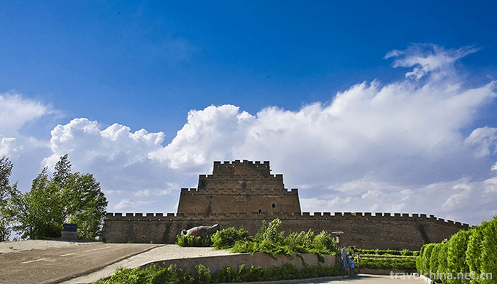
Zhenbeitai, World Heritage Site, National Key Cultural Relics Protection Unit. It is located on the top of Hongshan Mountain, 4 kilometers north of Yulin City, a famous national historical and cultural city. Zhenbeitai is one of the most magnificent and magnificent buildings in the site of the Great Wall of the Ming Dynasty. It is known as one of the three wonders of the Great Wall of China (Shanhaiguan in the east, Zhenbeitai in the middle, Jiayuguan in the west) and "the first platform of the Great Wall of the Wanli". There are poems such as "Beitai, Yongzheng, a hard backbone of the Great Wall", "coming on stage and going off stage to perform Dynasty operas and acting as generals". Zhenbei Tai is in danger. It controls the throat of the north and the south. For example, it is one of the largest fortresses along the ancient Great Wall and an important part of the Great Wall.
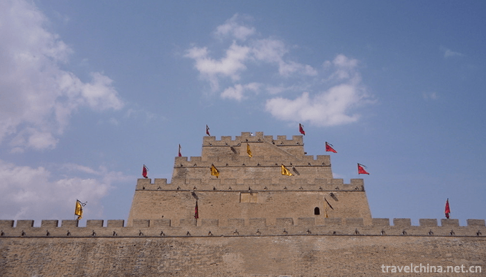
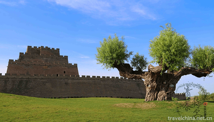
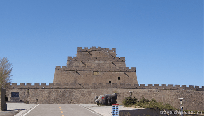
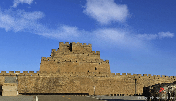
Zhenbeitai is square, with four floors and a height of more than 30 meters. Taiji is 82 meters long in the north, 76 meters long in the south, 64 meters in the East and 64 meters in the west, covering an area of 5056 square meters.
brief introduction
Zhenbeitai is located at the southwest corner of Tuigong City on Hongshan Mountain, about 5 kilometers from NATO in Yulin City. The east section of the city is opposite to the East section. The Great Wall of North Vietnam is East-West section. The west section is 210 National Highway with Laoye Miaoliang. The south section is Shawo. Its geographic coordinates are 109 43 33.9 north latitude 38 28 08.8 with an elevation of 118 Yuxi River flows through Hongshixia about one kilometer west of Zhenbeitai. Poplar, pine, cypress, Caragana and other vegetation are planted around the platform. East 200 meters and North 400 meters are newly built teams and bridgehead villages, with 50 households and about 200 residents.
Zhenbei Tai is in danger, controlling the throat of the north and the south, such as the huge lock of the border crossing, which is one of the largest fortresses along the ancient Great Wall.
The platform is square, with four floors and a height of more than 30 meters. Taiji is 82 meters long in the north, 76 meters long in the south, 64 meters in the East and 64 meters in the west, covering an area of 5056 square meters.
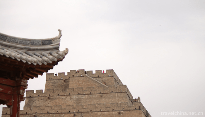
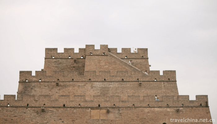
Every layer of the platform is covered with green bricks, and the outer side of the top of each layer is covered with a stack about 2 meters high. The upper part of the stack is provided with a lookout, and the inner and outer parts of each stack are connected. The first floor is surrounded by a series of buildings, which were the barracks of the guards at that time. So far, the base still exists.
Close to the small brick city under Taipei, the famous tribute city, was the venue for Mongolian and Han officials to receive talks and hold tribute ceremonies. In 1992, the Shaanxi Provincial Government announced it as a provincial cultural relics protection unit.
History
After the Qin Dynasty destroyed the Six Kingdoms, counties and counties were set up in Yulin area to build the Great Wall, and Zhenbeitai Great Wall was one of them. In the early Ming Dynasty, Yansui Town moved from Suide to Yulin, and established cities to trade with Mongolians in Hongshan, Shenmu, Huangfuchuan and other places north of Yansui Town.
Since the exchange of markets, Mongolians often wait for opportunities to go south and plunder property. In order to ensure the security of the border cities, Yu Zijun, governor of Yansui, built the Great Wall of Yansui Town in April on the basis of the Great Wall of Qin and Sui Dynasties in the 10th year of Chenghua in Ming Dynasty (1474). At the same time, in order to cooperate with the trade of Hongshan City, he built Yima City and the tribute city for Mongolians to control trade. In the thirty-fifth year of Wanli (1607), Beitai, a town built at the southwest corner of Gongcheng on the red hill, was also a prominent place in the north and south of the Great Wall. It stood high and observed the enemy's situation and mutual market situation. The plane of Zhenbeitai is square and four stories high.
structure
Zhenbeitai, built in 1607, belongs to one of the observatories of the Great Wall defense system. It is one of the strongholds in the middle of the Great Wall of the Ming Dynasty. The platform is square, four-storey, brick-and-stone-layered outside, rammed earth-layered inside, brick-and-stone-layered outside, with large bottom and small top, and receives layer by layer. It covers an area of nearly 5000 square meters.
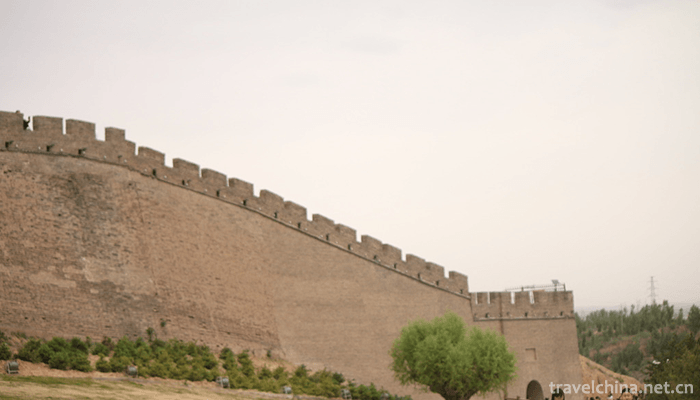
The first floor is the base, 82 meters north, 76 meters south, 64 meters east and west, 320 meters circumference and 12 meters deep. It is surrounded by walls on all sides. The inner wall is 5.5 meters high, the outer wall is 10 meters high, and there are stacks on it. The south side of the east wall is built with city gates, and the south-east side is built with masonry road.
The second one is 16.6 metres high, 130 metres in circumference and 5 metres deep. There is a coupon hole in the second floor of Tainan wall. The inner brick and stone steps straight through three floors. The word "Xiangming" is inscribed on the front of the coupon hole, and the word "Zhenbeitai" (destroyed) is inscribed on the north side by Tu Zongxun, governor of Wanli Yansui. The word "Zhenbeitai" is the topic of Wei tradition, a contemporary calligrapher. The third floor is 4.1 meters high, 88 meters in circumference and 3 meters deep.
Outside Taitung, masonry steps up to four floors. The fourth floor is 4.4 metres high, 35.44 metres in circumference, 225 square metres in top floor area, 2 metres in depth on each side. A square watchtower with brick and wood structure built in the Central Plains collapsed in the late Qing Dynasty. All floors are surrounded by parapets and mounds, and the terrace floor is covered with green bricks. On the first level, there are garrison barracks built inside the city wall, and some remains are still there. Each floor of the platform has stone steps to climb. Taiyi Mountain is dangerous and tall. Standing at the top of Zhenbeitai, we can see the golden sand and blue sky, the Bicheng reservoir, the Great Wall, the green forest belt and the suburbs.
You can see the Hongshixia Reservoir, the brilliant achievements of desert control - Sandy botanical garden and desert canal - Xisha Canal, Yudong Canal; the Haizi scenery and lush orchards in Yupujie Desert; the beacon flames and rolling loess hills of the Great Wall of Qin Dynasty; and the Hongshan City, Yima City, Hongshixia and Yulin Ancient City, which had friendly trade between Han and Mongolia in the 16th century.
characteristic
Overview
Zhenbeitai, for the thirty-fifth year of the Ming Dynasty (1607) from April to July next year, Tu Zongjun, governor of Yansui Town, built the largest military observatory on the Great Wall of the Ming Dynasty, known as the first Great Wall, in order to protect Hongshan City, which is located in the Mutual City of Mongolia and Han on the edge of the nearby Great Wall. It has a history of nearly 400 years up to 2009.
Zhenbeitai is located three kilometers north of Yulin City. It belongs to the national key cultural relics protection unit. In 2002, Jiang Zemin visited this platform personally, giving a glimpse of the local customs.
Zhenbeitai is located on the top of Hongshan Mountain, 4 kilometers north of Yulin City, Shaanxi Province. It is only 2 kilometers away from Hongshixia and 7 kilometers away from Yulin City. It was built in the thirty-fifth year of Wanli in Ming Dynasty (1067). Taiyi Mountain is in danger. It commands the throats of the north and the South and locks the main entrance of the Great Wall. It is an important pass and military lookout in ancient times.
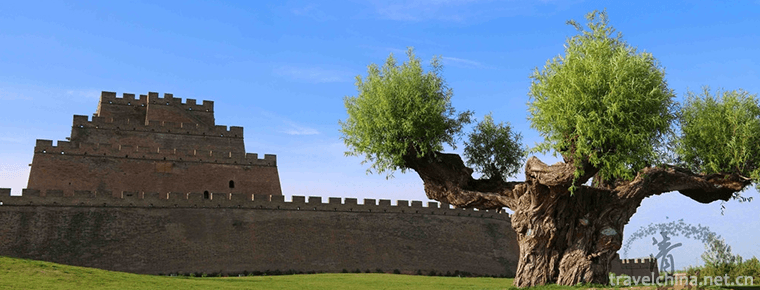
The word "Xiangming" in the forehead title of Tainan is Tu Zongruishu, governor of Wanli Period. It belongs to one of the observatories of the defensive system of the Great Wall of Ming Dynasty and is the Great Wall fortress in Northwest China. The sentry collapsed in the late Qing Dynasty. Every layer of Zhenbeitai is covered with surface bricks, and the top of each layer of platform is covered with brick stacks, about 2 meters high, and a hopeful mouth is built. The moss marks are barged, which is very simple and magnificent.
Governor Yansui of the Ming Dynasty, Governor of the Three Sides of Shaanxi Province and Right Sergeant Liu Minkuan of the Ministry of Military Affairs visited Zhenbeitai and wrote the poem "Zhenbeitai":
The autumn sounds of the important town are very loud, and the tour is not for the stage.
Thousands of mountains stretch far into the clouds, and a stream of water comes from the desert.
Cui Kuo of Xuge is close to the sky, and the stopper is twirling around the earth.
With Gao Ji's eyes on the wolf Yanjing, it seems that it is Xiaoyao Diaoyuan.
Kung Gong City
On the east side of Zhenbei Tai, there is a "Qianggong City" built in the same period, with a circumference of 668 meters and an area of about 2 hectares. It offers tributes, gifts and trade talks to Mongolian and Han officials. Chengchi dangerous, and Zhenbeitai constitute a complete Yulin Great Wall building system.
800 meters southwest of Taiwanese, there is the Ming Dynasty Yima City, an area of about 6.5 hectares, is the city of Mongolian and Han folk free trade, but also the historical witness of the harmonious coexistence of Mongolian and Han nationalities.
Yi Ma Cheng
During the exchange period between Mongolia and Han in Hongshan City of Yima City, Mongolian herdsmen drove cattle, sheep, camels, horses and furs. Hans businessmen from all over the country also came to Hongshan City with large quantities of cloth, satin, salt tea, tobacco and wine. Here, herds of cattle and sheep, scales of bags, camels call horses, the voice of people, a bustling scene of trade between Mongolia and Han Dynasty.
In response, Yang Yun, a literati in the early Qing Dynasty, wrote in "Spring Outlook of Zhenbei Tai": Closing the door and opening up the wilderness, Niu and Yang came to the market day by day, after the wind and snow of ten thousand li spring, visitors pointed out Heliantai. People stood at the top of Zhenbeitai and looked around. They could see all the scenery for tens of miles. Southeast: the forest net farmland, vertical and horizontal channels, willows, as well as the vicissitudes of Yulin ancient city style, sparkling Yuxi River and the new modern city of Naxi Shalou; Northwest: is the scenery outside the fortress, countless green hills and dunes surrounded by oasis, under the platform: Yima City, Qianggong City, and Pinghu on the Red Stone Gorge and Gorge.
Travel?
Aviation: Yulin Yuyang Airport. There are flights to Xi'an, Beijing, Shanghai, Haikou, Taiyuan, Zhengzhou, Harbin, Lanzhou and other places with convenient transportation.
Highway: The total mileage of highway in the whole region reaches 18732 kilometers. Buses travel daily to other cities such as Xi'an, Yinchuan, Baotou and Taiyuan, as well as counties and towns in the region. If you take Volvo from Tangdu Bus Station in Xi'an at 8:30 a.m. to Yulin directly, it will arrive at 9 p.m. and the fare is 128 yuan. It can also be transferred from Yan'an Long-distance Bus Station to Iveco to Yulin for a journey of about 5 hours.
Zhen Bei Tai
-
Lake Manasarovar
Ma Pang yongcuo is 35 kilometers east of the town of Pu Lan county
Views: 194 Time 2018-10-12 -
Portuguese chicken
The Portuguese chicken is one of the representative dishes in Macao. It's a Portuguese food from Africa and India. It's made of whole chicken
Views: 250 Time 2018-11-14 -
Huizhou cake
Huizhou cake, originally named "jujube mud crisp baked bread", is a traditional feature in Huizhou area, Anhui Province.
Views: 249 Time 2018-11-27 -
Ancient songs of Miao Nationality
Miao Ancient Songs, local traditional folk literature in Taijiang County and Huangping County of Guizhou Province, is one of the national intangible cultural heritage.
Views: 275 Time 2018-12-15 -
Fish Swallow in Bazhen Fresh Soup
Ingredients: Six or two fish swallows are served well. Lentinus edodes, crab willow, Jinhua ham, clam, shrimp
Views: 222 Time 2019-03-27 -
Dai opera
Dai Opera, one of the national intangible cultural heritage, is a traditional drama in Jingpo Autonomous Prefecture of Dai Nationality in Dehong, Yunnan Province.
Views: 110 Time 2019-04-23 -
Hainan Zhai Opera
Hainan Zhai Opera is a traditional sacrificial ritual drama in Hainan Province. It is similar to the Nuo Opera in northern China. It is known as "Nuo Opera in the north
Views: 221 Time 2019-05-02 -
Qingxu Caimen Building
Qingxu Caimen Tower is a local traditional handicraft in Qingxu County, Shanxi Province. Xu Caimen Tower in Qing Dynasty is said to have originated in Tang Dynasty. During the festival, people gathere
Views: 163 Time 2019-06-11 -
Construction Techniques of Tujia Diaojiao Building
Tujia hanging-feet building construction skills, Hubei Xianfeng County, Hunan Yongshun County, Chongqing Shizhu Tujia Autonomous County, local traditional skills, one of the national intangible cultur
Views: 159 Time 2019-06-23 -
Zong Baonao
The dance used for sacrifice - the Yao Zong Baonao Dance is evolved from an ancient legend. According to Changtang Yao people, from generation to generation, in ancient times, a beautiful Yao mother l
Views: 349 Time 2019-08-16 -
Beijing University of Civil Engineering and Architecture
Beijing Architectural University is a pilot University jointly constructed by Beijing and the Ministry of Housing and Urban-Rural Construction, the "Education and Training Plan for Excellent Engi
Views: 158 Time 2019-09-06 -
Nanchong mineral resources
Nanchong mainly has rock salt, oil and natural gas, placer gold, ferrotitanium, uranium, phosphorus and other mineral resources. Nanchong is located in the core of Nanchong rock basin, the largest rock salt sedimentary basin in Sichuan Province. Underground
Views: 351 Time 2020-12-17
