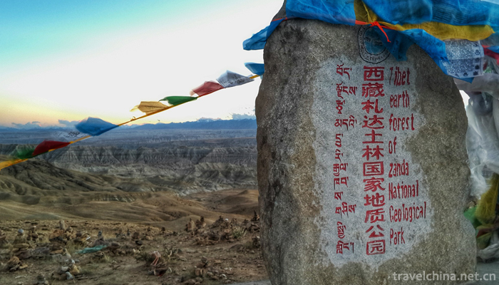
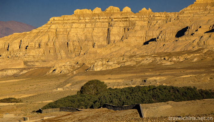
Zanda Tulin National Geological Park
Tibet Zanda earth Forest National Geopark is located in Zanda County, Ali Prefecture, southwest of Tibet autonomous region. In August 2005, the Ministry of land and Resources approved the fourth batch of national geological parks. It is a comprehensive geological park featuring a stone forest composed of red Ordovician carbonate rocks, as well as karst canyons, caves, lakes, springs and waterfalls. Including Hongshi Lin Karst Landform Scenic Spot, sitting Dragon River Gorge Scenic Area and Yifeng Lake Youshui river water body physiognomy scenic spot.
Located in the Tibetan Autonomous Region known as the "Roof of the World Ridge", the park is located in Pulan County to the east, Kashmir to the west, the Himalayas to the South and India to the north, Ayila Mountain to the north and Gar County to the center of Tolin Town, along the banks of the Xiangquan River, is a land characterized by soil forest landforms as the main geological relics. Texture and appearance of national geological park.
Distribution altitude is 3750 ~ 4450m, is the largest and most typical Neogene stratum weathering soil forest in the world. The geographical position is: 31 20 31 40 North latitude, 79 25 80 02 East longitude, and the total area of work area is 457.12 km.
Zhada Tulin National Geopark is situated at the junction of China and Kashmir, India and Nepal, 1500km from Lhasa City, there are about 700 km of sand and stone roads; 280 km from Shiquanhe Town, the seat of the Ali Regional Administration, of which about 120 km is Panshan sand and stone roads and dirt roads. The road is narrower and the road condition is poor. Tar oil is being built on this section of the highway. The road is expected to be opened to traffic in 2 years. The county has a total distance of 1065 km, including 219 national highways to Xinjiang, 318 national highways to Lhasa, the capital of the autonomous region, via Baer and Zhongba. Zanda County town leads to 6 villages and towns are all simple roads. Whenever the rainy season comes, some sections of the road can not be opened to traffic. So far, the county has poor overall traffic conditions.
Hydrology:
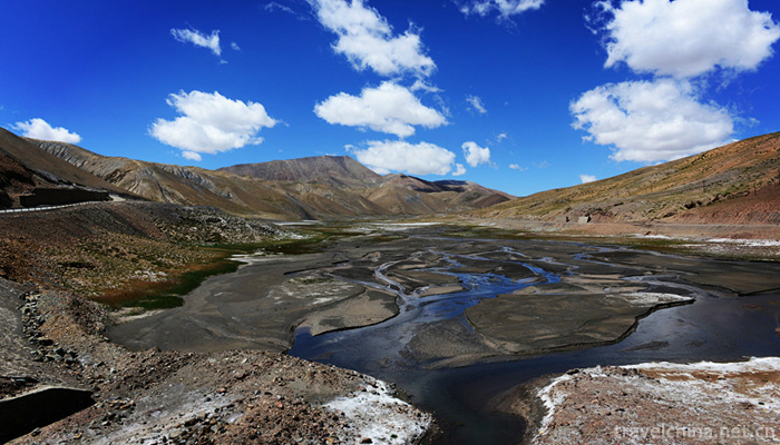
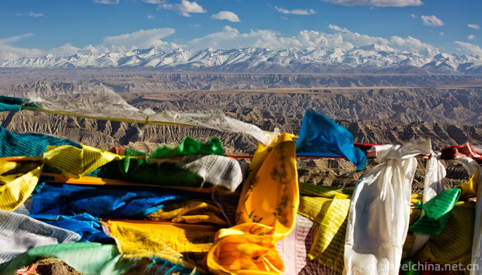
There are 14 large and small rivers in the territory, of which the Xiangquan River (known as the "Langqin Zangbu" in Tibetan) is the largest river flowing through the Zanda Basin, and the three outflow rivers in Zanda County have the largest average annual runoff. It originated from the Himalayan glaciers near the Lanta in the eastern part of Zanda County, because the mouth of the spring is shaped like an elephant cirrus. It is called the Quan river. After flowing through Qusundo, Torin and Ruba, it crosses the Himalayas west of the Shbuqi Pass and flows into India. It is renamed the Sutreki River. Xiangquan River has given birth to the brilliant Xiangxiong culture, Guge civilization, and magnificent landscape of earth forest.
Climate:
The climate of Zanda Basin is a plateau temperate monsoon arid region, which is greatly influenced by the alternation of westerly circulation and southwest monsoon. When the westerly circulation with the characteristics of climate subsidence prevails, Zanda presents the characteristics of dry climate, less precipitation, severe temperature difference and strong wind, and becomes the main weather system in winter. The southwest monsoon in summer enters over Zanda in early June or mid-June, which is characterized by warm climate and concentrated rainfall. The huge barrier action of the Himalayas on the south side of the Zanda Basin hinders the northward movement of the warm and humid currents to a great extent, thus making the Zanda Basin a "rain shadow area", and the annual precipitation is only about 160mm. Under the influence of the thermal effect of the valley basin, the climate in the Zanda basin has become very dry and hot. According to relevant meteorological data, the average annual temperature in Ali area is 3 C, and the average temperature in the hottest month (July) is 13.7 C. The monthly average temperature of the coldest month (January) is - 9.2, the days greater than 0, 230 days, 110 days greater than 10, the frost-free period is 124-130 days, and the annual sunshine hours are about 3,500 hours.
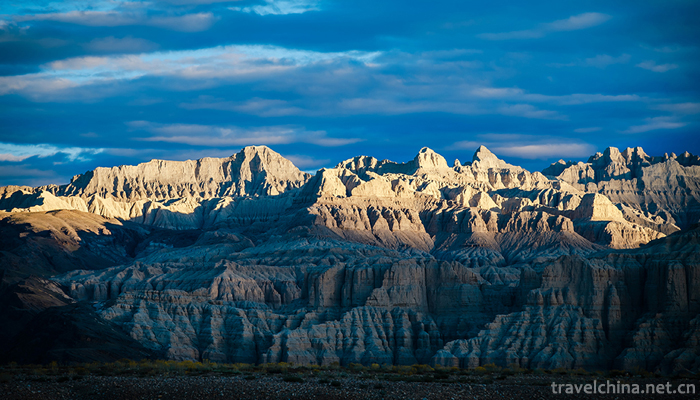
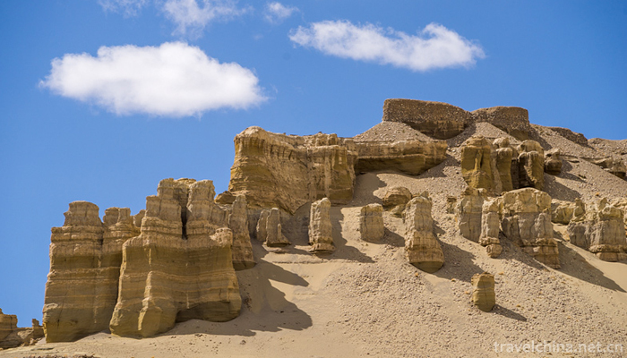
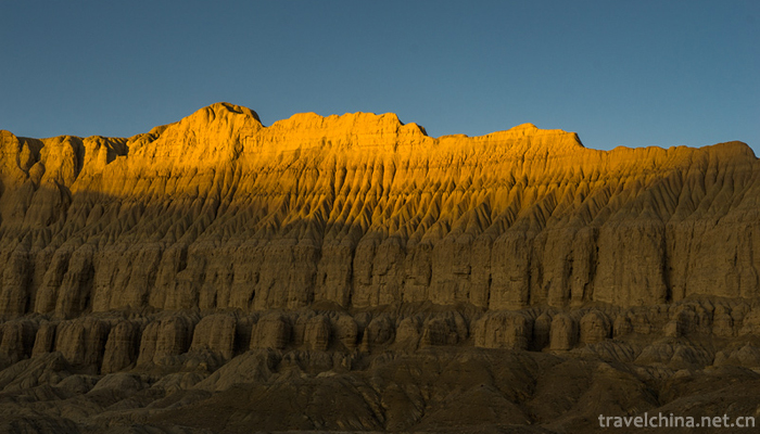
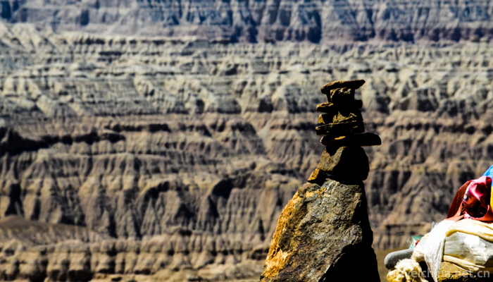
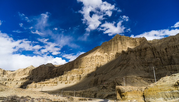
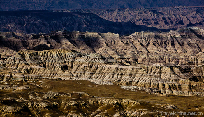
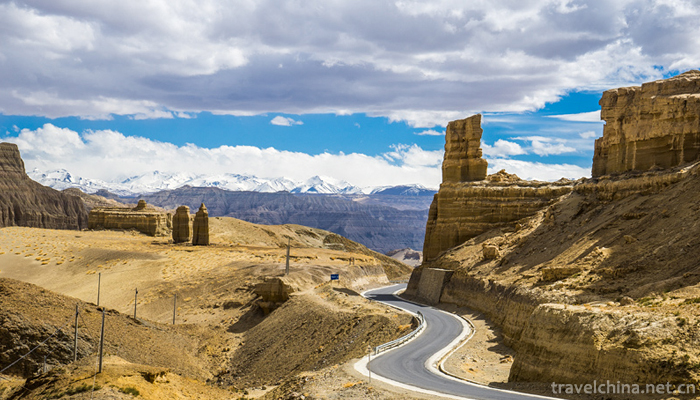
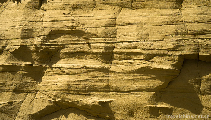
There are various types of geological relics in Zanda Tulin National Geopark, but the most representative one is the soil forest landforms occurring in the Zanda Group of Tertiary Pliocene to Quaternary Lower Pleistocene in Zanda Basin. Due to the differences in weathering resistance of various bedrock along the edge of the Zanda Basin, different landforms such as the number, scale, extension length and slope gradient of the tributaries and tributaries along the two banks of the Quanhe River are formed. The semi-consolidated rocks in the fluvial and lacustrine facies are formed after long geological evolution, such as undulation, overlapping of layers of forest and gas. The potential of the earth forest landscape. From a high point of view, the earth forest under the blue sky and white clouds stretches for hundreds of kilometers, stretching continuously and magnificently, like the ancient Gugexiong divisions marching in this vast land of Zada, making people solemn, solemn and solemn. The soil forest in Zanda area is the most typical, well-preserved, most peculiar and most widely distributed Tertiary stratum weathering soil forest landform found in the world. It is a typical area to study the development and evolution of soil forest landform.


Zanda Tulin National Geological Park
-
Mount Heng
Mt. Hengshan, also known as "Tai Mt. Hengshan", is known as "Xuanwu mountain" and "Yushan". Among them, inverted Ma Pass, Bauhinia Pass, Pingxiaoguan Pass, Yanmen Pass
Views: 224 Time 2018-10-30 -

Baishishan Scenic Area Baoding City Hebei Province
Baishishan Scenic Area, also known as Baishishan National Geological Park, is called "Xiaohuangshan" because its scenery resembles the Huangshan Mountain in Anhui Province.
Views: 298 Time 2018-11-24 -
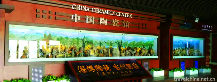
China Ceramic Museum
The China Ceramic Museum is located in the Cultural Square in the center of Zibo City. On the basis of Zibo Exhibition Hall in April 2001, it was transformed by large-scale investment
Views: 152 Time 2018-12-22 -
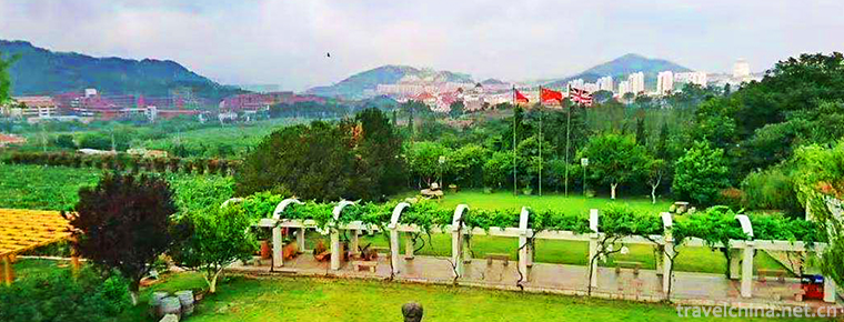
East China Bailey Winery
East China Wine Manor is located in Jiulongpo, Nanlongkou, Laoshan, Qingdao. It is the first European Wine Manor in China built strictly according to the European Wine Manor Model
Views: 191 Time 2018-12-26 -
Hongjiannao Scenic Area
Hongjiannao Scenic Area is located in Shenmu City, Shaanxi Province. It is located in the transitional zone between the Loess Plateau and Inner Mongolia Plateau, at the junction of Maowusu
Views: 135 Time 2019-01-16 -

Liao Zhai City
Liaozhai City was invested and built by Pujiazhuang, Zichuan. It is a large-scale famous garden scenic area with gardens as its manifestation and Liaozhai stories as its theme
Views: 187 Time 2019-01-30 -
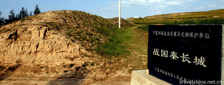
The Great Wall Site of Qin Dynasty in Ningxia
The site of the Great Wall of King Zhao of Qin Dynasty was built in the twenty-fifth year of King Zhaoxiang of Qin Dynasty (272 BC). It was built to defend against the invasion of the Huns in the sout
Views: 144 Time 2019-02-07 -

Poyang Lake National Nature Reserve
Jiangxi Poyang Lake National Nature Reserve is located in the north of Jiangxi Province. It is a nature reserve for wildlife protection. The main protected objects are rare migratory
Views: 217 Time 2019-02-07 -

Hengshui painting
Hengshui Inner Painting, a traditional folk art in Hengshui, Hebei Province, is one of the national intangible cultural heritage.
Views: 230 Time 2019-05-03 -

Flower shuttlecock
Shuttlecock is a traditional folk sport with a long history, which is widely spread in China. Regular exercise can activate muscles and bones and promote health. According to historical documents
Views: 307 Time 2019-05-04 -

Firing Techniques of Liling Unglazed Colorful Porcelain
The firing technology of Liling Unglazed Five-color Porcelain, the local traditional firing technology of Liling Unglazed Five-color Porcelain in Hunan Province, is one of the national intangible cult
Views: 185 Time 2019-05-13 -
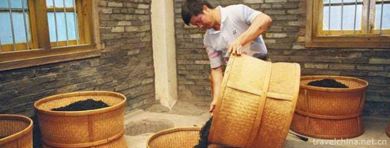
Production Techniques of Dahongpao of Wuyi Rock Tea
Wuyi Rock Tea (Dahongpao) production technology, local traditional handicraft in Wuyishan City, Fujian Province, one of the national intangible cultural heritage.
Views: 158 Time 2019-06-30