Yangtze River Source of Tuotuo River
Yangtze River Source of Tuotuo River
Tuotuo River: Located in Tanggula Mountain Town, Southern Region of Golmud City, Qinghai Province, it is the West source of the Yangtze River, south of the Hoh Xili Mountains. When it originated from the Jianggendi Glacier in Eastern Snow Mountains of Gradan, it was a stream of melting water from glaciers and ice buckets. At that time, the water surface was only 3 meters wide and only 20 centimeters deep. Then it flowed northward over a distance of 9 kilometers. Under the Bashan Mountains, the melting water from the glacier of the Gaqiadi Glacier Mountains was collected. After a valley about 15 kilometers long, it continued northward and was divided into two 4 meters wide. With the 6-meter river, there are many cobweb-like currents in the valleys on both sides of the river, which is the upper source of the Tuotuo River. At the exit of the valley, the valley suddenly cut down, forming a steep valley about 5 kilometers long, as high as more than 20 meters. After the confluence of many rivers, the Tuotuo River, the source of the Yangtze River, with its open channel and interlaced current, has been formed.
Administratively, it is under the jurisdiction of Tanggula Mountain Town, Golmud City (attached area).
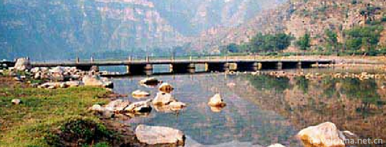
Related: along the Tuotuo River, the source stone tablet of the Yangtze River, the Tuotuo River Bridge and the Tuotuo River Railway Station.
Views on historical changes: in ancient times, the river after Garqu merged into Buqu was called Tongtian River (upper section), and that place was called Tongtian River (along Tuotuo River in the north), and Buqu was regarded as the main source; after the investigation in 1976, Tuotuo River was considered to be a long and large water volume, which stipulated that Tuotuo River was the main source and that the river below was called Tongtian River; later, it was found that Dangqu River was longer and had larger water volume. The Tongtianhe Bridge on Qinghai-Tibet Highway refers to Dangqu Bridge; the concept of river trees regards Buqu as the mainstay; contemporary Qinghai-Tibet Railway takes into account the historical term, and sets up Tongtianhe Station near the Buqu intersection along Tongtianhe.
Travel Tips
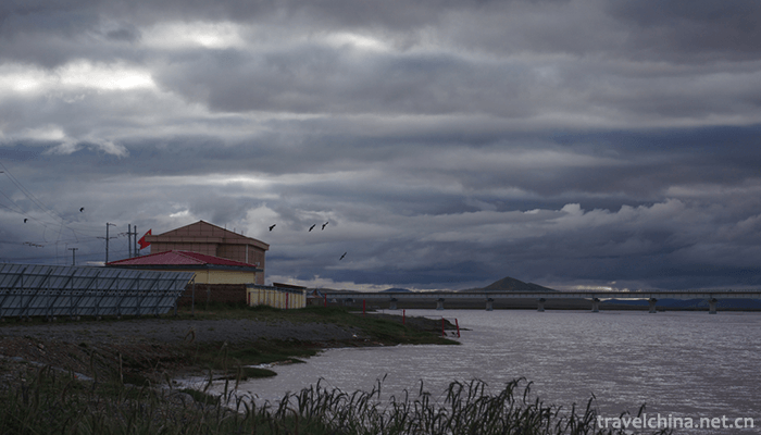
There are twenty or thirty roadside restaurants in the nearby town along the Tuotuo River (the residence of Tanggula Mountain Town), but the price of meals is more expensive. There are also 67 small hotels with general accommodation, and each bed charges 20 or 30 yuan per night. After 2008, it was merged into the State Grid and drinking water was also purified from the railway station.
The source of the Yangtze River (one of the three sources): that is, the source of the Yangtze River, that is, several sources of the Tongtian River, lies between the Kunlun Mountains and the Tanggula Mountains in the hinterland of the Qinghai-Tibet Plateau.
Historically, there are four sources: 1) Zhengyuan Benzhi (South Branch) is the first Tongtian River, which is the upper part of the Tongtian River in ancient times, i.e. Buqu, which is the main trend of the Qinghai-Tibet Railway in Tanggula Mountain Town area; 2) Zhengyuan Nanzhi Dangqu comes from the marshes at the eastern foot of the Tanggula Mountains, accepting Dangqu to form the second Tongtian River; 3) Zhengyuan Xizhutuo River began in Tanggu. The main peak of the La Mountains, the Great Ice Peak of Gradan East, forms the third Tongtian River when it accepts the Tuotuo River. 4) The Chumar River in the North originates from the southern foot of the Black Ridge Mountain in the Hoksili Mountains, which is the southern branch of the Kunlun Mountains, and the fourth Tongtian River is formed when it is accepted. Lemaqu (Xiushui River) between Zhengyuan and Beiyuan is the seasonal river.
In 1976, the investigation considered that the Tuotuo River was the main source. It was stipulated that the Tuotuo River would be called Tongtian River only when it joined the big river below, and Buqu in the upper reaches of Tongtian River in history was reduced to the largest tributary of Dangqu.
Later, it was found that Dangqu was the largest: it was longer than Tuotuo River and had a larger amount of water.
River Tree Concept: Buqu is the backbone of Tongtian River, with two branches left and right.
Contemporary Consideration: The contemporary Qinghai-Tibet Railway has Tongtianhe Station parallel to Tuotuohe Station (along the Tuotuohe River) in the place historically known as Tongtianhe Railway, taking into account the customary appellation in history.
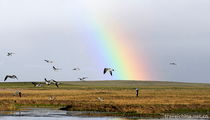
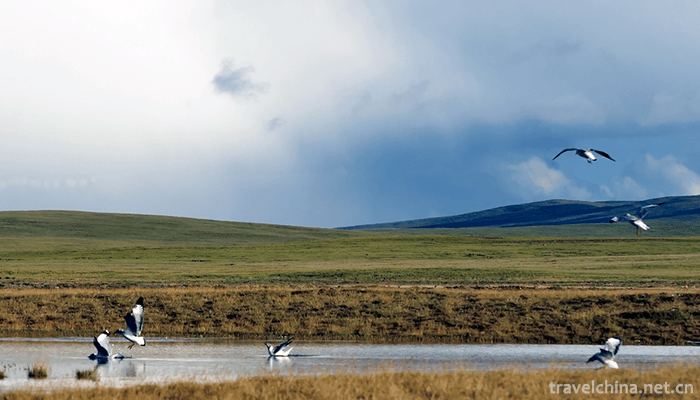
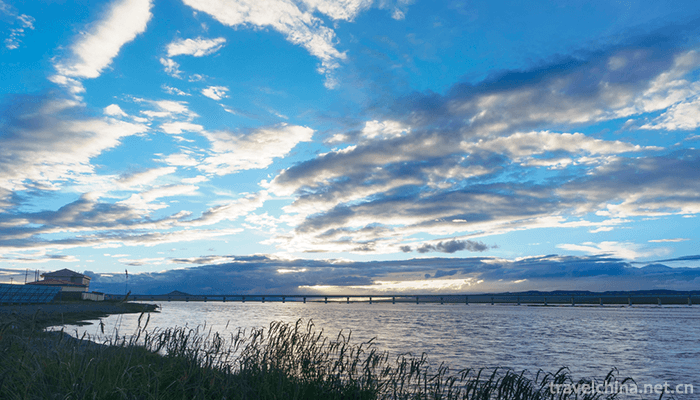
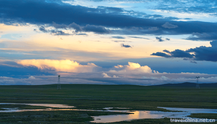
The Yangtze River source landscape is very magnificent, with snow mountain iceberg, boundless grassland, blue sky and white clouds reflected in the river water, constituting a relaxing and pleasant scenery.
The Yangtze River Source Reserve and the Kekexili Nature Reserve are interrelated, and its western part belongs to the Kekexili Nature Reserve and Tanggula Mountain Town.
Water volume comparison: Dangqu, the main source of the Yangtze River, has the largest amount of water and the longest length.
Introduction to Tuotuo River
Tuotuo River is also called Tuotuo River. Also known as the Ulan Mulun River, Mongolian means "Red River". Xiyuan of the Yangtze River in China. It originated in the glaciers on the southern side of East Snow Mountain in Geladan, the main peak of Tanggula Mountains. It is 375 kilometers (233 miles) long and forms the source water system of the Yangtze River together with Dangqu and Chumar rivers.
Tuotuo River is the Western source of the Yangtze River. As early as Shangshu, people were discussing the origin of the Yangtze River. Xu Xiake, a famous Traveler in the Ming Dynasty, believed that the Jinsha River was the origin of the Yangtze River and wrote the book Jiangyuan Kao. By the Qing Dynasty, people had realized the Tongtian River, but still could not determine the source of the Yangtze River. In 1956 and 1977, China visited the source areas of the Yangtze River twice. In 1977, it was found that the Tuotuo River, which originated in Geladandon, was the source of the Wanli Yangtze River.
When the Tuotuo River originated from Jianggendi Glacier in Geladandong, it was a stream of melted water from glaciers and ice buckets. At that time, the water surface was only 3 meters wide and only 20 centimeters deep. Then it flowed northward over a distance of 9 kilometers. Under the Badong Mountains, it collected melted water from the glaciers of the Gaqiadi Glacier Mountains. After a valley about 15 kilometers long, it continued northward and was divided into two 4 meters wide and four meters deep. There are many cobweb-like currents in the valleys on both sides of the 6-meter river, which is the upper source of the Tuotuo River. At the exit of the valley, the valley suddenly cut down, forming a steep valley about 5 kilometers long, up to more than 20 meters.
After flowing out of the Badong Mountains, the river first passes through a vast floodplain, then through a canyon, and then flows to the Hulu Lake, where it turns eastward. After more than 130 kilometers of flow, the river became wider. When it reached the Tuotuo River along the Qinghai-Tibet Highway, it was already a big river with a depth of 3 meters and a width of 20-60 meters.
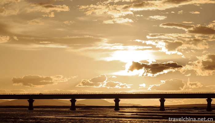
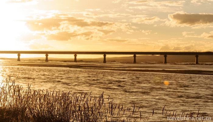
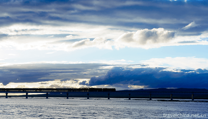
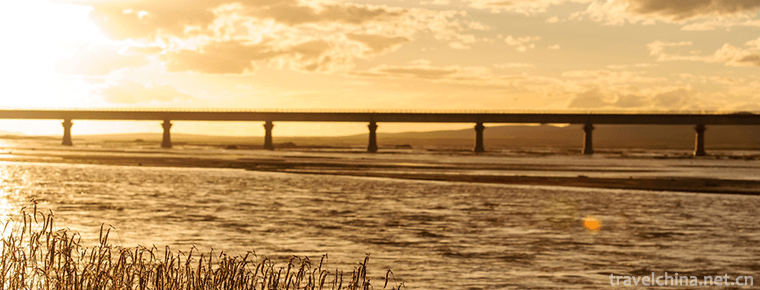
The famous Wanli Yangtze River First Bridge is built on the beach along the Tuotuo River. It is 324 meters long and 11 meters wide reinforced concrete bridge.
The Tuotuo River continues eastward from here, and joins Dangqu, Buqu and Dorqu at the time of Baoji Balong. It passes 375 kilometers and forms a large river more than 30 meters wide. From here its name is Tongtian River.
Pictures From:
http://bbs.fengniao.com/forum/10545389.html
Yangtze River Source of Tuotuo River
-
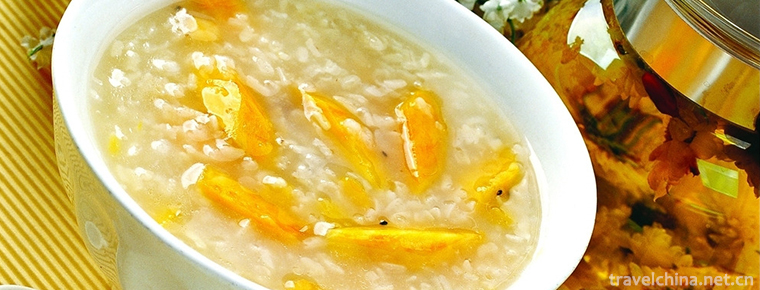
Sweet potato porridge
Main ingredients for food ingredients: 250 grams of fresh sweet potato, 150 grams of Japonica rice, a number of red dates, and a proper amount of sesame seeds
Views: 318 Time 2018-11-02 -

Beijing Olympic Park
Beijing Olympic Park Located in Chaoyang District of Beijing, Beijing Olympic Park is located at the north end of the central axis of Beijing
Views: 193 Time 2018-11-24 -
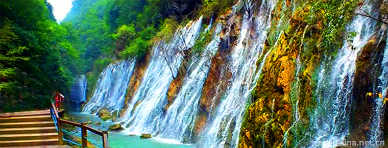
Zhongba Grand Canyon Scenic Area
Shiquan Zhongba Grand Canyon is located in the southern side of the Hanjiang River in Shiquan County, Shaanxi Province. It is 20 kilometers away from the county town
Views: 144 Time 2018-12-22 -
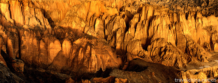
Jingtai Yellow River Stone Forest
The Yellow River Stone Forest is located in the southeast of Jingtai County, Baiyin City, adjacent to Longwan Village, Zhongquan Township. It covers an area of about 10 square kilometers
Views: 262 Time 2019-01-29 -
Traditional Chinese Medicine Culture
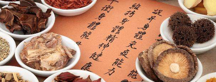
Traditional Chinese medicine (TCM) is the oldest and most complete medical system in the world. It is not only a method of treating diseases, but also a complete philosophy of the universe and life.
Views: 149 Time 2019-04-22 -
Production Techniques of Black Tea
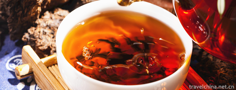
Qimen Black Tea is the only black tea among the top ten famous teas in China. It is produced in Qimen County, Anhui Province. Tea production in Qimen has a long history, which can be
Views: 157 Time 2019-05-03 -
Nuwa Festival
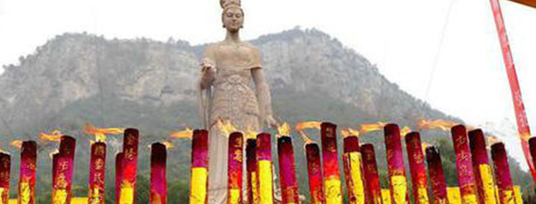
Nuwa Festival is an ancient traditional folk custom and folk religious and cultural activity. Legend has it that the eighteenth day of the third month of the lunar calendar is Nuwa's birthday. Therefo
Views: 274 Time 2019-06-08 -
Legend of Yongding River
Yongding River legend is one of the local folklores in Beijing. Among many legends, the legend of river blocking is representative; the legend of Shijing Mountain and Shijing Mountain; the legend of b
Views: 132 Time 2019-07-14 -

Rongxian Giant Buddha
Located in the eastern suburb of Rongxian County, Sichuan Province, the Giant Buddha of Rongxian county is carved in the Tang Dynasty. It is a cliff carved statue of Sakyamuni, 36.67 meters high, 8.76 meters long, 12.67 meters wide, 12 meters high and 3.5 meters wide. It is the world's largest Sakyamuni Buddha (Modern Buddha).
Views: 338 Time 2020-10-15 -
History of Mianyang
Mianyang, located in the south of Mianshan mountain, was named Mianyang in 1913 according to the ancient meaning of "south mountain and North Water" as "Yang".
Views: 156 Time 2020-12-14 -
Population of Mianyang
By the end of 2018, the total number of households in Mianyang was 2 million 61 thousand and 800, and the registered residence population was 5 million 362 thousand. At the end of the year, there were 4.857 million permanent residents, with the urbanization
Views: 123 Time 2020-12-14 -
Dazhou Railway
Railway lines: Chengdu Chengdu Railway, Xiangyang Chongqing railway, Dazhou Wanzhou railway, Daba railway and Chengdu Dazhou Wanzhou high speed railway (planned)
Views: 92 Time 2020-12-20