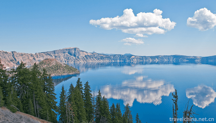
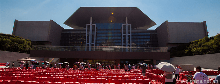
Tianshan Tianchi Scenic Area
Tianchi Mountain: World Natural Heritage, National AAAAA Class Tourist Scenic Spot, National Geopark, National Key Scenic Spot, National Civilized Scenic Spot, International and Natural Biosphere Reserve, China's Best Tourist Place, China's Top Ten Scenic Spots with Best Resource Protection, China's Top Ten Charming Leisure Tourism Lakes.
Tianchi Mountain, known as "Yaochi" in ancient times, is located in Fukang City, Changji Hui Autonomous Prefecture, Xinjiang Uygur Autonomous Region. On the north side of Bogda Peak, it is a natural scenic spot centered on alpine lakes, 97 kilometers away from Urumqi City. The planned area of the scenic spot is 548 square kilometers, which is divided into 8 scenic spots, 15 scenic spots and 38 scenic spots. It is a typical mountain-type natural landscape in arid areas of Northwest China.
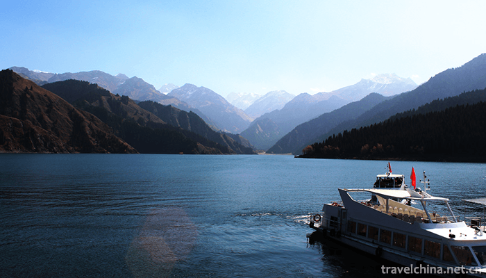
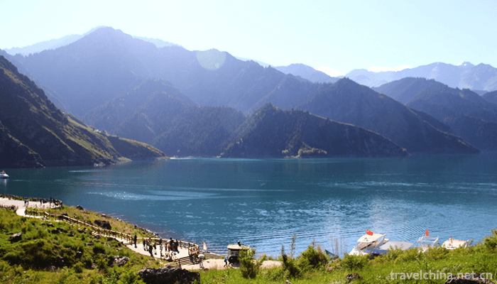
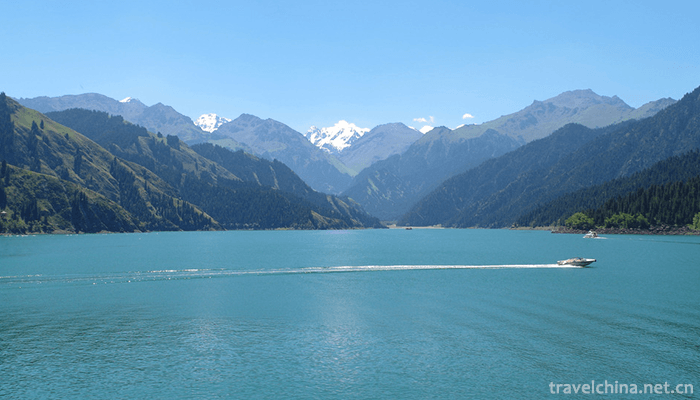
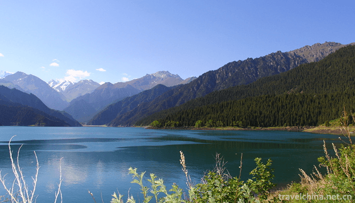
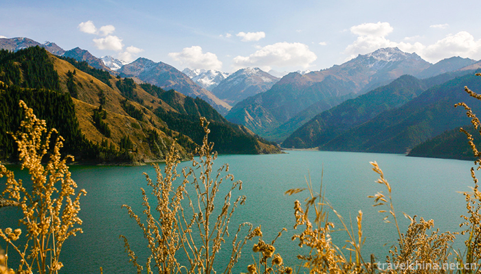
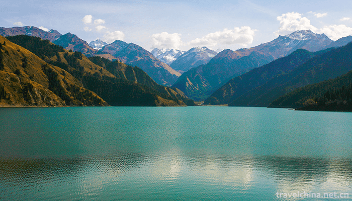
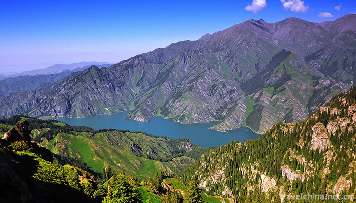
Tianchi Lake in Tianshan Mountains is 1910 meters above sea level, 3.5 kilometers long in North and south, 0.8-1.5 kilometers wide in East and west, and 103 meters deep in the deepest part. Surrounded by spruce on the lakeside, the snow peaks are magnificent. It is a famous summer resort and tourist destination. The origin of Tianchi Lake includes two theories: paleo-ice erosion-end moraine barrier lake, landslide barrier lake and landslide barrier lake. Tianchi Tianshan Mountain, snow peak reflected, spruce surrounded, clear water like mirror, picturesque scenery.
Tianchi Mountain is characterized by a complete vertical natural landscape belt, snow-capped glaciers and alpine lakes, with the myth of the ancient Queen Mother of Yao Chi West and religious and unique ethnic customs as its cultural connotations. It is the best place for sightseeing, popular science investigation, adventure tours, leisure and fitness, and national customs and sightseeing. In the 2008 Northwest China Tourism Marketing Conference and Tourism Equipment Exhibition, it was included in the "Magic Northwest 100 Sceneries" list.
Development and construction
In June 1980, the People's Government of Xinjiang Uygur Autonomous Region established Tianchi Nature Reserve with Bogda Peak as the center.
In November 1982, Tianchi Mountain in Xinjiang was approved by the State Council as the first batch of key scenic spots in the country.
On March 27, 1990, UNESCO approved the Biosphere Reserve at the northern foot of Bogda Peak, a temperate desert area in China, to join the United Nations Human and Biosphere Program, which mainly protects the biodiversity and natural landscape of Tianchi in the northern foot of Bogda Peak, and provides a model for the protection and rational utilization of deserts in China and the world.
In August 1990, with the approval of UNESCO and Tianchi Mountain as the center, the International and Natural Biosphere Reserve Protection Network of Bogda Peak was established. The reserve covers an area of about 1600 square kilometers.
In 1993, the Ministry of National Construction approved the "Master Plan of Tianchi Scenic Spot in Tianshan Mountain".
In 2000, Tianchi Mountain was rated AAAAAA Scenic Spot by the National Tourism Administration. The opening of Tianchi two-way highway will form Tianchi-Dabancheng-Turpan ring-shaped Golden Tour route. After the completion of the Bogda National Glacier Park and the Fossil Mountain Geological Park of Time Tunnel, Tianchi Scenic Spot in Tianshan Mountain, Xinjiang, will become more magnificent and mysterious, making Hainei more attractive. Foreign guests and visitors are fascinated and linger on.
Brief introduction of scenic spots
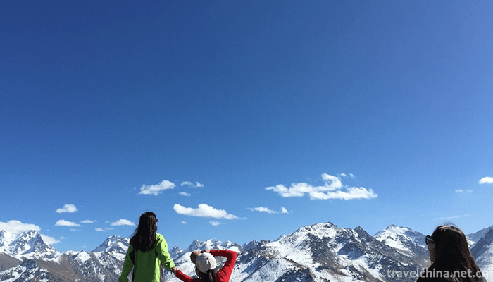
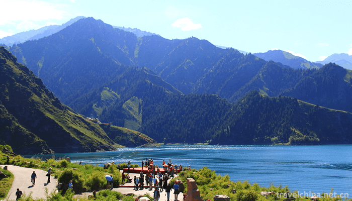
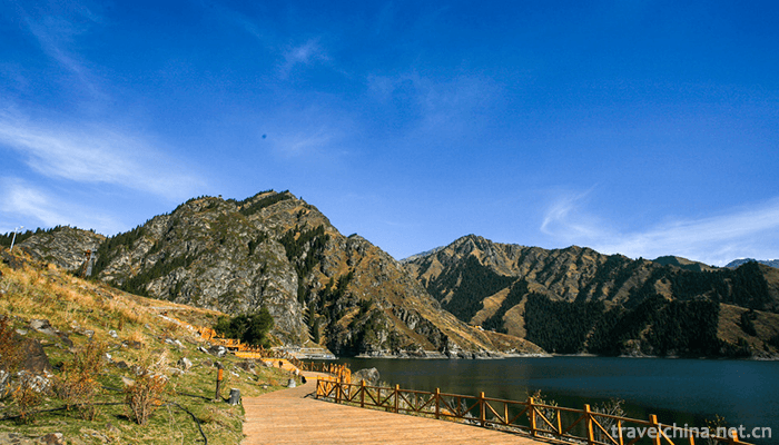
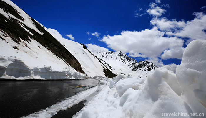
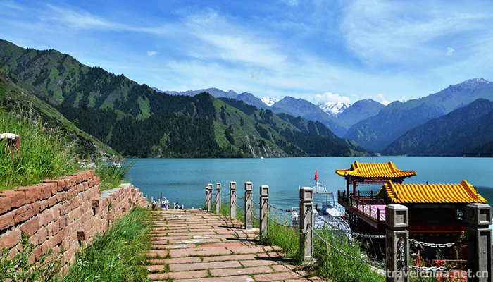
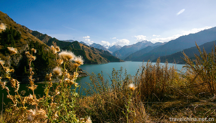
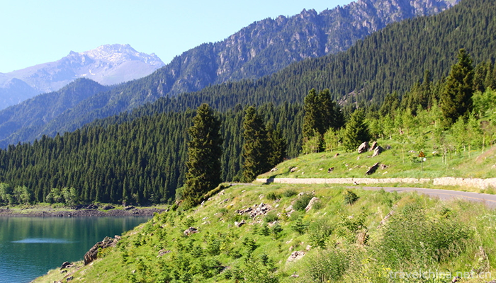
Tianshan Tianchi Scenic Spot is a national AAAAA class tourist attraction. Located in Fukang City, Changji Hui Autonomous Prefecture of Xinjiang Uygur Autonomous Region, about 110 kilometers away from Urumqi, it is an alpine lake formed by ancient glacial debris flow blocking rivers. Located at the mountainside of Bogda Peak, the highest peak in the eastern part of Tianshan Mountains, Xinjiang, it is a half-moon-shaped lake with an area of 4.9 square kilometers. It is a world-famous alpine lake. Bogda Peak in Tianshan Mountains is 5,445 meters above sea level, covered with snow and glaciers all year round. Tianchi is located in the upper reaches of Sangong River on the northern slope of Tianshan Mountain, with an elevation of more than 1,900 meters. The lakeside is densely forested and green. With the different altitudes of sea level, it can be divided into four natural videotapes: Glacial Snow belt, Alpine subalpine belt, mountain coniferous forest belt, and Tianchi Scenic Spot in Tianshan Mountains, Xinjiang. At the same time, Tianchi can enjoy the scenery of snow mountain, forest, clear water, lawn and flowers. There are also small Tianchi, Lightpole Hill, Shixia and other attractions nearby. Tianchishi was called "Yaochi" in ancient times. It was named Tianchi by the meaning of "Tianjing" and "Shenchi" in the Qianlong period of Qing Dynasty.
The Tang Dynasty Romantic poet Li Bai "invite you to redeem the emperor Mu Tianzi, still be able to make a shadow dance Tianchi", which is the first to call Tianchi today. First, it comes from Li Zhichang, the accompanying son of Qiu Chuji, the leader of Quanzhen School of Taoism in the Yuan Dynasty, who wrote "Journey to the West of Changchun Real Man", "There are pools on the mountains, with snow peaks standing around, reflecting the pool in the pool, the name of the teacher is Tianchi Another is from the Qing Dynasty Urumqi Dutong bright "Lingshan Tianchi Shuchi Canal Stele" -- "See the vastness of Shenchi, such as the sky mirror floating in the sky" sentence "Tianjing" and "Shenchi" of the "heaven" and "pond" synphony. Tracing back to its origin, Tianchi was established by Taizong of Tang Dynasty in 648 A.D. at Bogda Peak as the Yao Chi Capital Protectorate. It was changed to ice lake in Song and Yuan Dynasties and was called Tianchi in Qing Dynasty.
Scenery characteristics
Tianchi Scenic Spot, with Tianchi as its center, integrates forest, grassland, snow mountain and human landscape into a whole, forming a unique landscape features. It starts at Shimen in the north, reaches the snow line in the south, reaches the Maya Mountains in the west, and reaches the Donggou in the east, covering a total area of 160 square kilometers. Standing on the high ground, looking forward, a green wave, one after another, that Hong Bibo hangs high in the middle of the mountain, just like a jadeite Calendula is held high by the giant hand of the rock mountain. Along the coast, the pines and cypresses are craggy and smoky; the mountains are covered with green grass and flocks of sheep are moving; and there are thousands of years of ice peaks, silver-coated, steep and unusual, the whole lake and mountain scenery is beautiful.
Tianchi has three water surfaces, besides the main lake, there are two water surfaces on both sides of the East and west. The east side is the small Tianchi Lake. The ancient name of Heilongtan is located 500 meters east of Tianchi Lake. It is said that it is the place where the West Queen Mother bathes and washes. Therefore, it is also known as "combing and washing Jian" and "bathing fairy basin". Under the pool is Baizhang Cliff, there are waterfalls flying down, just like a long rainbow falling according to the sky, which is spectacular and helps to form a "hanging spring Yaohong" in a day. The west side is the small Tianchi Lake, also known as the Yunutan Lake. Legend has it that the West Queen Mother washes her feet, which is located two kilometers northwest of Tianchi Lake. West small Tianchi like a full moon, the water is clear and deep, surrounded by Tasson. If the bright moon is in the sky, the silent shadow sinks into the wall and the scenery is infinite, so it also has a view day: "Longtan Blue Moon". There is also a waterfall on the side of the pool, tens of meters high, such as the landing of the Milky Way, spattering pearls with jade, which is called "Jade Belt Silver Curtain". There is Wentao Pavilion on the pool. It's very interesting to see the waterfall in the pavilion. The eyes can see the curtain rolling pool waves, the pine green water, and the ears can hear the water breaking through the rocks and the sound-shock rift valley.
Three kilometers west of Tianchi is Dengpu Mountain, 2718 meters above sea level, and the length of the mountain is about 3 kilometers. Laojun Temple and Dongyue Temple were built here. At that time, Taoist priests erected a pine pole on the top of the hill, hanging sky lanterns, which were not extinguished day and night. People in Urumqi used sky lanterns as a metaphor. As long as the lights were not extinguished, they foretold peace in the world. So the lamp was also called Taiping lantern. Looking from the lamp pole in Shanxi, Urumqi can have a full view, especially when the Chinese lantern is on the rise, it is a great pleasure to see the lights of Urumqi's ten thousand families from afar.
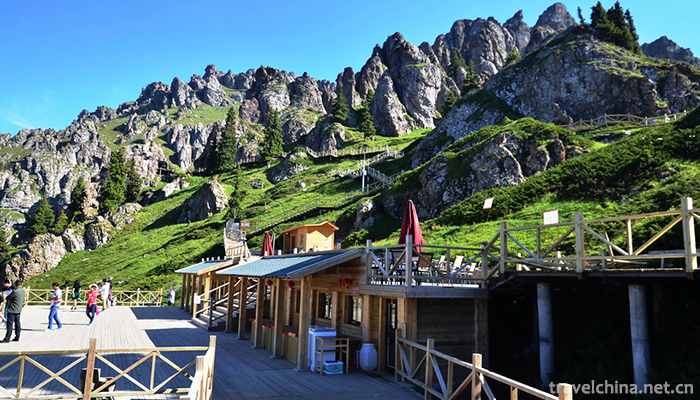
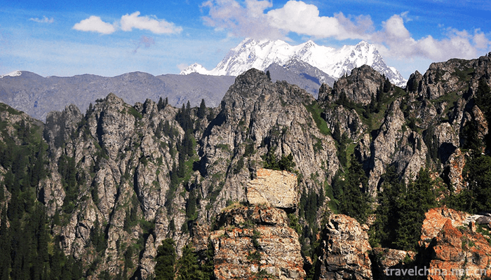
Two kilometers southwest of Tianchi, there is Maya Mountain, 3056 meters above sea level, 5 kilometers long, the top of the mountain cliffs and cliffs, huge rocks stand, like a row of huge Maya, hence the name. Maya Mountain Stone Forest is a unique scenic spot of Tianchi Lake. Those boulders are eroded by the wind and form the Maya Landscape of the hall. The stone hall has strange shapes, different shapes, or huge tusks, like beast bloodshed, or rolled up like waves of the sea layer by layer. Among them, a stone resembles an ancient herdsman, with a felt hat on his head and a calm manner. Walking into the Stone Forest always makes you daydream. On the top of Mount Maya, we can see Tianchi in the north, with beautiful eyes; Bogda in the east, three peaks in the snow sea, Urumqi in the west, Lushe Tianzhuang in the west.
On June 21, 2013, the 37th World Heritage Conference, held in Phnom Penh, Cambodia, voted to include Tianshan Mountain in Xinjiang, China, in the UNESCO World Heritage List.
Tianshan Tianchi Scenic Area
-
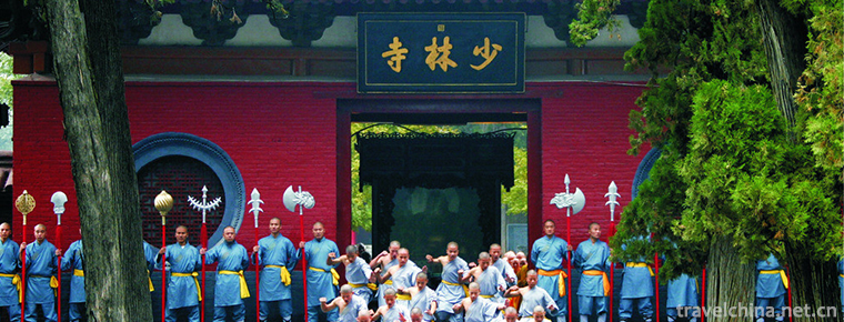
Shaolin Temple
Shaolin Temple is the birthplace of Chinese Buddhist Zen ancestors and Kungfu. It is now a world cultural heritage, a national key cultural relics protection unit
Views: 143 Time 2018-11-11 -
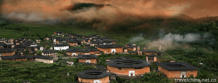
Fujian earth building (Fujian Tulou)
Fujian Tulou is also called "Hakka Tulou" because most of it is built by Fujian Hakka people. Tulou came into being in Song and Yuan Dynasty and matured in the late Ming
Views: 199 Time 2018-12-08 -
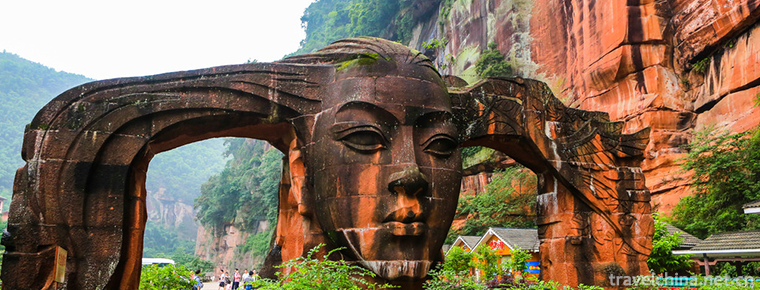
Danxia Chishui
Danxia National Geopark in Chishui City, Guizhou Province, is located in the southern edge of Sichuan Basin, close to the northern foot of Daloushan Mountain in northern Guizhou Province and the weste
Views: 231 Time 2019-01-05 -
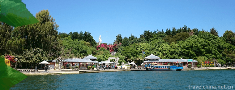
Nanzhao Custom Island Dali
Nanzhao Custom Island in Dali is one of the three islands in Erhai Lake, located in Shuanglang Township at the southeast end of Eryuan County, the golden section of Cang Er National Scenic Area
Views: 189 Time 2019-01-06 -
Hunan Provincial Museum
Hunan Museum is the largest museum of history and art in Hunan Province. It covers an area of 49,000 square meters and has a total floor area of 91,000 square meters.
Views: 131 Time 2019-01-16 -
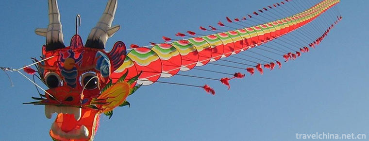
Kite making skills
Kite making skills, Weifang City of Shandong Province, Nantong City of Jiangsu Province, Lhasa City of Tibet Autonomous Region, Beijing, Tianjin and other local traditional skills, one of the national
Views: 137 Time 2019-04-29 -
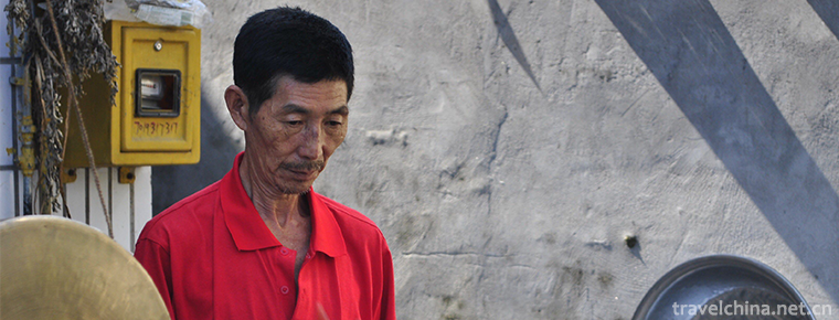
Liang Pings Gong and drum
Liangping Gong and drum is a kind of traditional folk instrumental music spread in Liangping District of Chongqing. In Liangping, the predecessors said that "Shu people Chao shan, gongs and drums
Views: 310 Time 2019-05-13 -

Yi Medicine Water Plaster Therapy of Yi Medicine
Yi medicine is the summary and wisdom crystallization of the Yi people's long-term struggle against disease, and it is an important part of the great treasure house of Chinese medicine. There are thou
Views: 227 Time 2019-07-12 -

Brocade Weaving Skills of the Zhuang Nationality
After thousands of years of development, the brocade has its own system of three categories, more than 20 varieties and more than 50 patterns. It is famous for its durability, exquisite skills, unique
Views: 224 Time 2019-08-16 -

Beijing Film Academy
Beijing Film Academy is a University of art with film history and profound film culture. Its predecessor is the Institute of Performing Arts founded in 1950. It was relocated in 1951 and renamed as th
Views: 184 Time 2019-09-06 -

Rongxian Gaoshiti Forest Park
The landform of Gaoshiti Forest Park is peculiar, with boulders, odd peaks, valleys and streams forming a typical natural landscape of low mountain landform in southern Sichuan. Gaoshiti Forest Park covers a total area of 182.13 hectares. It was approved as a provincial forest park by the provincial forestry department in 1993.
Views: 180 Time 2020-10-15 -
Tibetan lads are really popular
Who is Ding Zhen? He is a Tibetan Boy, 20 years old. On November 25, a tourism propaganda film "Ding Zhen's world" made him popular all over the country. Netizens once thought that his hometown was in Tibet, and the photographer could not help but clarify that Ding Zhen was from Litang County, Ganzi, Sichuan Province.
Views: 121 Time 2020-12-07