South China Sea Channel
South China Sea Channel
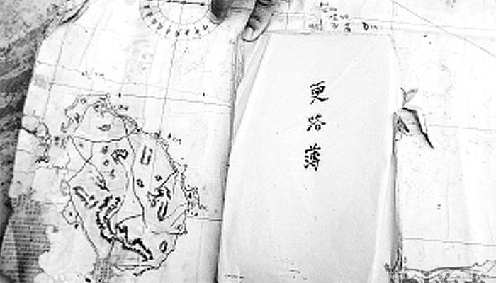
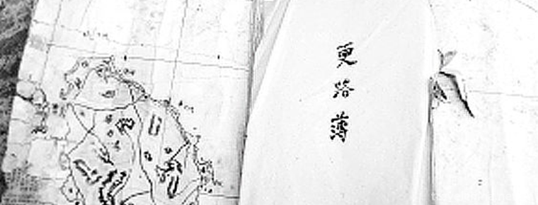
South China Sea Channel is a traditional folk culture in Wenchang City, Hainan Province. Local fishermen have compiled their own "secret book" for navigation since ancient times. It is a handbook booklet to record navigation knowledge or a hand-drawn navigation book. In Wenchang, Qionghai and other places, fishermen's biography of "Geng Lu" can be traced back to the Ming and Qing Dynasties. A compass plus a copy of "Geng Lu" enables Chinese fishermen to go to the South China Sea smoothly without accurate navigation icons and satellite positioning systems, and to trade in the South China Sea. It is a necessary chart for every captain and the route, essentials, meteorological flow recorded in the chart, not to mention how many fishermen have exchanged their blood for "life route". It provides strong evidence to prove that Xisha and Nansha Islands belong to the territorial sea of China.
On June 14, 2008, the South China Sea Channel, declared by Wenchang City, Hainan Province, was approved by the State Council and listed in the second batch of national intangible cultural heritage lists.
historical origin
"Nanhai Geng Lu Jing" also has the names of "Nanhai Road Jing", "Nanhai Timing Jing Bit", "Southwest Sha Geng Book", "Downwind Deli", "Note East and Beihai Geng Road Book", "Waterway Book to West and Nansha". Different names have different manuscripts and oral expressions.
The South China Sea islands and reefs were first discovered and developed by the Chinese people. Historical records show that 7,000-3,000 years ago, a branch of the "Luoyue people" from southern China came across the sea and became a living ancestor of Hainan Island, later known as the Li nationality, indicating that people had mastered the skills of crossing the sea at that time.
As far back as the Qin and Han Dynasties, Chinese ancestors had already carried out maritime trade and fishery production activities in the South China Sea. Since the Han Dynasty, China has opened the "Maritime Silk Road" to communicate with many countries in Southeast Asia, South Asia, Oceania, Africa and Europe. Hainan Island and the South China Sea Islands are necessary places. Numerous merchant ships, full of traditional Chinese goods, sailed away, while returning to many exotic treasures abroad, maritime trade came into being at the historic moment.
According to experts'textual research, "Nanhai Geng Lu Jing" was formed in the Ming Dynasty. Today, Hainan fishermen are still enriching "Nanhai Geng Lu Jing" in practice.
The South China Sea islands and reefs are scattered, which are regarded as dangerous roads by navigators. In the central part of the Nansha Islands, there is a proverb that "three lives are lost by sailing on water". Generations of captains have passed on from mouth to mouth, taking notes, sorting out navigation technology, route currents and island reefs, which is the crystallization of fishermen's wisdom --- the South China Sea Passage.
There are two kinds of Nanhai Geng Lu Jing, one is handed down in the form of manuscripts, commonly known as Nanhai Geng Lu Ji, and the other is handed down orally, commonly known as "Geng Lu Zhuan". Mainly distributed in Wenchang and Qionghai coastal areas. Second, Haikou City, Lingshui Li Autonomous County, Wanning City, Sanya City, Lingao County and other port and coastal fishing villages.
The so-called "more routes, more routes, more routes" is actually the "secret book" of navigation compiled by fishermen for their own use since ancient times. It is a manuscript brochure to record navigation knowledge, or a hand-drawn chart of navigation, which is a necessary chart for every captain.
Folklore activity "Sacrificing Brothers Off the Sea Ceremony" is a series of folk custom celebrations such as "Sacrificing 108 Brothers Off the Sea" and a ceremonial that fishermen in Qionghai must hold before voyage. The ceremony is popularly known as "making good fortune" in order to make the voyage smooth and peaceful.
Inheritance and Protection
Value Significance
The value and significance of the book are as follows:
The place names recorded in Geng Lu Jing of South China Sea Channel are named by Hainan fishermen and have been used up to now. They have strong Hainan dialect characteristics, such as replacing islands and islands with "shi" and referring to hidden reefs with "sand" or "line", which fully proves the long history of Hainan residents'development and construction of Xisha and Nansha, and proves that Nansha has been the territory of China since ancient times; Geng Lu Jing of South China Sea Channel 》 The scope of navigation recorded in the book is different from that in the general nautical needle scriptures. It focuses on the Xisha and Nansha sea areas. There are not many records about the overseas alternative routes. The hydrological and meteorological information recorded in the book, such as routes, reef landforms and sea conditions, as well as waves, tides, wind directions and storms, are valuable historical materials for the study of China's navigation history and the development history of the South China Sea.
"The South China Sea Channel is more accessible" is the historical witness of the ancient Qionghai fishermen's development of Xisha and Nansha Islands, which provides strong evidence to prove that Xisha and Nansha Islands belong to the territorial sea of our country. "South China Sea Channel More Route" is a practical guide for the navigation of the "Silk Road on the Sea", which has a precious historical value and significance for the study of the history of overseas Chinese, foreign trade and the development history of the South China Sea.
Protection Planning
The protection of Geng Roadbook, an important cultural relic of the South China Sea in Hainan Province, has attracted many attentions. In view of the lack of successors of the "Geng Lu Book" heritage, Wenchang and Qionghai cities in Hainan Province have drawn up a "three-year plan" for its salvage protection, in-depth searching for old fishermen familiar with the "Geng Lu Book", increasing subsidies for the successors of the "Geng Lu Book", establishing institutes and special databases, etc., to prevent them from dying with the progress of navigation technology.
"Nanhai Channel More Passage" is popular in the eastern coastal areas of Hainan. Its protection unit is the cultural halls of Wenchang and Qionghai in Hainan. At present, the project inheritance and dynamic protection are facing great difficulties. There are few successors and the collection of objects is very difficult. It is urgent to protect "Nanhai Channel More Passage". In order to save this precious cultural heritage, Wenchang and Qionghai have already done so. Start and implement the "South China Sea Channel More Passage" project protection plan.
data base
The plan puts forward that we should continue to search for old fishermen who are familiar with "more routes", record relevant information about "more routes of South China Sea Channel" in oral form by scientific means, and use multimedia means such as text, recording and video recording to record authentically, systematically and comprehensively the experience of different insiders and inheritors when they go to sea, and establish a special database.
Inheritor
In terms of enhancing the cultivation of inheritors, we should form a system of inheritance of "more routes" in the South China Sea by means of subsidizing "more routes" apprentices and setting up heritage centers, and encourage "more routes" to be disseminated and inherited among the public.
South China Sea Channel
-

Mount Hua
Mount Hua, known as "Xiyue" and "Taihua Mountain" in ancient times, is one of the five famous mountains in China and the birthplace of Chinese civilization
Views: 384 Time 2018-10-30 -
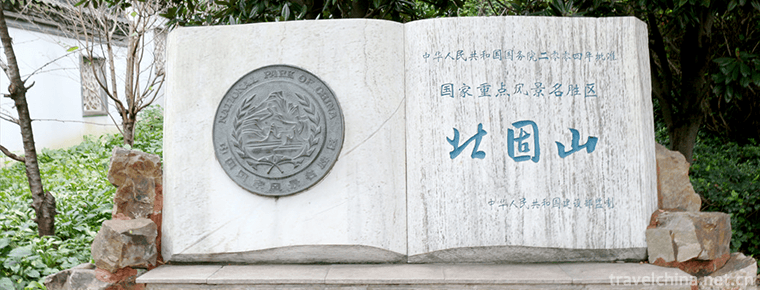
Beigushan HillBeigu Mountain
Beigu Mountain, one of the three scenic spots in Zhenjiang, overlooks Beigu, pillows the river, rocky walls, and the mountain is dangerous, so it is named Beigu Mountain
Views: 174 Time 2018-12-06 -

Dang Kou ancient town
Dangkou Ancient Town is located in the southeast of Xishan District, Wuxi City, Jiangsu Province. It is adjacent to the Yue noble tombs and Taibo Tombs in the west, and to Suzhou and Changshu in the e
Views: 165 Time 2019-01-08 -

Yongquan Qicheng Great Wall Ecological Scenic Area
The Great Wall of Yongquan Qi is a quiet tourist scenic spot, located in Yongquan Village, Zihe Town, Zibo City, where Pu Songling lived in the southeast mountain area. Here the mountains are connecte
Views: 139 Time 2019-03-05 -

Zhoucun Ancient Mall
Zhoucun Ancient Mall, also known as Street, is located in Zhoucun District, Zibo City, Shandong Province. The main road of Shandong Province, Jiqing Expressway
Views: 156 Time 2019-03-20 -
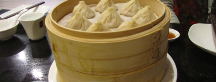
Traditional pasta making techniques
Traditional pasta making technology was listed in the second batch of national intangible cultural heritage list in 2008.
Views: 120 Time 2019-04-20 -

Dong Pipa Song
Dong Pipa song is distributed in the southern dialect area of Dong nationality, which can be divided into lyric and narrative Pipa song. Its singing content almost covers Dong history
Views: 151 Time 2019-04-28 -

Run Dong luo dongdong
"Lolola is a local traditional folk music in Hubei Province. It belongs to the first provincial intangible cultural heritage in Hubei Province. Jianli belongs to the Chu area of Jianghan since an
Views: 314 Time 2019-05-15 -

Jianmen Shu Road
Jianmen Shudao is one of the first batch of national scenic spots, with jianmengguan as the core, starting from Ningqiang, Shaanxi in the north and Chengdu in the south, with a total length of 450 km. The culture of the three kingdoms along Jianmen Shu Road is profound. Pang Tong, Jiang Wan, Jiang Wei, Deng AI,
Views: 239 Time 2020-11-08 -
Neijiang in yuan Ming and Qing Dynasties
In 1279, China was unified and the Yuan Empire was established. After more than 30 years of war between the end of Song Dynasty and the beginning of Yuan Dynasty, the system of Zizhou and Puzhou has not been restored except Jianzhou. In the 22nd
Views: 292 Time 2020-12-16 -
Nanchong ecological environment
In 2019, the total amount of funds used for environmental protection capacity building and supervision and operation of Nanchong City is 14.1809 million yuan, including 2.4476 million yuan for monitoring capacity construction and 11.7333 million yuan for environmental
Views: 327 Time 2020-12-17 -
Meishan peoples life
In 2019, the per capita disposable income of urban residents is 36743 yuan, an increase of 9.0%. The per capita consumption expenditure of urban residents was 23554 yuan, an increase of 12.0%; the per capita disposable income of rural residents was 18177
Views: 425 Time 2020-12-18