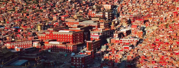
Sertar County
Sertar County is a county under the jurisdiction of Ganzi Tibetan Autonomous Prefecture in Sichuan province. Located in the northeastern part of Ganzi, north latitude 31 degrees 38 '-33 degrees 20', east longitude 98 degrees 48 '-101 degree 00'. Located in the intersection of Sichuan Province, Qinghai Province and Aba Prefecture, Ganzi Prefecture and Guoluo Prefecture of Qinghai Province, as well as the junction of Rantang County, Ganzi County, Luhuo County, Shiqu County, Dari County and Banma County, to the east of Yantang County, Aba Tibetan and Qiang Autonomous Prefecture, to the north of Banma and Dari counties in Qinghai Province, and to Ganzi Prefecture in the West and south of Gansu Province, respectively. Zhe and Luho two counties are adjacent to each other.
In 2011, the area under the jurisdiction of Seda County was 9338.98 square kilometers, covering 2 towns, 15 townships and 134 administrative villages. At the end of the year, the total population was 45 661, the birth rate was 11.09, and the natural population growth rate was 6.19.
In 2011, the county's total GDP reached 382 million yuan, an increase of 13% over 2010. Among them, the added value of the primary industry was 197 million yuan, an increase of 6.9 percent over 2010; the added value of the secondary industry was 33.45 million yuan, an increase of 14.6 percent over 2010; and the added value of the tertiary industry was 151 million yuan.
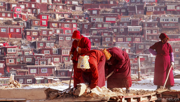
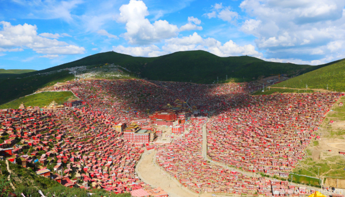
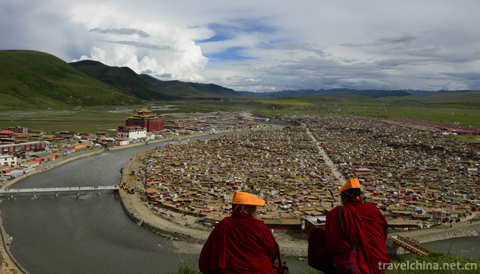
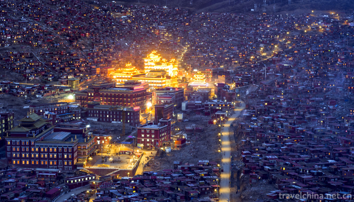
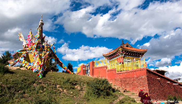
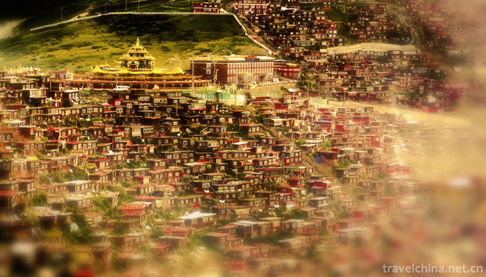
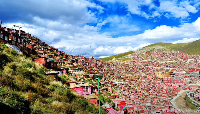
The city covers an area of 1.8 square kilometers, with 7802 permanent residents and an average of 8,000 floating people for many years. It is the political, economic and cultural center of the county. The city is composed of "three vertical and six horizontal" streets with "well" shaped roads. Seda County is the Tibetan people with the highest altitude, the coldest climate and the worst natural conditions in Ganzi Prefecture. Ethnic groups live together.
The origin of the name of Seda County, after textual research, is mainly due to the early discovery of a horse-shaped gold in Setang named, so it is known as "Golden Horse".
In September 25, 2018, the Ministry of Commerce received the honorary title of "e-commerce in 2018 into the rural comprehensive demonstration county".
It has a long history. As early as 3,000 years ago, human beings have been breeding here. The Dong clan, one of the six major clans of the ancient Tibetan, lived a nomadic life of water and grass. The local people called "Agaromai" that means ape man.
The ancient town of Se Da is Qiang.
Tang and song belong to Tubo.
Yuan is a branch of Tubo and other road propaganda and comfort department.
Ming is the ruler of the Department of command. At the end of the Ming Dynasty, the part of the tile bone system moved to Seda Duke and nomadic in the upper reaches of Ke Ke.
In the Qing Dynasty, Kang district changed the territory to return to the stream. Zhao Erfeng repeatedly referred to the attempt of zedad to return to Cheng Cheng.
In the period of the Republic of China, there was no change in Qing Dynasty.
In August 1952, Saida was liberated peacefully, and the Xikang government was built in Sichuan, Ganzi county. 1955 11 menstruation approved by the State Council county.
topographic features
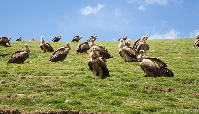
The topography of the county is complicated. Located at the southern foot of Bayan Kara Mountains, the tectonics belongs to the fold belt of Bayan Kara Mountains in the western Sichuan geosyncline system. The elevation of the whole area is mostly over 4000 meters. The whole terrain is inclined from northwest to southeast, high in Northwest and low in southeast.
Most of the area in Seda County is a typical hilly plateau, with dense streams and rivers in the northwest, poor drainage and swamp development. The gradient is less than 30 degrees, a few peaks protrude from the plateau 700-900 meters, elevation of more than 4000 meters for the typical hilly original landform, relative height of 500-1000 meters; below the altitude of 3500 Baerba valley, the river is deep, water erosion is serious, plateau mountain original landform. The total area is about 84% of the plateau area, 15% of the mountain area and 1% of Pingba.
The whole territory of Sai Da is cut by three faults. It is northwest or west. It belongs to the West Wing of Jin Tang arc. The Seda fault crosses the mud meander (river) along the Geletuo-Loroe-Seda line obliquely; the Kangle fault crosses the mud meander (river) basin along the Tazi-Kangle line; and the Xianshuihe fault only appears on the right side of the Daqu (river). Except for Geletuo-Luoruo-Seda fault, the three faults are relatively stable, the other faults are in active state.
hydrology
There are four big rivers in Seda County. The valleys are wide and shallow, with many branches and heart beaches. The first-order terraces develop and form plateau flat dams. The Daqu and Niqu rivers are the Yalong River systems. The Niqu (river) originates in the southern foot of the Bayan Kara Mountains and flows about 230 kilometers. The Duqu and Sequ rivers are the Dadu River systems. The Sequ river originates in the Tuolu Valley and flows 144 kilometers. The average annual runoff is 4.936 billion cubic meters, and the water energy reserves are 634.79 million kilowatts. The water energy reserves of the Sequ and Niqu rivers alone are more than 260,000 kilowatts. There are 18 tributaries in the basin area of 100 square kilometers.
climate
The climate of Seda County belongs to the continental plateau monsoon type. The annual average temperature is - 0.16 C, the January average temperature is - 11.1 C, the July average temperature is 9.9 C, the extreme minimum temperature is - 36.3 C, the extreme maximum temperature is 23.7 C, there is no summer in the long winter. Frost and snow can appear in all seasons, and the oxygen content in the atmosphere is less than 60% of the standard. The daily average temperature is more than 3 degrees, and the annual total solar radiation is 80 - 200 thousand /cm.
The annual average sunshine hours in SE Da county are 2451.1 hours. The average precipitation is 65L4mm, mostly concentrated from June to September. The average frost-free period of the whole region is 21 days. The area below 3700 meters above sea level is slightly longer, and there is no absolute frost-free period at high altitude.


Sertar County
-
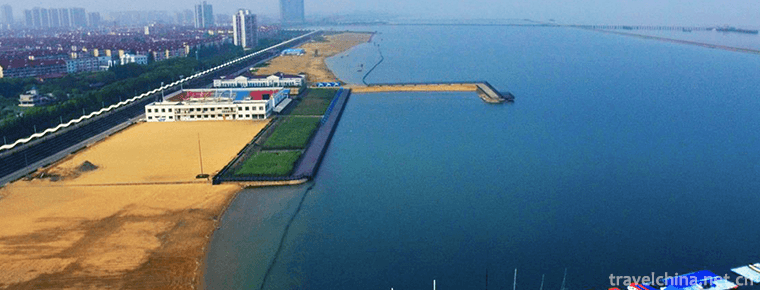
Jinshan City Beach Shanghai
Jinshan City Beach is located in Jinshan District of Shanghai, located in the southwest of Shanghai and the North Bank of Hangzhou Bay. It is adjacent to Pinghu and Jiashan City in Zhejiang Province
Views: 188 Time 2018-12-19 -
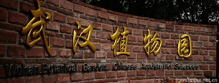
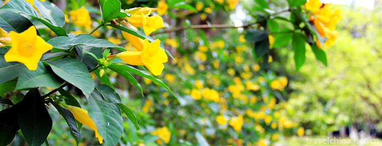
Wuhan Botanical Garden Chinese Academy of Sciences
Wuhan Botanical Garden of the Chinese Academy of Sciences is located in Wuchang District, Wuhan City, Hubei Province, China. It is a comprehensive scientific research institution integrating scientifi
Views: 152 Time 2018-12-22 -
Guangxi Medicinal Herb Garden
Guangxi Medicinal Botanical Garden is located in Xiangzhu Avenue, Nanning City, Guangxi Zhuang Autonomous Region. It was founded in 1959 and covers an area of 202 hectares
Views: 135 Time 2019-01-13 -
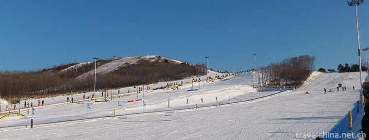
Shenyang Weipo Skiing Ground
Shenyang Qiaopo International Skiing Resort is located in AAAA Scenic Area of Qiaopo in Shenyang, which is surrounded by mountains in the northeast direction and boundless forest sea.
Views: 243 Time 2019-02-08 -

North Road Bangzi
Bangzi, also known as Shanglu Opera, is a local traditional drama in Datong, Shuozhou, Xinzhou and parts of Inner Mongolia and Hebei in northern Shanxi Province. It is one of the national intangible c
Views: 179 Time 2019-04-04 -

Imitated Diet Making Skills of Imperial Diet in Qing Dynasty
Imitated meals (imperial meals of the Qing Dynasty) production skills, Beijing Xicheng District local folk traditional skills, one of the national intangible cultural heritage.
Views: 303 Time 2019-04-29 -
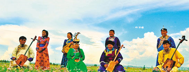
Mongolian Folk Songs
Mongolian folk songs are mainly divided into two categories: ritual songs and pastoral songs. Mongolian folk songs are famous for their magnificent voices and melodious tunes.
Views: 110 Time 2019-06-04 -
Nanyin Rap
Nanyin rap is a form of rap sung in Guangzhou dialect. It is also a common melody in Cantonese opera and Cantonese opera. It is said that Nanyin rap was developed on the basis of wooden fish and drago
Views: 315 Time 2019-06-07 -
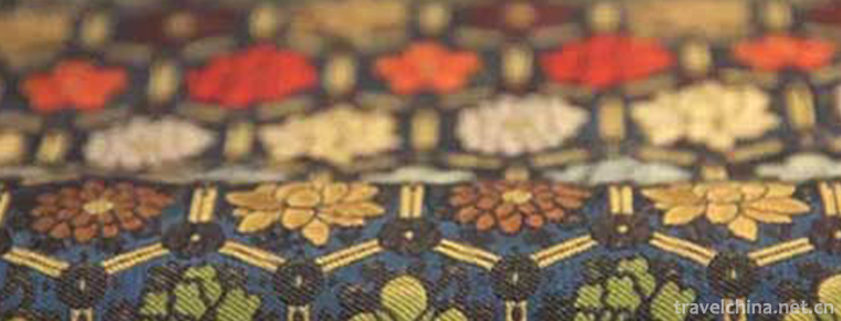
Song Brocade Weaving Skills
Song brocade weaving technology, traditional handicraft in Suzhou City, Jiangsu Province, is one of the national intangible cultural heritage.
Views: 107 Time 2019-06-16 -

Taihao Fuxi Festival
Taihao Fuxi Festival is a traditional folk custom and folk sacrificial activity with a long history. Fuxi was the founder of Chinese civilization. He taught shareholding, tools, farming, marriage, fam
Views: 213 Time 2019-06-18 -
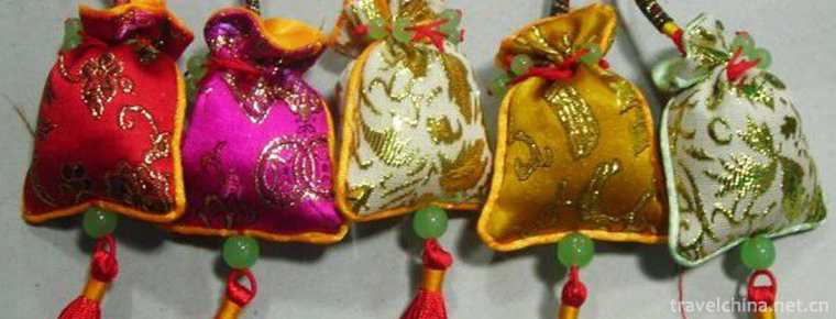
Sachet
Incense bag is also called odor-tolerant, incense bag, incense bag, incense sauce, Pei Mo. Nowadays people call it purse, toy and dim. It is a folk embroidery handicraft created by ancient Chinese wor
Views: 216 Time 2019-07-03 -
Folk Stories of Zouma Town
Folk stories of Zouma Town, Jiulongpo District, Chongqing City, are spread in Zouma Town. The exact age of its origin can not be verified. However, the Zouma Town was established in the late Ming and
Views: 531 Time 2019-08-16