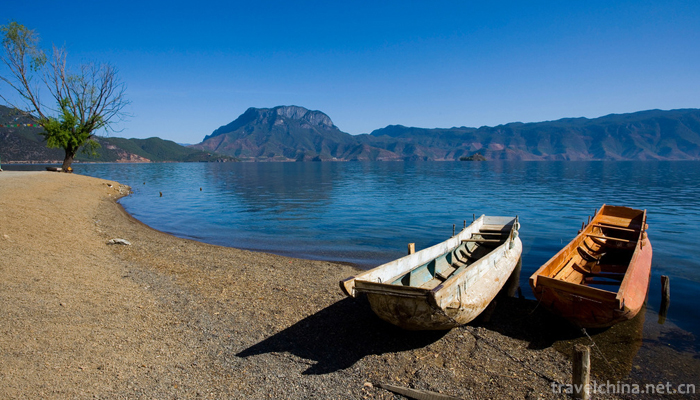
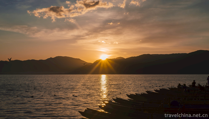
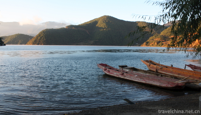
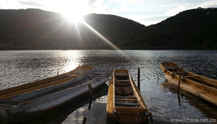
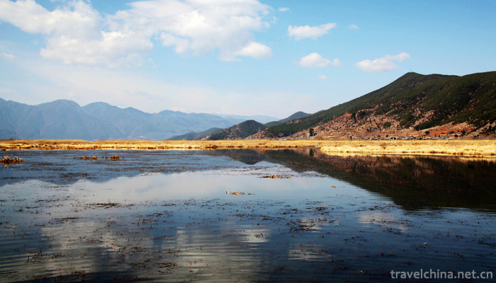
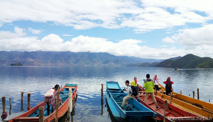
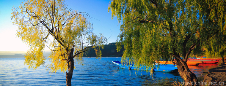
Lugu Lake
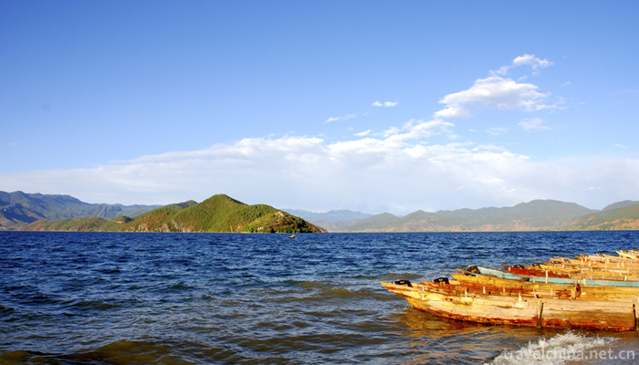
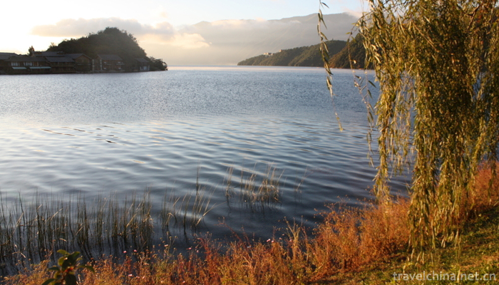
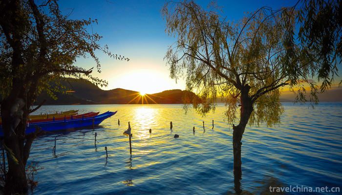
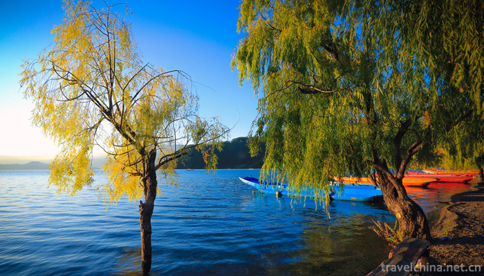
Lugu Lake, commonly known as Zuozuohai, the ancient name Lede Sea, Luku Lake, Naxi Mosuo language "Lu" for the valley, "Gu" for the inside, meaning the lake in the valley, the lake is located in Yanyuan County of Sichuan Province and Ninglang County of Yunnan Province at the junction of Sichuan Province and Yunnan Province, under the jurisdiction of Sichuan and Yunnan Province, the east of the lake is Yanyuan County Lugu Lake Town (the original left area), the west of the lake is Yongning Township of Ninglang County. The lake is slightly northwest-southeast, with a length of 9.5 km from north to south, a width of 5.2 km from east to west, a coastline of 44 km long, a lake area of 50.1 square km, a catchment area of 247.6 square km, a maximum depth of 105.3 meters, an average depth of 40.3 meters, a reservoir capacity of 2.252 billion cubic meters, a maximum transparency of 12 meters, and a surface of the lake and sea. Pull 2685 meters.
Lugu Lake is a plateau fault dissolution lake, consisting of a northwest-southeast fault and two East-West faults. It is a tributary of the upper reaches of the Yangtze River, the tributary of the Jinsha River, the Yalong River tributary, Litang river system. There are altogether 18 rivers (11 in Yunnan and 7 in Sichuan) flowing into the lake. The lake water flows through the Dacaohai Sea to the East into the Qiansuo River in Yanyuan County, then into the Gaizu River (downstream called the Yongning River), then into the Wolong River (also known as the Liluo River and the Yanyuan River), into the Litang River, and finally into the Jinsha River branch in the upper reaches of the Yangtze River. Liu Yalong River.
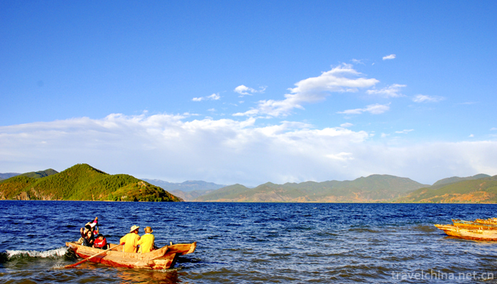
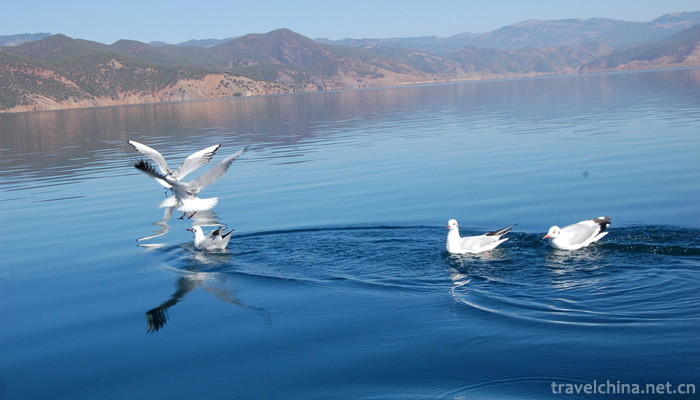
Lugu Lake is the highest Lake in Yunnan province and the third largest deep-water Lake in China. There are mainly Mosuo, Yi and Pumi people living around Lugu Lake. There are seven Mongolian nationalities, about 13,000 people living along the coast.
Located between Yanyuan County, Liangshan Yi Autonomous Prefecture, Sichuan Province, and Ninglang Yi Autonomous County, Lijiang City, Yunnan Province, Lugu Lake is a plateau fault-eroded and subsided lake. In total, the lake shoreline of Sichuan is about 2/3 longer than that of Yunnan, the eastern part of the lake is Lugu Lake Town in Yanyuan County (formerly Zuosuo District), the western part of the lake is Yongning District in Ninglang County, and the regional geographic coordinates are between 27 36 55 27 47 2', 100 43 36'- 100 54 20', and the central coordinates are 100 longitude East . The range is 45 '- 100 degrees 51', 27 degrees north latitude 41 '- 27 degree 45'.
Lugu Lake is the third deepest freshwater lake in China. The lake is slightly northwest-southeast. It is 9.5 km long in North and south, 5.2 km wide in East and west, 44 km long in coastline and 20 km in Sichuan. The lake area is 50.1 square kilometers, of which Sichuan has 31.2 square kilometers. Lake catchment area of 247.6 square kilometers, part of Sichuan 140.6 square kilometers. The maximum water depth of Lugu Lake is 105.3 meters. The Lake area with water depth exceeding 50 meters accounts for about half of the lake area. The average water depth is 40.3 meters. The capacity of the lake and reservoir is 2.252 billion cubic meters. The maximum transparency of the lake water is 12 meters. The altitude of the lake is 2,685 meters.
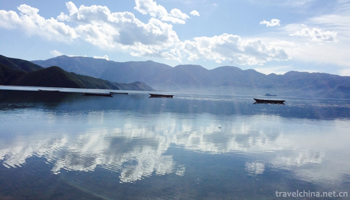
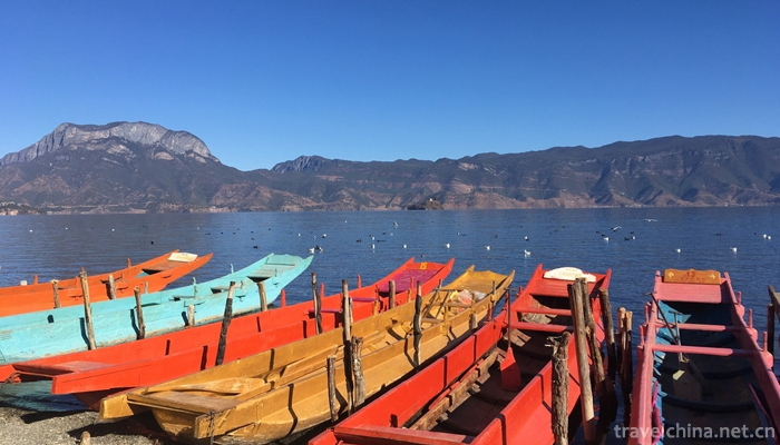
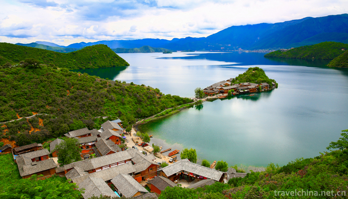
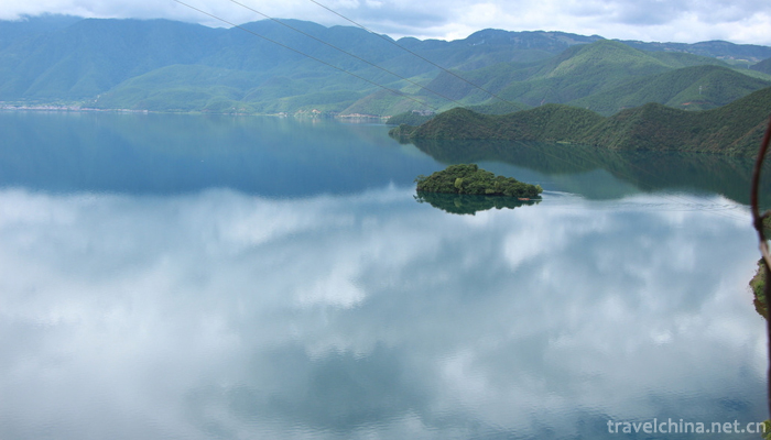
Lugu Lake is under the jurisdiction of Yanyuan County in Sichuan Province and Ninglang County in Yunnan Province. Yanyuan County in Sichuan Province has 29.6 square kilometers in the East (including 5.8 square kilometers of marsh wetlands) and Ninglang County in Yunnan Province has 27.0 square kilometers in the west. There are five whole islands, four peninsulas, a long island and 14 bays in Lugu Lake. There are five whole islands, three peninsulas and one seawall Island scattered in the lake, generally 15-30 meters above the water surface, surrounded by mountains around the lake. The Goddess of Grim is high on the shore of the lake, and the Houlong Mountain is wedged into the center of the lake, forming a horseshoe-shaped Lugu Lake.
The Luguhu area, which belongs to the junction of the Hengduanshan fault zone and the Kangdian-Yunnan-Taibei oblique zone, was formed during the middle Quaternary neotectonic movement and external dissolution. Lugu Lake is a plateau fault dissolution Lake consisting of a northwest-southeast fault and two East-West faults. The Lugu Lake Basin is a Bayan Kara geosyncline area with the Jinshajiang fold system. The Paleozoic and Mesozoic strata are well developed in the lake area. The Quaternary strata are only sandy gravel beds near the lake without typical lacustrine sedimentation. The fault cliff triangles around the lake and U-type glacier valleys can be seen everywhere. The lake basin is surrounded by mountains, with many banks on the lakeshore and Cape Bay.
Lugu Lake is a relatively low-lying basin in Hengduan Mountains. It belongs to fault structure in geological structure. It is a plateau dissolution fault basin formed by crustal movement. This structure is similar to Sailimu Lake in the north of Yili Kazakh Autonomous Prefecture of Xinjiang. The lake basin is rocky and its inner wall is very steep. However, a large amount of mountain sediment has been deposited into the lake on the Sichuan side due to geological history. The inner wall of the lake is steeper than that on the Yunnan side, and the mountains on the Yunnan side almost penetrate the lake bottom. Lugu Lake is a kind of dissolution geology. There are many karsts along the coast. If the ground works are not properly disposed of groundwater, it is easy to induce subsidence.
Lugu Lake belongs to the cutting mountain gorge area of Hengduan Mountains, the high mountain gorge sub-area of the northern part of Hengduan Mountains and the mountain plain area of the eastern Yunnan Basin, and the boundary zone of the mountain source sub-area of the Northwest Yunnan. The banks of Lugu Lake are curved, forming a small harbor of abyss. There are seven islands in the lake, all of which are limestone mounds. Along the lake there are four large peninsulas extending into the lake, of which the long island stretches from east to West for four kilometers, covering an area of six square kilometers, separating the lake into a horseshoe-shaped surface. There are long deep grooves at the bottom of the eastern Lake and steep slopes on both sides of the north and Long Island. There is Lion Hill 3754.7 meters high in Hubei, Xiaojia Volcano 3737 meters high in northeast, and dog drilling hole mountain 3,400 meters high in southwest. The highest point is 4,200 meters high near Yaoniuping in southwest of the lake, forming a spectacular scene with a relative height difference of 1,500 meters. Lugu Lake is like a mirror embedded in the mountains of Gaoyuan Group. The main rocks in the surrounding mountains are lower Silurian limestone and shale, which distribute in the Shizishan area. Lower Triassic mudstone and sandstone with a small amount of marl are distributed in the West Bank of the lake.

Lugu Lake
-
Anhui rescue
Anhui rescue Great rescue is a traditional feature of Shouxian County in Anhui Province, which has a history of more than 1000 years.
Views: 231 Time 2018-11-27 -
Hometown of Zhu De
Zhude Hometown Scenic Spot: National AAAAA Tourist Scenic Spot, National Key Cultural Relics Protection Units, National Patriotic Education Demonstration Base, National Anti-corruption Education Base,
Views: 314 Time 2018-12-12 -
BaoGuGu National Forest Park
Baoqianggu National Forest Park, Shandong Province, is located in the southeast of Shanting District, Zaozhuang City, Shandong Province. Its geographical coordinates are 34 degrees north latitude 59'4
Views: 181 Time 2019-01-02 -
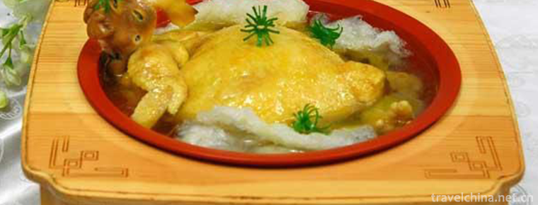
Eight treasures whole chicken
It's a delicious dish with the characteristics of beige color, delicious taste and delicacy. The main raw materials used are 1 bamboo shoot hen (about 1.75 kg), 100 grams of Jiangmi, 25 grams of dates
Views: 464 Time 2019-03-26 -

Guilin fishing drum
Guilin fishing drum, commonly known as sentiment, is the local traditional rap and singing art of Guilin. The Song Dynasty was introduced into Guilin from the north,
Views: 163 Time 2019-05-02 -
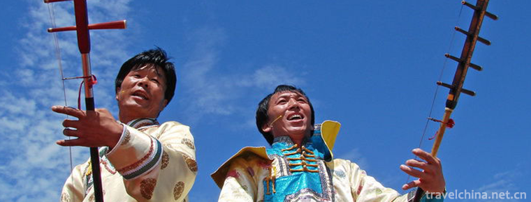
Good luck treasure
Haolaibao is a kind of Chinese Mongolian folk music, singing in Mongolian. Haolaibao means "alliteration" in Mongolian, that is, the first syllabic rhyme of each line of lyrics, so it is als
Views: 371 Time 2019-05-02 -
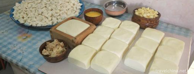
Dairy Products Production Techniques
Mongolian phonetic translation. Mongolian drinks. Also known as "white food", that is, dairy products. Milk, mare's milk, goat's milk, camel's milk, cream of milk skin, cheese, dried milk, s
Views: 154 Time 2019-06-07 -
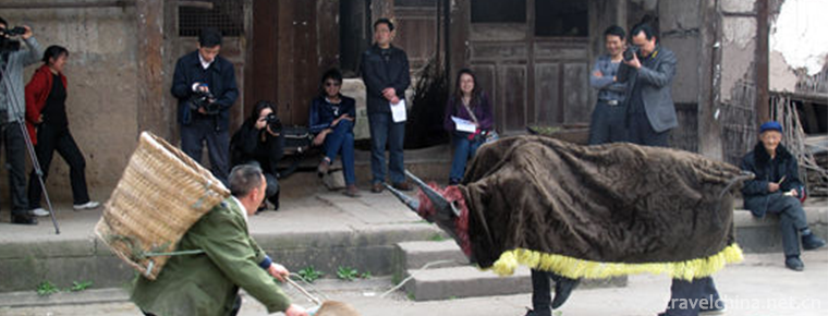
Play with cattle
Playing cattle originated from the worship of nature in ancient times. In the era of farming civilization, cattle farming is particularly important for people's production and life. Therefore, through
Views: 350 Time 2019-06-25 -
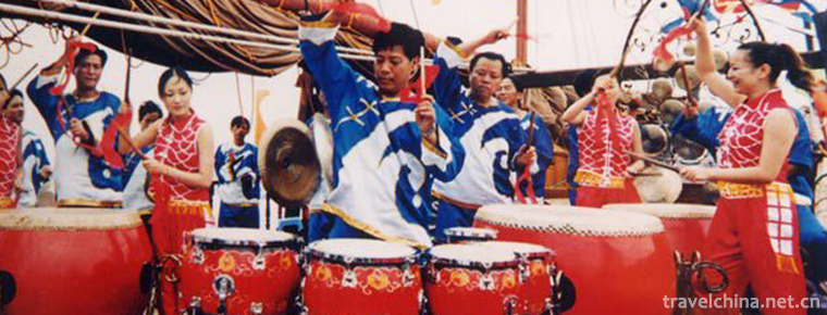
Zhoushan gongs and drums
Zhoushan gongs and drums are the representatives of traditional folk art in Zhoushan City, Zhejiang Province. They are based on gongs, drums, cymbals and clappers, with silk bamboo, magnificent sound
Views: 128 Time 2019-08-10 -

Beijing Sport Univerrsity
Beijing Sports University was founded in 1953, formerly known as the Central College of Physical Education, renamed Beijing Sports College in 1956 and Beijing Sports University in 1993. It is a nation
Views: 200 Time 2019-09-06 -

Music that Ding Zhen likes
Zhaxi Dingzhen (Chinese Name: Ding Zhen), Tibetan, lives in Litang County, Ganzi Prefecture, Sichuan Province.
Views: 258 Time 2020-12-07 -
Dazhou environmental protection
In 2019, the afforestation area of Dazhou city is 11666.60 hectares, the forest area is 735300 hectares, and the forest coverage rate is 44.34%. The air, water and soil pollution prevention and control were carried out in depth. The air compliance rate
Views: 159 Time 2020-12-20