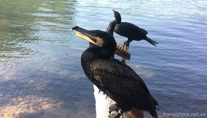
Lijiang River
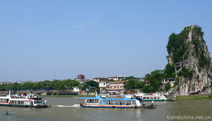
In the urban area of Guilin, the Lijiang River enters the urban area of Guilin from the Qin family of Lingchuan County, crosses the urban area from north to south, turns southward from the Peach Blossom River to the Douji Mountain, winds southward through the Lingchuan Dadi Town, and flows into Yangshuo at the canopy rock of Lawn Township, 49.3 kilometers through the urban area. At the Guilin Hydrological Station (at the end of Zhangmu Village, Chuanshan Township), the basin covers an area of 2762 square kilometers, with an average width of 39.2 kilometers and a main stream length of 105 kilometers. The river basin is a long, multi tributary river system with narrow and wide middle. The karst peak forest plain is located between Darong River and Guilin. The river bed ratio drops to 0.94, and the average river bed ratio drops to 0.44.
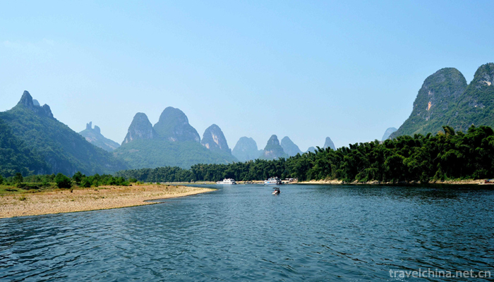
In the county of Yangshuo, it flows from the official village of Yang Di to the county. It flows through Yangdi, Xingping, Welfare, Yangshuo Town, Chengguan, Puyi, Shanbei River, Tuling River, Dayuan River, Zhanggui River, Shuangyue River, Tianjia River, Shuangqiao River and other tributaries to Puyi Township, Ma Lao, Pingle County. It is 69 kilometers long and occupies the main stream of the Lijiang River (usually called Xingan-Pingle River, 164 kilometers long). 42% of kilometres is the longest passage through every county.
In Pingle County, Lijiang (Lipu River, Lijiang River, Chajiang (Gongcheng River) three rivers in Pingle Town known as Guijiang, south into Zhaoping County.
River bed characteristics
The surface elevation of the two sides of the Lijiang River in Guilin is between 154 and 132 meters, belonging to the accumulation of the first-order terrace. The upper part is silty clay with a thickness of 2-4 meters, and the lower part is sandy layer with a thickness of 20-30 meters. The width of the channel is between 125~585 meters and the river bank is 3~5 meters high. The river bed is composed of sand and pebble, and often has long grass. The river bed and the beach are interconnected, and the beach is long and deep. The beaches are mainly distributed in Dongjiaxiang, Xinquan, Jiefangqiao, Xiangshan, Lijiang River Bridge, Baiguoshu Village, Wujia, Wang Jia, Zhemu Town and the vicinity of Xiaolongmen Village. In dry season, the depth of the beach is generally less than 1 meter, and the length of the beach is generally 500-1000 meters, of which Wujiatan is the longest, reaching 1970 meters. The deep pools on the riverbed are mainly distributed in the vicinity of Baishitan, Sizhou Bay, Mulongdu, Fubo Mountain, Jiuliang Wharf, Xiangshan, Nanxi Mountain, Jingpingshan, Huziyan, Longmen Village and Majiafang. When the river reaches deep pool, the water depth is more than 6 meters, the deepest is Jingpingshan pool, the water depth is more than 14 meters, followed by Nanxi Mountain and Majiafang, the water depth is more than 12 meters.
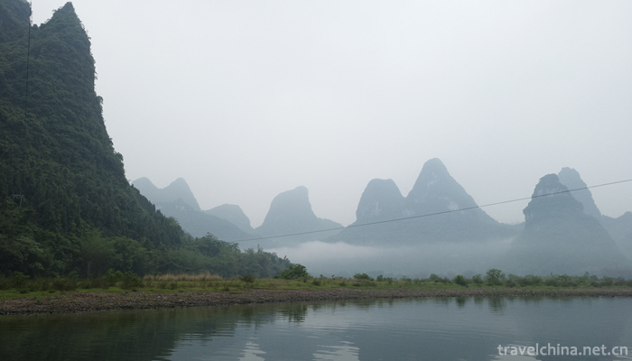
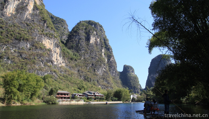
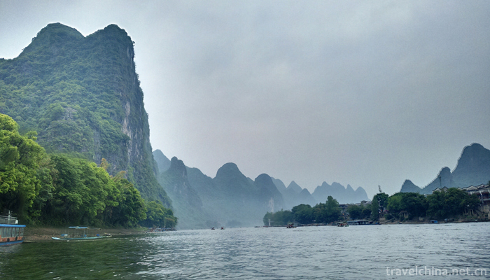
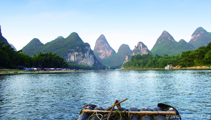
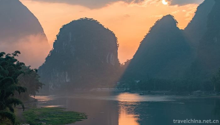
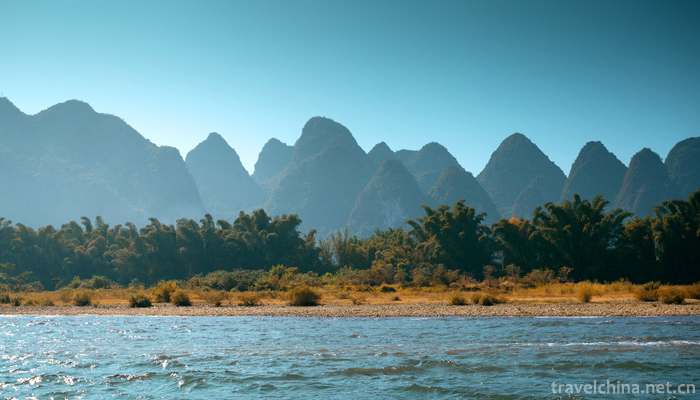
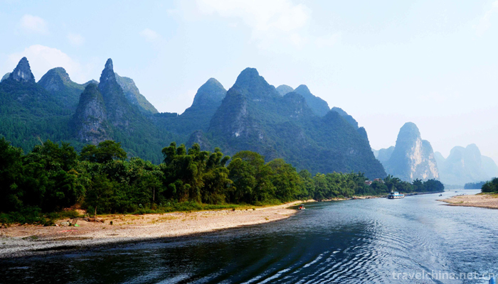
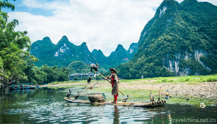
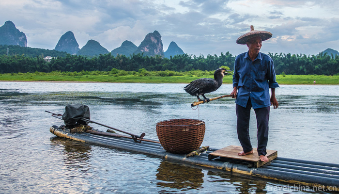
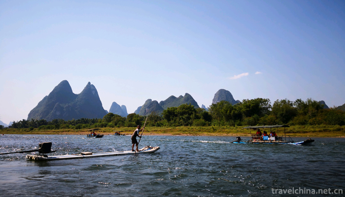
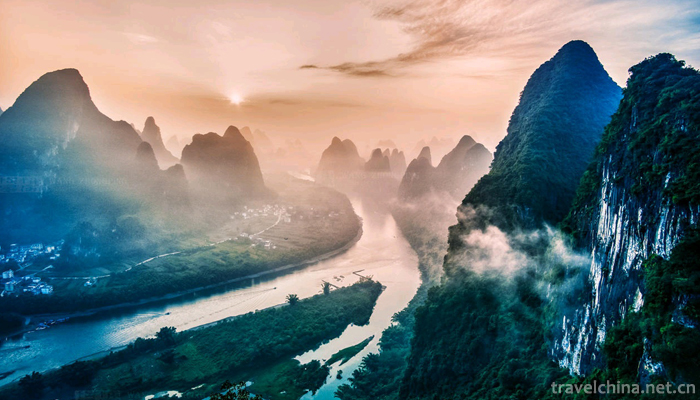
The Yangshuo section of the Lijiang River is the most typical karst peak forest landform in the world. It is also the most beautiful river in Guangxi. Beginning with the Qianjing Village near Yangshuo County, the Lijiang River enters the valley, winding among the mountains, and the valley is 400 meters deep. The Lijiang River is not only a deep valley, but also a large riverbed drop, averaging four thousandths, forming many beaches, continents, Gorges and rocks. There are 38 banks in the Lijiang River in the county. There are 29 flood plains and floodplains with different widths on both sides of the river, covering an area of 2397 mu. The soil is thick and soft, rich in organic matter, moderate acidity and alkalinity, and high natural fertility.
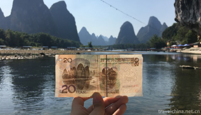
, is located in the northeastern Guangxi Zhuang Autonomous Region. Traditionally, the beginning of the Lijiang River is Maoer Mountain in Yuechengling, the source of the Guijiang River. Modern hydrology is defined as Lingqu Estuary in Rongjiang Town, Xingan County, and the end point is Pingle Sanjiang Estuary. The upper reaches of the Lijiang River are the large dissolved rivers and the lower reaches are the traditional Guangxi river. The Lingqu estuary is the boundary between the Great Solution and Lijiang sections of the Guijiang River, and the Lipu and Gongcheng estuaries are the boundary points between the Lijiang and Guijiang sections. The total length of Lijiang River is 164 km. The river bed along the river is mostly water quality pebble, with small amount of sediment and clear water, and the two sides are mostly karst landforms. Rich in tourism resources, the famous Guilin Scenery is on the Lijiang River.
The upper reaches of the Guijiang River, a tributary of the Xijiang River (the upper reaches of the Pearl River), lie in the northeastern Guangxi Zhuang Autonomous Region. Historically, there are three versions of the birthplace of the Lijiang River: (1) Shuijing Zhu said, "Lishui also comes out of the Yanghai Mountains", "Xiangli is of the same origin, divided into two parts, Lishui in the South and Xiangchuan in the north". Song Fan Chengda's "Guihai Yu Heng Zhi" said: "The two rivers of Hunan and Lishui all come from the sea of Lingchuan, traveling a hundred miles, dividing north and south. North says Xiang... South, Li,... ". (two) in the five to eight years of Qing Dynasty Qianlong, the Yellow Sea, Xingan's magistrate, Li Shui originated from the double well in the south of the county. (three) Tang Zhaomin said in the preface of the "soul canal literature", "... Lishui (Lishui), in fact, is the source of today's Xing'an County West Yangang, upstream called Yuanjiang, middle called Shilong River, downstream called Qingshui River, water flow more than 30 miles of a river, that is, the history of the famous Ba (zero water). "We know that water is water." They all refer to the source of the canal, not today's Lijiang River. The Lijiang River rises in Huajiang Township, Xing'an County, Guangxi Zhuang Autonomous Region (the highest peak of the 400-mile Yuechengling Mountains) on the southern side of the Laoshan boundary, 1732 meters (the base of the Yellow Sea) north of the eastern Maoer Mountains. Surrounded by mountains and boundless bamboo seas, the Wugui River and Shamu River, the main source of the Lijiang River, meet at the foot of the mountain in the Shili Gorge (Maoershan Shili Gorge), connecting the Longtang River in the middle and west of the South Stream, the Dongna Heidong River, and the Liudong River after the confluence of the three rivers, flowing southward to the Simen River and the Huangbai River and the Chuanjiang River, known as the Darong River, to the Rongjiang Town. The nearby Lijiang River joins the Ling River. The Lijiang River flows through Guilin in Lingchuan County and joins the Gongcheng River in the north of Pingle Town, Pingle County. The whole length of the Lijiang River reaches 164 kilometers. Pingle town is called Gui River below. The river continued to flow southward to Wuzhou and into the Xijiang River.
In Xing'an County, the river mouth from the Rongjiang Town, the ancient canal Lingqu, the starting point for the Lijiang River (ancient hydrology: Lingqu for the source of the Lijiang River ), after the small Rongjiang exit.
In the county of Lingchuan, the village is located in the village of Xiao River. The drainage area of the Lijiang River is 2173.29 square kilometers. The total length is 45 kilometers, divided into two sections: the upper section is 33.5 kilometers, and the river surface is 160 meters in width. Since Xiaorongjiang Village, it has flowed through Xiabei, Yantou, Sanjie, Fuqiudu, Feitou, Shuangtan, Cui Jiawei and Sanchawei, and successively flowed into Guilin along the Lower Qin Dynasty to the Great Fair along the Baiyun River, the Lujiang River, the Ganjiang River, the Falls, the Sanbaiyuan River and the Gantang River. The next 11.5 km, the average width of the river 220 meters, are all pebbles, sand, mud, river bottom. From Lijiao Village in Dadi Town to Nancun County, through Danxing, Dadi Town to Nancun, Nahuangsha River, Jiansha River, Chaotian River, south to Qingshuitan by the ancient East water, out of the suburbs of Guilin City, Xiayangshuo County.


Lijiang River
-
Tourist Area of Wu Taihu Lake in Suzhou
Wuzhong Taihu Lake Tourist Area in Suzhou is located in the southwest corner of the paradise of Taihu Lake, covering an area of 21.5 square kilometers.
Views: 233 Time 2018-12-06 -
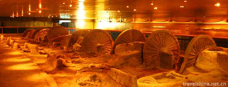
China Antique Car Museum
Located on the Houli Cultural Site, the Chinese Ancient Car Museum is the first most systematic and complete Museum in contemporary China, which integrates the Car and Horse Sites with the display of
Views: 124 Time 2018-12-22 -
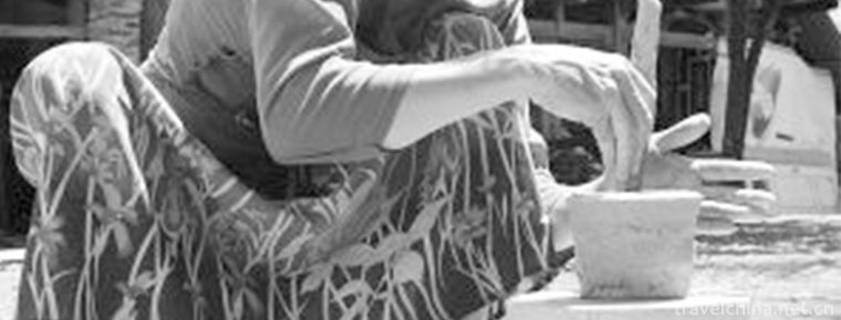
Dais Slow Wheel Pottery Technology
Dai Slow-wheel pottery, the primitive traditional handicraft of Yunnan, is one of the national intangible cultural heritages.
Views: 127 Time 2019-04-24 -
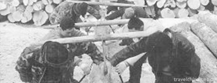
Woodbugle
Forest chant is a traditional folk song in Northeast China. It is a kind of song sung by woodcutters who are engaged in carrying wood in the forest. As the saying goes, "trumpet". At present
Views: 101 Time 2019-06-12 -
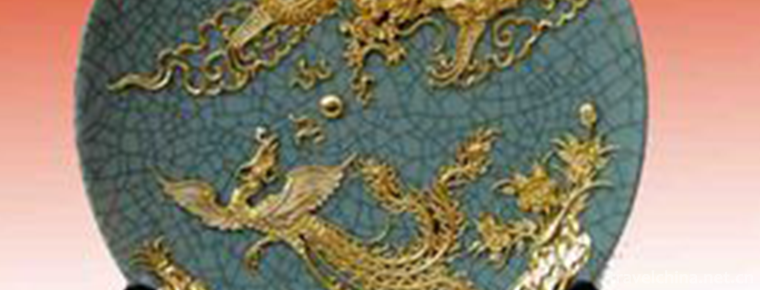
Xiamen lacquer line carving skills
Xiamen lacquer line carving technique is to use old brick powder, large paint and cooked tung oil as raw materials to mix, repeatedly beat into soft and resilient clay (commonly known as "lacquer
Views: 101 Time 2019-06-12 -
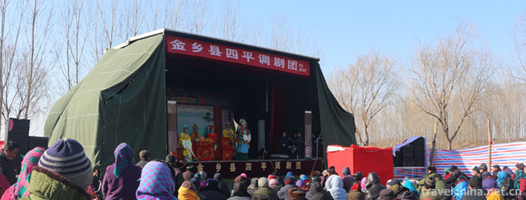
Siping Tune
The Siping tune evolved from the flower drum in eastern Henan. After digging and sorting out, it absorbed the tunes of opera critics, Peking Opera, Henan Opera and so on. It gradually perfected and fo
Views: 139 Time 2019-06-16 -
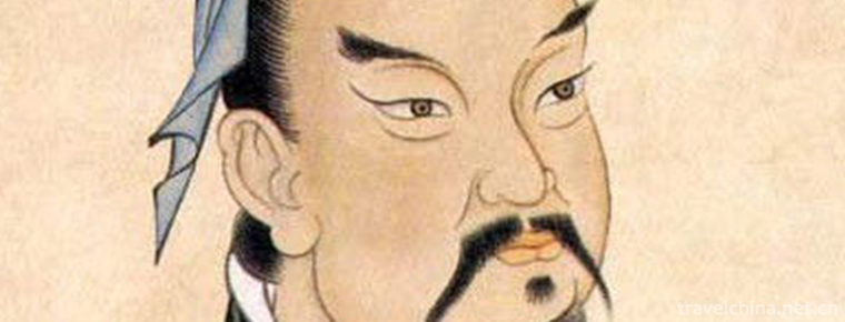
Sun Tzu
Sun Wu (about 545 BC - about 470 BC), long Qing, late spring and autumn. Qi State Le An (today) Shandong ProvincePeople in the North 。 China's famous military strategist and statesman in the spring an
Views: 206 Time 2019-09-04 -

Beijing University of Civil Engineering and Architecture
Beijing Architectural University is a pilot University jointly constructed by Beijing and the Ministry of Housing and Urban-Rural Construction, the "Education and Training Plan for Excellent Engi
Views: 155 Time 2019-09-06 -

Huangshan University
Huangshan University, formerly known as the Huizhou normal school, was founded in 1978. In December 1997, it merged with the Huizhou Junior College of University of Science and Technology of China. It
Views: 139 Time 2019-11-17 -

Rongxian Giant Buddha
Located in the eastern suburb of Rongxian County, Sichuan Province, the Giant Buddha of Rongxian county is carved in the Tang Dynasty. It is a cliff carved statue of Sakyamuni, 36.67 meters high, 8.76 meters long, 12.67 meters wide, 12 meters high and 3.5 meters wide. It is the world's largest Sakyamuni Buddha (Modern Buddha).
Views: 341 Time 2020-10-15 -
Yibin science and technology
In 2019, there are 34 new high-tech enterprises, 13 provincial science and technology achievements transfer and transformation demonstration enterprises, 2 provincial science popularization bases and 6 Municipal Science Popularization base
Views: 326 Time 2020-12-18