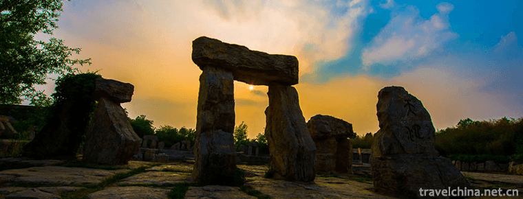
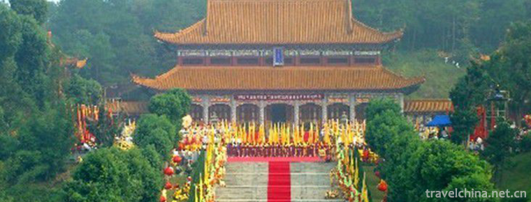
Chaya Mountain Scenic Spot
Chaya Mountain, also known as Linglong Mountain, Xianshan Mountain on a journey to the West and Qiu Mountain Scenic Area, is located in Suiping County, Zhumadian City, Henan Province. It was developed in 2004 and is 40 km south of Zhumadian City. Its geographical coordinates are 33 degrees 07'57.52 in the north latitude and 113 degrees 43'22.31 in the East longitude, covering an area of 148 square kilometers .
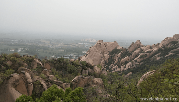
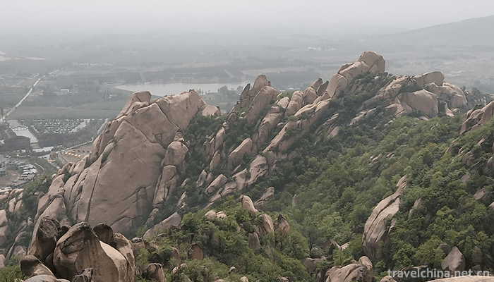
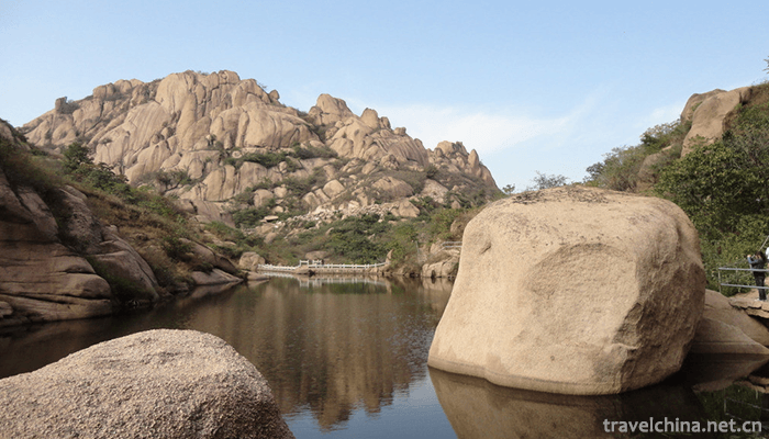
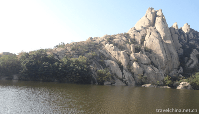
The remaining veins in the eastern margin of Funiu Mountains in the Lyushan Mountains are connected by Nanshan, Beishan, Huaguoshan and Liufeng Mountains. Xiumei Lake, Biwa Lake, Baihua Lake and Tianmo Lake are distributed among them, with more than 300 scenic spots such as peaks, caves, shed and stones.
In 2004, Mt. Cheng was listed as National Geopark ; in 2015, Mt. Cheng was rated as National AAAAA Tourist Scenic Area
Historical evolution
In May of the Republic of China (1944), the 13th Brigade of the Fifth Division of the New Fourth Army was established on the basis of Hongshiya in Lyushan; in November, the Henan Guerrilla Independent Corps headed by Huang Lin led the main force to cross the Huaihe River to the area of Lyushan to open up an anti-Japanese base area. The headquarters were located in Hongshiya, with commanders Huang Lin, deputy commander Yu Zhilong and political commissar He Zhenya .
On April 20, 1958, the People's Satellite Commune of Mount Cheng was founded in Mount Cheng, the first people's commune established in China and the second people's commune in the world after the Paris Commune. In July of the same year, Chen Boda, former alternate member of the Political Bureau of the Central Committee and editor-in-chief of the Red Flag Magazine, made an investigation and study in Mount Cheng and drafted the brochure of the People's Satellite Commune of Mount Cheng. The General Statement of the People's Commune was revised and approved by Mao Zedong and issued at the expanded meeting of Beidaihe Political Bureau; on September 1, the General Statement of the Satellite People's Commune of Mount Cheng was published in the seventh issue of the Red Flag magazine; in October of the same year, the office building of the Satellite People's Commune of Mount Cheng was established; on October 13, the same year, Chairman Mao Zedong visited the Satellite People's Commune of Mount Cheng in person .
In 1972, the Yonghong Reservoir was built in Chenglai Mountain (in 2004, Yonghong Reservoir was renamed Biwa Lake).
In 1989, Shanxi Travel Notes Brick Sculpture Museum was completed .
In 1997, the original Baogong Temple was expanded to Baogong Temple in Mt. Chenglai .
In 2000, Wu Gongting Pavilion and Bai Monkey Bridge were built in Chengshan.
In 2004, the tourism development and construction project of Mount Chenglai was launched.
In 2005, the Lanshan Geological Museum was officially completed and opened to tourists.
In 2009, the project of Hot Spring Town was launched in Mt. Chenglai .
geographical environment
Location context
Located in Suiping County, Zhumadian City, Henan Province, Mt. Lyushan is 40 kilometers south of Zhumadian City. Its geographical coordinates are 33 degrees 07'57.52'north latitude and 113 degrees 43'22.31' East longitude. It covers an area of 148 square kilometers and the main scenic area is 50 square kilometers.
topographic features
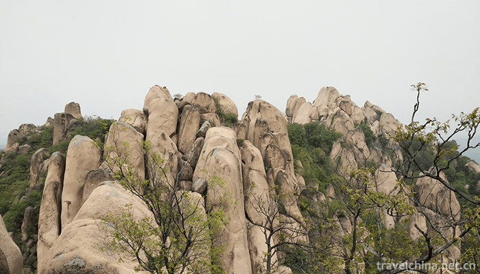
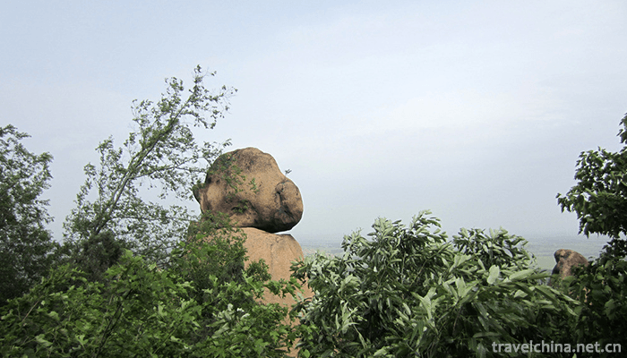
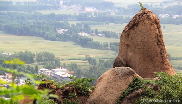
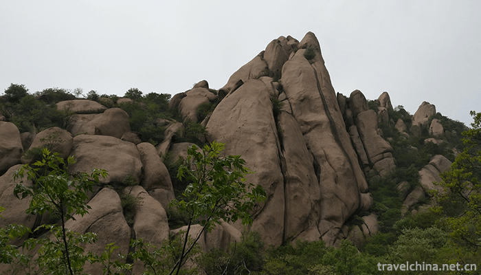
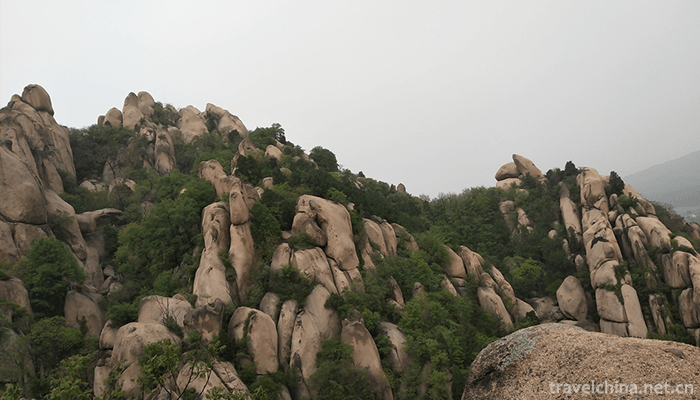
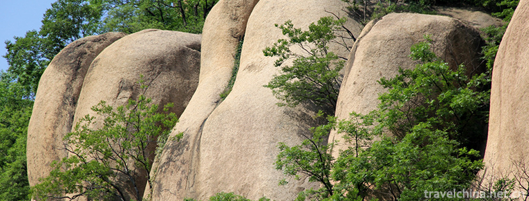
Located in the south-central part of Henan Province, Lyushan is a granite-shaped geomorphic area. It consists of Miwa Mountain, Nanshan, Beishan, Liufeishan, Huaguo Mountain and Tianmo Mountain, which are connected with each other. The main peak of Miwa Mountain is 300 meters high without a gap. It is formed by long weathering and denudation. The granite of Lyushan belongs to medium-coarse-grained orthogonal (potassium) feldspar with fleshy red theme and porphyry. Zonal structure, rich in medium-grained, coarse-grained potash feldspar, also known as medium-coarse-grained potash feldspar; Lyushan formed in the late Triassic to Cretaceous Yanshanian orogenic movement, after the formation of mountain rocks through orogenic movement, mountain body relative rise or fall, forming a peak .
Climatic characteristics
Located in the transition zone between subtropical zone and warm temperate zone, Chenglai Mountain is a typical continental monsoon semi-humid climate with abundant sunshine, abundant rainfall, mild and humid, four distinct seasons, annual average temperature 15.1 C; the hottest in July, monthly average temperature 27.5 C; the coldest in January, monthly average temperature 1.4 C. The annual average precipitation is 927 mm and the annual average sunshine is 2126 hours.
natural resources
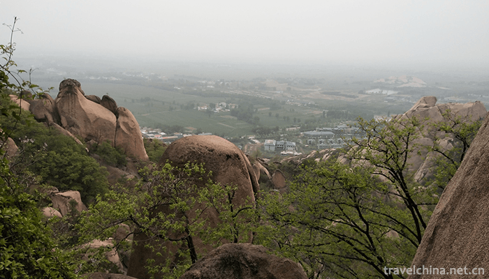
There are thousands of native plants growing on the mountainous body of Mt. Chenglai, covering more than 95% of the total. There are broad-leaved, needle-leaved, evergreen, deciduous irrigated trees and wild fruits, medicinal materials, wild vegetables and flowers, etc. In late autumn, red leaves are a natural phenological landscape in the frost season.
Main attractions
Overview
Range Hill is mainly composed of Nanshanmen, Nanshan, Beishan, Liufeng Mountain, Tianmo Lake and Biwa Lake. Stone, mountain and water are interdependent in the scenic area. Gorges, valleys and peaks are connected. Nanshan, Beishan and Liufeng Mountains are adjacent. Xiumei Lake, Biwa Lake and Tianmo Lake are scattered among them, including Nanshanmen, Dongshanmen and Beishanmen.
Tourism information
Admission ticket
70 yuan per person;
Children under 1.4 meters are exempted from tickets, elderly people over 70 years old are exempted from tickets, soldiers, journalists and disabled people are exempted from tickets; those above 1.4 meters are purchased with student certificates, and those aged 60-70 with old age certificates and identity cards are purchased with preferential tickets .
Opening Hours
The opening time of Mount Chengqi is 7:30-17:30 (summer) and 8:00-17:00 (winter).
Traffic information
Public transport railway
From Beijing, Shanghai, Guangzhou, Zhengzhou, Xiamen, Xi'an, Taiyuan, Chongqing, Chengdu, Wuhan, Changsha, Shijiazhuang, Yichang, Huaihua, Yinchuan, Guiyang, Wuxi, Nanjing, Suzhou and other places, trains pass through Zhumadian Railway Station and transfer to Suiping County Bus Station. Suiping County Bus Station transfers to Changyishan Scenic Area.
Self driving
Traffic routes from Zhengzhou, Anyang, Jiaozuo, Xuchang, Xinxiang and Kaifeng to Chenglai Mountain:
Beijing-Zhuhai Expressway - Suiping Export - Lyushan direction - about 20 km to Lyushan;
The route from Luohe to Mount Ronglai is as follows:
National Highway 107 - Suiping - the direction of Lyashan - about 20 kilometers to Lyashan;
The traffic routes from Luoyang, Jiyuan and Sanmenxia to Chenglai Mountain Scenic Spot are as follows:
(Lianhuo) Erguang Expressway - Nanluo Expressway - Luohe East to Beijing-Zhuhai Expressway - Suiping Exit - Laoshan Direction - about 20 km to Laoshan.
The route from Pingdingshan to Chenglaishan:
Pingdingshan - Wugang - 107 National Highway - Xiping - Suiping - Changlai Mountain;
Traffic routes from Xinyang to Chenglai Mountain Scenic Spot:
Beijing-Zhuhai Expressway - Suiping Export - Lyashan direction - about 20 km to Lyashan.

Chaya Mountain Scenic Spot
-
Fenghua Xikou Tengtou Tourist Scenic Area
Fenghua District, Ningbo City, Zhejiang Province, is under the jurisdiction of the established towns, the first batch of famous national landscape tourism towns
Views: 202 Time 2018-12-07 -

Great Wall of Ming Dynasty in Datong County
According to documents, the Great Wall of Qinghai Province in the Ming Dynasty was built in the middle of the Ming Dynasty. It lasted 51 years from 1546 to 1596.
Views: 179 Time 2019-01-07 -
Wangcheng in heaven
Tianwangcheng Scenic Area is located 40 kilometers northwest of Yishui County, Linyi City, Shandong Province. The main part of the Scenic Area is located in Jiwanggu. It is the national AAAA scenic sp
Views: 123 Time 2019-02-21 -

Two strands
Erguxian is an ancient traditional opera, which was formed in Song Dynasty and has a history of more than 500 years. The two-strand string is evolved from folk minor,
Views: 300 Time 2019-04-28 -
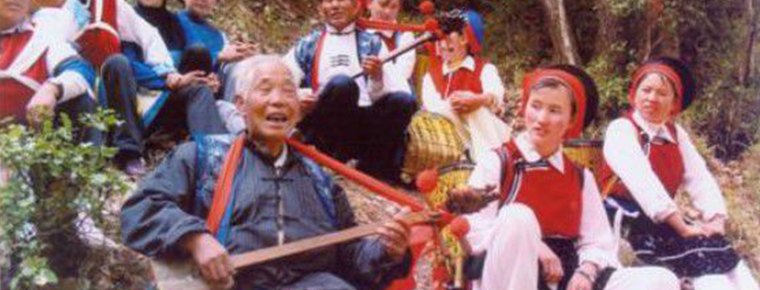
Jianchuan Opera
Jianchuan Baiqu is an ancient music variety with a long history and wide spread in Bai nationality area. It is mainly popular in Jianchuan, Eryuan and Tongdian, Jinding and Jiuhe of Lanping County, Nu
Views: 327 Time 2019-05-05 -

Lotus fall lian hua lao
Lotus Flower is a kind of traditional folk art with both rap and singing. The performers are mostly one person, self-talk and self-sing, self-play seven pieces of accompaniment.
Views: 160 Time 2019-05-13 -

Five major tunes in southern Shandong
The five major tunes in southern Shandong, also known as Tan Ma Diao and Tan Ma Diao, are traditional folk song suites that are active in Tancheng County, Linyi City, Shandong Province, with Tan Town
Views: 431 Time 2019-05-15 -

Lv Opera
Lv Opera, also known as masqueraded Yangqin and Qinxi Opera, National intangible cultural heritage, one of the eight major Chinese operas, Shandong's most representative local operas, is popular in mo
Views: 181 Time 2019-05-15 -
Wheat straw cut and paste
Straw clipping is a traditional folk handicraft. Also known as "wheat straw clipping", "wheat straw clipping". Using the natural luster of wheat straw and the characteristics of ru
Views: 261 Time 2019-05-16 -
Clay sculpture
Clay sculpture, commonly known as "color sculpture" clay sculpture art, is an ancient and common folk art in Chinese folk tradition. That is to say, a kind of folk handicraft made of clay mo
Views: 158 Time 2019-06-07 -
Yandi Festival
"Yandi Mausoleum Festival" is divided into official and folk sacrifices. Folk sacrifice began in summer, official sacrifice originated in Zhou, and Emperor sacrifice originated in Tang Dynas
Views: 200 Time 2019-07-10 -

Guangan secondary industry
In 2019, the industrial added value of Guang'an City will reach 28.87 billion yuan, an increase of 8.8%, and its contribution rate to economic growth will be 34.9%. At the end of the year, there were 597 Industrial Enterprises above Designated Size, and
Views: 176 Time 2020-12-19