Aerhchin Mountains
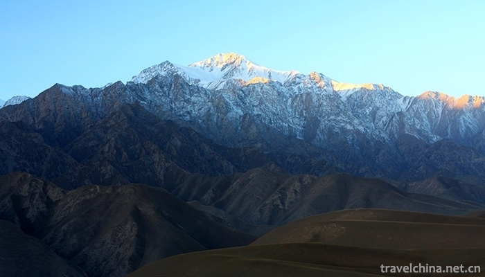
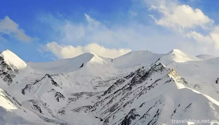
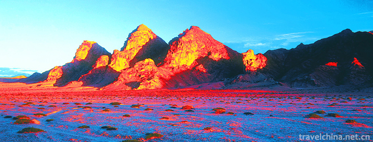
Altyn Tagh is a mountain range in southeastern the Xinjiang Uygur Autonomous Region, China. The eastern end extends to the two provinces of Qinghai and Gansu, and is the boundary of the Tarim Basin and the Qaidam Basin. Northeast east extends to an average height of 3000~4000 meters. The western section of is higher and the highest peak is 6161 meters. There are small glaciers. Ruoqiang River, Milan River and so on originated here, but the water quantity is not big; the foothills of Ruoqiang, Milan and other oasis area is very small. There are small glaciers. It was reduced to less than 4000 meters and increased to 5798 meters at the junction of Xinjiang, Qinghai and Gansu provinces. The climate is dry and the vegetation is poor. There is no river with water all the year round. The Eastern Altun Mountains are connected with the Qilian Mountains. The Dangjin Pass between the two mountains is the main traffic route between the Qaidam Basin and the Hexi Corridor. There is a highway through it.
From the south to the north, there are three mountains and two valleys in the peak area.
The peak height is between 5200 and 5828 meters. Nearly 30 peaks above 5000 meters above sea level are distributed along the ridge line in the main peak area. There are 31 modern glaciers on both sides of the ridge, of which 20 are on the northern slope. There are 17 glaciers in Sam sak valley. Glacier No. 10 is the largest glacier in the region, with a length of 3.8 km, an elevation of 4520 m at the end of the glacier and an elevation of 4840 m at the grain line of the glacier. The main peak is located at the back wall of the 5 glaciers at the southern slope of the two glaciers. On the back wall of the No. 10 glacier grains snow basin south of Samusak Valley, another 5,782-meter peak is opposite to the eastern main peak, which is 6,000 meters apart and 46 meters apart. Samusak Valley, high in the East and low in the west, 4200-4400 meters above sea level, is a river formation area, the ditch north across the central fault of Zhonglie Mountains into Qingshigou, is the source of Qingshigou.
The peak is 4700-5550 meters above sea level. The mountain is cut and broken. 12 glaciers have been developed on the northern slope, and only one small glacier on the south slope. The largest glacier in the mountain range is the Seven Mile valley glacier, with a length of 2.1 km. The average length of the glacier is 4660 meters above sea level. The relative height of the middle row of the mountain and the sak sak Valley is about 1000 meters. The upper reaches of the Sa mu ha Tula valley are 3500-4200 meters above sea level. The western part of the valley (Qingshigou) is broader and has a lower elevation. The eastern part of the valley has five watersheds between 4000 and 4200 meters.
The East and west of Qingshigou area is obviously lower, the terrain is scattered, the peak height is between 3500-4849 meters, there is no modern glacier distribution, the mountain is the Altyn Mountains peripheral mountain, and then gradually into the foothills, and finally in the lower Shule River.
The Mongolian mountains of the Altyn mountain range mean "Cypress Mountain". Mountains are located in the northern margin of the northern Tibetan plateau, the northern and southern boundaries between the Qaidam and Tarim basins, east-west and the Qilian and Kunlun Mountains connected to the two major mountain systems, the East-West length of the mountains about 730 km, north-south width of about 60-100 km, approximate to the East-West direction. The eastern and western parts of the mountains are high at the ends and low in the middle (4000-4200 meters above sea level). There is a modern glacier over 5000 meters above sea level.
The highest peaks in the western and middle Altyn Mountains, Sulamutag (6295 meters) and Yusupu Aleck (6062 meters), are still Virgin Peaks due to their difficulty in accessing and lack of information; the eastern part of the mountain is relatively easy to enter, the highest peak is also known as Altyn Mountain, with an altitude of 5828 meters, and the eastern part of the Gansu-Qinghai Highway is about 100 kilometers away from the Dangjin Pass. It is the boundary between the Altyn Mountains and the Qilian Mountains mountains.
The foothills of the eastern Altyn Mountains lie on the South Bank of the lower Shule River. The southern slope is near Sugan Lake. The relative height difference between the north and the south is about 3000 meters and 4800 meters respectively. The main peak rises from the ground and cuts into the clouds. It is on the Altyn deep fault line, which is directly related to the high elevation of the peak area.
Karst geomorphology
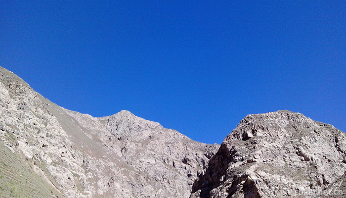
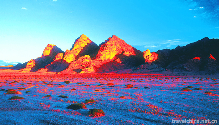
In the Altyn Mountains, there is an ancient karst landform (also known as karst, karst), from the east to the Bukadaban Mountains, and from the west to Lake Aqikkule, 350 kilometers long, 20-30 kilometers wide, covering an area of about 10,000 square kilometers, deep in the mountains of 4400-5000 meters above sea level. This ancient limestone mountain after thousands of years of wind and rain, dissolution and differentiation, showing a strange shape. Some of the stone peaks stand up straight into the blue sky; others are like camels, elephants, canglong, crouching tigers, pen racks, flyovers, temples, point towers, cactus, stone flag poles, horse-tied stakes, which are vivid; there are thousands of forms of dissolution ditches, stone buds, Yongdao, corridors. The karst landform of the Altun Mountains, due to the influence of the Quaternary glaciers in some areas, formed a "static sweep group of mountains, suddenly supporting the blue sky" corner peak. There are 388 glaciers around the plateau basin, covering an area of 878.3 square kilometers, with a total glacier storage of 67.82 billion cubic meters. Muztag and Xinqingfeng are the concentrated areas of modern glaciers. The glacier area accounts for 77.5% of the total glacier area in the reserve, and the thickness is more than 100 meters. There are various types of glaciers, such as suspended glaciers, glacial bucket glaciers, Valley glaciers, slope glaciers, flat-top glaciers and so on.
The Altyn Mountains are situated in the Northwest desert, north to the Kumutag Desert, south to the Qaidam Basin, and belong to the cold zone of the Qinghai-Tibet Plateau. Although in the latitude of the warm temperate zone, but because it is located in the plateau mountains, the average altitude of more than 3000 meters, altitude on the impact of temperature has exceeded the role of latitude position. It is characterized by drought and less rainfall and large temperature difference in the four seasons. The winter is long and cold, summer is short, windy and dry. Generally, snow and ice begin to snow in mid September, and the ice and snow period is as long as 9 months. The average annual temperature in Gobi is 3.5, the average maximum temperature in January is - 9.2, the average minimum temperature in June is - 10.8, and the average maximum temperature in July is 16.7. The average annual precipitation is 110.0 mm, but the distribution is very uneven. The annual precipitation in the mountain area is 200 mm to 250 mm at the altitude of 4000 meters, and the annual precipitation in Lake Sugan is less than 50 mm at the altitude of 2900 meters. The annual average evaporation is 2495.2mm, which is more than 20 times the annual average precipitation. The annual average wind speed is about 3m/ seconds, and the monthly average maximum wind speed is 5m/ seconds. In winter and spring, the strong winds are mostly northwest wind. Natural disasters are frequent. Flash floods, droughts, hailstorms, strong winds and strong cooling are a great threat to mountaineering safety.
The Altyn Mountains are the coldest in January, with a monthly average temperature of -20 to 30 degrees Celsius, and the highest in July with a monthly average temperature of 8 to 10 degrees Celsius. The annual precipitation distribution is uneven, and a large amount of precipitation is concentrated in the summer of July. From mid September to the end of May next year, it is not suitable to enter the mountain area during the snow cover period.
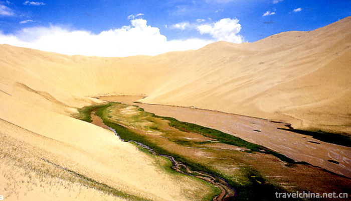
The Altyn Mountains consist mainly of 8 rivers and a large number of seasonal rivers which form the "great arteries" in the Plateau Basin. The drainage area of the 8 main rivers is twenty thousand square kilometers. There are two main types of water supply in rivers: glacier melt water and outflow spring. The Sulubei Tilek River is the largest river, originating from the northern slope of Xinqingfeng and pouring into Lake Ayake Kumu. It is 280 kilometers long and has a basin area of 6250 square kilometers.
The northern slope of the mountain is a vertical vegetation spectrum of extreme arid desert. Desert vegetation is dominant in the Piedmont, Zhongshan, subalpine and alpine belts. The main plants are: herb, Kunlun Artemisia, camel hair and jade column. A few sparse plants, such as Hippophae rhamnoides, Tamarix brachyphylla, Salt spike wood, Flowers and firewood, Camel's spine with sparse leaves, Ephedra inflata and Kashiba, are found in the valley of 2300-3000 meters.
In the vertical zone of soil, there is a lack of mountain pale chestnut calcareous soil zone; the mountain brown desert soil rises to 2800 meters, and the upper limit of mountain pale calcareous soil can reach 3800 meters. 3800 meters above the subalpine steppe soil and alpine desert soil. Salinized Alpine desert soil is developed in the valley, swamps and large and small salt lakes appear at the bottom of the valley. Swampy soil and mountain salt soil are distributed around the valley, and turtle cracked soil can be seen in some depressions.
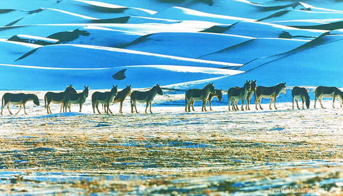
Due to abundant precipitation, good vegetation restoration, abundant water and grass, the distribution of various types of wildlife showed a relatively concentrated, dense, large population, and large number of trends. According to 2007 statistics, there are 359 species of wildlife, Tibetan antelope, wild yak and Tibetan wild donkey are estimated to have about 100,000 ungulates (37,000 Tibetan antelope, accounting for more than one third of China, nearly 39,000 Tibetan wild donkeys, more than 5800 wild yaks), plus Tibetan antelope, rock sheep and other species. Widely distributed, dense and large, other ungulates also have varying degrees of growth. The number of ungulates in protected areas should be more than 150 thousand, with more than 100 thousand birds.
On August 19, 1989, two Chinese and Japanese climbers from Lanzhou City, Gansu Province, and Kuokuda County, Japan, successfully climbed 5,782 meters of Glacier 10 on the northern side of the Altyn Mountains.
August 23-28, 2001, Gansu Feihong Outdoor Sports Club climbing team failed to climb the northern route, the southern slope of the route of six members reconnaissance rose to 5600 meters above sea level.
From August 13 to 23, 2002, five members of the Gansu Feihong Outdoor Sports Club climbed the 5828-meter main peak of Mount Altyn, which is still the virgin peak. On August 20, five players reached the summit successfully, and Li Qian became the first woman to climb the main peak of Mount Altyn.
Aerhchin Mountains
-
Letinous edodes chicken Noodles
Letinous edodes stewed chicken originated in Northern Jiangsu
Views: 165 Time 2018-10-12 -
Shantou beef ball
Views: 501 Time 2018-11-02 -
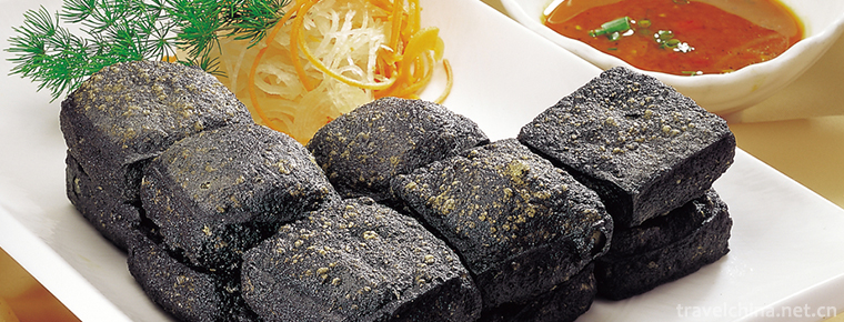
Huizhou stinky tofu
The common name of stinky tofu in Huizhou is "Big Dumb and stinky", which is a characteristic traditional snack in Huizhou, Anhui Province.
Views: 223 Time 2018-11-27 -
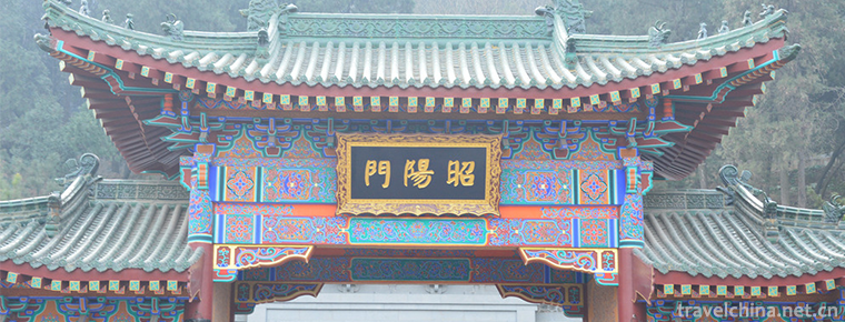
Huaqing Pool Scenic Area
Tang Huaqing Palace is another palace for feudal emperors in Tang Dynasty. Later also known as "Huaqing Pool", located in Lintong District, Xi'an City, Shaanxi Province.
Views: 177 Time 2018-12-12 -
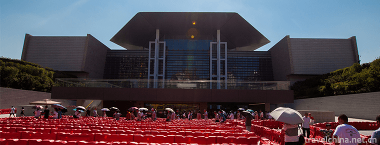
Sun Yatsen Memorial Hall
Zhongshan Memorial Hall is located in Dongfeng Middle Road, Yuexiu District, Guangzhou City, Guangdong Province. It was built by the people of Guangzhou and overseas Chinese to commemorate Dr. Sun Yat
Views: 164 Time 2018-12-22 -
Hunan Provincial Museum
Hunan Museum is the largest museum of history and art in Hunan Province. It covers an area of 49,000 square meters and has a total floor area of 91,000 square meters.
Views: 132 Time 2019-01-16 -
Longtan Ecotourism Resort
Lianzhou Longtan Eco-tourism Resort is a tourism project invested and constructed by Lianzhou Aidi Tourism Development Co., Ltd. of Qingyuan City. Based on the original Huangchuan
Views: 160 Time 2019-01-19 -
Qixia Mous Manor
Mou's Manor, also known as Mou Erhei Manor, is located in Ducun, an ancient town in the north of Qixia City (the northern head of the original Xiaguang Third Road).
Views: 167 Time 2019-02-07 -
Batik art
Miao batik technology, the traditional handicraft of Danzhai County, Guizhou Province, is one of the national intangible cultural heritage.
Views: 129 Time 2019-05-10 -
Legend of Mencius Mother and Godson
Legend of Meng Mu and Godson, Zoucheng local traditional folk literature, Shandong Province, one of the national intangible cultural heritage.
Views: 186 Time 2019-06-04 -
Pinghu cymbal book
Cymbals are a unique form of local traditional folk art in the Wu dialect area of Jiangnan. According to the Records of Songjiang County, it was formed in the Qing Dynasty (1821-1850). It is now mainl
Views: 154 Time 2019-06-09 -
Sichuan Zhuqin
Sichuan Zhuqin is an ancient traditional opera. The performers hold fishing drums and rap stories. The original name is Mingqin. Because its accompaniment instrument is a bamboo drum drum, it is also
Views: 111 Time 2019-06-16


