Hukou Waterfall
Hukou Waterfall
Hukou Waterfall is a national scenic spot and a national AAAA scenic spot. Hukou Township, Yichuan County, Yan'an City, Shaanxi Province in the west, and Hukou Town, Jixian County, Linfen City, Shanxi Province in the east, are the two provinces'common tourist attractions. It is 350 kilometers south of Xi'an, Shaanxi Province, and 387 kilometers north of Taiyuan, Shanxi Province.
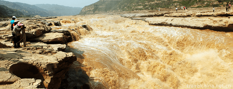
Hukou Waterfall is the second largest waterfall in China and the largest yellow waterfall in the world . The Yellow River runs to this point, with steep stone cliffs on both sides and narrow estuaries, so it is called Hukou Waterfall. The Yellow River in the upper reaches of the waterfall is 300 metres wide and is compressed to 20-30 metres in less than 500 metres. The 1000 cubic meters per second of river water poured down from the cliffs over 20 meters high, forming the atmosphere of "a pot harvesting thousands of miles of the Yellow River".
In December 2013, "Hukou Scenic Spot of the Yellow River in Yichuan County" was named one of the "thirteenth batch of national water resources scenic spots" by the Leading Group of Water Resources Scenic Spot Construction and Management of the Ministry of Water Resources of the People's Republic of China. The award of honor to Hukou Water Conservancy Scenic Spot of the Yellow River has become the fourth national name card of Hukou Scenic Spot after the National Geopark and Geological Heritage Reserve, the National Key Scenic Spot and the National 4A Scenic Spot. It is the only national water conservation scenic spot in Yan'an City. The 2008 China Yellow River Tourism Conference was named "50 Sceneries of the Yellow River in China".
On September 29, 2018, Shanxi Huanghe Hukou Cultural Tourism Development Co., Ltd. issued an urgent notice, notifying that "the Yellow River Reception Committee has notified that during the National Day, the Hukou Waterfall scenic spot of Shanxi Huanghe River will maintain a relatively high water level and do not meet the opening conditions. To ensure safety, the scenic spots are temporarily closed during the National Day.
Research on Hukou
One "Hukou" was first seen in Shangshu Yugong in the Warring States Period. For example, "Hukou, Leitou and Taiyue" are related to the route and strategy of Dayu's water control. Here the mouth of the pot is lifted without saying the waterfall.
"Mengmen Mountain" one, first seen in the Zhou and Qin Dynasties, "Shanhai Jing" book, the book records "and the southeast 320 li, called Mengmen Mountain, on which there are many emeralds, its lower Yellow chalk, Dogne stone". In Yan Daoyuan's Annotation of Shui Jing, Meng Men and waterfalls are described profoundly: "Huainanzi says: Longmen has not been opened, Lu Liang has not been chiseled, the river overflows over Meng Men's gate, there are no hills, Gaofu extinguishes it, known as flood, Dayu dredging, Meng Meng's gate. Therefore, "Biography of Mu Tianzi" said: Beideng, Mengmen Jiuhe pedal, Mengmen, that is, the upper mouth of Longmen, is indeed the great Osaka of the Yellow River, and Mengjin's name. This stone is chiseled at the beginning, gargled in the river, with deep cliffs and steep cliffs. The boulder is in danger, and if it falls, it will be restored. Ancient people said that water is not stone chisel but can enter stone, believe me. Among them, the water is balanced, the air is cloudy, and the people who come and go from afar often feel like fog and palpitation. Its waters are still in full swing, the suspension is huge, the Hunhong is the most angry, Gushan Ruoteng, Chunbo decadent barrier, until Xiakou, we know that Shenzi Xia Longmen floating bamboo, is not the pursuit of horses. It is noted here that the waterfall lies at Mengmen, not at the mouth of the Yellow River.
Yuanhe County Chronicle also describes Hukou as a stone trough. One said, "There are mountains in the river, such as troughs in the chisel, and beams are suspended for more than 70 feet." Besides, "the stone trough is a thousand steps long and thirty steps wide", which is obviously different from what Yun Daoyuan said, indicating that Hukou Waterfall has moved upstream. The Annals of Yuanhe Prefectures and Counties was written in the eighth year (813) of Tang Xianzongyuan and three years (527) of Xiaochang, the Xiaoming Emperor of the Northern Wei Dynasty who died of Duo Daoyuan, in 286. This shows that in the 286 years after Duo Daoyuan, Hukou Waterfall pushed a thousand steps upstream from Mengmen, and burst out a deep trough with a length of 1000 steps and a width of 30 steps on the river bed. Now it has moved up to the vicinity of Longwangzhao, about 5 kilometers away from Mengmen, which is called the Ten Mile Dragon Trough. The above is the history of pot mouth evolution in the past 1500 years.
There are four known places named Hukou in Shanxi Province. The Hukou recorded in Shuijing Zhu Fenshui Zhu is not the Hukou on the main stream of the Yellow River. In addition to the inconvenience of transportation in ancient times, there were not many scholars who could visit Hukou Waterfall in person. Therefore, in some ancient documents, there were some scholars who regarded Hukou as the mouth of the Yellow River; those who regarded Hukou and Longmen as one place; and there were some errors in location, which were inevitably caused by falsehood.
Before liberation, Wu Bing, the earliest compiler of Yichuan County Records in the eighteenth year of Qianlong in Qing Dynasty (1753), pointed out that Hukou of the Yellow River "had a wide upper flow, so it was closed to the channel, such as the mouth of the pot, hence its name". Meng Meng Men also said that "it belongs to Pingzouli. In the Yellow River, 100 miles northeast of the county, Ren Shui surges to the sky and can't help it." His article "Hukou Kao" corrects some inaccuracies in the previous literature and has important reference value in the study of Hukou.
geographical environment
Location Scope
Hukou Waterfall is located in the southern section of the Qin-Jin Gorge, about 65 kilometers south of Longmen and 5 kilometers south of Mengmen. Hexi belongs to Yichuan County of Shaanxi Province. Hedong is connected with Jixian County of Shanxi Province. It is a large Canyon waterfall landscape in China.
Geographical form
In Hukou area, the West Bank of the Yellow River descends steeply and gently, the width of the narrow valley bottom is about 400 meters, the height of the narrow valley bottom is about 150 meters from the bottom of the valley to the slope of Longwangpo, the cliff bank is very steep, the valley shape above Longwangpo is widened, the slope of the Valley is gentle, and the cross section of the Yellow River forms a valley in the form of a middle valley. To the north of Longwangzhao, the width of the river is the same as that of the narrow valley, the river is filled with narrow valleys, and the constant More than 400 meters wide, below Longwangzhao, the water flows to the mouth of the pot and flushes into a deep channel at the flat bottom of the valley (a small channel is set in the big channel). The channel is 30-50 meters wide and 30 meters deep. Above the mouth of the pot, water is popular in the wide trough. Up to the top of the deep trough, the water surface 400 meters wide is poured into the deep trough 30-50 meters wide, forming a waterfall. The riverbed here is like a huge teapot, which receives all the water of the Yellow River, hence the name of the mouth of the teapot. Hui Shiyang's poem of the Ming Dynasty "originated from Kunlun Yandaliu, Yuguan nine turns a pot to collect." It is a true portrayal of the pot mouth. Hukou Waterfall is very spectacular. The torrential yellow water pours down, the torrential current surges, the turbid waves roll over, the spray splashes, the smoke is misty, the roaring waves roar, the sound shocks are several miles, the waterfall height can reach 15-20 meters in dry season, 45 meters in summer and autumn. In a flood, when the torrent rolls and gushes out of the deep trough, the waterfall falls into a torrent and disappears in the form of a waterfall. Five kilometers down the deep channel is Mengmen. After leaving Mengmen, the water surface widened, the water potential slowed down and restored to the scene above Longwangzhao.
geological structure
The bedrock exposed in Hukou area is mainly Triassic Zhifang Formation. The upper part is purple-red, purple-grey and grey-green fine sandstone interbedded with argillaceous rocks, while the lower part is deep sandstone. The sandstone is mainly feldspar sandstone, which is relatively hard. The argillaceous rocks are mainly shale, which is soft and fragmented and easy to be eroded by running water. In a steep canyon, when the torrential jet cuts vertically, it encounters alternating geological conditions of hard and soft rocks. Its hard rocks form rock sills or waterfall layers. Soft rocks are eroded into steep sills. When the torrent flies over the sills, a waterfall will be formed. Of course, the soft and hard rock layers are only favorable conditions for the formation of waterfalls.
The favorable tectonic conditions are also very important for the formation and development of Hukou Waterfall. From Hukou to Mengmen, the occurrence of bedrock is nearly horizontal, with an inclination of 3-5 degrees, and gently tilts northwest. In addition, the Qin-Jin Gorge itself is a weak zone with relatively developed joints, which is vulnerable to water erosion and cutting. As a result, the Yellow River flows through this area, often forming a steep river bed, but also can develop into waterfalls.
Modern tectonic movement also has an important influence on the formation and development of Hukou Waterfall. After the Himalayan movement, the crustal movement here has been dominated by slow uplift, so the downward shear of water flow is active, which contributes to the formation and development of waterfalls.
Stratigraphic characteristics
Hukou area belongs to the stratigraphic division of Shaanxi-Gansu-Ningxia Basin in North China. The basement rocks exposed in the Yellow River valley are the lower Triassic Zhifang Formation (T2Z), while in some tributaries of the West Bank of the Yellow River, the upper Triassic Tongchuan Formation (T2t) is occasionally exposed, and the basement rocks are covered with the Middle Pleistocene and Late Pleistocene loess (Q2+3). According to the order from old to new, the strata around the mouth of the pot are as follows:
The lower middle Triassic Zhifang Formation (T2Z):
The group was named in Zhifang Town, Tongchuan City. Sand-mudstone interbedding with purple-red and purple-grey lithology. Lower thick and upper fine, including vertebrates, plants, ostracods, valves, gills, limbs and other fossils. Its thickness is about several hundred meters, and it belongs to inland river and lake facies deposits.
Upper Triassic-Tongchuan Formation (T2t):
From the bottom to the top, it is black and dark grey-green shale. From bottom to top, it turns from coarse to fine and has its own cycle. Tongchuan is the most complete section. The most abundant fossils are named. It is more than 400 meters thick and still belongs to inland river and lake facies deposits. There is an integrated contact between Tongchuan Group and Paper Mill Group.
Quaternary Pleistocene Lishi Loess and Upper Pleistocene Malan Loess (Q2+3):
Lishi loess of the Middle Pleistocene is light grey yellow and light red grey loess with different thickness of reddish-brown paleosol layer and sub-sandy soil or sand layer at the bottom, which contains abundant vertebrate fossils.
The Upper Pleistocene Malan Loess is an aeolian deposit of light gray yellow loess.
Loess and underlying bedrock show obvious unconformity contact.
GEOTECTONICS AND ITS EVOLUTION
Hukou Waterfall is located in the southeastern part of the Loess Plateau in northern Shaanxi in the central part of the Ordos Basin. Tectonically, it belongs to the Ordos depression, a secondary tectonic unit of the Sino-Korean quasi-platform. Its basement is composed of Archean and Early Proterozoic metamorphic rocks. The caprock is composed of sedimentary rocks widely developed since late Proterozoic, and there is obvious angular unconformity contact between the caprock and the base. The formation of platform basement has undergone a complex and long evolutionary process. In the Ordos depression, the basement is seldom exposed because it is covered by huge Paleozoic, Mesozoic and Cenozoic strata.
In the late Proterozoic, although the platform has entered the stage of platform development, it still has some activity. At that time, there were obvious differences in uplift and subsidence within the platform, accompanied by faulting activities. The central part of the platform is dominated by uplifts, while the marginal areas are characterized by long and narrow bands of depressions and uplifts. The deposits accepted in the depression zone become the first cover of the platform. During the Sinian period, most of the platforms had been uplifted to land and suffered continuous weathering and denudation.
Mesozoic is a period of great development of Ordos Basin. The inland river and lake facies deposits are well developed, and the lithofacies and thickness are quite stable. The crustal movement is dominated by the whole uplift and fall. Only in the Yanshanian movement at the end of Jurassic and early Cretaceous did the platform cover fold slightly and form a wide syncline. In the late Early Cretaceous, the basin began to rise differently, the southeast was higher and suffered denudation, while the northwest was relatively declined and became the sedimentary center. At that time, the surface tilted from southeast to northwest, just the opposite of today. From the end of Cretaceous, the whole area rose slowly, and the surface was eroded and flattened to become a quasi-plain in the Miocene. As a result, the Paleocene and Eocene were generally absent in the basin. At the end of Miocene or the beginning of Pliocene, due to the influence of tectonic movement, the northern uplift and southern descent of the quasi-plain, the topography of the whole area has turned to high in the northwest and low in the southeast, and the general tilt direction of the ground is consistent with modern times.
The Quaternary tectonic movement in the Ordos Basin is characterized by increasing difference and rhythm. From Pleistocene to Holocene, the crust experienced a development process from rhythm to strong rise, so erosion and accumulation took place in different degrees on the basis of pre-Quaternary palaeogeomorphology. Loess accumulation and fluvial-lacustrine deposits formed in the same section at different times and in different sections at the same time constituted the main content of Quaternary system in this area. Especially the Middle Pleistocene loess, which is widely distributed and thick, constitutes the material main body of the plateau, beam and ditch. The loess landform in this area evolved on the basis of this.
The formation of the Yellow River has undergone a long geological age. Before the Quaternary, the basin geomorphology was basically close to modern times, but the unified Yellow River had not yet formed. Up to the early and middle Pleistocene of Quaternary, the main lake basins in the basin were Gonghe, Yinchuan, Hetao, Fenwei (Sanmen Lake) and North China. These Lake basins, except North China Lake, which was once connected with the ocean, are all inland type, forming independent catchment systems. As a result of rivers'retrogressive erosion and extension between the lakes, the lake basins collude with each other, and their sequence is different. Finally, a unified Yellow River was formed from the end of Late Pleistocene to the beginning of Holocene. So Qianli Changxia and Hukou Waterfalls in Qin and Jin Dynasties were gradually formed in the course of the formation of the Yellow River.
topographic features
Before the Yellow River had not formed a unified water system, most of the Qin-Jin Gorge was an inland river flowing into Sanmen Lake.
During the formation of Fenwei graben, a series of lakes with different sizes, shallows and distances were formed due to the decrease of differences in different sections and sections. From the Tertiary to the early Quaternary, such as Linfen, Yuncheng and Guanzhong, the lakes and marshes were the main environments. Especially at the end of Pliocene, with the formation of Fenwei graben rift system, the lake scale became larger and larger. In the early Pleistocene, at the junction of Shaanxi, Shanxi and Henan provinces, including Guanzhong area of Shaanxi Province. A lake with an area of about 23,000 square kilometers, Shanmen Lake, is formed in the southwestern part of Shanxi Province and the western part of Henan Province. This ancient tide is the forerunner of Guanzhong, Linfen-Yuncheng and Lingbao-Sanmenxia basins. The settlement of Sanmenxia Lake area and the uplift of surrounding areas accelerated the deepening and extension of the Qin and Jin ancient rivers. Qinjin Valley and Hukou Waterfall are gradually formed on the basis of such ancient landforms.
The formation and development of Hukou Waterfall is the result of the development and movement of riverbed cracks, which are the sudden formation of steep slopes in rivers. The most typical breakpoint is the waterfall, because the waterfall is where the river falls vertically. Therefore, a waterfall must have a layer of hard rock to form a "waterfall layer" in order not to be easily eroded by the river and make the waterfall into rapids. Below the waterfall is a deep pool washed down by the waterfall. If the waterfall layer is eroded and retreated, a long Canyon will be formed in front of the waterfall, indicating the result of the continuous retreat of the waterfall. That's what Hukou Waterfall is like. Mengmen used to be the site of Hukou Waterfall. As a result of traceable erosion, cracks continue to move up the river, and the deep pool under the waterfall extends into a small channel in the original channel, namely the "Shili Dragon Channel". Now the breakpoint of this section of the Yellow River has reached Longwangzhai, the Hukou Waterfall, and Mengmen is the two stone islands left on the river bed when the breakpoint retreated and the river cut down in recent geological period.
Hukou Waterfall, Shili Longgou and even Mengmen Shidao are all washed out by the Yellow River. The erosion of water flow is controlled by regional geological structure, landform, climate, hydrology and other natural geographical factors. Due to the comprehensive influence of various natural conditions in different periods, the migration speed of Shuoyuan source of Hukou Waterfall is different from that of "Longgou". For many years, the water fall of Hukou Waterfall is 3.3% per year. At the same speed, the Dragon trough extends upstream.
Landform characteristics
Yichuan County, Shaanxi Province and Jixian County, Shanxi Province, are located in the Loess Plateau area. The main landform type is broken loess plateau. Only two narrow areas in the Yellow River Valley form thin loess-covered rocky hills.
Yichuan's fractured plateau is mainly distributed on both sides of the Yunyan River and Shiwang River Basin. The plateau surface is 1000-1400 meters above sea level, slightly inclined from west to east. The whole plateau surface has been destroyed and divided into some small plateau by valleys. Among them, Niujia tableland, attic Tableland and Gaobai tableland have larger areas, which correspond to the broken loess tableland in Jixian County, which separates the Yellow River and Shanxi Province. The underlying bedrock palaeogeomorphology of the fractured plateau is an Intermountain basin that the main stream of the Yellow River later passed through. Pliocene laterite and early Pleistocene loess were mostly denuded. The thick loess of the Middle Pleistocene laid the foundation of the Loess plateau. Late Pleistocene Malan loess deposited. Under the action of successive rivers and modern gullies, it gradually became a fractured loess plateau. The plateau surface is not only broken, but also from the edge of the valley to the central part of the plateau, the relative height difference can reach 100-120 meters. For example, Niujialing Plateau is thousands of meters wide in the East and west, tens of kilometers long in the South and north. It transits from a gently inclined terrace to a main ditch, and the slope increases from 1-3 degrees in the center of the tableland to 10-15 degrees in the edge of the tableland. Because the rivers in the tableland area converge in the Yellow River with a very low base level, all kinds of erosion are relatively active.
The narrow strip area on both sides of the Yellow River is a rocky hilly area covered by thin loess. The bedrock exposed in Hukou area is mainly Triassic sandstone and shale, which is covered by thin discontinuous loess with a thickness of 0-40 meters. The top part of the hill is beams and ridges. The elevation of the top surface is generally about 1200 meters above sea level. It is similar to the elevation of the surrounding broken plateau and 400-500 meters higher than the bottom of the Yellow River valley. Because of its close proximity to the valley of the Yellow River, the strong undercutting of the Yellow River makes its coastal communication also strongly undercutting, thus splitting the coastal surface into fragments, forming a stone hill covered with thin loess. Beams and ridges fluctuate and valleys are deep. Apart from the exposed bedrock in the lower part of the beam and the dune, the overlying loess has been eroded and the bedrock has been exposed directly in some areas, which presents a kind of scene of bedrock remnants.
Qin-Jin Gorge
After the Yellow River flowed out of the western part of the Loess Plateau, along the faulted basins on the western and Northern margins of the Ordos Plateau, it turned from south to North and then to east, turning a large right-angle bend. Due to the obstruction of Luliang Mountain, at Hekou Town south of Toketo, Inner Mongolia, it suddenly turned southward and entered the eastern part of the Loess Plateau to the south of Lama Bay in Qingshuihe County. The Yellow River jet flows southward, separating the Shanxi and Shanxi loess plateaus. Near Tongguan, driven by the Qinling Mountains and the Weihe River, the Yellow River bends eastward and cuts through the mountains between Shaanxi, Shanxi and Henan, leaving the Peach Blossom Valley and entering the North China Plain. From Lama Bay to Longmen, the river is more than 700 kilometers long. Except for a few wide valleys, most of the cliffs on both sides of the river stand steeply, 10 meters to 100 meters above the surface of the water. The river is generally 200-400 meters wide. It is the most magnificent long gorge on the main stream of the Yellow River. Among them, the section from Hequ County to Longmen is 500 kilometers long - Qinjin Gorge. Known as the Qianli Long Gorge, the canyon has little change along the way. The River maintains its north-south direction, which is roughly parallel to the direction of the Mesozoic strata in the Paleozoic and Mesozoic. From Fugu to Hukou Waterfall, the river channel is cut into Triassic sandstone and shale, and the two sides of the valley are also steep cliffs, with the river width of about 300-400 meters. Longmen is the end of the Qin-Jin Gorge with a width of about 150 meters. The outcropping strata are mainly Ordovician limestone, Carboniferous and Permian sandy shales. Mountains on both sides of the Taiwan Strait extend from NE to SW and become the barrier of Fen and Wei plains. After the Yellow River left Longmen, the width of the river bed suddenly expanded.
The Qin-Jin Gorge had taken shape long before the Pliocene, and the present Yellow River was roughly cut down along the ancient Valley developed on the denudation surface of the Tangxian Period. The main reason for the lower cut of the Yellow River is the break-up and uplift of the Shanxi Tailong uplift in the late Pliocene, the normal fault occurred in Longmen Mountain at Yumenmenkou, the northern site rose and the southern part declined, and the Yellow River cut down on the bedrock to form a magnificent canyon. In the process of intermittent ascent and descent, five distinct base terraces are formed in the canyon. Between Wupu and Yumenkou, the relative height of the highest base terrace is 230-250 meters, while the other four levels are 160-205 meters, 75-95 meters, 25-35 meters and 8-12 meters, respectively. The cause of formation of these five terraces can not be attributed to the result of crustal uplift. At least the lowest terraces were caused by the humid climate, increased discharge and enhanced downward cutting of rivers after loess accumulation in the late Pleistocene.
Climatic characteristics
Hukou Waterfall is located in a warm temperate humid and semi-humid, semi-arid climate. The average annual temperature is 9.9 C, the average temperature in the hottest month (July) is 23.3 C, the average temperature in the coldest month (January) is - 5.7 C, the annual difference is 29 C, the extreme maximum temperature is 39.9 C, and the minimum temperature is - 22.4 C. Annual precipitation of 577.2 mm, about 60% concentrated in 7, 8, 9, 3 months, hot and rainy season, and more rainstorms. The area has four distinct seasons, short and slightly hot summer, slightly long dry and cold winter, and mild and changeable spring and autumn.
Hydrological survey
Rainstorm in Qinjin Gorge Basin is one of the main sources of flood in the middle reaches of the Yellow River. Flood in the middle reaches of the Yellow River is characterized by high peak, short duration and thin process line. Because this area mainly belongs to the Loess Hilly and gully region, the surface undulates greatly, the catchment time is short, after the rainstorm, water and sediment all fall into the Yellow River, forming a flood storm with very high sediment content, which has a strong erodibility to the river bed. According to observation, the maximum discharge near Hukou Waterfall can reach 10500 cubic meters per second during flood period. In addition, the sediment amount entering the Yellow River from Hekou Town to Longmen interval averages 908 million tons per year, accounting for 55.7% of the total annual sediment transport of the Yellow River.
Scenic spots
Waterfall
With the waterfall, there are a series of peculiar scenery, mainly eight spectacles, called: smoking under the water, boating in dry land, neon water, flying mountains and seas, rain in clear sky, thunder in dry days, ice peak hanging upside down, ten-mile dragon trough.
Smoke from the bottom of the water
At the entrance of the Yellow River to the "Hukou", the water mist caused by the turbulent flow rises in the air, and the steaming clouds follow the sky. It seems that the smoke from the bottom of the water is billowing, which is expected to be ten miles away.
The size of the mist in the pot mouth is related to the season and flow rate. In winter, rivers are frozen, waterfalls are mostly ice-covered, surface water is reduced, the flow of pot mouth is reduced to 150-500 cubic meters per second, water falls down, the surge is not big, and water fog flying out of the trough is very little; in summer, the flow increases greatly, the flow overflows the deep trough, the drop is very small, the waterfall disappears, and it is not easy to form dense water fog rising into the upper air; in spring and autumn, the flow is moderate, the temperature is not high, and the fall of the waterfall is over 20 meters. The torrent splashes, forming a heavy fog in the air, that is, "smoke from the bottom of the water" scene.
Dryland boating
Hukou Waterfall falls greatly, and the deep groove under the waterfall is long and deep, and the current is turbulent, which brings great difficulties to the navigation of ships on the water. Ships traveling downstream from the upper reaches of Hukou have to stop at the Dragon King's Ridge on the upper side of Hukou first, and all the cargo will be removed from the boat to be loaded by people and carried by livestock along the river bank to the downstream wharf. At the same time, the empty boat is pulled out of the water by manpower, and the round wooden bars are laid under the boat. The empty boat rolls along the river bank to the lower part of the pot mouth where the current is slower. Then the boat is put into the water, loaded with cargo, and continues to descend. Manpower tugboats on the shore are laborious and often require hundreds of people to pull the fibers desperately. Although there are some circular bars that roll under the boat, the stone bank is still scratched by nails on the bottom of the boat. Under the current conditions, "dry land boating" may be the best choice for water transport across Hukou Waterfall, which is suitable for the gentle rocky riverbanks above and below Hukou Waterfall. Due to the rapid extension of highways and railways, and the construction of the Yellow River Bridge near Hukou, the water navigation across Hukou has been blocked for many years. Dryland boating can only see the traces left by the old boating.
Neon Water Playing
The water mist formed by repeated impacts of Hukou Waterfall rises in the air, causing sunlight to refract and form a rainbow. Rainbows sometimes arc from the sky into the water, like long dragons absorb water; sometimes straight ribbons across the water, like color bridge flying frames, sometimes in the thick smoke in the emergence of clusters of flowers, colorful, erratic, confusing, for the world's wonders.
Neon water-playing is the product of the interaction of "smoking under water" and sunshine. In spring and autumn, smoke and thick fog are rising from the bottom of the water. Every sunny day, the sunshine often forms a rainbow obliquely. In summer, when it rains and clears, sometimes rainbows appear.
Mountain flying and sea standing
The Yellow River passes through the Qianli Gorge and the torrential currents force the Hukou Waterfall directly. Suddenly, the water flows back to the channel, forming a spectacular waterfall. Looking up at the water curtain, the rolling yellow water pours down from the sky, such as the landslide of thousands of mountains and the dumping of the four seas, forming the core landscape of Hukou Waterfall.
Rain on a clear sky
Suspended waterfall, the formation of water mist floating into the sky, although the hot sun in the sky, but near the waterfall, like a drizzle, wet clothes. This is another interesting view of the smoking underwater. Generally, the closer the river is, the thicker the fog is. Therefore, when smoking from the bottom of the water, it is unavoidable that clothes are wet when watching waterfalls on the bank, such as washing them lightly.
Thunderstorm in dry weather
The Yellow River travels through the valley, its turbulent waves are like thousands of horses, galloping and roaring, and the sound shocks the valley. When the waterfalls fall down and repeatedly impact the rocks and water surface, it produces tremendous sound, and echoes in the valley, just like thousands of drums, thunder and thunder in drought days, and sound transmission is tens of miles away. Only in the vicinity of Hukou Waterfall can we truly feel the "roaring of the Yellow River" and "roaring of the Yellow River".
Ice peak hanging upside down
In the mid-winter season, the Dragon trough is ice-sealed, and the water column formed by the streams on both sides hangs upside down like ice peaks of different sizes. Rainbows appear and disappear from time to time, and the rainbow drifts in between. The colorful and glittering contrast makes the visitors sigh at the magic of creation.
Shili Longgou
Hukou to Mengmen is about 5 kilometers. At the bottom of this 400-meter wide box-shaped canyon, the Yellow River flows downward, forming a deep trough 30-50 meters wide and 10-20 meters wide. When the water of the Yellow River rushed down from the mouth of the pot, it was attributed to the trough with a huge flow of thousands of cubic meters per second. Because it is said to be a dragon body with a length of about 10 miles, it is named "Ten Mile Dragon Trench" or "Ten Mile Dragon Trench". Hukou Waterfall traces its origin upward, and the deep pool under the waterfall extends continuously. This deep trough is embedded in the bedrock riverbed at the bottom of the original valley. Most of the bottom of the original riverbed beside the trough becomes the riverbank in the non-flood period. The riverbank is relatively wide and flat. It is made up of hard sandstone. Near the water, there is hardly any sand and stone. It is flat to drive on the river bed. This kind of geological and geomorphological condition is utilized by "boating on dry land".
On the high bank of the river, the "Dragon Channel" and the flow of the Yellow River can hardly be seen, but only the Yellow turbid water and dust in the purple-brown bedrock riverbed and the roaring sound of the billowing waves can be seen. The torrent in the trough is like a pot of boiling water. It rushes left and right, tumbles down rapidly, and sprays mist over the trough, making the Yellow River dim here. When the Yellow River rises during the flood season, the flood overflows one end of the Dragon Channel at Hukou, and there will be a long flow curtain one or two kilometers long on the East Bank of the Dragon Channel, which is very spectacular. Looking at the Dragon trough in the distance, the bent stone trough in the gorge is like a giant dragon wagging its head and tail. The mouth of the pot is the tap, which engulfs the huge current of the Yellow River. Mengmen is the dragon's tail, and the abdominal discharge river is downstream.
Mount Mengmen
Five kilometers downstream of Hukou Waterfall, beneath the "Ten Mile Dragon Trough" and in the riverbed at the bottom of the Yellow River Valley, there are two spindle-shaped boulders standing tall in the huge current, forming two river-centered islands, which is Mengmen Mountain in ancient times known as "the pedal of the nine rivers". Legend has it that the two islands were originally a mountain, blocking the river course, causing floods to overflow. When Dayu harnessed the water, the mountain was split into two, and the water was flowing smoothly. These two islands look like boats from afar, mountains from afar and doors from afar. It is also said that in ancient times, the descendants of the Meng brothers were washed away by the river and were rescued here. Therefore, the two islands are called Meng Men Shan.
Damengmen Island is about 300 meters long and 50 meters wide, about 10 meters above the surface of the water. In the early years of Qing Dynasty and Yongzheng Dynasty, there are four characters inscribed on the stone cliff on the south side of Jinmingjun, which are inscribed by Xu Yuanying, namely "Houzhen Ramps". The plaque is 2.5 meters long and 1 meter wide. It is a true portrayal of the wonders of mountains and waters here. Xiao Mengmen Island is located more than 10 meters upstream of Da Mengmen Island, only five or sixty meters long. These two islands are all composed of massive gray-green sandstones produced horizontally. The rocks are hard and have strong weathering resistance.
Meng Meng Men stood up in front of the turbulent mud flow, letting the water soar all the year round. Meng Men's poems are famous for their unique features, such as "four-hour mist and rain fan pot mouth, the waves on both sides shake Meng Men" and "four-hour mist and rain fan pot mouth".
In historical documents, there are many records of Mengmen, and there are more legends about Mengmen among local people. According to Geographic Knowledge, Mengmen was originally a crack in the Yellow River bed, where Hukou Waterfall appeared at that time. For a long time, the earth's crust has been rising, the river downcutting has been strengthened, the traceability erosion has been enhanced, the crack point has been raised, the waterfall has moved from Mengmen to the present position, and the deep pool under the waterfall has developed into the "Ten Mile Dragon Trough", while the Mengmen Mountain is the residual rock mass from the deep pool of the waterfall.
Although Montenegro Mountain is not enough to be called "mountain", its peculiar scenery is fascinating. Nanpeng, a Qing Dynasty poet, wrote in his poem, "Meng Men is small, but he looks like a fist. Born in a Book scene, planned to hang in the painting.
Mengmen of the Yellow River has not only charming scenery and the beauty of "Mengmen Night Moon", but also important scientific value in the study of the development history of the Yellow River.
Wonders of the Yellow River
"Ice Bridge" and "Dry and Thin" are two wonders of the change of the water level of the Yellow River in Hukou area.
The Yellow River ice bridge
In the mid-winter season, the water surface of the Yellow River in Hukou area was frozen. In some areas, the ice layer was thicker, forming a natural bridge connecting the two sides, called the Yellow River Ice Bridge.
The freezing period is from the formation of a stable ice sheet on the river surface to the day when the ice sheet breaks down and begins to flow. The freezing period begins on Dec. 10 - Dec. 20 and ends on Feb. 20 - 25 of the following year, usually 50 - 70 days. During the freezing period, the Shili Dragon Trough was covered with ice and snow, and the ice layer on it was "small snow drift, big snow bridge". Nine cold days, the ice can be higher than the two sides, not only spectacular scenery, but also the formation of ice bridge. When the river channel was first closed, people saw the footprints of wild animals such as foxes, and knew that the ice below was thicker and could pass. Therefore, there is a folk legend of "fox fairy stepping on the line".
Yichuan Yijindu and Fengjiaqi Gehehe in Jixian County, Shanxi Province, are facing each other. The ice is solid in winter, and the traffic is full of water. Because they are located above the pot mouth, they call this ice bridge "Shangqiao". When the rivers around Longwangwu and Qilangwo were frozen, they had a smooth road, people and horses flowing in and out, which was called "old bridge" and "Shenqiao".
According to records, in the last three years of Chongzhen (1630) in the late Ming Dynasty, when Wang Jia, the general of Li Zicheng's Rebel Army, led the Rebel Army to ride the ice-sealed Yellow River, he crossed the "Ice Bridge" from Hukou to conquer Jixian County in Shanxi Province.
At the end of the Qing Dynasty, the Western Nian Army was transferred to northern Shaanxi. During the five years of Tongzhi in the Qing Dynasty (1866), commander Zhang Zongyu, king of Liang Dynasty, crossed the Yellow River Ice Bridge at King Wuqiang of Xilong, crossed Mount Luliang, and rescued the Eastern Nian Army.
The Yellow River Ice Bridge has played a certain role in promoting economic and cultural exchanges and interpersonal exchanges between Qin and Jin Dynasties.
The Yellow River is thin and thin
The water volume of the Yellow River has decreased sharply, the water surface has narrowed, the water depth has become shallow, and sometimes the river water has become clear for a short period of time, or is close to drying up and so on. Locals call it "the Yellow River is thin".
"The Yellow River is thin" is an abnormal phenomenon in nature, rarely occurs, so as a wonder of the Yellow River. According to the literature, the Yellow River in Yichuan, Jixian section, there have been many times of drying up thin.
Sui Daye twelve years (616) River clear.
Tang Gaozu Wude seven years (625) September, the Yellow River clear water.
In the second year of Yongle Ming Dynasty (1404), from December 29 to January 18 of the third year (1405), the river became clear.
From December 11, 1726, the fourth year of Yongzheng in Qing Dynasty to the seventh day of the first month of Yongzheng in 1727, the Yellow River was clarified for 27 days and nights.
Tongzhi Decade (1871) The Yellow River dried up on November 4, and the day after Qilangwo to the clam beach (about 15 kilometers) came back at 2 o'clock.
In November of the second year of Guangxu (1876), the water above Hukou Waterfall was cut off by tens of feet and connected half a day.
Guangxu three years (1877) November 26 to four years (1878) January 8, river water clear 42 days and nights.
Six years (1917) and eighteen years (1929) of the Republic of China, the Yellow River dried up.
On May 15, 1981 (April 12, lunar calendar), the flow of the Yellow River gradually diminished. The river water under the original slope of Wangjiayuan Township, Jixian County, Shanxi Province, changed from 300 meters wide to 10 meters wide. People can reach the other bank by stepping on the rocks in the core of the river, and the river water is close to clarification. This lasted for 19 days. By about 10 a.m. on June 3 (May 2), the river water gradually increased and became turbid, and the flow rate tended to be normal on June 10 (May 9).
In 1987, the water of the Yellow River bottomed out for two months.
Short-term water volume of the Yellow River has decreased sharply, which is generally related to climate drought in the upper and middle reaches of the Yellow River.
Winter is the season with the lowest precipitation in the middle and upper reaches of the Yellow River. The cold climate, frozen river surface and sometimes ice blockage can also lead to the drying up of some river sections.
In other seasons, if severe drought occurs, the river water only depends on ice and snow melting water in the upper source area and groundwater recharge along the way, the water volume decreases dramatically. In addition, the irrigation water and urban and rural water consumption in the valley plain increase dramatically, and the evaporation on the river surface increases. The water volume in the area of Hukou is less, the velocity of flow slows down, and the sediment carrying capacity decreases, so the river is clear, dried up or cut off. For example, from October 1980 to May 1981, there was little rainfall in the area above Hukou. Especially after February, more than 100 days of rain did not fall. Some tributaries of the Yellow River were cut off at the same time, and groundwater recharge decreased significantly.
Xi Long Zhang Yuan
The north of Xilongzhangyuan is from Taoqu, south to northern liquorice, the east boundary is the valley wall of Qin and Jin Dynasties, and the west boundary is the west of Anle Mountain. The landscape features typical scenery of Loess Plateau and plateau villages, with open plains on the plateau.
Python mountain
Located in the eastern part of Yichuan County, Yan'an City, Shaanxi Province, the Mangtou Mountain National Forest Park is 800 to 1439 meters above sea level, with a total area of 2120 hectares and a forest coverage rate of 89.1%. The area is divided into three scenic spots: Notre Dame Hall, Shihua Mountain and Wang Anzhai. There are more than thirty scenic spots. The scenic area is densely forested, with Pinus bungeana, Platycladus orientalis and Quercus liaotungensis as the main coniferous and broad-leaved mixed forests. There are more than 400 higher plants, including more than 100 woody plants. The largest secondary forest of Pinus bungeana in China is distributed.
Historical culture
natural history
The Loess Plateau, the Yellow River, the Qin-Jin Canyon, Hukou Waterfall, Shili Longgou and Mengmen Mountain are all products of nature and important natural historical relics. In addition, there are the following natural and historical sites near the mouth of the pot:
Higher Terraces of the Yellow River
On the rock surface 100 meters above the riverbed, there are 1-2 meters thick gravel layers, which together constitute the first-class high terrace of the Yellow River. This accumulation terrace is the product of the early development of the Yellow River and the remnant part of the Yellow River bed at that time. This high terrace also exists in some parts of the Qin-Jin Gorge, which is of great significance to the study of the development history of the Yellow River and the characteristics of crustal movement at that time.
Fossil Origin of Bidactylus
Fossils of two-toed beasts were found 3 kilometers downstream of Hukou Waterfall, covering an area of about 40 square meters. Two-toed animals lived millions of years ago. The discovery of the origin of this fossil palaeontology is of great significance to the study of the palaeogeographic environment in Hukou area.
Loess Landscape
Loess plateau, moat, beam and gully between them are all large loess landforms, while the Loess pillars, loess caves, loess bridges, loess walls, loess caves and so on, which appear on the edge of Loess cliffs, are all small landscapes of Loess landforms. In Hukou area, along the broken Loess Plateau on both sides of the Yellow River, small landscapes of loess are mostly distributed.
There is a natural bridge on the cliff on the north side of Shiwang Valley, about 15 kilometers from the mouth of the county river. The bridge is 6-7 meters long and 1.5-3 meters wide. The top of the bridge is flat and overhanging. It is very dangerous.
On the Henan side of Jingyang Village, about 10 kilometers east of Yichuan County, there is a cave named Baiyun Cave at the waist of Zhongshan Mountain in Heishanling. The cave is square and only allows one person to creep. The cave is suddenly widened and can stand and walk. It has stone like pagoda stalactite, 2-3 meters high, and is lustrous and lovely.
Rare Plant-Peony purple-spotted dwarf
Yichuan was known as Danzhou in ancient times. It is said that Yichuan was named for its abundant peony.
According to the old county chronicle, "The famous peony plateau of Dongshan Mountain in Xingji Town (where the government of Linxiang Township is located this autumn) is rich in peony in summer and autumn, but it blossoms in the wild, and its flowers are full of mountains, scent is dozens of miles, but no one cultivates it, the native people take it as salary." This is a wild peony, known as the purple spot dwarf peony, is a wild variety. It was widely distributed in northern Shaanxi in the past, but now it is a rare plant species that should be protected.
As early as the Tang and Song Dynasties, Yichuan was not only one of the four famous producing areas of peony, but also "Danzhou Huang" peony varieties had been transplanted in Luoyang, Henan Province as a precious variety at that time. Among the eight earliest peony gardens in Luoyang, the first one is "Danzhou Garden". Ouyang Xiu, a famous writer in the Song Dynasty, describes "Peony out of Danzhou" and "Danzhou yellow, Chiba yellow lace" in "A Tale of Luoyang Peony".
Danzhou peony buds and leaves on the stem in February, and seedlings in March are green like autumn garden of sheep peach. The thick flesh of the peony root is red-brown. Li Shizhen praised "the root bark of Peony in Danzhou is wonderful for medication" in Compendium of Materia Medica.
Because of long-term woodcutting and man-made destruction, the Wild Peony distributed in succession is scattered on some mountain beams, which is a small number.
Humanistic history
Ancient Wharf and Market Town
The scale of Donglong Wangzhao on the East Bank of the ancient wharf and market town and the polder needle beach on the West Bank of the river are larger. In addition, the Yijindu, Xiaohekou and Guantoudu crossings on the West Bank of the river are respectively opposite to the Fengjiaqi, Ma Duan and clam beaches on the East Bank of the river. Hukou Waterfall is a natural obstacle to the water transportation of the Yellow River. It divides the water transportation of the Yellow River into two sections. Before sailing to Hukou, the ships will berth at the ferry and unload cargo. They will cross Hukou Falls through "dry land boating" and then ship to another ferry. In addition, between Qin and Jin Dynasties, economic exchanges were frequent, and ice bridges were available in winter, so there were many ferry crossings. At that time, these ferry crossings were the distribution centers of water cargo in the south, north, East and west of the middle reaches of the Yellow River. The Yellow River water transport in Qinjin Gorge has played an active role in the economic development of Inner Mongolia and Central Plains, Shaanxi and Shanxi.
Before the opening of the Beijing-Baotou Railway, the shipping of the Yellow River was very developed, and Donglong Wangwu was one of the important land and water wharfs of the Yellow River and one of the more prosperous markets for commerce at that time. At that time, every March Peach Flood season began to drift boats, except for the rainy season when the peak time was interrupted, until the annual snow, snow river current transit period, from uninterrupted downward freight merchant ships. In order to exchange goods and materials, people in the upstream carry local products such as licorice, dates, grain, leather, animal bones, coal, porcelain, salt, alkali surface and so on. They are transported to Fenglingdu and Mengjin downstream through Hukou, where they sell all their cargo with ships, and then return to their homeland on foot by empty people. These vessels, with the exception of a few official vessels, are mostly merchant vessels. In terms of carrying grain, large ships can carry more than 9000 kilograms of grain and small boats can carry more than 6000 kilograms of grain. There are 4,000 or 5,000 boats passing through the wharf on Nianjinglu. At most, there were more than 1000 boats at the time of stopping. Hundreds of people worked as boat pullers in "dry land boating". According to a variety of inscriptions preserved by Donglong Wang Yi, the town flourished in the early Ming Dynasty and prospered in the Qing Dynasty, especially during the period from Qianlong to Daoguang. It declined before the War of Resistance Against Japan, and lasted for about 400 years. According to the inscriptions on the burned temples of the Ninth Year of Tongzhi (1870) in the Qing Dynasty, there were 63 shops that donated money to repair the temples, including Qianzhuang, Pizhuang, Pawnshop, Salt Shop, Pharmacy Shop and Beijing Store. Its economic activities are considerable.
The economic activities of Donglong Wangwu Wharf need not only corresponding commercial organizations, but also a corresponding large shipping organization, in order to speed up the speed of "dry land boating". Thus, in the early years of Kangxi in the Qing Dynasty, the non-governmental organization "Six-stranded Head" appeared, which was mainly composed of six villages near Hukou, Jixian County: Nanyuan, listing, sergeant, Liucun, Nancun, Guxian, responsible for the distribution of handling tasks, organizing manpower and distributing fees, taxes, etc. This organization continued to the Republic of China for 20 years (1931). During its 200-year activities, it played a positive role in prospering the local economy and developing cultural exchanges.
In addition, Yijindu, Fengjiaqi, Xuanjiatan, Xiaohuai and so on are all famous ferry and shipping terminals in history. The villagers, army and businessmen in the gorges often come and go from there. The ancient ferry of Xiangkui Pingtan still retains a relatively complete style of the ancient market town, and the stone holes of the coastal cable boats and the mountain roads excavated by boatmen on the rocky shore remain the same.
Hundreds of holes in Ming Dynasty caves, complete courtyards and ancient streets paved with stone slabs are also preserved in Donglong Wangzhao and Zhanpintan.
Since the completion of the Beijing-Baotou Railway, Inner Mongolian goods have been transported in Baotou, generally no longer using the Yellow River channel in the Qin-Jin Gorge. After the completion of the Yellow River Bridge, the highways were in all directions, and the ferry and wharf near Hukou became useless.
Military relics of past dynasties
"Qin and Jin divisions, Xiongguan Guyi more", Hukou to Longmen of the Yellow River Valley section, the two sides of the cliff towering, there are the Yellow River graben, Qin and Jin natural barrier, so it is also a historical place for military strategists to compete. In order to consolidate the frontier, the dynasties in successive dynasties had military and political organizations along the line, such as the "General Administration Office", "Cima garrison", "Hou Si" and "Inspection Department". In the Qing Dynasty, the Great Wall was built on the East Bank of the Yellow River to prevent the Western Nian Army from crossing the river.
According to records, the main military activities in Hukou area in history are:
In the Spring and Autumn Period, in order to seek the Guanzhong Plain, Jin State fought twice with the Di people in Huanglongshan, Hexi Province, to collect mulberries (the small boat nest near Hukou today).
During the Eastern Jin Dynasty, Yao Xiangcheng, the leader of the Qiang Nationality, built Yao Xiangcheng along the Yellow River (the southeastern village slope of the present river) and stood by to enter the prison.
At the end of the Northern and Southern Dynasties, Yao Xiangcheng was the beachhead position of the Northern Zhou Dynasty, which prevented the Northern Qi Dynasty from crossing the Yellow River in the west.
In the thirteenth year of Sui Kaihuang (617), Tang Gong and Li Yuan led the army into Hukou, and "hundreds of boat donors by the people of Binhai" attacked Chang'an.
At the end of the Southern Song Dynasty, the Mongolian Army took Fangzhou and crossed the Yellow River from Zhanjiantan Mountain to Yuehuanglongshan Mountain, recapturing Xizhou from the hands of the Jin Dynasty.
In 1368, the residual forces of YuanHuizong (Shunde Emperor) withdrew from Beijing to build a cable bridge on both sides of Hukou Longgou, which is called "Yellow River Flying Bridge". The remains remain.
In the three years of Chongzhen Ming Dynasty (1630), Li Zicheng's Revolutionary Army crossed the "ice bridge" from Hukou to conquer Jixian County in Shanxi Province when the Yellow River was frozen.
At the end of the Qing Dynasty, the Western Twisting Army in northern Shaanxi was led by King Zhang Zongyu of Liang Dynasty in 1866, crossing the Yellow River Ice Bridge, crossing Luliang Mountain and rescuing the Eastern Twisting Army.
During the Anti-Japanese War (1937-1945), Yan Xishan, under the threat of the Japanese army, retreated from Taiyuan, Shanxi Province, to the South Village slope of Hukou East Bank in the twenty-seventh year of the Republic of China (1938), along with Sangbai Village on the West Bank and Autumn Forest in Yichuan, and erected a Ferry Cable Bridge at the original site of the Cable Bridge.
The main remaining military sites are:
Clear the Great Wall. Founded in Tongzhi for five to eleven years (1866-1872), the Qing government built the Great Wall on the East Bank of the Yellow River by transferring Huaihe Army in order to intercept the Western Nian Army and cross the Yellow River eastward to ensure the safety of Beijing and Tianjin. The Great Wall starts from Pingdu Pass in the north and reaches Yumen Gate in the south. It is 75 kilometers long. The outer wall is over 10 meters high and the top is 5 meters wide. There are forts on it, and there are stacks, passages and fortresses. Donglong Wang Yi was the seat of the central command post at that time, with 3500 troops stationed under the supervision of the command organ.
Nancunpo and Ma Duan Tan. Nancunpo is located 5 kilometers east of the upper reaches of Hukou River. Ma Duan Tan is on the slope of Nancun. During the Anti-Japanese War, it was the headquarters of the Kuomintang's Second War Zone and the seat of the Shanxi Provincial Government. It had been stationed for five years. There are large stone buildings such as "loyal martyr temple" and "Yueqiantang" and well-preserved stone cave buildings. There are hundreds of holes in Wanghe Pavilion and earth cave caves of the garrison at that time. More than 20,000 people were stationed at that time.
Shek Bao Village. Located at the upper reaches of Hukou, it is three sides empty and has a cliff wall on the east bank overlooking the Yellow River. It is said that the Western Nian Army was built in the Song and Jin Dynasties, which confronted the Qing Army. There are dozens of holes in the gate, wall and cave.
In addition, the small boat nests and clam beaches on the Eastern Bank of the river have been garrisoned in the past.
Stone carving art
In Hukou area, because of the special geographical position and the importance of ancient economic and military activities, many important activities were inscribed on the stone. The main stone inscriptions preserved were the inscriptions of the King of Donglong. There are more than 10 existing ones, among them:
(1) Dragon King Temple Theatre Monument and Restoration of Music Building Monument. These two tablets were inscribed in Jiajing and the early years of Kangxi respectively. The inscriptions recorded the formation and economic activities of Longwangwu Market Town.
(2) The Niuma Wang Temple rebuilt the Music Tower and the Mountain Gate Stele, which recorded the prosperity of Donglong Wang Wu as a flood-drought wharf and an important market town.
(3) The restoration of the temple tablets burned down by the Nian Army during the Eastern Crossing was inscribed in the Ninth Year of Tongzhi in the Qing Dynasty (1870), reflecting the economic activities of Wang Zhao of the Eastern Dragon at that time.
(4) The monument to the dead soldiers of the Qing army in the battle against the Nian army's forcible crossing of the Yellow River provides an important clue for the study of the military activities of the Nian army.
_The official stele is inlaid on the stone cliff near Gudu Port, Zhanjiantan. It records the robbery of timber in the drifting of timber in the Yellow River. The whole stele is well preserved.
Mengmen Stone Carvings. The inscriptions of Xu Fengying in the Qing Dynasty on the four characters of "Hou Zheng Mao Liu" are carved on the huge stone of Mengmen, which vividly summarizes the natural characteristics of Mengmen Mountain.
(5) Stone Carvings in the Eight Years of the Republic of China (1919). The Hukou Waterfall is an important historical material for the construction of Hukou Waterfall Scenic Spot (the plaintiff is in the cultural relics).
Tourism related
Tickets for scenic spots
On March 1, 2016, Yichuan Hukou Scenic Area began to implement new ticket prices, 100 yuan for full fare and 50 yuan for half fare. Preferential policies shall be implemented in accordance with the provisions of the State.
Traffic information
Xi'an-Hukou Self-help Tour
Xi'an Textile City Passenger Station has Xi'an to Hukou special line bus, two buses a day, 8:00 a.m. and 13:20 p.m. respectively. The whole journey is 350 km, and the journey is about 4 hours. The whole fare is about 97.5 yuan.
Linfen-Hukou Self-help Tour
Driving from Linfen City to Jixian County along Linji Expressway is about 100 kilometers. Driving another 45 kilometers to Hukou Town is about 1.5 hours to Hukou Waterfall Scenic Area.


-
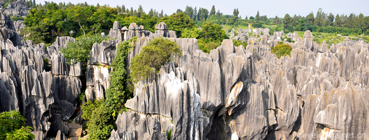
Kunming CityStone Forest Scenic
Kunming Stone Forest Scenic Area, also known as Yunnan Stone Forest.
Views: 291 Time 2018-10-21 -
Yandang Mountain Scenic Spot
Yandang Mountain, the first batch of national key scenic spots, has the titles of "Sanitary Mountain, Safe Mountain, Civilized Mountain", National Civilized Scenic Spot, National AAAAA Touri.
Views: 190 Time 2018-12-07 -
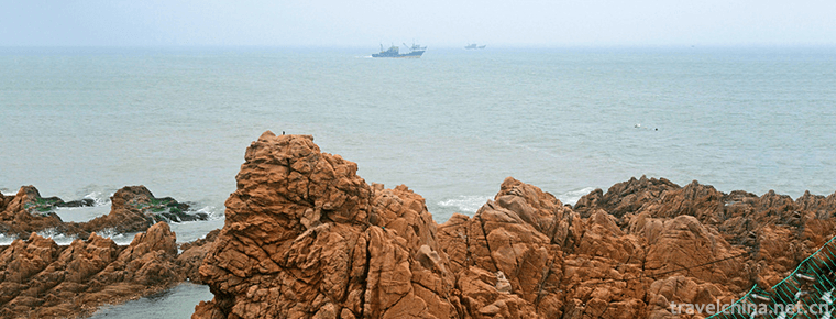
Chengshantou Scenic Spot
Chengshantou Scenic Spot is located at the easternmost end of Chengshan Mountains in Rongcheng City, Shandong Province, so it is named Chengshantou. Chengshantou is 200 meters above sea level.
Views: 187 Time 2019-01-05 -
Lao Leshan Tourist Scenic Spot
Lao Leshan is located in the south of Henan Province, 9 kilometers southwest of Zhumadian City and 8 kilometers west of Queshan County. National Highway 107.
Views: 135 Time 2019-01-29 -
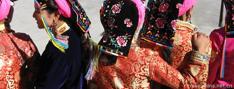
Tibetan costume
Tibetan costumes Tibetan men's clothes are divided into three categories: labor dress, superfluous dress and warrior dress. Women's clothes change greatly in festivals, major events in life and etique.
Views: 202 Time 2019-04-05 -
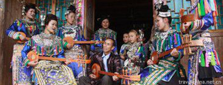
Dong Pipa Song
Dong Pipa song is distributed in the southern dialect area of Dong nationality, which can be divided into lyric and narrative Pipa song. Its singing content almost covers Dong history.
Views: 118 Time 2019-04-28 -
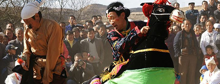
Jingbian donkey
Jingbian Donkey Running, a traditional dance in Jingbian County, Yulin City, Shaanxi Province, is one of the national intangible cultural heritage..
Views: 257 Time 2019-05-08 -
Qianjiang Folk Songs
Qianjiang folk song is a traditional folk song in Hubei Province. Popular in Qianjiang City, folk songs created by local working people in their work, life and customs. Its rich content,.
Views: 294 Time 2019-06-10 -
Cross stitch
Flower picking, a kind of drawing work, also refers to a needle method of embroidery, Chinese folk traditional handicraft. Also known as "pick weave", "cross embroidery", "cro.
Views: 230 Time 2019-06-21 -
Tongwei Opera
Tongwei Xiaoqu Opera is a kind of traditional Xiaoqu Opera popular in Tongwei County. In the Ming and Qing Dynasties, Tongwei folk artists absorbed various flavors of Longdong Daoqing, Wanwanwanqiang .
Views: 194 Time 2019-06-21 -
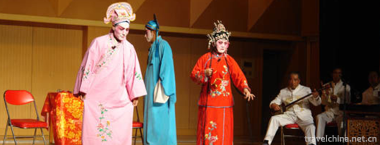
Xilu Bangkok
Xilu Bangzi a Xilu Bangzi is an ancient traditional opera. Now the embryonic form of Hebei Bangzi was formed in Qingdaoguang period. Its predecessor is Shanshan-Shaanxi Bangzi, which was introduced in.
Views: 197 Time 2019-07-01 -
Bing Xin
Bing Xin (October 5, 1900 - February 28, 1999), female, formerly known as Xie Wanying, Changle, Fujian province (now Changle District, Fuzhou), China Association for democracy promotion ( China Associ.
Views: 159 Time 2019-09-06
