Danxia Chishui
Danxia National Geopark in Chishui City, Guizhou Province, is located in the southern edge of Sichuan Basin, close to the northern foot of Daloushan Mountain in northern Guizhou Province and the western Yangtze Platform. It is the representative of Danxia landform in the early youth. Its area is more than 1200 square kilometers. It is the largest and most beautiful Danxia landform in China.
Cashui Danxia includes a national nature reserve, two national forest parks and a national scenic spot, and is located in the core area of the National Nature Reserve for rare and endemic fish in the upper reaches of the Yangtze River. It mainly includes Chishui Danxia Tourist Area (including Chishui Falls, Foguangyan and Yanziyan), Zhuhai National Forest Park, Chinese Jurassic Park Alsophila Scenic Area, Sidonggou Scenic Area and Hongshiyegu Scenic Area . Now, the Danxia tourist area in Cashui is declaring national AAAAA class tourist attractions.
The combination of Caeshui Danxia and six famous Danxia Landform Scenic spots such as Langshan in Hunan, Danxia in Guangdong, Taining in Fujian, Longhu Mountain in Jiangxi and Jianglangshan in Zhejiang has become the "Danxia of China", which was voted on at the 34th World Heritage Conference and has become the 8th World Natural Heritage Project in China.
Formation and Development of Danxia
The formation and development of the Danxia landform in Cashui can be roughly divided into four stages, namely, the ancient lake sedimentary stage, the uplift and denudation stage, the juvenile Danxia stage and the youth Danxia stage.
- Paleolake Sedimentary Period
The Indosinian movement in the middle and late Triassic made the Zhongtai Depression in Sichuan fall and subside to form the Bashu ancient lake. During the late Triassic to Cretaceous, it was in the inland lake basin environment and deposited red beds and coal-bearing assemblages up to 1000 meters thick, which provided a good material basis for the development of the late Caeshui Danxia landform.
Uplift denudation period
The Yanshan movement at the end of Cretaceous caused Zhongtai depression in Sichuan to break away from the Inland Lake Basin environment. The huge red beds deposited in the Bashu ancient lake exposed the surface. During the Tertiary period, along with the Qianbei platform uplift on its southern side, it underwent a long process of intermittent erosion and leveling, forming a multi-level relief and gentle planation surface. Overall, the terrain is high in the southeast and low in the northwest.
Youth Danxia I
After entering the Quaternary, influenced by the neotectonic movement, the uplift of Guizhou plateau was tilted, resulting in the development of the landform of Danxia in Chishui towards spring. Sichuan Basin is strongly compressed, especially in its margin. Because of the strong rigidity, poor fold development and small rise in Sichuan Basin, the dip angle of strata in most areas is relatively gentle, but the X joints of steep hectares are very developed. The Jurassic and Cretaceous red beds in the southern margin of Sichuan Basin where Cashui Danxia is located are significantly increased by the rapid uplift of Guizhou Plateau. The geographic difference between Guizhou Plateau and Sichuan Basin is further widened. Affected by this, Chishui River and its tributaries cut down intensely, resulting in inherited development and shaping deep canyons along large joints. The ancient planation plane formed in Tertiary period began to disintegrate. However, due to the short time of downcutting erosion and the lack of deep valleys, a large area of plateau surface has been retained in many areas. Due to the impact of gravity collapse, some red cliffs have been developed around the platform, but the height is not very high.
Youth Danxia II
With the continuous downcutting of Chishui River and its tributaries, Danxia landform develops to depth. The peak height of the eastern core area is basically the same (1400-1500m), and the ancient planation plane is vaguely visible. The original canyon-type Danxia landscape is very typical. The number of "V" shaped Danxia deep valleys has greatly increased, and the depth is much greater than that of the previous stage. The relative difference between the bottom of the valley and the top of the mountain can generally reach hundreds of meters. Danxia cliff, as the representative landscape of Caesarean Danxia, has a great development both in quantity and height, and can be seen everywhere as high as hundreds of meters. The western region is in the early stage of the youth development of Huichun. The watershed area retains a large area of Plateau surface, but the surrounding areas have begun to suffer relatively strong cutting and tend to be fragmented. However, the depth and spatial distribution density of the canyon are far less than that of the eastern core area. It belongs to the typical plateau Canyon Danxia landform in morphology, and has formed a relatively obvious spatial contrast with the eastern core area.
The Development of Human History
Danxia area in Chishui has a long history of human activities, which spanned the Neolithic, Pottery, Porcelain, Bronze, Iron and other periods to the contemporary era. From the ruins of the Long March of the Red Army in the Neolithic Age, Han, Tang, Northern Song, Yuan, Ming and Qing Dynasties to the 20th century, we can find the process of the expansion of human activity space in Chishui area through valleys, caves, riversides and to the Danxia level.
Before the 1920s, there were few records of visiting Danxia scenery. Since the 1930s, there have been related landscape records. Since the 1980s, systems have been gradually formed, laws and regulations have been formulated, and the boundaries of landscape protection areas within Danxia landform have been delimited. The main features of Danxia landform, waterfalls, bamboo sea, Alsophila and primitive forests have been developed, which include the history and culture of the Long March, cultural relics and historic sites, forming a collection of ecology, popular science, archaeology, sightseeing, culture, leisure and vacation. It has been approved as a national scenic spot, a National Nature Reserve and a national forest park. It has established an effective management system for multi-level management and worked with local residents, communities, enterprises and social organizations to protect Danxia landscape and biodiversity.
Repair history
On December 12, 2006, Chishui began preparations for the application of Danxia Heritage Site.
On July 23, 2008, when UNESCO held a seminar on World Heritage Management and expert exchange in Beijing, Li Guangrong led Fu Yuliang, Secretary of the Chishui Mu Rongkun and other relevant personnel to Beijing to report to Mr. Yayi, President of the Executive Board of UNESCO, on the progress of the binding declaration of the world natural heritage of Caeshui Danxia landform. They expressed their strong support and help to tie up and declare the world natural heritage of the Danxia landform in Cashui.
On October 16, 2008, the Guizhou Provincial People's Government Office set up a leading group to declare China's Danxia Landform World Natural Heritage Site. Xin Weiguang, Vice Governor of Guizhou Province, was the group leader.
On March 2, 2009, the World Heritage Center officially accepted the declaration project of Danxia World Natural Heritage in China, and commissioned the World Union for Conservation of Nature (IUCN) to conduct an investigation and evaluation of six Danxia nominated sites in China.
On January 15, 2010, IUCN experts made supplementary suggestions on the application of Danxia Heritage Project in China.
geographical environment
Location area
The core area of Danxia in Chishui covers 273.64 square kilometers and the buffer area 448.14 square kilometers, with a total area of 721.78 square kilometers. Danxia Landscape is the largest Danxia Landscape in China.
Heritage sites lie between 105 42 30 to 106 10 50 in east longitude and 28 17 51 to 28 31 38 in North latitude. The total area of heritage sites is 721.78 square kilometers, and the core area and buffer area are 273.64 square kilometers and 448.14 square kilo Taking Chishui River as the boundary, the heritage site is divided into two areas: East and west. The area of Danxia in Chishui (west area) is 101.42 square kilometers. The coordinates of center point are 105 47 39 in east longitude and 28 22 in North latitude. The area of Danxia in Cashui (east area) is 172.22 square kilometers. The coordinates of center point are 106 2 33 in east longitude and 28 25 in
topographic features
Cashui Danxia is located in the southern margin of Sichuan Basin, the largest red bed basin in China. It is located in the transition zone between Guizhou Plateau and Sichuan Basin. The development of Danxia landform in Chishui is in the early stage of Huichun youth development. There are many canyons, cliffs, streams and waterfalls in the area. Danxia landform mainly consists of plateau Canyon and mountain canyon. The Canyon is deep, the ground is broken and the terrain is undulating. The highest elevation is about 1730 m, the lowest is 240 m, and the relative elevation difference is nearly 1500 m. There are 1600-1700 m, 1400-1500 m, 1200-1300 m, 900-1000 m and 300-500 m topographic surfaces. The Cretaceous Jiading Group is the core material basis for the development of Danxia landform in Cashui. It is mainly composed of thick red sandstone with siltstone in fluvial and lacustrine facies. Its rocks are hard, anti-erodibility is strong, and its vertical joints are well developed. It mostly develops tall and magnificent Danxia landform such as canyon cliff wall. The Jurassic strata are mainly purple-red, purple-grey sandstone, mudstone and shale, with soft lithology and weak erosion resistance. The main geomorphological forms of the Jurassic strata are denudation-erosion red rock low mountains and hills, with gentle slopes.
Main attractions
Four ditch
Four caves, roughly equal distances in the scenic area, are lined up with waterfalls with different postures. These waterfalls are located in a section of the scenic area about 4 kilometers of the river. The four falls in the scenic area are wonderful. It is divided into water curtain cave waterfall with pearl curtain suspension, thunderous voice and strong momentum; moon pool waterfall with beautiful curved silver comb; flying frog cliff waterfall with surging lake green among boulders; and Bailongtan waterfall with huge momentum of rain and fog 60 meters down.
In the scenic area, there are beautiful peaks, beautiful mountains, lush bamboos at the bottom of valleys, lush trees in the mountains, and the roads paved with Dannepheline. Alsophila spinulosa, Xiaojinhuacha and other rare plants protected at the national level can be seen everywhere. And the magical Danxia spectacles such as Shixiangshan and Duxianqiao.
Danxia Tourist Area in Chishui, Foguangyan
Foguangyan is 44 kilometers away from Chishui City. It is a famous landscape in the core area of Danxia World Natural Heritage, with the Baiyan of "Danxia Cliff, World Wonder" and the Wuzhu Peak of "Created by Heaven, Made by Heaven and Made by God and Craftsmanship" as its main landscapes. Foguangyan is located in the rapid subsidence area of Guizhou plateau to Sichuan basin, with steep valleys and steep slopes, longitudinal and transverse streams, cutting depth between 500 meters and 1300 meters, peaks more than 1200 meters, fault rocks and valleys, and great difference in height. The outcropped strata are all Jurassic and Cretaceous fluvial-lacustrine red sedimentary rocks.
Natural landscape
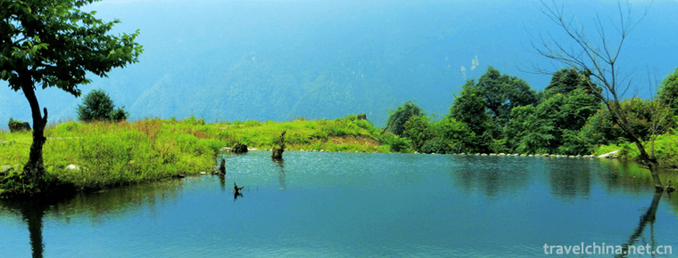
Danxia in Caeshui is a subtropical wet area Danxia and plateau Canyon type Danxia. It develops typical Danxia individual morphology such as cliff, Fangshan, stone pillar, valley, groove and hole-piercing. Due to the superior natural conditions and less human activities, Caeshui Danxia has developed and preserved complete ecosystems such as Alsophila spinulosa National Nature Reserve, Zhuhai National Forest Park, Yanziyan National Forest Park, subtropical evergreen broad-leaved forest nature reserve, with high forest coverage and rich species. The landscape of Danxia in Chishui is characterized by high terrain, deep and narrow valleys, cliffs and waterfalls.
Visiting reference
Ticket information
Danxia Landform in Chishui can be divided into several scenic spots or sections, which can be visited by tickets or different sets of tickets.
Tickets for Danxia Tourist Area in Chishui are 180 yuan, including 90 yuan for Danxia Tourist Area in Chishui Foguangyan Tourist Area 90 yuan for Great Falls Tourist Area in Chishui 60 yuan for Yanziyan Tourist Area in Danxia Tourist Area in Chishui 85 yuan for Sidonggou Tourist Area as well as joint tickets and set tickets, and specific consultation and understanding of the scenic area.
Traffic information
Self-driving and taxis
From Chishui bus station to Foguangyan 44 km, 45 minutes by car; to Chishui Falls 34 km, 40 minutes by car; to Yanziyan 26 km, 30 minutes by car, to Chishui Falls via Yanziyan.
Chishui City 2.5 kilometers departure base price during the day (06:00-24:00) 4 yuan per train, at night (00:00-6:00) 5 yuan per train. Freight is 0.6 yuan/0.5 km in daytime and 0.8 yuan/0.5 km in night. The starting price for taxis in urban areas is usually enough.
Chartered car
Chartered or self-driving tour. The car costs about 300 yuan per day, 4-5 people per day, and 350 yuan per day for 6-7 cars. The fuel and parking fees are included. Drivers will wait at the entrance of each scenic spot for the end of the tour and then travel to the next destination.
Best travel time
All seasons are suitable for tourism of Caesarean Danxia. Summer is the peak season for tourism.
Spring (March - May) is a good time to watch Baoyuan terraces. After irrigation, there are pieces of water mirrors and layers of glittering. Spring bamboo shoots burst out of the earth, and wild flowers blossomed in the mountains.
Summer (June-August) Sigou Cave, Chishui Falls and other waterfalls are in full swing. The green shadows in the bamboo forests of Zhuhai Park are the most beautiful season in Chishui. In addition, the temperature in the tourist area is 3 to 5 degrees lower than that in Chishui City, which is a good time to avoid summer. It is very pleasant to walk between the green mountains and the clear waters.
Autumn (September-November) is full of red mountains. Unlike autumn in other places, the maple leaves in Chishui are more and more beautiful and moving against the background of Danxia landform.
In winter (December-February), there are more red water and rainwater, and the lowest temperature is around 4 degrees, which is suitable for winter travel.


-
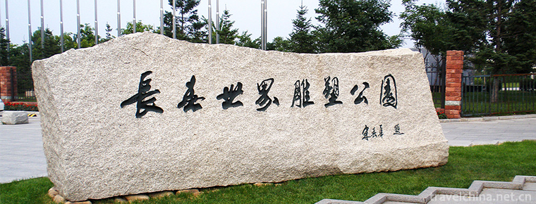
Changchun World Sculpture Park
Changchun World Sculpture Park is located in the south of Renmin Street in Changchun City. It covers 92 hectares, including 11.8 hectares of water. .
Views: 201 Time 2018-12-05 -
The ancient city of Qingzhou
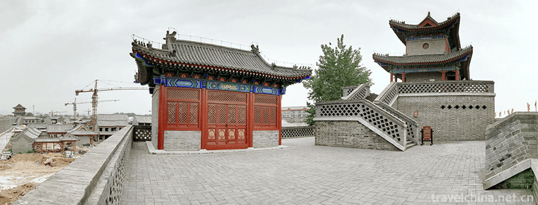
Qingzhou ancient city is one of the ancient nine states. It has a history of more than 7,000 years, a history of civilization of more than 5,000 years.
Views: 193 Time 2018-12-08 -
Luofu Mountain Scenic Area
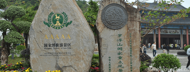
Luofu Mountain Scenic Area is a national AAAAA level scenic area. It is located on the Dongjiang River of Guangdong Province, 35 kilometers away from Boluo County, Huizhou City.
Views: 307 Time 2018-12-12 -
Xingwen sea
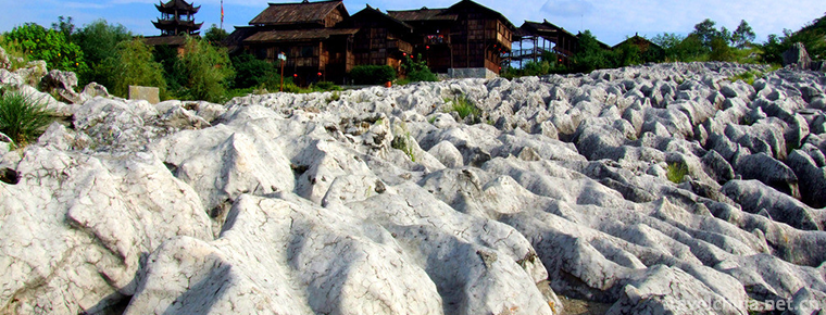
Xingwenshihai is located in Xingwen County, Yibin City, Sichuan Province. It is located in the transition zone between Sichuan Basin and Yunnan-Guizhou Plateau. Its total area is about 156 square kilo.
Views: 235 Time 2018-12-24 -
Heizhugou Scenic Area
Heizhugou National Forest Park, located in Heizhugou Town, Ebian Yi Autonomous County, Leshan City, Sichuan Province, spans Haqu Township, Lewu Township and Jinyan Township..
Views: 220 Time 2019-01-13 -
Restoration Techniques of Ancient Architecture
Ancient buildings are an important part of historical relics in China. Protecting, restoring and renovating ancient buildings is one of the important tasks in the protection of cultural relics..
Views: 109 Time 2019-05-01 -
The Mausoleum of the Yellow Emperor
The Mausoleum of the Yellow Emperor is one of the national intangible cultural heritages, which has formed a certain scale format and sacrificial ceremonies in the long-term practice..
Views: 150 Time 2019-05-04 -
Huizhou three carving
The three carvings in Huizhou are a kind of local traditional carving art. They refer to three kinds of local traditional carving crafts, i.e. wood carving, stone carving and brick carving, .
Views: 144 Time 2019-05-04 -
southern accent
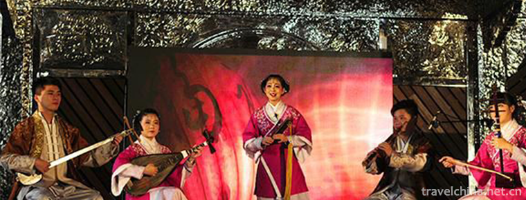
Nanyin, also known as "string" and "Quanzhou Nanyin", is the oldest ancient music in China. During the Han, Jin, Tang and Song dynasties, the immigrants from the Central Plains bro.
Views: 194 Time 2019-06-07 -
Uygur Dastan
Uygur Dastan is a kind of Uygur singing and playing music. It is a kind of long narrative poem with rap and singing. It is a long poem with complete stories and characters. It is a folk art form with .
Views: 137 Time 2019-06-26 -
Borneol Bridge
Luxian county is the "hometown of dragon culture" and "the hometown of Longqiao" in China. There are hundreds of ancient Longqiao bridges in the Ming and Qing Dynasties in Luxian County, which is the largest group of Longqiao in China and even in the world..
Views: 143 Time 2020-10-16 -
International cooperation of Chengdu Giant Panda Base
According to the major political and diplomatic needs of the country, under the leadership of the state, provinces and cities, the panda base has successively established a "long-term international cooperative breeding program for giant pandas" with Japan, the United States.
Views: 113 Time 2020-12-13
