Wucai Beach
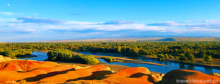
The Wucai Beach is located in Buerjin County, Altay area, north end of Xinjiang. It is located on the first and second terraces on the North Bank of Ertiz River, the only one injected into the Arctic Ocean in China. It is 480 meters above sea level and 24 kilometers away from Buerjin County Town. It is also the only way to Kanas Lake Scenic Area. April 13, 2018, was included in "Magic Northwest 100 Scenes".
brief introduction
The two sides of the Five-color Beach and the river are different from north to south. It is a national 4A-level scenic spot. The Wucai Beach, located in Yegezitobe Township, about 24 kilometers northwest of Buljin County, Xinjiang Uygur Autonomous Region, crosses the Ertiz River into the Arctic Ocean. Five-color beach landform is special, long-term dry zone, which belongs to the typical color hills (or hills).
April 13, 2018, was included in "Magic Northwest 100 Scenes".
Geographical profile
The Wucai Beach is located about 24 kilometers north of Buljin County Town. It is the only way to Habahe County and Kanas. It is adjacent to the Ertiz River, which ripples in the blue waves. It reflects the lush and verdant River Valley scenery on the opposite bank. It can be said that "one river separates two banks, since it has two days". The weathering resistance of riverbank strata varies, and the outline varies. The different minerals in the rocks give rise to various splendors, so they are named "Five-color Beach".
There are large-scale wind power generation websites in front of the Wucaitan scenic spot. Mountains on the north bank are undulating and changeable in color. They are formed by violent River erosion, cutting and gale erosion. Because the weathering resistance of riverbank rock layers varies in strength and form uneven outlines, the rock color here is changeable, and under sunset, the rock color is mainly red, green, purple, yellow, white, black and transitional colors, colorful. Whenever the wind blows, there will be strange cries of different lengths and heights in the ditches and under the rocks.
Geological origin
The multi-color riverbank is formed by flow erosion cutting and wind erosion. On terrace slopes, gullies grow vertically and horizontally, valleys and small soil beams are developed, the width is 5-10 meters, the height of soil beams is generally 5-15 meters, the maximum height is about 25 meters, the height is scattered, and the distribution area is about 3 square kilometers. Located in the arid and windy zone, the weathering resistance of riverbank rocks varies from layer to layer, resulting in uneven outlines. The rocks are composed of red, earth red, light yellow and light green sandstone, mudstone and sandy conglomerate. The rocks are of different colours and colorful shapes, such as coloured castles, monsters and peak clusters. They are typical coloured hills. When the wind blows, it makes strange sounds, which adds mysterious color. Its development and construction undoubtedly add to the scenery of Kanas scenic spot, with considerable passenger flow and economic benefits. The colorful riverbanks will attract tourists both at home and abroad to come here for sightseeing with their typical and unique landforms.
There are large and small stone peaks, stone walls and stone pillars in the scenic area of Wucaitan Beach. The peaks are like forests, dense and intertwined, and their shapes are gorgeous.
Ticket information
In 2008, the ticket price of Wucaitan scenic spot is 50 yuan per person, and will be adjusted according to the specific conditions of scenic spot construction, management, service quality and environmental improvement. For minors (children under 1.3 meters in height), elderly people over 65 years old and disabled people, tickets are exempted; for tourism teams, preferential fares are implemented. At the same time, the Wucaitan Scenic Spot and Tourism Administration emphasized that the clear-code price will be strictly enforced in the scenic spot to further improve the environmental conditions and improve the service level and quality.
In addition, considering the closed management of Wucaitan scenic spot, the implementation of one-time ticket purchase is effective within the same day. The above standards have been in effect since April 1, 2006.
Every year, from October 15 to April 15, the scenic area is closed due to weather changes, but there are duty personnel on the west side of the gate. During this period, you can go to the west side of the gate for sightseeing. There are monitoring facilities in the scenic area. Violators should pay 200-500 yuan compensation or hand over to the public security organs for treatment.
Traffic information
They can carpool to and from Burqin County accommodation and other places, with about 20-30 yuan per person. Drivers can wait outside the scenic area until sunset to take tourists back.


-
Bian Que Temple Tourist Area
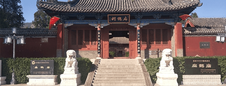
Bian Que Temple, also known as Bian Que Temple, is situated at the foot of Que Mountain, 26 kilometers west of Neiqiu County Town. It is an ancient building group to worship and worship the Chinese me.
Views: 100 Time 2019-01-03 -
Gourd sculpture
There are two techniques for carving gourds. One is to use three kinds of special steel needles, large, medium and small, to carve the landscape, flowers and characters in the gourd.
Views: 386 Time 2019-05-03 -
Lanzhou drum
Lanzhou Drum, also known as Lanzhou Drum Ci and Lanzhou Quzi, is a popular folk form in Lanzhou area and one of the ancient Chinese Quyi. Lanzhou drum is a form of music art mainly composed of sitting.
Views: 185 Time 2019-05-10 -
Old soup essence formula
The formulation of Royal Food Old Tangjing includes the formulation and production technology of Old Tangjing, which is a valuable cultural treasure in the history of condiment development in China. T.
Views: 126 Time 2019-05-11 -
Qinghai Lake offering sacrifices to the sea
Qinghai Lake is a pearl on the plateau of the mangyang snow area, which has been admired by people for thousands of years. This paper systematically expounds the origin, course.
Views: 194 Time 2019-06-10 -
Sheng Guanyue
The term "Sheng wind music" is not only a popular name in Chinese folk, but also a scientific name in the current academic circles. It refers to the orchestral performance form consisting of.
Views: 146 Time 2019-06-14 -
Mosaic inlaid porcelain
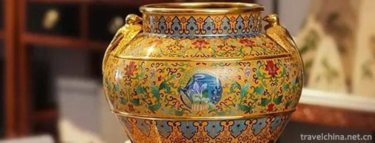
Chinese mosaic art has a long history and unique style. In the Yin and Shang Dynasties, the decorative patterns of gold inlaid with jade appeared in bronze casting. With the continuous improvement of .
Views: 151 Time 2019-07-06 -
Yigou gou
"Yigou" is a traditional drama in Gaotang area of Shandong Province and one of the national intangible cultural heritages..
Views: 127 Time 2019-07-12 -
Chen Sheng
Chen Sheng? In the first 208 years), Yangcheng (now Southeast of Dengfeng, Henan) To talk about southwest of Shangshui County in Henan today People. One of the leaders of the peasant uprising in the l.
Views: 209 Time 2019-09-07 -
Cultural corridor of Confucianism Buddhism and Taoism
Emei Mountain Confucian, Buddhist and Taoist cultural corridor inherits and develops Chinese traditional culture through different aspects, and excavates its own value and charm from Emei Mountain's historical culture, and highlights its connotation of "China's first mountain"..
Views: 146 Time 2020-10-15 -
Leshan climate
Leshan has formed a variety of climate types under specific geographical conditions. Because the region is located near 29 ° n, the city belongs to the middle subtropical climate zone, with the characteristics of four distinct seasons, abundant rainfall, water.
Views: 377 Time 2020-12-17 -
Guangan highway
Guang'an is the transportation hub of Northeast Sichuan Province. The national highway 210, 212, 305 and 318, provincial roads 203, 304 and 18, and county, township and village roads crisscross each other, and the highway network exte.
Views: 144 Time 2020-12-19
