Conch Valley Scenic Area
Hailuogou is located in Moxi Town, Luding County, Sichuan Province, on the eastern slope of Gongga Mountain. It is a very high mountain area on the eastern edge of the Qinghai-Tibet Plateau. Located at the foot of Gongga Snow Peak, Hailuogou is famous for its low-altitude modern glaciers. Shining modern glaciers pour down from high valleys; huge ice caves and steep ice bridges make people like crystal palaces in mythology.
Especially the unparalleled Big Ice Falls, as high as 1000 meters, about 1100 meters wide, more than ten times larger than the famous Huangguoshu Falls, magnificent. Conch Trench is the lowest modern glacier discovery area in Asia, with an elevation of 2850 meters. Its ice waterfall is 1080 meters high and 0.5 meters wide to 1100 meters wide. It is the highest ice waterfall ever found in China. The trench contains large flow boiling hot and cold mineral springs, large area of virgin forest and high glacial erosion peaks, a large number of rare animal and plant resources, and the golden and silver mountains are magnificent. On October 9, 2016, the National Tourism Administration issued the "Red and Black List" for 11 holidays, and the Hailuogou scenic spot was listed as the best tourist service scenic spot. On February 25, 2017, it was newly promoted as a national 5A tourist attraction.
Historical evolution
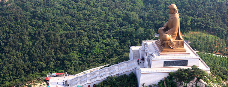
Tang Dongjiebufa, a great achievement of the post-Tibetan Shangba Garga School in history, traveled to India, Han Dynasty and other places of Kangzang. Knowledgeable, wise and skillful, he built 128 Buddhist pagodas and 128 bridges in Tibet, Ganzi and Qinghai Tibetan areas. Tang Dongjiebufa, the founder of Tibetan opera, founded the Yao Wang Temple in Tibet and wrote many historical stories of opera singing. He has profound knowledge in medicine and invented Baiwan, a Tibetan medicine which can cure all kinds of diseases in internal medicine, and Hongwan, a Tibetan medicine which can cure epidemic plague. He died in KangDistrict at the age of 125 and was one of the longest-lived Tibetans. He is an outstanding and influential architect, Buddhist, dramatist, historian of Tibetan medicine and master of bridge. All his life, he has made great achievements and made great contributions to the future generations of the sacred Buddhist figures. King Jebfa of the Tang Dynasty left his footprints in Hailuogou, Yanzigou and Dadu valleys and built the old sites of temples, Manidou and Buddhist pagodas.
One day in the mid-summer of 1705, King Jebfa of Tang Dong came to the Luding Bridge Bridge construction site and saw that craftsmen were at a loss to cross the river with iron ropes. He instructed craftsmen to use bamboo ropes to pierce short bamboo barrels and tie them up with bamboo ropes to slip through the barrels. The craftsmen hang the rope, which is more than 40 feet long and weighs more than 2,000 kilograms. When King Jebfa saw that the craftsmen could not pull the rope keys, he took out his treasure conch and blew three times. The magical conch voice ghost made the magic conch slip away and safely crossed 13 rope keys.
After the completion of Luding Bridge, King Jebfa of East Tang took the road to build a pagoda on the west slope of Fanxueshan Branch of Hailuogou. Living in a glacial megalithic rock cave in a dense forest at night in Hailuogou, I chanted Buddhist Sutras in front of the cave in the morning and evening, kneeling in front of Gongga Shenshan. When I blew conch, birds and animals in the forest surrounded the cave to listen to his chanting. After King Djiboufa left, birds and animals still gathered around the rock cave according to the time when King Djiboufa blew conch. At the top of the cave, trees grew out, flowers and plants gathered among all living beings. One day King Tang Dongjiebufa gave his disciple Tuo Meng, saying that he had lived in the cave boulder in Hailuogou, and had been named "Conch Lingshi" by Gongga Mountain magic. The deep valley he had traveled through was sealed with conch, his treasure. The names of Conch Trench and Conch Lingshi are thus named.
geographical environment
position
Hailuogou is located in the southeast of Ganzi Tibetan Autonomous Prefecture, Sichuan Province, and on the eastern slope of Gongga Mountain. It is a very high mountain area on the eastern edge of the Qinghai-Tibet Plateau. It is 296 kilometers away from Chengdu.
Located at the foot of Gongga Snow Peak, Hailuogou is famous for its low-altitude modern glaciers.
Geology and geomorphology
To the east of the main peak ridge line of Gongga Mountain in Hailuogou is a steep high-mountain canyon with obvious relief. The Dadu River roars and rushes with narrow water depth and steep cliffs. In the horizontal distance less than 30 kilometers up to more than 6500 meters, the formation of the world's rare Grand Canyon.
Causes of formation
The formation of Gongga Mountains has undergone the geomorphic processes of Pliocene leveling period, early Pleistocene mountain lake basin period and deep valley period since the Middle Pleistocene.
The ancient leveling period (3.4 million years ago) was the formation period of the planation surface in China, and Gongga Mountain was only the Eryu Mountain which was more than 1000 meters high.
The transverse movement of the mountain lake basin during its development period (3.4 million to 1.3 million years ago) led to the disintegration of the planation surface in China. A series of fault-depressing Lake basins, Xigeda Lake, were formed at the eastern foot of Gongga Mountains and south of Gongga Mountains. With the uplift of mountains, the lake basin continued to subside and accumulated strata hundreds of meters thick.
The Yuanmou movement ended the period of regional Xigeda Lake deposition and turned into river action, forming deep valleys such as Dadu River, and developing glaciers for many periods in the alpine region.
In the process of Gongga Mountain evolving from Eroded Yushan on the ancient planation plane to extremely high mountain, neotectonic movement is the controlling factor, while Quaternary glacier plays the role of landscape intensification.
Glaciation
Hailuogou Glacier, also known as No. 1 Glacier, is the longest of 71 glaciers in Gongga Mountain. It covers an area of 16 square kilometers, with a maximum altitude of 6750 meters and a minimum altitude of 2850 meters. It has three steps along the longitudinal direction: grain snow basin, the breeding ground of glaciers; large ice waterfall, 500-1100 meters wide and 1080 meters high, which is the largest and most spectacular glacier waterfall found in China so far. It reaches 6 kilometers into the primeval forest and forms a unique landscape where glaciers and forests coexist. Hailuogou has the strongest glacier activity. In the movement of glaciers, the glacier arc arches, ice caves, ice ladders, ice gates, ice lakes and ice peaks are formed.
Glacier ablation
Hailuogou glacier is in a period of intense melting, the main melting period is from March to November and from May to October every year. The melting intensity of glaciers is 8 centimeters per day, and 9.3 millimeters per day, calculated from the correlation between melting and temperature, according to the observation of ice surface at an altitude of 3600 meters (21 June-1 July 1981). The annual average ablation depth (absolute ablation) of ice tongue area is estimated to be 10-15 meters.
Glacier No. 1 moves faster, so its supply is more adequate. According to the observation of ice surface topography in two cross sections across glaciers (October 1988-May 1989), the ice surface height in the middle part of the tongue decreases by an average of 1.5 meters annually, that is, 85% of the melted ice has been recharged by new ice. On the whole, however, the amount of glacier melting in Conch Trench is larger than the amount of recharge, resulting in the following results:
The tip of glacier tongue retreated significantly from the plane position of glacier tongue of Glacier No. 1, and retreated more than 3 kilometers compared with the ice advance before 1580. Since the early 1930s, it has retreated about 500 meters. From 1966 to 1982, the average annual retreat was 25 metres, from 1983 to 1985, 15 metres, from 1985 to 1990, 16 metres and from May 1990 to June 1991, 14 metres. The elevation of the tip of the ice tongue also moved up from 2850 metres in 1966 to 2940 metres in 1991.
Group glacier melting is one of the important conditions for glacier landscaping. With the intense melting of glaciers, different shapes appear. The peculiar glacier landscape has high ornamental value.
climate
The coldest temperature in Hailuogou is January, the lowest temperature can reach - 12 degrees, the daily average temperature is 3.9 degrees; the highest temperature is August, the daily average temperature is about 13 degrees, the highest temperature is 22 degrees, the annual average temperature is 5 degrees, the snow thickness is 35 centimeters.
Characteristics of scenic spots
Five Characteristics of Conch Valley
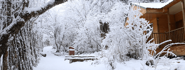
First, Rizhao Jinshan. Located at the foot of the mountain, Hailuogou is surrounded by 45 guard peaks over 6000 meters above sea level, which are covered with snow for thousands of years and glittering with silver. Every day when the weather is clear and the East is white, the brilliant sunshine rises, and the golden light shines from the long sky directly at the guardian peak. In an instant, dozens of snow peaks are covered with a golden dazzling light, which is magnificent and magnificent. This is the famous "Sunshine Golden Mountain".
Second, glaciers pour. Most glaciers in the world are located at higher altitudes, but at lower altitudes in Conch Trench, glaciers can be seen pouring down from high canyons. Especially the unparalleled ice waterfall, which is more than 1000 meters high and about 1100 meters wide, is more than 10 times larger than the famous Huangguoshu waterfall. It is magnificent and has thousands of scenes.
Thirdly, Snow Valley Hot Spring. A snow-capped area nearby, open-air hot spring pool steam rolling empty, so that the original forest of green trees and strange flowers and grass hazy, shadowy. How romantic it is to enjoy snowflakes dancing in hot natural hot springs. The highest water temperature of Hailuogou hot spring is more than 90 degrees, and then the pools drop down one by one. The most suitable pool water for human immersion varies from 45 degrees to 35 degrees.
Fourth, virgin forest. The forest area of Hailuogou is 70 square kilometers. Walking slowly along the mountain road around Hailuogou, visitors will be attracted by the changeable plant landscape beside them. In the jungle, lovely animals such as macaques, pandas, antelopes and red-bellied pheasants are often dimly visible.
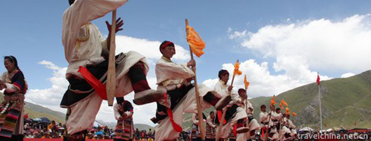
Fifth, the Tibetan customs of Kangba. Hailuogou is located in Ganzi Tibetan Autonomous Prefecture of Sichuan Province. It has vast plateau land and raises Tibetan children in 18 counties of Ganzi. Colorful costumes, different Tibetan villages, moving songs and dances, strong Kangba Tibetan customs and the mountains and waters here are integrated.
Main landscape
Glacier landscape
1. Glacier Landscape
Glacier landscape such as glacial foliation, glacial cracks, glacial faults and folds, glacial streaks, ice avalanches, etc.
Glacier No. 1 overflows from a grainy snow basin and forms a large ice waterfall along the steep slope of the ice bed along the front of the basin. Glaciers on ice waterfalls are super-stretching currents that are in a state of collapse and frequently occur ice avalanches and avalanches. With the continuous movement of glaciers, ice avalanches on ice waterfalls continue throughout the year. If the granular snow basin is a reservoir of ice formation and tunneling, the great ice waterfall is like a crusher of glacial ice, and the foot of the glacial waterfall is a new foundry of glacial structure.
2. Melting Landscape
Melting landscapes such as glacier cups, ice wells, glacier shafts (connected with subglacial rivers), ice columns, ice caves, ice bridges, lakes, glacial rivers, subglacial rivers (glacial gate holes), ice gushing springs, glacial milk, etc. At the end of the glacier tongue, the surface outlet of the subglacial river is the glacier city gate tunnel (the tunnel under the ice cliff, like the city gate), and the underground outlet is the ice fountain with a flow of 10 cubic meters per second (October), which is the mainstream water source of the conch ditch. The location of the glacier gate hole and the ice spring moves upstream continuously with the retreat of the tip of the ice tongue, which is one of the scenic spots of Conch Trench.
3. Compound Landscape
Composite landscape is formed by the superposition of two or more kinds of functions, such as glacial arc arch, glacial fold, ice mushroom, subglacial tunnel, etc. Hailuogou glacial arc arch belongs to the type of arc arch indicating the age. In the process of ice and snow re-deposition at the foot of the Great Ice Falls, the summer deposits are black due to melting and polluting, and the winter deposits form a black-and-white glacial zone (layer). With the movement of the glaciers, it is formed by a downstream arc bending. The calculated 140 m/year glacier velocity of 14 pairs of arc arches in the range of 2 km basically coincides with the observed velocity (180-90 m/year).
Landform landscape
1. Glacier eroded landforms
Conch Valley develops a set of typical and spectacular ice erosion landforms, such as ice erosion valleys, suspended valleys, valleys, corner peaks, edge ridges, ice ridges, ice buckets, grain snow basins (ice cellars), polished surfaces, notches, grooves and so on, especially in the valley, pyramid corner peaks, polished surfaces on a large scale.
- Valley in Valley
New glaciers developed in glacial erosion valleys of late Gongga period, and glaciers of late Gongga period developed in glacial erosion valleys of early Gongga period, while modern glaciers still lie on the bottom of glacial erosion valleys of new glacial period, cutting down successively from old to new, forming the landform of Taogu. The pyramid-shaped angle peaks in Gongga Mountain area are characterized by pyramid-shaped ice erosion peaks. The ratio of tower height to tower base is 1:2. There are more than 20 ice erosion pyramids with high dry height standing in the Hailuogou watershed alone, and there is much snow. Under the blue sky and dark green forest belt, it is a scenic spot of high mountains.
- Valley wall polishing, notching, grooving
The glacier polished surface on the wall of quartz schist Valley on both sides of the middle section of glacial tongue of Glacier No. 1 is 20 meters (south bank) and 50 meters (north bank). It is covered with different inclination combination marks, brackets and grooves, even reverse (upstream) marks and grooves. The largest groove is 1.8 meters deep and 3.8 meters high.
2. Geomorphology of Glacier Accumulation
The glacial depositional landforms in Hailuogou and Guri areas are well preserved by the moraine dikes of the late Gongga glacial period and the Holocene glacial water depositional landforms.
Late Gongga glacial side moraine dike occupies both sides of the upper and middle reaches of Hailuogou valley. The length of the dike is 10 km (left bank) and 5 km (right bank), and the height of the dike is 50-150 meters. There are Moraine Lake (Shuihaizi) and a large number of boulders (such as large rock nests, large rock baskets, rock baskets, etc.). The levee is covered by primitive forest and is a forest resort of Conch Valley.
Holocene Icewater Platform
The Moxi Platform at the mouth of Conch Trench is composed of 120 meters thick glacial water, glacial flood and gravel deposited by glacial debris flow. The platform was originally a valley ice level plain (accumulated in the early Holocene), which was formed by the Moxi River and its tributary Yanzigou from both sides with a length of 10 km and a width of 0.2-1.2 km following the rapid rise of Gongga Mountain (middle Holocene).
- Periglacial geomorphology
There are permafrost in the ditch (the lower limit is about 4900 meters above sea level), seasonal permafrost, thawed debris slope, thawed debris flow, snow-eroded ancient ice bucket, snow-eroded depression and ice mound stone rings on the tongue, etc.
Forest landscape
The forest area of Hailuogou is 70 square kilometers, most of which are primitive forests. It is characterized by strong biodiversity and abundant ornamental plants. Thirty-eight species of rare plants have been identified in the ditch, including one national first-class protected plant, seven secondary protected plants and 13 tertiary protected plants; 150 species of wild vertebrates, including six national first-class protected animals and 22 second-class protected animals (Liu Zhaoguang et al., 1985; Yu Zhixiang et al., 1988). The vast majority of these rare animals and plants are monotypic genera, subspecies and endemic species. The Gongga Mountain area, including Hailuogou, is one of the most preserved areas of ancient and primitive biological species in China. It is called the "refuge" of animals and plants in the Quaternary Glacier Period by botanists and zoologists, and hundreds of ornamental plants in the gully, including Magnolia, Rhododendron, Orchid, Primula and Gentian.
There are more than 100 kinds of flowers such as flowers, lilies, snow lotus, wild osmanthus, dozens of epiphytic plants such as rhododendron, epiphytic trees, more than 100 kinds of super-large plants, tree groups on drifting gravel, and dozens of community types such as vegetation zoning, evergreen and seasonal plant communities.
Natural Band Spectrum Landscape
The complete vertical natural band spectrum based on subtropical zone is one of the landscape characteristics of Conch Trench. Among the geographical elements such as climate, soil, vegetation and landform, the vertical differentiation between climate and vegetation is the most obvious and intuitive.
Honor
In November 2017, he won the honor of "Boao International Tourism Communication Forum 2017 Tourist Destination".
Tourist guide
traffic
From Chengdu through Yakang (Shuangliu, Xinjin, Qionglai, Mingshan, Ya'an, Luding) Expressway, from Ludingxia Expressway to Hailuogou Scenic Spot along Sichuan Provincial Highway 211. The total length is 296 kilometers, and the journey to Hailuogou Scenic Area is about 3 hours. Along the way, you can enjoy the beautiful scenery of Yakang Expressway (preferred).
From Chengdu to Hailuogou Scenic Spot along the 211 Line of Sichuan Provincial Highway after the Yaxi (Shuangliu, Xinjin, Qionglai, Mingshan, Ya'an, asbestos) Highway. It's 341 kilometers long. The journey to Hailuogou Scenic Spot is about 4 hours. Along the way, you can enjoy the beautiful scenery of Yaxi Expressway.
Starting from Chengdu, there is a long-distance bus going straight to Hailuogou every day at Xinnanmen Station. It arrives in about 4 hours and costs about 110 yuan per person. Starting around 9:30, there are many trips. Or choose the train to Kangding to buy Luding, starting at around 8:00, and the ticket to Luding is usually about 120 yuan per person. The fork to Hailuogou is in Ganlusi Village, Lengqi Town. The local people call it "the bottom of the dry valley". Then they can hitchhike or rent a car for about 15 yuan to Moxi Town. However, it is usually suggested to go to Luding County Town. Apart from the convenience of finding cars in Luding County Town, you can also see the famous Luding Bridge.
Starting from Luding, there are daily buses to Moxi Town, Hailuogou. There are also many local minibuses running this line, about 25 yuan per person, 50 kilometers and 1.5 hours. After 9:00, there will be a train to Moxi Town from Camp No. 3. It will get on with the tickets purchased before. There are many bakeries running between Moxi Town and Luding County Town. It is convenient to go from Luding to Kangding or return to Chengdu.
From Chengdu to Dujiangyan, Wolong Nature Reserve of Aba Tibetan and Qiang Autonomous Prefecture, Xiaojin County, Danba County of Ganzi Tibetan Prefecture and Luding, 750 kilometers are traveled, and the Hailuogou Scenic Spot can be reached within two days. You can visit Siniangshan first, then turn to Xiaojin County, down the Xiaojin River to Danba County. Not only is the scenery beautiful, but the road condition in Danba County is quite good (the whole asphalt road/cement road). There are many great scenic spots in Danba County. They are most famous for their towers, Tibetan stockades and Shenshan Mountain in Melbourne, as well as the beauty of Danba. After that, we went to Kangding by bus through Bamei, Tagong and Xindu Bridge (with beautiful scenery along the way) and then to Conch Trench. Apart from Kangding-Luding section, the other sections of the road have very good road surface and very good driving. If 4-5 friends rent an off-road car or a van, they can enjoy the beautiful scenery of Siniangshan, Hailuogou, Danba and Kangding.
Tips
1. Conch Valley is a high altitude area. It is not suitable to exercise vigorously, drink alcohol and eat more vegetables and fruits in order to prevent mountain reaction. Common medicines should be prepared, preferably with small oxygen cylinders.
2. Driving in winter, please pay attention to the ice in the mountains, preferably with anti-skid chains.
3. Fireworks are strictly prohibited in scenic spots.
4. The scenic spot has strong sunshine, strong ultraviolet rays and strong sunlight reflection. For long outdoor activities, please wear sunglasses. Apply anti-frost to protect skin.
5. The temperature difference between day and night in the scenic area is large, and the glacier climate is changeable. Please bring enough warm and cold-proof clothing and prepare commonly used medicines.
Natural disaster
Avalanches - perennial avalanches mainly occur at the basin margins of the grain basins of Glacier No. 1 and Glacier No. 2, especially at Glacier No. 1 Great Ice Falls. In July 1988, an avalanche originating from the eastern slope of the main peak and skiing over the Great Ice Falls, amounting to 500,000 cubic meters, caused one person to suffer. Seasonal avalanches originate from the winter snow cover of the ancient ice buckets and depressions near the watershed at an altitude of more than 4000 metres. Generally, they are small in scale. They mainly occur in the area of yellow avalanches in Lion Rock-Ma Rigang and Qingshi-Ban, with the lowest descent reaching the front of steep slopes at an altitude of 3000-3200 metres.
Glacier landslide - occurs on both sides of the tip of the glacier tongue. The sliding body is the glacial-alkali layer of the late Gongga Period. The glacier melting reduces the height of the glacier surface, which leads to the instability of the foot of the slope and causes the slow sliding of the slope.
Glacier Flood - On July 26, 1989, a flood broke out in Glacier No. 1, with a flow rate of 10 Hunan seconds and a flow rate of 1,156 square meters, which destroyed the River Valley Tourist routes.
The mixed debris flow of ice, snow, melting water and rainwater - the branch ditch of Hailuogou, Changcaoba ditch and Huangcao gully. The hot water ditch and the Yanzigou ditch outside the ditch day have occurred many times of mixed debris flows of ice, snow, melting water and rainwater, which are the main types of disasters.
Ice debris flow, which occurs in the left gully of glacial tongue of Glacier No. 1, is a special type of ice-snow rain debris flow.
Admission ticket
The ticket price of Hailuogou is: 90 yuan (RMB)/person.
The price of Hailuogou sightseeing car is 70 yuan (RMB)/person (round trip)
The price of conch ditch ropeway is: 150 yuan (RMB)/person student card, senile card and other preferential treatment is 140 yuan (RMB)/person (round trip).
Hailuogou hot spring is divided into:
1) The price of Hailuogou Glacier Hot Spring Resort ranges from 80 to 120 yuan (depending on whether tourists need swimsuits or not).
2) The price of Gonggashen soup in Hailuogou is 188 yuan per person.
Yanzigou ticket price: 119 yuan (RMB)/person
Yanzigou sightseeing car price: 80 yuan (RMB)/person (round trip)
1. The following tourists can enjoy free tickets
1. Children under 1.4 meters in height (accompanied by guardians).
2. Voluntary servicemen holding the Soldier's Certificate of the People's Republic of China.
3. Chinese tourists with valid ID cards and over 70 years of age.
4. Non-active disabled servicemen shall hold the Disabled Soldier's Card of the People's Republic of China issued by the Ministry of Civil Affairs, and active disabled servicemen shall present their active service certificates at the same time.
5. The ticket-free tourists within the scope of Article 2, 3 and 4 above must provide copies of their certificates and pay the cost of admission tickets and the premium of 5 yuan per person.
2. The following tourists enjoy preferential tickets
1. Children over 1.2 meters in height (accompanied by guardians).
2. Chinese tourists aged 60-69 with valid ID cards.
3. Active servicemen who hold the Officer's Certificate and Sergeant's Certificate of the People's Republic of China.
4. Foreign tourists over the age of 60 with valid passports.
5. Visitors with disabilities who hold the "Disabled Person's Card of the People's Republic of China" of the Ministry of Civil Affairs may not show their certificates.
6. Adult education does not enjoy preferential treatment for students enrolled in full-time national education with valid student registration cards.
Remarks:
1. The above discount tickets purchased with certificates are only used by the holder himself, and there are photocopies. All other people's use of the certificates is invalid.
2. Preferential policies are effective between the opening of scenic spots in the morning and the closing of scenic spots in the afternoon.
3. The interpretation of this preferential policy belongs to the Publicity and Marketing Department of Hailuogou Scenic Area Administration


-
Mount Heng
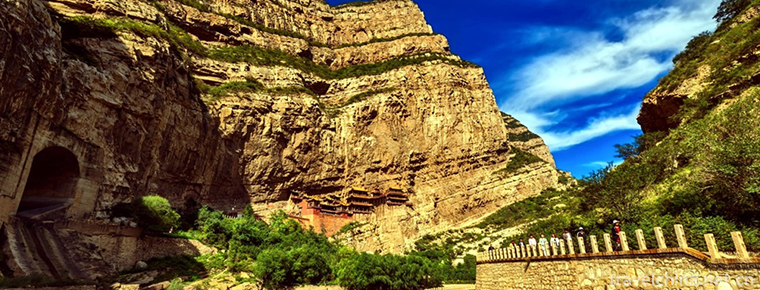
Mt. Hengshan, also known as "Tai Mt. Hengshan", is known as "Xuanwu mountain" and "Yushan". Among them, inverted Ma Pass, Bauhinia Pass, Pingxiaoguan Pass, Yanmen Pass.
Views: 196 Time 2018-10-30 -
Sun Zhongshans hometown
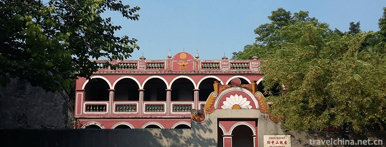
Sun Yat-sen's hometown is located in Cuiheng Village, Zhongshan City, Guangdong Province. It is surrounded by mountains on three sides: south, north and west, East by the Pearl River Estuary.
Views: 157 Time 2018-12-12 -
Nanning Zoo
Nanning Zoo, located at 73 East University Road, Nanning City, was built in 1973. It was officially opened to the outside world in 1975 with a total area of 39.1 hectares. It receives more than 1 mill.
Views: 172 Time 2018-12-27 -
Putuo Zong Cheng
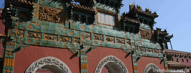
Putuo Zongcheng Temple, located in the north of Chengde Summer Resort and south of Shizigou, Hebei Province, covers an area of 220,000 square meters.
Views: 154 Time 2019-02-07 -
Chishan Scenic Area Shidao
Chishan Scenic Area of Shidao, located in the Shidao Management Area of Rongcheng City, the easternmost end of Shandong Peninsula, is a national 4A-level tourist attraction.
Views: 158 Time 2019-02-08 -
A harmonic
A harmonic, also known as Dabu Ah Hsiang, means "the song of laborers", originated from a form of labor called "Da Ah Hsiang" among Tibetan people..
Views: 233 Time 2019-03-29 -
Man Han tune
Han Han tune. Chinese translation means desert tone. A form of folk songs. Mainly popular in Mongolia and Han mixed Yikezhao League Zhungeer Banner, Dalat Banner and Baotou City Tumut Right Banner, Ho.
Views: 115 Time 2019-05-21 -
Naxi Dongba Painting
Naxi Dongba painting is an important part of Naxi Dongba culture and art, which is spread in the ancient city area of Lijiang City and Yulong Naxi Autonomous County of Yunnan Province. During the ritu.
Views: 135 Time 2019-06-07 -
Tajik Marriage Customs
On the Pamir Plateau, which is more than 4000 meters above sea level, there is a Tajik people living in China. This is a people who can sing, dance and hospitality. Their life is full of mystery, and .
Views: 113 Time 2019-06-17 -
Brick and plastic
Brick sculpture is the handicraft of folk craftsmen. It is made of mud into various animal models. Some of the images are realistic, but more are romantic and exaggerated ways of expression, the shape.
Views: 130 Time 2019-08-10 -
Administrative division of Panzhihua
Panzhihua City has 5 county-level administrative divisions (Municipal District 3, county 2) and 49 township level administrative divisions (street 11, town 23, township 15). It covers an area of 7440 square kilometers and has a population of 1.12 million. Panzhihua Municipal People's government is located at No. 2, bingcaogang street, East District..
Views: 318 Time 2020-12-14
