Diaoyu islands
Diaoyu Island, also known as Diaoyutai, Diaoyu Island and Diaoyu Mountain, is the main island of Diaoyu Island and its affiliated islands in the East China Sea, and is an inherent territory of China since ancient times. Located at 25 degrees north latitude 44.6', 123 degrees east longitude 28.4', about 358 kilometers away from Wenzhou, Zhejiang, Fuzhou, Fujian, about 385 kilometers, Keelung, Taiwan, about 190 kilometers, the surrounding sea area is about 174,000 square kilometers.
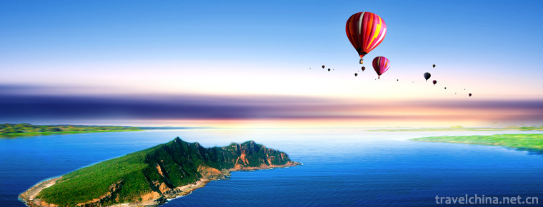
Diaoyu Island is about 3641 meters long, 1905 meters wide, about 3.91 square kilometers, the highest elevation about 362 meters, the northern terrain is flat, the southeastern side of the steep rocks, the eastern side of the reef rather like a spire, the central mountains across the East and west. Diaoyu Island is rich in camellia, palm, cactus, hibiscus and other precious Chinese herbal medicines, inhabiting a large number of seabirds, known as "flower and bird island"
In 1972, when the United States withdrew from Ryukyu, it "handed over" the "administrative jurisdiction" of the Diaoyu Islands to Japan. According to ancient Chinese historical records, China has always had territorial rights over the Diaoyu Islands. Therefore, the disputes over the Diaoyu Islands arise. At present, the Diaoyu Islands and their territorial waters belong to the People's Republic of China, but Japan actually illegally administers the island. Since September 10, 2012, Chinese government departments have carried out normalization monitoring and monitoring of Diaoyu Islands and their affiliated islands.
China's Marine Surveillance vessels have been carrying out law enforcement patrol missions in the waters of Diaoyu Dao, and fishery administration law enforcement vessels have been conducting regular law enforcement patrols and fishery protection missions to uphold normal fishing order in the waters of Diaoyu Dao. China has also exercised administration over Diaoyu Dao and the adjacent waters by releasing weather forecasts and through oceanographic monitoring and forecasting.
Ancient ancestors in China first discovered and named Diaoyu Dao through their production and fishery activities on the sea. In ancient Chinese literature, Diaoyu Island is also known as fishing island, Diaoyutai, fishing mountain. The earliest recorded historical records of places such as Diaoyu Island and Chiweiyu Island are "Sending along the Wind" written in 1403 (the first year of Yongle Ming Dynasty).
In 1171 (the seventh year of the Qianlong Road in the Southern Song Dynasty), General Wang Daya, who guarded Fujian Province, set up a military camp in Penghu. He dispatched troops to settle the islands. Taiwan and its subsidiary islands, including the Diaoyu Islands, were under the military jurisdiction of Penghu and administered by the Jinjiang River in Quanzhou, Fujian Province.
In 1372 (Ming Hongwu five years), Ming Tai sent his delegation to Ryukyu, and the king of Ryukyu paid tribute to the Ming Dynasty. By 1866 (five years of Tongzhi in the Qing Dynasty), the Ming and Qing Dynasties had sent envoys to the Ryukyu Kingdom 24 times, and Diaoyu Island was the place where the envoys traveled to Ryukyu. A large number of records about Diaoyu Island appeared in the reports written by Chinese envoys.
In the eleventh year of Jiajing (1532), Ming and Chen Kan called Diaoyu Island as Diaoyu Island in the Record of Ambassadors to Ryukyu, which was already in the sea area of China.
In 1561 (forty years of Jiajing in Ming Dynasty), Hu Zongxian, the supreme general stationed in the southeast coast of Ming Dynasty, and Zheng Ruozheng compiled the book "Preparatory Chart Compilation". Diaoyu Island and other islands were clearly compiled into the "coastal sand map" and included in the Ming Dynasty sea defense.
In 1605 (Ming Wanli 33 years), Xu Bida and others drew the "Qian Kun unified coastal defense map" and 1621 (tomorrow the first year) Mao Yuanyi drew the coastal defense map of China "Wu Beizhi coastal defense 2 Fujian coastal sandy map", will also be the Diaoyu Islands and other islands into China's coastal areas.
The Qing Dynasty not only followed the practice of the Ming Dynasty, but also continued to put the Diaoyu Islands and other islands under the jurisdiction of the local government of Taiwan. The jurisdiction over Diaoyu Island was recorded in the official documents such as Taiwanese Prefecture Records in Qing Dynasty and the Record of Taihai Envoy compiled by Huang Shubi.
In 1708, Ryukyu scholar Cheng Shunze clearly recorded Diaoyutai, Huangweiyu and Chiweiyu in his book "Guidelines in a Broad Sense", and called Gumi Mountain (Jiumi Island) as "the town on the southwestern border of Ryukyu".
In 1719, Xu Baoguang, a Qing Dynasty envoy to Ryukyu, pointed out in his book Zhongshan Biography that his sea route was to go out of Min'an Town from Wuhumen, take chicken coop, pass through Huafanyu Island, Pengjiashan, Diaoyutai, Huangweiyu, Chiweiyu, take Gumi Mountain, Horsetooth Island, and enter Ryukyu Naba Harbor.
In 1762, the Portuguese Nautical Needle Map clearly indicated that the Diaoyu Islands and their affiliated islands belonged to Taiwan.
In 1786, Lin Ziping, a fan from Sendai, Japan, produced the "Three Kingdoms" in the "National Map of Ryukyu" lists the Diaoyu Islands, and indicates that China's shipping route to Ryukyu.
In 1809, French geographer Pierre Rabbi and others drew a map of the coastal countries of the East China Sea. Diaoyu Island, Huangwei Island and Chiwei Island were painted in the same color as Taiwan Island.
In 1816, London published a Navigation Guide to East India, China, Australia and other places, which clearly recorded the affiliated islands of Taiwan, and marked the longitude and latitude of the islands, including the Diaoyu Islands.
In 1871 (Ten Years of Tongzhi in the Qing Dynasty), Chen Shouqi and other compilers of Fujian Tongzhi, Volume 86, listed the Diaoyu Island as a coastal defense scour point, under the jurisdiction of the Taiwanese government of Karma Lan (now Yilan County, Taiwan Province).
In 1872, Zhou Maoqi described the Diaoyu Islands in the complete picture of Taiwan.
In 1884, the Fukuoka native of Japan, Siro Koga, claimed to have "discovered" the Diaoyu Islands and their affiliated islands, and applied to the Japanese Ministry of Internal Affairs for the demarcation of the Japanese border to Yamashita Prefecture, Japan's Secretary of State, for a letter on the matter to Foreign Secretary Inoue. Inoue wrote back in 1885, saying, "This island is close to the border of the Qing Dynasty. It is smaller than the Dadong Island which had been inspected before, and the Qing Dynasty has named it." In response to Inoue's suggestion, Yamamoto sent a letter to Okinawa refusing to set a national standard on the Diaoyu Island immediately and stressing in the letter that the incident "should not be known to the media".
After the outbreak of the Sino Japanese War, Japan took the opportunity of war to compile the Diaoyu Island and Huang tau island into Okinawa county.
In January 14, 1895, the cabinet of Japan passed the resolution secretly, and incorporated the Diaoyu islands into the jurisdiction of Okinawa county.
On April 17, 1895, when the Qing government was defeated in the Sino-Japanese War of 1895, it was forced to sign an unequal Treaty of Shimonoseki with Japan, ceding "the whole island of Taiwan and all its affiliated islands". The Diaoyu Dao Islands were ceded to Japan as "islands appertaining or belonging to the said island of Formosa".
On June 10, 1895, Siro Kogaichen submitted to the Japanese Ministry of Internal Affairs a "Royal Pledge of Official Land Loan", or "Rental Application".
In September 1896, the Japanese government agreed to lease the so-called "Diaoyu Island" and "Jiuchang Island" (that is, Diaoyu Island and Huangtai Island) to Siro Kogakashi for 30 years.
In 1900, Hei Yanheng, who was taught at the Okinawa Normal School, was inspired by the British to call the island Pinnacle lslands and renamed the Diaoyu Islands and their affiliated islands the Senkaku Islands.
In 1941, the Japanese puppet regime under the "Taipei Prefecture" and Okinawa Prefecture for the Diaoyu Islands fishing ground litigation dispute, the Japanese court ruled that these islands belong to the "Taipei Prefecture" jurisdiction.
On December 1, 1943, China, the United States and Britain issued the Cairo Declaration, insisting on Japan's unconditional surrender and depriving Japan of all the islands occupied in the Pacific Ocean since World War I in 1914, stipulating that "Japan's territory stolen from China, such as the four northeastern provinces, Taiwan, Penghu Islands and so on, should be returned to the Republic of China." Other Japanese land seized by force or greed also deported Japan.
On October 25, 1945, the ceremony of the surrender of Taiwan Province to Japan in the Chinese theater of war was held in the Taipei General Assembly Hall. Japanese 10th Front Army Commander and Taiwan Governor Tadao Ando Liji signed and sealed the letter of surrender. The islands of Taiwan and Diaoyu Islands, which were occupied by Japan for half a century, have returned to China.
On September 8, 1951, the United States and other countries signed the San Francisco Peace Treaty with Japan. When the U.S. military took over the Ryukyu Islands, the Diaoyu Islands and its affiliated islands were delimited under the jurisdiction of the United States People's Government of the Ryukyu Islands without authorization. "Territory".
On December 25, 1953, David A.D.Ogden, Deputy Chief Civil Affairs Officer of the Ryukyu Islands Civil Administration and Major General of the United States Army, issued a Notice of Order 27 on the "Geographical Boundary of the Ryukyu Islands". The Diaoyu Islands are assigned to the Ryukyu Islands with six geographical boundaries of latitude and longitude. The document unauthorized expansion of the US trusteeship and illegally transferred the Diaoyu islands into the Ryukyu trust area of the United States.
In May 1969, a water police and engineering team from the Okinawa Bajongshan Island Public Station mounted the Diaoyu Islands and set up a "national standard" of cement pillars, clearing away traces left by the Chinese people on the island.
In August 31, 1970, the Japanese authorities passed the law to confirm that the so-called "Senkaku Islands" belonged to Japan.
On September 10, 1970, the United States, in accordance with the "Okinawa Civil Affairs Notice 27" delimited the scope of the Ryukyu Islands, the Diaoyu Islands into the Japanese Self-Defense Force "air defense identification circle".
On June 17, 1971, Japan and the United States signed the Japan-United States Agreement on the Ryukyu Islands and the Greater East Islands, returning the "regime" of the Ryukyu Islands and the Diaoyu Islands to Japan. In November of the same year, the United States Senate ratified the relevant agreements.
On December 30, 1971, the Ministry of Foreign Affairs of China issued a statement stating that "this is a flagrant violation of China's territorial sovereignty, which the Chinese people absolutely cannot tolerate. It is totally illegal for the United States and Japan to include the islands such as the Diaoyu Islands in the "Return to Okinawa Agreement". This will not change the territorial sovereignty of the People's Republic of China over the islands such as the Diaoyu Islands.
In 1972, the establishment of diplomatic relations between China and Japan. Zhou Enlai proposed to hang up the ownership of the Diaoyu Islands and other islands until the future conditions are ripe. The two sides reached an agreement.
In 1978, China and Japan signed the Treaty of peace and friendship. Vice Premier Deng Xiaoping said that the issue of Diaoyu Island could be resolved in the future. The Chinese government explicitly declared that the dispute over sovereignty over the Diaoyu Islands should be shelved for future generations.
In 1979, Japan built a heliport on the Diaoyu Island, and the two sides of the Taiwan Strait raised negotiations and protests with Japan.
In 1990, the Japanese youth agency built a lighthouse on the Diaoyu Island, causing a wave of fishing.
In 1992, after China passed the Law on Territorial Seas and Contiguous Areas, stating that the Diaoyu Islands and other islands were Chinese territory, Japan raised a "protest", and the Chinese Foreign Ministry reiterated that the Diaoyu Islands belonged to China.
In July 14, 1996, the Japanese youth agency set up a lighthouse on the Diaoyu Island. China's foreign ministry said it was "deeply concerned" about the incident, which triggered strong protests across the Taiwan Strait.
In August 2017, the ancient map of Japan, published by the Japanese historian Kubaoki, confirmed that the Diaoyu Islands were China's inherent territory. He also said that the ancient maps on the official website of the Japanese Ministry of foreign affairs were forged.


-
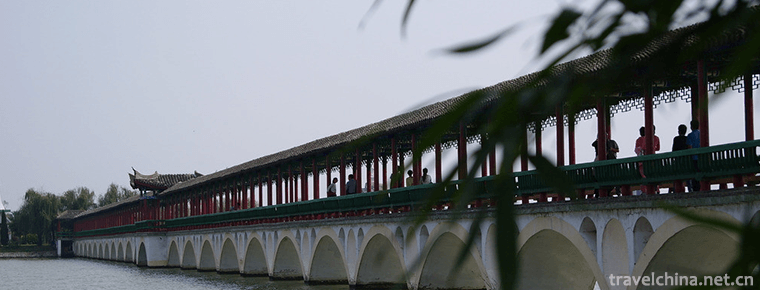
Bali River Scenic Area
Bali River Scenic Spot is a national AAAAA-level tourist attraction with "Global 500 Top" environmental protection. It is located in Yingshang County.
Views: 248 Time 2018-12-08 -
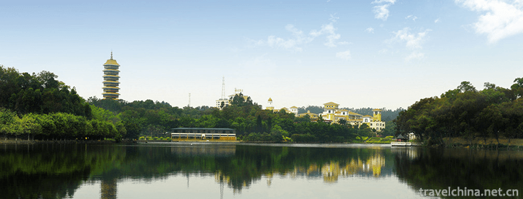
sanshui forest park
Sanshui Forest Park is located in the north suburb of the southwest town of Sanshui District, Foshan City, Guangdong Province..
Views: 142 Time 2018-12-18 -
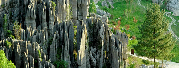
Longlishi Sea Scenic Area
Located in Shilin Town, Wansheng District, Chongqing, Longlishi Sea Scenic Area is a karst geological park type natural scenic tourist area with a planned area of 4.7 square kilometers and a distance .
Views: 229 Time 2019-02-06 -
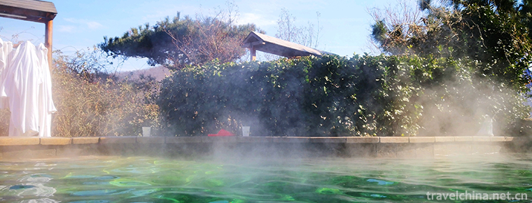
Taishan Hot Spring City
Taishan Hot Spring City Cultural Tourism Scenic Spot is invested and constructed by Shandong Taishan Hot Spring Tourism Development Co., Ltd. with a total investment of 2.6 billion yuan.
Views: 135 Time 2019-02-13 -
Xianghu Lake
Xianghu Lake is known as the "sister lake" of the West Lake for its beautiful scenery. It is a lake located in Xiaoshan District, Hangzhou City, Zhejiang Province, China. Xianghu Lake is als.
Views: 168 Time 2019-02-25 -
Wenzhou opera
Ou Opera has a history of more than 300 years with "written warmth" as its stage language. The more influential traditional plays are Gao Ji and Wu Sanchun, Yanghe Pickup and the modern play.
Views: 89 Time 2019-06-08 -
Construction Techniques of Tujia Diaojiao Building
Tujia hanging-feet building construction skills, Hubei Xianfeng County, Hunan Yongshun County, Chongqing Shizhu Tujia Autonomous County, local traditional skills, one of the national intangible cultur.
Views: 145 Time 2019-06-23 -
Celadon Firing Techniques of Yue Kiln
The firing history of celadon in Yue kiln has gone through the firing process of primitive, primitive and mature ceramics kilns and mature ceramics kilns (i.e. ceramics kilns). In the firing process, .
Views: 140 Time 2019-07-16 -
Cantonese opera Yuequ
Cantonese Opera is a popular Cantonese dialect area in Guangdong and Guangxi, and has spread to Hong Kong, Macao, Southeast Asia and the Americas where Cantonese overseas Chinese live. It is a variety.
Views: 154 Time 2019-07-16 -
North China Electric Power University
North China Electric Power University is a national key university directly under the Ministry of Education. It is a key construction University of "211 Project" and "985 Project Advant.
Views: 244 Time 2019-09-22 -
Chuzhou University
Chuzhou University is a full-time general in Anhui province. Undergraduate Colleges Yes. Anhui higher education revitalization program "Local application type" High level University Construc.
Views: 150 Time 2019-11-09 -
Neijiang social security
In 2019, there were 109600 people participating in the endowment insurance (including retirees) of government institutions, 842500 people of enterprise employees (including retirees), and 1501700 people of urban and rural residents. 52100 new urban jobs.
Views: 353 Time 2020-12-16
