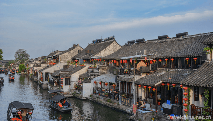
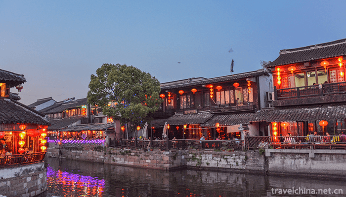
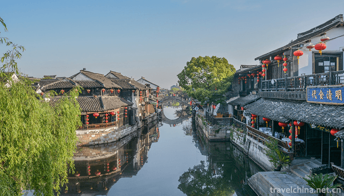
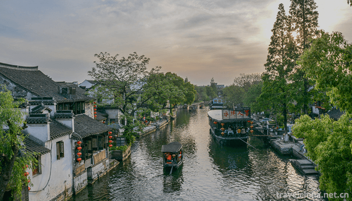
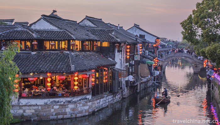
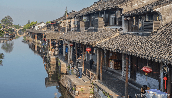
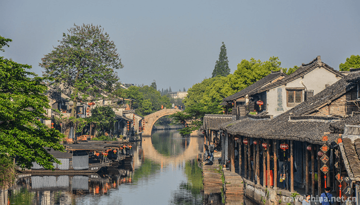
Xitang Ancient Town Tourist Scenic Spot
Xitang Town, belonging to Jiashan County, Jiaxing City, Zhejiang Province, is located at the junction of Jiangsu, Zhejiang and Shanghai. It has an ancient name of Xietang, Pingchuan, Yaozhuang Town in the east, Tianning Town and Taozhuang Town in the west, Ganyao Town in the south, Luxu Town in the north. Its central geographic coordinates are 120 53', 30 56', 10 km from Jiashan City. The area is 83.61 square kilometers. Xitang Town is located in the water network area of Hangjiahu Plain and belongs to the East Asian monsoon area on the southern edge of the North Subtropical Zone.
By 2013, Xitang Town had 18 villages and 4 communities. In 2016, Xitang Town had 574,000 households and 29,000 migrants. In 2016, Xitang Town achieved a regional GDP of 5.44 billion yuan .
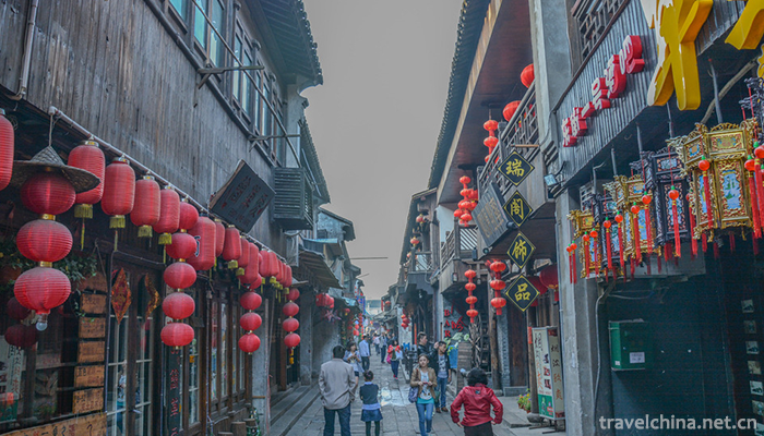
Xitang has a long history. It is one of the birthplaces of ancient Wu-Yue culture and one of the six ancient towns in the south of the Yangtze River. It is a thousand-year old water town of Wu local culture. During the Spring and Autumn Period and the Warring States Period, Wu and Yue were the border areas between the two countries, known as "Wugen Yuejiao" and "Yuejiao people". October 2003 was listed in the first batch of famous historical and cultural towns in China. In 2003, it was awarded the "Outstanding Achievement Award for the Protection of Cultural Heritage in the Asia-Pacific Region" by UNESCO. In 2006, Xitang Ancient Town was listed on the preparatory list of China's World Cultural Heritage . In 2017, Xitang Ancient Town was promoted to National 5A Tourist Scenic Area . On May 24, 2018, Xitang Town was selected as the top 50 small towns with the most beautiful characteristics.
Xitang, the ancient name of Xietang. In Ming Dynasty, Jianshi Town was named Xitang after Xitang, which borders Yongan and Qianshan townships.
In the fifth year of Xuande in Ming Dynasty (1430), Jiashan County was built, and the county was first proposed to be located in Xietang. In the twelve years of orthodoxy (1447), the Taozhuang Taxation Bureau moved to Xietang City, which is called Xietang City in Hongzhi of the Ming Dynasty. Zhengde (1506-1521), known as Xitang Town.
In the thirty-fifth year of Jiajing in Ming Dynasty (1556), Japanese invaders invaded and the markets around Xigutan were destroyed, then moved eastward gradually. Wanli Zhong was renamed Xietang Town. In the thirty-eighth year of Emperor Qianlong (1733), the county ministry was set up in Wangjiajiao Township. Tongzhi eight years (1869), moved to the east of Nantangqiao Yaqian Street, until the end of the Qing Dynasty abandoned.
At the beginning of the Republic of China, local autonomy was implemented. The county was divided into 12 autonomous regions. Xitang Town was the seat of Xitang Autonomous Region's public office.
In the nineteenth year of the Republic of China (1930), the county was re-divided into four districts, and Xitang was established as the third district of Jiashan County.
In the twenty-third year of the Republic of China (1934), the establishment of the district was abolished. It was directly under the county government and set up Xitang Town Public Office in Yaqian Street.
In the twenty-sixth year of the Republic of China (1937), on November 11 (the ninth day of October on the lunar calendar), Xitang was occupied.
In May 1949, Xitang was liberated and the Xitang District People's Government was established on June 5, 1949.
In June 1951, Xitang Town was transformed into a town directly under the county.
In March 1981, the revolutionary committees of societies and towns were abolished and the Xitang Commune Management Committee and the Xitang Town People's Government were restored.
In January 1984, the Administration Committee of Xitang Commune was changed to Xitang Township People's Government.
In June 1985, Xitang Township was abolished and merged into Xitang Township.
In September 1986, Xitang Town was approved as a satellite town in Shanghai Economic Development Zone.
In 1992, Zhendong, Zhenxi, Shendao and Zhennan were built.
In August 1996, the Town Aquaculture Villagers'Committee abolished the administrative system and established Xitang Aquaculture Farm.
In 1997, the Town People's Government Building was relocated to Nanyuan Road.
Xitang Town is located in the north of Jiashan County, Yaozhuang Town to the east, Tianning Town to the west, Taozhuang Town to the south, Ganyao Town to the north, Luxu Town to the north. Its central geographic coordinates are 120 degrees 53', 30 degrees 56', 78 kilometers north of Suzhou, 9 kilometers south of Jiashan County Town, 80 kilometers east of Shanghai City, and 100 kilometers west of Hangzhou. The administrative area of the town is 83.61 square kilometers.
topographic features
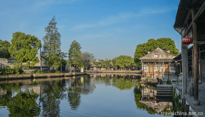
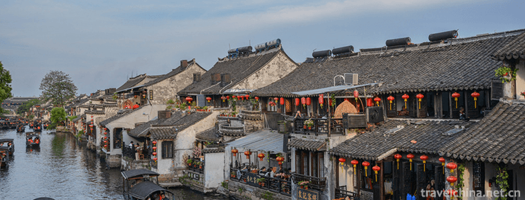
Xitang Town is located in the water network area of Hangjiahu Plain. Its terrain is flat and its stratum is covered by Quaternary system. It is composed of river, lake and shallow sea sediments. There are mainly Xitang Port, Shangtang Port and Xilu Port in the North-South direction, Hongqitang Port in the East-West direction, Xinjinggang Port and Qijingtang Port in the East-West direction. Xitang Town has a low terrain with an average elevation of 1.60 meters (Yellow Sea elevation, the same below).
hydrology
Xitang Town is located in the Hangjiahu Plain water network area of Taihu Basin and belongs to the canal water system. Therefore, the flow speed of the river is gentle and the seasonal variation of water level is significant. Typhoon rainstorms in summer and autumn often cause the sudden rise of river water, while the water level in winter is low.
climate
Xitang Town belongs to the East Asian monsoon area on the southern edge of the North Subtropical Zone. It has the characteristics of mild and humid, distinct seasons and abundant rainfall. Monsoon is the main factor affecting climate, and the temperature is characterized by cold winter and hot summer. Most of the precipitation days are concentrated from April to September, accounting for more than 65% of the annual rainfall. Among them, April and May are alternating spring and summer monsoon, continuous low temperature and rainy, continuous "spring rain" and June and July are "plum rain" periods. Due to the influence of monsoon climate, southeast-east wind prevails in summer and northwest wind prevails in winter.
-
1.Bihai Jinsha Water Paradise
Bihai Jinsha Water Paradise (i.e. Coastal Recreation Park, abbreviated as "Water Paradise") is built outside the flood control wall, along the flood control wall 1313 meters
Time 2019-01-03 -
2.Tianjin Water Park
Tianjin Water Park, formerly known as Qinglongtan, as a scenic resort, can be traced back to the beginning of the last century. It was officially opened to tourists on July
Time 2019-02-21 -
3.Tibetan New Year
Tibetan calendar year is the traditional festival of the Tibetan people. Bhutan and Mongolia, which are deeply influenced by Tibetan culture, also celebrate the Tibetan New Year
Time 2019-04-04 -
4.Daur Folk Songs
Daur people mainly live in Inner Mongolia Autonomous Region and Heilongjiang Province, and a few live in Tacheng County, Xinjiang. Daur means "pioneer".
Time 2019-04-22 -
5.Peacock Dance of Dai Nationality
Dai peacock dance is the most famous traditional performing dance in Dai folk dance in China. It is spread in Ruili, Luxi, Xishuangbanna, Mengding, Mengda, Jinggu, Cangyuan
Time 2019-04-24 -
6.Luo Juan Opera
Luojuan opera, commonly known as trumpet opera, is one of the local operas and one of the national intangible cultural heritages spread in Runan County of Henan Province and Dengzhou City of Henan Pro
Time 2019-05-15 -
7.Ningxia Xiaoqu
Ningxia Xiaoqu, a national intangible cultural heritage project, is a traditional rap art form with strong local characteristics.
Time 2019-06-08 -
8.Legend of Su Xian
The legend of Suxian is a local folklore with a long history. Su Xian, Ming Lian, from Guiyang. Su Da lost his father in his early years and depended on his mother for his life. One year, the plague w
Time 2019-06-17 -
9.Yao Opera
Yao Opera is popular in Yuyao, Cixi, Ningbo, Zhoushan, Shangyu and Shaoxing. It developed on the basis of folk singing and dancing "horse lantern", "dry boat" and "tea basket&
Time 2019-07-11 -
10.Yao Folk Songs
Yao folk song is a popular Yao folk song in Ruyuan Yao Autonomous County of Shaoguan City. Yao language is called "Saihua handle". It is translated into Chinese to mean "the language th
Time 2019-07-11 -
11.Leshan Sports
In 2018, Leshan City organized a team to participate in the 13th Sichuan Provincial Games and won 19 gold medals, 25 silver medals and 47 bronze medals. 63 provincial-level sports fitness projects were established, and 279 municipal level national fitness
Time 2020-12-17 -
12.Yibin landform
The topography of Yibin City is high in the southwest and low in the northeast. In the west, there are yuxu of Liangshan and Xiaoliangshan, and Laojun Mountain is the highest point of Wuzhi Mountain in Pingshan County with an altitude of 2008.7 meters;
Time 2020-12-18