Geographical environment of Guangyuan
Geographical environment of Guangyuan
Location context
Guangyuan City is located in the north of Sichuan Province. Its geographical coordinates are 31 ° 31 ′ n to 32 ° 56 ′ N and 104 ° 36 ′ e to 106 ° 45 ′ E. in the north, it borders Wudu County, Wen County, Ningqiang County and Nanzheng County of Shaanxi Province in the north, Nanbu County and Langzhong City of Nanchong City in the south, Pingwu County, Jiangyou City and Zitong County of Mianyang City in the west, and Nanjiang county and Bazhou District of Bazhong City in the East. It covers an area of 16314 square kilometers.
topographic features
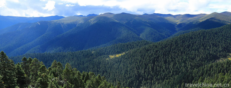
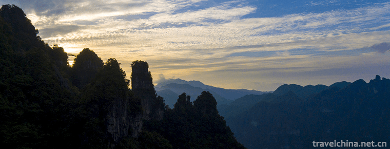
Guangyuan City is located in the northern edge of Sichuan Province, and the mountainous area is transitional to the basin. Motianling and Micang mountains span the north of the city from east to west, which are Sichuan Gansu and Sichuan Shaanxi border mountains respectively; Longmenshan mountain is synclinally inserted into the west of the city; the south of Guangyuan city is covered by Jianmen mountain, Dalan mountain and other Arc Mountains in northern Sichuan. The terrain is inclined from north to Southeast, and the relative height difference of ridge is more than 3200 meters. The altitude of Motianling ridge decreased from 3837 m (big lawn) in the west to 2784 m in the East and 800 m in the south. Longmen Mountain is connected with Motianling, which is in the whole territory of Qingchuan and the west of Lizhou district.
From north to south, the elevation of the ridge decreased from 3045 meters (sedan chair top) to 1200 meters. The top of the mountain is sharp, the slope is generally above 25 degrees; the river valley is deep, and the relative height difference is between 600-800 meters. Micang mountain is located in the north of Wangcang County to Guangyuan line in Chaotian district. The elevation of the ridge decreases from 2276 meters (guangtou mountain) to 1368 meters (Shijialiang) from north to south. The slope is more than 25 degrees, and the peak is round. The relative elevation difference of deep valley is generally between 500-800 meters. The arcuate mountains in northern Sichuan are located in Yuanba District, the south of Wangcang County, and Cangxi and Jiange counties. The altitude dropped from more than 1200 meters to more than 600 meters from north to south. The river valley is also deeply cut, mostly in "V" shape. The relative height difference is 200-500m. The top of the mountain is gentle, mostly in the shape of platform beam, and the slope surface is generally about 12 degrees.

-
Water Margin City Scenic Area of the Three Kingdoms
The Wuxi Film and Television Base of CCTV is the first large-scale film and television shooting and tourism base in China. Founded in 1987, it is the first theme park in China that combines film and t.
Views: 154 Time 2018-12-18 -
Chaibuxi Canyon Scenic Area
Chaibuxi Canyon Scenic Area is located in the eastern part of Wufeng Tujia Autonomous County, with Wulingyuan in the South and Qingjiang River in the north. Zhangjiajie belongs to Wuling Mountains..
Views: 216 Time 2019-01-04 -
West Mountain Scenic Spot of Guiping
Guiping Xishan Scenic Spot, National AAAA Scenic Spot, National Geopark. Located in Guiping City, southeastern Guangxi Zhuang Autonomous Region, Xishan Scenic Spots 1 km away from the outskirts of the.
Views: 117 Time 2019-01-13 -
Cai Luns Paper making Legend
Cailun Paper-making Stories and Legends are legends circulated in Cailun's fiefdoms, burial sites and experimental sites of Yangxian Longting and surrounding areas..
Views: 206 Time 2019-04-04 -
Sama Festival of Dong Nationality
Sama Festival of Dong Nationality is spread in Rongjiang County, Liping County, Congjiang County and the surrounding areas of Dong Nationality in Guizhou Province.
Views: 103 Time 2019-04-28 -
Jingzhou Miao Geku
The Miao people's song (tgong) has been declared as the first batch of national folk intangible cultural heritage and one of the two "national treasures" of Huaihua City..
Views: 132 Time 2019-05-08 -
Pinghu cymbal book
Cymbals are a unique form of local traditional folk art in the Wu dialect area of Jiangnan. According to the Records of Songjiang County, it was formed in the Qing Dynasty (1821-1850). It is now mainl.
Views: 134 Time 2019-06-09 -
Yangge Dance
Yangge is a popular and representative folk dance genre in China (mainly in the northern region). There are different appellations and styles in different regions. In folk, there are two kinds of appe.
Views: 899 Time 2019-07-10 -
Wawu mountain
Wawu Mountain National Forest Park is under the administration of Hongya County, Meishan City, along the western edge of Sichuan Basin. It is 180 km away from Chengdu and covers an area of 1.05 million mu. .
Views: 291 Time 2020-10-15 -
Hunter peak
Hunter peak is located in the Shuangqiao gully of Siguniang mountain, with an altitude of 5360 meters and adjacent to Jianzi mountain. The two peaks stand shoulder to shoulder, with a huge stone pillar in the middle.
Views: 231 Time 2020-11-05 -
Climate characteristics of Mianyang
Mianyang City belongs to the humid monsoon climate zone of north subtropical mountain. In 2016, the average temperature was 17.9c, the days of excellent air quality were 279, and the average annual precipitation was 823.3mm. .
Views: 86 Time 2020-12-14
