Jingpo Lake
Jingbo Lake: National AAAAA-level tourist attractions, World Geopark, National Key Scenic Spots, International Ecotourism Resort, National Civilized Scenic Spots Demonstration Sites, China's Top Ten Leisure Tourism Resorts, China's largest and the second largest alpine barrier lake in the world.
Jingbo Lake is located in Ning'an City, Mudanjiang City, Heilongjiang Province, on the main stream of Mudanjiang, a tributary of Songhua River, 50 kilometers away from Ning'an City. The lake surface is 351 meters above sea level, the average depth of the lake is 40 meters, the highest water level is 353 meters, the lowest is 345 meters, the average annual flow is 9.2-10 cubic meters per second, and the water storage capacity is 1.625 billion cubic meters. Besides the main stream of Mudan River, there are also small rivers such as Dalishugou River and Xigou River in Erzhan. In Tang Dynasty, the Manchu ancestor, Tan Yu, called Jingbo Lake Hu Khan Sea, Liao Yanshui and Jin Bierteng Lake. In the early Qing Dynasty, Ninggu Pagoda flowed into Jingbo Lake, which was named Jingbo Lake because the lake shone like a mirror.
Jingbo Lake National Scenic Spot is composed of Baili Changhu Scenic Spot, Volcanic Crater Primitive Forest Scenic Spot and Shangjing Longquanfu Site Scenic Spot in Bohai State. The overall planning area is 1726 square kilometers. It is a comprehensive scenic spot for scientific research, summer resort, tour, sightseeing, vacation and cultural exchange.
Jingbo Lake, located in the southwest of Ning'an County, is 50 kilometers away from Ning'an City (129 0 5 longitude east, 42 2 latitude north), with an altitude of 351 meters. In the Tang Dynasty, as far back as 1,000 years ago, the ancestor of the Manchu nationality who lived here called Jingbo Lake Hu Khan Sea, Liao Yanshui, Jin Bierteng Lake. In the early Qing Dynasty, Ninggu Pagoda flowed into Jingbo Lake, which was named Jingbo Lake after the water shining like a mirror.
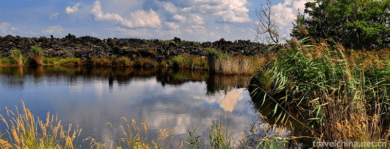
The northeast direction of the lake flows to the north of Zhangjialiangzi in Beihutou, and then flows to the northeast to pour into the deep pool of the waterfall. Manchu calls this pool "Faku", which means "Hai Eye", from which lake water flows into Mudan River. Jingbo Lake is a volcanic lava barrier lake. At the exit of the lake, a steep cliff is formed by basalt. The water of the lake is washed down from the top, forming a Jingpo Lake waterfall with a width of about 30 meters and a drop of more than 20 meters, commonly known as the "hanging water tower". Zhang Guangcai Mountain in Changbai Mountains winding along the lakeside, the highest elevation is 930 meters (Old Montenegro zigzag Laoyu), the lowest is 353 meters (according to the water level of the lake), the whole area is a mountain area.
The lake is S like. The total length of North Hunan is 45 kilometers, which is 32.5 kilometers according to the straight line distance between North and south of the lake basin, and 45 kilometers according to the curve length of the lake basin and bay. The southern part of the lake is wider, the widest part is about 6 kilometers; the northern part is narrower, the narrowest part is only about 400 meters. The average width is about 2 kilometers. The lake covers an area of about 95 square kilometers.
The depth of the lake gradually deepens from south to north, with the deepest depth of 62 meters, averaging 40 meters. The average annual water level is 353.65 meters and 345.61 meters, with an average annual flow of 9.2 cubic meters to 10 cubic meters per second and a water volume of 1.6 billion cubic meters. The controlled watershed of the whole lake covers an area of 11,820 square kilometers, with a water storage capacity of 1.625 billion cubic meters and an average annual inflow of 3.11 billion cubic meters.
The annual variation characteristics of water level in Jingbo Lake are as follows: the highest water level mostly occurs from August to September, the lowest water level mostly occurs from March to April, the annual average water level is 347.95 meters, the highest water level is 354.43 meters, and the lowest water level is 339.17 meters. Mudan River originated in Mudanling Mountain, Changbai Mountain, Jilin Province. The ratio of river to water is large. Jingbo Lake is about 300 kilometers away from the source of Mudan River, with a drop of about 750 meters.
Jingbo Lake is a volcanic lava barrier lake on the main stream of Mudanjiang River. Jingbo Lake is a source of water in Mudanjiang River. Mudan River is called Hu Khan and Hu Erha River in ancient times. Mudanling, originating in the southwest of Dunhua City, Jilin Province, flows into Jingbo Lake from the mouth of the big river and flows out from the Northeast waterfall of the lake. It flows into Wenchun Town, a jurisdiction area in the suburb of Mudanjiang City, two kilometers north of Houyaolongtun, Fan's hometown in the north of the county boundary.
More than 30 rivers, large and small, converge centripetally into the lake. From the South Lake head into the lake water: southeast into the Dashi River, Songyi River, Fangshen River, Xiaojiaji River and other four rivers; from the southwest into the lake water has Tongdunhua County Nanling and Yemu Town and other two rivers converged in the southwest of the lake Sancha estuary, through Gongyububbles and other bubbles into the lake in the Old Heishan, known as the Great River Estuary; The injector is Riweihu (Manchu Dumu River). There are cliffs and steep walls at the entrance to the lake, named Rihubutu Peak.
Dalishugou River, 2 kilometers north of Wang Bazhi in the northwest direction of Jingpo Lake, joins Jingpo Lake. The basin covers an area of 60 250 square kilometers and runs 10.5 kilometers in Ningan.
Erzhan Xigou River: Also known as "Erzhan River". The second tributary of Songhua River. Located in the west of Ning'an County. Originated in the east of Zhangguangcailing, there are two river sources, namely, the Nangou River of Erzhan and the Beigou River of Erzhan. When they converge near the garrison of Erzhan cars, they are called "Erzhan River". From West to east, Jingbo Lake is injected into the Erzhan estuary. The river is 74 kilometers long, 27 meters wide and 0.5 meters deep. The basin area is 1010 square kilometers.
Xiaobeihu River, 0.5 kilometers north of Xiaotuanshanzi in Jingbo Lake, converges into Jingbo Lake, with a basin area of 422,776 square kilometers and a length of 51 kilometers in Ningan.
Shitouhe River, in Jingbo Lake aquaculture farm into Jingbo Lake, basin area 84,038 square kilometers, 18.5 kilometers long in Ningan.
Songyi River, 1 km east of Jingbo Village, Jingbo Township, converges into Jingbo Lake, with a basin area of 492,288 square kilometers and a length of 41 kilometers in Ningan.
Fangshengou River, 2 kilometers south of Hunan Village, Jingbo Township, joins the lake. The basin covers an area of 204,801 square kilometers and is 30 kilometers long in Ningan.
Dajiaji River, which originated from Niuxindingzi 2 km west of Jingbo Township, converges into Jingbo Lake at the West estuary of Hunan Village, Jingbo Township. It covers an area of 153 114 square kilometers and is 25.5 kilometers long in Ning'an.
Jingbohu Mountains are located in the transition area between Zhangguangcai Mountains and Laoyeling Mountains in Changbai Mountains, and belong to the low mountain and hilly landform. Huxi Mountain has a relatively large fluctuation, while the eastern and Hunan Mountains are relatively gentle. Hubei is a lava platform with a flat terrain. The northern part of Jingbo Lake Scenic Area is a complex landscape with 12 volcanic craters. The highest elevation of the mountain range is 1260.7 meters (Old Montenegro west of Luyuan Island) and the lowest elevation is 339.17 meters (lowest elevation). The geological structure of Jingbohu Lake is mainly composed of granite, perlite and basalt.
Jingbo Lake belongs to the fault depression valley formed in the middle of Cenozoic Tertiary. In the late Quaternary, a fault occurred in the northern part of the lake basin, and the subsidence part of the fault block laid the foundation of the lake basin today. The Volcanic Group in the northwest of the park has erupted continuously since 1 million years ago, forming a basalt platform with a length of more than 100 miles. The lava of the last volcanic eruption about 4800 years ago also overflowed near the dam of Jingbohu Hydropower Station and along the fault valley of Shiudianzi River. The lava flow and eruptions from the Volcanic Group in the northwest of the park And lava collection. A basalt barrier near the hanging water tower blocked the Mudanjiang River and its tributaries, forming the largest volcanic lava barrier lake in the world, Jingbo Lake, and a series of large and small lakes, such as Xiaobeihu Lake, Drilling Core Lake and Yuanyangchi Lake.


-
Yashan Huahai Stone Forest
Yashan Huahai Stone Forest Tourist Area, located in Nanling County, Wuhu City, Anhui Province, is one of the important scenic spots in Anhui's "two mountains and one lake" tourism economic c.
Views: 160 Time 2018-12-20 -
Guan Lin Scenic Area
Guanlin, a national key cultural relic protection unit, National AAAA tourist attraction, is the first place for the burial of Shu generals Guanyu in the Three Kingdoms period. The former is an ancest.
Views: 129 Time 2018-12-24 -
Bao Xiaosu Temple
Baoxiao Sugong Temple, abbreviated as "Baogong Temple", is located on a mound in the east section of Huancheng South Road, Hefei City, Anhui Province. It is the main ancient building complex.
Views: 117 Time 2018-12-26 -
Hengdian Film and Television City Scenic Area
Hengdian Film and Television City is a large-scale comprehensive tourist area which integrates film and television, tourism, vacation, leisure and sightseeing. It has been rated as the national AAAAA-.
Views: 166 Time 2019-01-13 -
Silkworm custom
Haining City, the ancient name is meaningful, and later because of drunken plum from wood changed its name to salted plum. This is the seat of Changshui County in the Spring.
Views: 122 Time 2019-04-04 -
Cooking Techniques of Beef and Mutton
Strict raw materials for roasting whole sheep should be two-year-old lambs. Paste made of egg yolk, salt, cumin, pepper, flour, etc. will be applied to the whole sheep after treatment, and the head of.
Views: 308 Time 2019-06-08 -
Surface painting
Water and land painting Festival is a traditional religious painting. Originated in the Three Kingdoms Period, Buddhist monasteries prevailing from the Jin Dynasty to the Yuan, Ming and Qing Dynasties.
Views: 303 Time 2019-06-15 -
Tao Zhugong Legend
Tao Zhugong's legend originated from Dingtao, Shandong Province, and is widely spread among Chinese people and Chinese businessmen in the world. It has a history of more than 2500 years. Tao Zhugong, .
Views: 140 Time 2019-06-18 -
Wenzhou Drum Ci
Wenzhou Drum Ci, also known as "Quci" or "Blind Ci", commonly known as "Singing Ci", is the largest type of opera in southern Zhejiang Province, and also one of the main .
Views: 187 Time 2019-06-28 -
Zhangjiajie Yangxi Opera
Zhangjiajie Yangxi Opera originated in the middle of Qing Dynasty and has a history of more than 300 years. It belongs to Beilu Yangxi Opera. The singing feature is the singing method of "golden .
Views: 116 Time 2019-07-16 -
Climate of Luzhou
Luzhou city belongs to subtropical humid climate zone, and the three-dimensional climate is obvious in the southern mountainous area. It has high temperature, sufficient sunshine, abundant rainfall, four distinct seasons, long frost free period, temperature, light and water in the same season.
Views: 373 Time 2020-12-14 -
Neijiang in the period of the Republic of China
The 1911 Revolution ended the rule of Qing Dynasty in Neijiang City. In the 24th year of the Republic of China (1935), Sichuan government was unified, and the districts, cities and counties of Neijiang City were divided into the second (Zizhong, Neijiang, Ziyang, Jianyang,.
Views: 336 Time 2020-12-16
