Benxi Water Tunnel Scenic Area
Benxi Water Cave, National AAAAA Class Tourist Scenic Spot, National Key Scenic Spot and Asian Member Unit of International Tourist Cave Association, is the world's longest underground water-filled cave discovered so far. It is praised as "The Peak View of ZhongRuqi is thousands of, the Poetry and Painting Room of Light Boat and Clear Water; Zhong Xiu should only be in the fairyland, the only cave in the world".
Benxi Water Tunnel is located 35 kilometers northeast of Benxi City, Liaoning Province. It consists of six scenic spots: water tunnel, hot spring temple, Tanggou, Guanmen Mountain, Tiesha and Miaohou Mountain. It integrates mountains, water, caves, springs, lakes and ancient human cultural sites. It distributes along the Taizi River in a belt with a total area of 200 square kilometers.
Water Cave Scenic Spot is a large limestone water-filled cave formed millions of years ago. The cave is deep and wide. Now the underground river is 3000 meters long. The water flow is endless, clear and bottomless. The stalactites on the cave roof and rock wall are well developed, with various forms. It makes people forget to go back and forth by boating. Hot Spring Temple Scenic Area, spring water temperature 44 degrees Celsius, daily flow of 400 tons, has high medical value. Miaohoushan Ancient Culture Site is an early Paleolithic cave site in Northeast China, which is of great value to the study of ancient human distribution and ancient geography in eastern Liaoning Province.
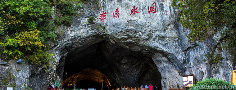
Benxi Water Cave is a large water-filled cave formed hundreds of thousands of years ago. It is situated on the Bank of the Prince River in the eastern mountainous area 26 kilometers away from Benxi City. Its longitude is 124 degrees and its latitude is 40 degrees and 18 degrees. It has two caves of water and drought. The mouth of Benxi Water Tunnel is 16 meters high and 25 meters wide. It is half-moon-shaped. There are four characters on the top of it, which are inscribed in a thin hand-written book, "Benxi Water Tunnel". The entrance is a "living room" with a height of more than 20 meters and a width of more than 20 meters, which can accommodate thousands of people. Hall to the right, there is a dry cave 300 meters long, cave high and low scattered, there are holes in the cave, twists and turns, each cave sky.
As far as 570 million years ago, Benxi Shuidong area was once a vast ocean. During this period, the climate was warm, a large number of bamboo stalagmites, brachiopods, gastropods and ladder insects were bred and derived. Each family group followed the natural law to renew itself. Their bodies deposited different types of biological carbonates and chemical carbonates due to hydrodynamic washing and turbidity sinking. The limestone of Benxi Shuidong was developed by lithology during the period of Liangshan Formation of Lower Ordovician and Majiagou Formation of Middle Ordovician. Later, due to crustal movement, the sea receded, and the platform slowly rose to land. Limestone is continuously eroded by external forces in geological movement, accumulated over time, after hundreds of millions of years, it gradually develops into today's water caves. This dissolution is still going on.
Benxi is located in the mountainous area of Eastern Liaoning Province, where the mountains are high and densely forested. It is an important water conservation area in eastern Liaoning Province. The rivers are vertical and horizontal. Benxi is indeed the "source of water". However, the origin of the name "Benxi" has other origins.
Benxi is named Benxi Lake. Benxi Lake is located in the city, less than 15 square meters of Lake surface, can be said to be the smallest Lake in the world. Although the lake is small, it is also well-known. It was once listed in the ten sceneries of Guandong. During the Tongzhi period of the Qing Dynasty, the book "Benxi Lake in East Liaoning" was inscribed at the mouth of the lake. The ancient temple of Cihang was built near the lake. It was built at the end of Ming Dynasty. The incense of Sanskrit was once very popular. The lake is surrounded by hills and peaks, wide and narrow, very similar to the rhinoceros horn wine cup, so it is called "Cup Rhinoceros Lake", homophonic "Benxi Lake". Henceforth, the city is famous for its lakes. Benxi Lake City was officially established in 1939. After the founding of New China, the word "lake" was removed and named Benxi City.
Benxi has a long history. Ancient human cultural sites excavated in the archaeological excavation of Miaohou Mountain show that human ancestors multiplied and thrived here in the Paleolithic Age 40,000 to 500,000 years ago. This not only fills in the gaps of Paleolithic human fossils in Northeast China, but also provides valuable historical data for the study of human distribution and transfer in Northeast Asia.
Water tunnel
The wharf leading to the water tunnel, with a surface of more than 1000 square meters, is like a quiet and chic "harbour", where the lights reach, the boats in the water and the stone scenery in the cave are reflected, making people feel like a fairyland. From the revetment stone steps down, through the corridor from the wharf on board, you can swim in the tunnel. The total length of the water tunnel is 5800 meters. Now it has developed 2800 meters with an area of 36,000 square meters and a space of more than 400,000 cubic meters. The widest opening is 38 meters high and 70 meters wide. There are more than 1000 square meters of water on the front of the hall. There are docks for 40 cruise ships at the same time, and boating for swimming in the cave. You can enjoy the big cave, the long cave, the depth of the cave and the beauty of the waterfall. Then you have to wonder: "There are thousands of peaks in Zhongrui, and there is only one cave in fairyland for Zhong Xiu." 。 The air in the cave is smooth and the water flow is endless throughout the year. The flow rate is 14,000 tons every day and night. The average water depth is 1.5 meters. The deepest depth is 7 meters. The temperature in the cave is constant at 12 C. The river course is winding and winding. The water in the cave is clear and bottomless. There are three gorges, seven palaces and nine bends. The former name is Jiuqu Galaxy. The water area is spread along the cave body with a depth of 2.3 kilometers. It is wide, narrow and tortuous. The stalactites, stalagmites and pillars in the cave are mostly crowded out of the fissures, forming various objects without carving. These images are strange and ornamental. Traveling inward by yacht from the wharf, you can enjoy the wonderful scenery of Feiquan, Baopinkou, Haichao, Baolian Lamp, Monkeys, Fushou Double Stars, Corn Tower, Baoding, Xiandan Stone, Longjiao Rock, Sword Group, Kylin Rock, Waterfall, Unihorn Rhinoceros, Spring Bamboo Shoot, Vertical Curtain, Three Towers, Leaning Towers, Jade Elephant, Yitian Changjian, Peacock Rock, Snow Mountain and so on. They are wonderful and vivid. Especially the corn tower, the Jade Elephant and the snow mountain three sceneries, are in line with the real name, can be chaotic. There are many stalagmites and picturesque stalagmites on both sides of the Milky Way. The stalagmites hang high above the cave. They are brilliant and interesting. There are more than 100 scenic spots along the river. They have their own characteristics. Boating among them, such as in fairyland, is a mysterious cave made of water and stone. It is the longest cave found in the world so far. Underground rivers that can be visited by boat.
Dry hole
Drought cave is 300 meters long, the height of the cave is scattered, there are caves in the cave, twists and turns, there are cave days, cave roof and rock wall stalactites develop in groups along the cracks, showing a variety of objects, not fake chiseling, naturally interesting, like a fairyland of the Dragon Palace. Gujing, Longtan, Baibuchi and many other landscapes make visitors daydream and forget to return. On the left is a "harbour", where the lights reach and the objects in the cave hang upside down in the water. At the end of the cave is a pool of clear pools, deep and bottomless, and the water is coming, which makes people sad and cold. Now, the unique resources of the dry cave have been artificially transformed into paleontology palace, and advanced sound, light and electricity technologies have been used to reproduce the evolution process of paleontology, which is the best landscape for tourism and popular science education.
The original "Jiuqu Galaxy Cave" of Benxi Water Cave. It is a large underground karst cave with a total length of 5 km. The developed tourist tunnel has a length of 2438.4m, an area of 45,000 square meters and a volume of 390,000 cubic meters. It has a huge scale and various karst landscapes. It has more than seven palaces, three gorges, two gates and nine curves. Underground underground rivers flow smoothly and steadily for a long time and enjoy pleasant boat trips, such as entering fairyland.
Benxi Water Cave is currently one of the longest water tourism caves in the world. In 1994, the State Council approved it as a national key scenic spot. Visiting Benxi Water Cave can not only enjoy the fantastic and fantastic scenery created by nature, but also acquire a lot of knowledge about cave science.
Karst caves, also known as karst caves.
The word "karst" comes from the Karst Plateau of the Yugoslavia. Because of the peculiar landscapes, there are caves in limestone, which attract scientists'attention. Since then, all good phenomena have been called "karst". The science of studying this object is called karst science and cave science.
Karst caves are formed in the limestone and dolomite layers of soluble rocks, especially carbonate rocks, due to the long-term dissolution of water.
Water in nature is not pure water. It contains carbon dioxide. When water containing carbon dioxide encounters limestone, carbonation reaction occurs in limestone fissures, resulting in calcium bicarbonate. Because calcium bicarbonate dissolves in water, it is taken away by water. Over time, fissures are dissolved into caves.
The longest karst cave in the world is the Mamofh Cave System in Kentucky, USA. It has been surveyed since 1802 and its length is 550 Km after 180 years.
The longest karst cave in China is Tenglong Cave in Lichuan City, Hubei Province, with a length of 39.5Km.
Because of the unique landscape of karst caves, it has become an extremely important tourist resource worldwide. In China, more than 200 karst caves have been developed and constructed into tourist caves for tourists to visit. Among them, Yaolin Cave in Zhejiang, Jiguan Cave in Henan, Panlong Cave in Guangdong, Furong Cave in Sichuan, Zhijin Cave in Guizhou, Guanyan Cave in Guangxi, Shihua Cave in Beijing and Benxi Water Cave in Liaoning all introduced cave science research in different stages of development and construction, which improved the science of tourist caves. Taste.
Dear friends, you may have traveled all over the country and visited many famous tourist caves. Today, when you visit Benxi Water Cave, you will surely feel that it is still beautiful. Each tourist cave has its own unique and beautiful landscape, and the Nine Curves Galaxy of the Water Cave is the essence of its beautiful landscape.
Underground underground rivers are winding and winding. The river runs endlessly throughout the year, with a flow rate of up to 50 million cubic meters per day and night. Where did the water come from? Through tracer test and isotope hydrology research, it has been confirmed that the source of water has three parts: one is the direct recharge of Tanghe River water; the other is the karst water recharge of the Ordovician limestone aquifer under the Tanghe River bed overburden; the third is the Cambrian and Ordovician limestone aquifer distributed on the West Bank of the water tunnel. Karst water supply. After the three parts of the water are fed into the underground river of the water tunnel, they are discharged from Yinbo Cave (East Branch Cave) and Panlong Cave (West Branch Cave - Submerged Current Cave) respectively to the Taizi River.
Jiuqu Milky Way is the downstream section of the Underground River, i.e. the length from the cave to the source is 2320 M. Its average water depth is 2 m, the deepest is 7 m, and the water temperature is maintained at 7-12 C. The water quality of Jiuqu Milky Way is proved to be high-quality drinking water according to the results of water quality analysis and comprehensive analysis.
Professor Zhu Xuewen, chairman of the Cave Research Association of the Chinese Geological Society, visited the water cave in early 1996. He said that the large and small underground rivers he had seen at home and abroad had sand and gravel sediments. How could the underground rivers in the water cave not be traced by sand and gravel? There's only one kind of grey silty clay deposit! He believed that there was no gravel sediment in the underground river bed, which was one of the secrets of Benxi Water Tunnel. It aroused great interest and special attention from his incomprehensibility. After that, it was found that there were three reasons:
First, there is no large water intake tunnel in the upstream section. If the water supply of Tanghe River is "centralized inflow" type, there will be large "inflow" caves in the upstream section, and there will be large inflow caves. In the lower reaches of the tunnel, there will be accumulation of sand and gravel deposits. The fact that there are only silty clay sediments in the downstream section shows that there are no large inflow caves buried by alluvium in the riverbed and Bank of Tanghe recharge area. Secondly, as a karst underground channel, the development of water tunnel is disturbed and blocked by igneous rock-dike rock in limestone aquifer, which is like a sieve built by a high wall of dike rock. Sand and gravel are not allowed to pass through. Thirdly, the hydraulic gradient of the underground river is very gentle, only 1.5%, and the flow rate is very low. Sand and gravel cannot be transported to the lower reaches of the Dark River.
The continuation cave is the upper reaches of the Dark River, which is about 3km long from the source cave to the infiltration point of the Tanghe River.
Dear friends! When you sail on a cruise ship to a completely unfamiliar underground tunnel, you will be intoxicated by the mythical and strange scenery.
Now I'd like to introduce my friends to the second secret of Benxi Water Cave. This is also the question raised by Professor Zhu Xuewen, the chairman of the Cave Research Institute mentioned earlier, during his investigation of the cave in early 1996. "Why is the size of the water tunnel entrance so large? This is also the difference between the underground river karst caves he saw at home and abroad. Generally speaking, all underground river karst caves have larger intakes and smaller outflows, but the "Benxi Water Cave" is invisible to the intakes and large outflows, which is of course a mystery.
After the scientific research of Benxi Water Tunnel in 1996, this problem has been explained satisfactorily. Now what you see is not the original outlet, but a section of the tunnel which is about 800m in length because of the lateral erosion of the Prince River. Because the Taizi River belongs to the old superficial leftover river, its plane shape is serpentine, so its erosion ability is particularly strong, and it is fully capable of "eating" the water tunnel at the waist for 800m. Under the Yandan Pavilion, about 800 meters northwest of the entrance, there is a cave whose entrance is submerged by the Prince River. This underwater cave should have been connected with the water cave. Because the side erosion of the Prince River eats this section, the water cave becomes a broken-head cave. Therefore, the entrance of the water cave is not the original entrance, but the middle part of the cave. As a result, the opening of the cave is very large, up to 5.75m.
According to the 1996 research results, the recharge of Shuidong Underground River is mainly surface water Tanghe River, which belongs to the "lateral input" type of Underground River. However, the laterally inputting underground rivers in southern China are all concentrated inflows of surface water, i.e. point-filling recharge to aquifers. Therefore, it is very important for the development of "inflow caves" to have larger entrances. Although the underground river of Benxi Shuidong is recharged by Tanghe River, it is not a centralized inflow type, but a decentralized infiltration type. Therefore, there is no important "inflow type cave" development, and there is no large intake cave. This special phenomenon of Benxi Water Tunnel adds a new deepening model to the theory of "systematic evolution of Underground River Cave development", "Benxi Water Tunnel Model", i.e., the lateral input type of scattered infiltration.
The formation of karst caves can be divided into three stages: early diving cave stage, middle groundwater level cave stage, semi-filling cave stage and late completely separated from groundwater level early cave stage (also known as fossil cave).
Benxi Water Cave is in the middle stage, that is, the groundwater level cave (semi-filled) development stage. The dry cave on the West and middle sides of the cave has entered the late fossil cave stage, while the Yinbo cave on the east side of the cave mouth is still in the early stage of water-filling cave development.
The initial stage of water tunnel development was in the early stage of Middle Pleistocene before 400,000-500,000 years ago. After the water infiltration from Tanghe River entered the Ordovician limestone aquifer with strip distribution in the Tanghe-Taizihe section, there was a thicker Carboniferous-Permian sandy shale layer in its downstream direction, which was the impervious layer. The influence makes the karst water move centrally. Under the condition of fractured subsurface flow, the rock seepage should be dominated by dissolution. At this time, the water tunnel was fully filled, and lasted until the middle of the Middle Pleistocene about 300,000 years ago, forming the prototype of the water tunnel. After full water filling, the water tunnel has been expanding continuously, especially the continuous downcutting of the Taizi River and the continuous decrease of drainage base surface. With the influence of palaeoclimate, the water tunnel has entered the stage of "groundwater level cave" in the semi-water filling state and formed a hidden river about 200-300,000 years ago. When the underground river tunnel is completely or seasonally separated from the state of full water filling, collapse occurs in areas with gentle strata, weak lithology and strong fragmentation of the mechanism, which makes the space of the cave body increase rapidly. The height of the cave top can reach 32 m, which is the height never reached by the groundwater level of the aquifer.
In addition, about 200,000-250,000 years ago, the flow of surface water continuously infiltrating underground also began to move on the cave top and wall, thus producing the oldest stalactite-dominated secondary sediments.
Between 120,000 and 140,000 years ago, the main entrance of long-term drainage has become a dry entrance without water flow. Today's dry cave developed into a new drainage outlet, during which a 6-7m thick silty clay alluvium was formed and the lower part of the cave was blocked.
In the middle and late Late Pleistocene, the Yinbo Cave on the east side of the water tunnel became a new drainage outlet, while the dry cave on the west side became a dry cave and no drainage.
Since Holocene, the dry cave on the west side of the mouth of the cave has formed underground undercurrent and discharged directly in the form of springs along the eroded Bank of the Taizi River.
In the past 10,000 years, the secondary chemical sedimentation in the water cave has formed many sediments of stalactites, calcareous slabs and mudslides in the relatively favorable areas of cave infiltration.
Age of water tunnel
There have been many theories or speculations about the age of formation of water tunnels.
Firstly, the age of water tunnel formation is about several hundred million years.
Secondly, the formation age of water tunnels is about tens of millions of years.
Thirdly, the age of water tunnel formation is about millions of years.
Fourthly, the age of water tunnel formation is about billions of years and so on.
In fact, the formation age of water cave is not so long. According to the scientific research achievements of Benxi water cave in 1996, it has been accurately told that water cave began to develop in the early and middle Pleistocene of the Quaternary period 400-500,000 years ago, and formed the rudiment of water cave by filling fissures and expanding caves.
In the late Middle Pleistocene, 200-250,000 years ago, underground rivers such as today's were formed.
After you have visited the water tunnel, you must be curious to know how the water tunnel was formed. Briefly introduce the origin of Benxi water tunnel to you.
According to the latest authoritative research results in 1996, it has three basic advantages: first, the water tunnel is developed in the limestone of the lower Ordovician Majiagou Formation. The limestone layer is a soluble rock layer, which distributes in strips between the Taizi River and Tanghe River. Secondly, the faults and normal fissures here are specially developed with four groups of faults: E-W, S-N, NW and NE. The East-West F1 fault is almost the same as the extension direction of the water tunnel. Fracture structure destroys the integrity of rock and is also the channel through which groundwater migrates. Thirdly, the water flowing in limestone fissures is supplied by Tanghe water, which has strong dissolution capacity.
Because the above conditions coexist in the water cave area, Tanghe water flows in limestone strata. After hundreds of thousands of years of dissolution and collapse, Benxi water cave, a large underground karst cave, is finally formed.
Secondary chemical deposition
When the cave rises under the influence of neotectonic movement and is completely or partially separated from the groundwater level, it accepts the effect of surface seepage water. The seepage water of limestone undergoes carbonation reaction in the process of fracture migration. The chemical composition of limestone is the result of the reaction of water containing carbon dioxide with calcium carbonate, which produces calcium bicarbonate. Because calcium bicarbonate dissolves in water, it continues to permeate downward with seepage water. In this way, the cracks are continuously eroded and enlarged. If the water containing calcium bicarbonate (also known as karst water) seeps out from the fissures on the top or side wall of the cave, some of its water evaporates due to the change of physical and chemical conditions, resulting in the formation of calcium carbonate crystals on the top or side wall of the cave, which is a secondary chemical sediment.
The secondary chemical sediments, which grow downward from the top of the cave and are bell-like or conical, are called stalactites. The secondary chemical sediments, which grow up from the bottom to the top of the cave, are called stalagmites. Stone stalactites and stalagmites are connected up and down called pillars. The shape of the curtain formed on the side wall is called the mantle.
The types of secondary chemical sediments in water caves are relatively simple. But in a sense, it has a special status and unique characteristics.
All kinds of stalactites, stalagmites, pillars, mantles, flags, shields, rubble dams, calcium slabs and stone flowers are formed on the platforms on the top, walls and banks of the cave.
Some of them are dribbles and flowstones formed by gravitational water deposition, and others are formed by non-gravitational water deposition.
1. Goose tube: This is the initial form of stalactite, which belongs to dripping stone. It is called stalactite abroad. Its diameter is the same as that of water droplets.
2. Stone Shield: It is named for its disc-shaped shield slate. It is formed by a special fractured flow.
3. Stalagmite: It is formed by dripping water. It is named for its bamboo shoot shape.
4. Stone Column: It is named for the columnar connection between stalactite and stalagmite.
5. Leaning Tower: This is a skewed stalagmite. The stalagmite was originally upright on the soil platform along the bank. Because the underground river washed away the soil layer, the platform collapsed and the stalagmite tilted. According to the measurement, the stalagmite is 3.5m in height, and its growth age is between 197,000 and 279,000 years ago. It has gone through 51,800 years, and its growth rate is 6.76 cm every four years.
6. The stalactite suspension pillar: It was originally a stone pillar, which was erected on the bank soil platform, and then washed away by underground river water, so that the stone pillar was suspended on the top of the cave.
7. Stone mantle: Stone mantle on the cave wall is named for mantle-like sediments formed by continuous sheet flow water along the cave wall fissures.
8. Stone Waterfall: It is named for the waterfall-like sediment formed by continuous sheet flow.
9. Suspended stone tray: The chassis is a horizontal cover, with epigenetic goose tube in the center and skirt-shaped rubble or stalactite at the edge. They used to be small stone pillars, standing on the soil platform of the shore, whose chassis covers the soil layer of the platform. Later, it was named after the small stone pillars with chassis were suspended because the soil layer on the foundation was washed away by underground river water.
10. Arctic Palace: The largest hall-shaped tunnel in the cave, 32 m high and 50 m wide, with an area of 3768.75 square meters. Such a magnificent tunnel is mainly caused by the massive collapse of rock strata on the top of the cave, which enlarges the space of the cave body.
11. "Kunlun Yingxue" is also known as "Daxueshan". It is the largest stacked Stalagmite in the water tunnel. Its formation is mainly influenced by the dikes.
The magma in the deep crust intrudes into the cracks in the limestone layer of Majiagou Formation, forming a water-proof layer, which hinders the development of the water tunnel and controls the extension of the tunnel.
The dark brown band on the top of the cave is dike rock, which distributes along the East-West direction. Because the dike rock is impervious, the underground river is blocked. It takes more energy to pass through the dike rock, so that the rock around the dike rock will be more damaged, resulting in massive collapse, so that the collapsed rocks are lined up along the East-West direction. Later, because the water flow in the aerated zone infiltrated along the boundary between limestone and dike rock and formed calcareous plates on the rock blocks, large stalagmites were formed along the demarcation line.
12. Jade elephant playing in water, Taibai magic brush, Tianshengqiao...
The oldest stalactite in the water tunnel is the small stalagmite on the platform about 18 meters from the right bank of the Yuhuang Palace. It is the oldest stalagmite on the platform. It is only 145,000 years old. It is less than "Long live".
Cave creatures
Generally, there are three kinds of animals in caves: one is true cave animals. This kind of animal can only live in caves, leaving the cave environment to lose the ability to survive outside the cave. The representative animals are: blind fish, blind loach, spiders and grasshoppers. These animals are characterized by obvious degeneration or disappearance of eyes, special sensing organs, lack of pigments, low metabolism, slow growth, poor reproductive capacity and long life span.
The other is cave animals. The eye and body color of these animals have changed in varying degrees, basically adapting to cave life and reproduction.
Thirdly, cave-like animals. These animals are cave-loving and live in caves temporarily and seasonally.
At present, cave animals are mainly found in caves: bat range, stove, these animals mostly migrate from outside the cave to temporary residence, or have adapted to cave horses, horses, moths and so on. Fish (bleached fish), shrimp and clams are found in underground rivers. Cave-like animals whose living environment has not reached genetic variation can be seen from the fact that the organs such as eyes and body color have not changed significantly.


-
Free and unfettered hu hot soup
The authentic Xiaoyao Town Hu Hot Soup, produced in Xiaoyao Town, Xihua County, Zhoukou City, Henan Province, is a famous snack in China.
Views: 277 Time 2018-11-26 -
Famen Temple Buddhist Cultural Scenic Area
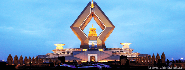
Famen Temple Cultural Scenic Area is located in Famen Town, 10 kilometers north of Fufeng County, Baoji City, Shaanxi Province. It is 110 kilometers east of Xi'an City and 90 kilometers west of Baoji .
Views: 255 Time 2018-12-12 -
Huaxi Qingyan Ancient Town Scenic Area
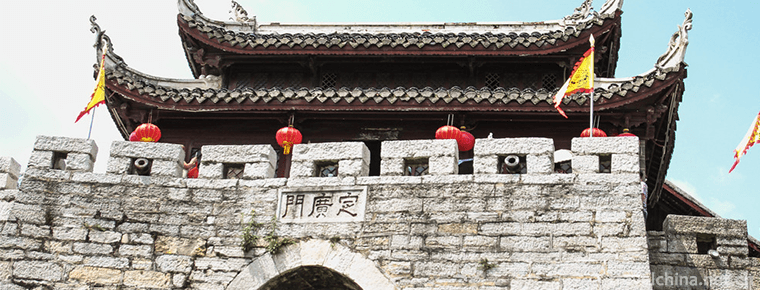
Qingyan Ancient Town, one of the four ancient towns in Guizhou, is located in the southern suburb of Guiyang City. It was built in Hongwu ten years (1378) of Ming Dynasty and was formerly a military f.
Views: 214 Time 2018-12-12 -
Linzhi Basongcuo Scenic Area
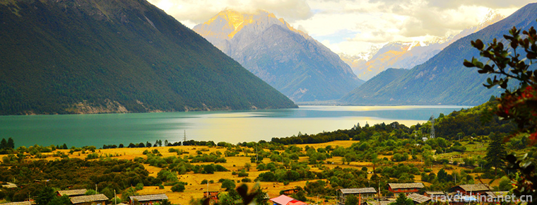
Basongtao, also known as Caogao Lake, means "green water" in Tibetan. It is about 18 kilometers long. Its surface area is about 27 square kilometers. .
Views: 157 Time 2018-12-12 -
Guangyou Temple Scenic Area
Guangyou Temple is located in Liaoyang City, Liaoning Province, with Baita in the West and moat in the east. It covers an area of 60,000 square meters. The central axis of the north and south is archw.
Views: 150 Time 2019-01-13 -
Korean Huajiali
The flower armor ceremony of the Korean nationality is one of the important rituals of the Korean nationality's birthday ceremony. Since ancient times, the Korean people have regarded respecting the e.
Views: 275 Time 2019-04-16 -
Tibetan Engraving and Printing Skills of Dege School of Printing
Tibetan engraving and printing skills of Dege Printing Institute, local traditional handicraft skills of Dege County, Sichuan Province, and one of the national intangible cultural heritages..
Views: 199 Time 2019-04-26 -
a kind of local opera popular in Shandong Province
Liuqiang, a local traditional drama in Jimo City, Shandong Province, is one of the national intangible cultural heritage..
Views: 243 Time 2019-05-14 -
Ningxia Xiaoqu
Ningxia Xiaoqu, a national intangible cultural heritage project, is a traditional rap art form with strong local characteristics..
Views: 220 Time 2019-06-08 -
Shijiazhuang Silk String
Shijiazhuang silk string is also known as string tune, string tune, Hexi tune, small drum tune, Luoluo tune, daughter tune and so on. It is a local traditional drama in Hebei Province and one of the n.
Views: 175 Time 2019-06-15


