Beijing Olympic Park
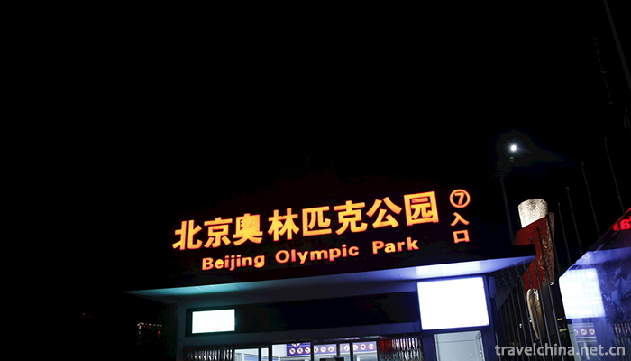
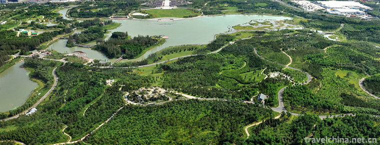
Beijing Olympic Park Located in Chaoyang District of Beijing, Beijing Olympic Park is located at the north end of the central axis of Beijing, north to the South Bank of Qinghe River, south to North Tucheng Road, east to Anli Road and Beichen East Road, West to Lincui Road and Beichen West Road. It covers an area of 11.59 square kilometers. It embodies the three concepts of "science and technology, green and humanities", and is a fusion. Office, business, hotel, culture, sports, conference, residential multi-functional new urban areas .
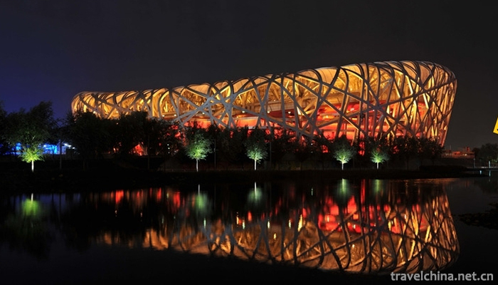
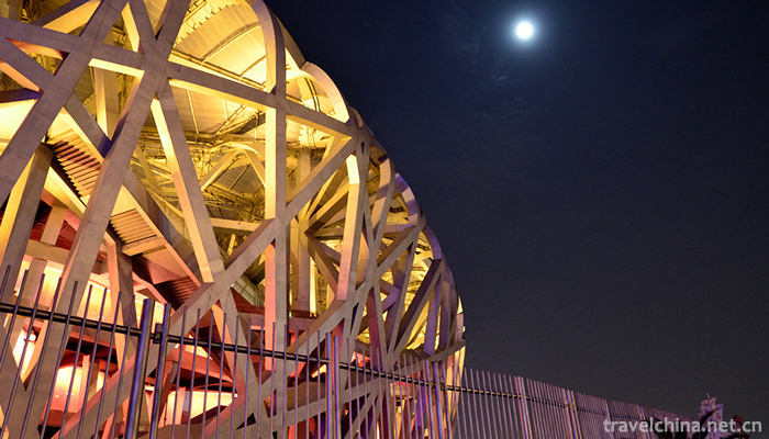
During the 2008 Olympic Games, there are 10 Olympic competition venues, such as Bird's Nest, Water Cube, National Stadium, National Convention Center Fencing Hall, Olympic Sports Center Stadium, Olympic Sports Center Stadium, Yingdong Swimming Hall, Olympic Park Archery Course, Olympic Park Tennis Course, Olympic Park Hockey Course and so on. In addition, there are seven non-competitive venues including the Olympic Main News Center (MPC), International Broadcasting Center (IBC), Olympic Reception Center and Olympic Village (Paralympic Village). They are comprehensive public activity centers including sports events, Convention and Exhibition centers, science and education culture, leisure shopping and other functions.
Beginning on December 4, 2017, the Beijing Olympic Park will try out the real-name system into the park.
Beijing Olympic Park is located in Chaoyang District, Beijing. It covers an area of 11.59 square kilometers from the north end of the central axis of Beijing City to the South Bank of Qinghe River, from the south to the North Tucheng Road, from the east to Anli Road and Beichen East Road, and from the west to Lincui Road and Beichen West Road.
Beijing Olympic Park is a temperate continental semi-humid monsoon climate. The four seasons are distinct and the precipitation is concentrated. In spring, it is dry and windy, with a large temperature difference between day and night; in summer, it is hot and rainy; in autumn, it is sunny and rainless, with suitable temperature and light; in winter, it is cold and dry, with more wind and less snow. The annual average temperature is 11.6 C, the average temperature in the coldest month is 4.6 C in January, the average temperature in the hottest month is 25.9 C in July, and the frost-free period is 192 days. The annual average precipitation is 581 mm (1971-2000), and the summer precipitation accounts for 75% of the whole year. Since 1998, the climate has become warmer and drier, with successive years of drought. The annual total sunshine radiation is 134.24 kcal and square centimeter, and the physiological radiation accounts for 49% of the total annual radiation. The total sunshine hours were 2841.4 hours in the whole year, the highest in May, 279.1 hours, followed by June, 277.3 hours.
Beijing Olympic Park is divided into three parts: 6.8 square kilometers of Olympic Forest Park in the north, 3.15 square kilometers in the middle, and 1.64 square kilometers in the south.
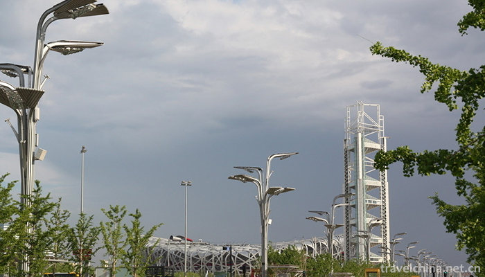
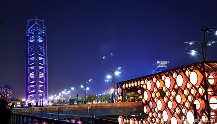
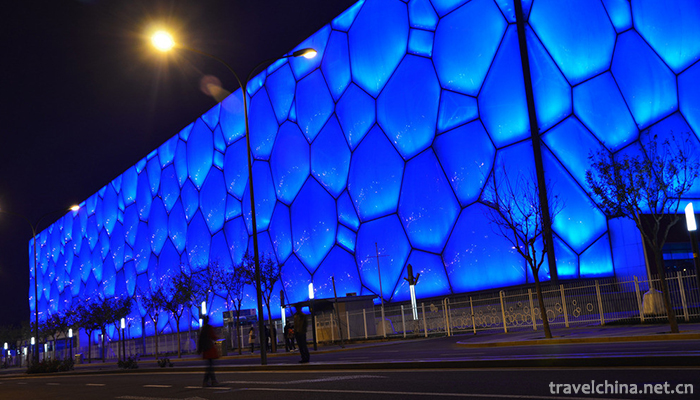
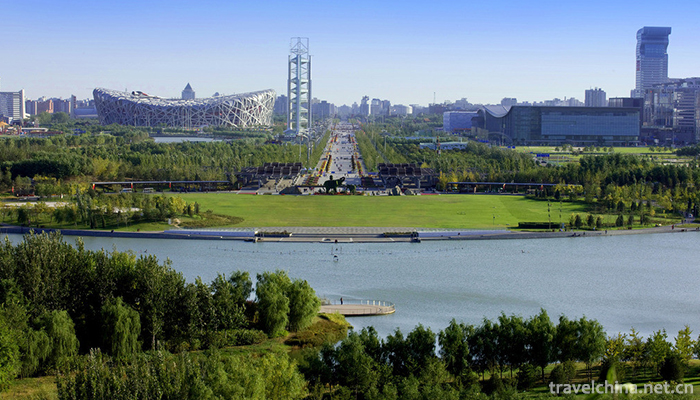
The built and reserved area was originally the National Olympic Sports Center, located in the south of the Middle North Fourth Ring Road and east of Beichen Road. All the venues are the venues of the 1990 Asian Games, including the Olympic Sports Center Stadium, the Olympic Sports Center Stadium and the Yingdong Swimming Hall. The reserved area in the South will be developed into a cultural business district. The central area is located in the central part of the Olympic Park, south of Keyi Road and north of North Fourth Ring Road. There are Olympic villages in the northwest corner and main venues in the south, including the National Stadium Bird's Nest, the National Swimming Center Water Cube, the National Stadium and the National Convention Center (fencing hall and international broadcasting center at the time of competition). In addition, the Olympic Multifunctional Broadcasting Tower (Linglong Tower), the Digital Beijing Building and the Main News Center are also located in this area. Located north of Keyi Road, the forest park uses ancient Chinese gardening techniques of digging lakes and piling mountains to construct "Aohai" and "Yangshan", which serve as the end point of the northward extension of Beijing's central axis. The park is divided into the north and the south by the Fifth Ring Road. The south is dominated by artificial landscapes, while the north is more closely related to natural wildlife. In the middle of the two districts, there is an "ecological corridor" across the Fifth Ring Road. To the west, there are Olympic Park Hockey Course, Olympic Park Archery Course and Olympic Park Tennis Court (now known as the "National Tennis Center"). In the other way, except for the Olympic Village, the regions are grouped according to the planning function and divided into five areas:
South of the North Road of the National Stadium is the "Sports Function Zone". The main sports facilities such as the National Stadium "Bird's Nest", "Water Cube" of the National Swimming Center, the National Stadium, the Olympic Sports Center Stadium, the Olympic Sports Center Stadium and the Yingdong Swimming Hall are located in this area. Between the North Road of the National Stadium and Keyi Road, the east side of the Dragon-shaped Water System is the "Cultural Science and Education Zone". The new Museum of Science and Technology of China, the planned New Museum of Art of China and the Chinese National Science Center are located in this area. Between the North Road of the National Stadium and the Keyi Road, the west side of the Dragon-shaped Water System is a "characteristic commercial area". The National Convention Center, Beichen Intercontinental Hotel, the sunken square commercial area and the watchtower under construction are located in this area . The "Forest Recreation Area" between Keyi Road and the Fifth Ring Road corresponds to the South District of Forest Park. To the north of the Fifth Ring Road is the "ecological health zone", which corresponds to the north of the forest park.
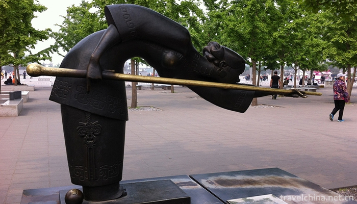
The Olympic Park has designed different landscapes around the central axis running through the whole park, and designed three axes - the central axis, the tree array on the west side and the dragon-shaped water system on the East side. Three different spaces (celebration square, sunken garden, leisure square) were set between the dragon-shaped water system and the central axis. Landscape design was also carried out on both sides of the river system. A landmark landscape tower, Linglong Tower, was set up in the park to provide studio and TV broadcasting services for the media during the competition. In addition, the existing historical relics in the park, including the Niangniang Temple in Beiding, are also included in the consideration of landscape design.
The central axis itself is designed as a landscape Avenue with a total area of 400,000 square meters. There are no buildings in the middle (called "virtual axis"), as opposed to the "solid axis" of buildings in the inner city. From Panda Circle Island in the south to Nanmen Square in the forest park in the north, the length of the road is 3.7 kilometers. Gray granite is used to imitate the imperial road in ancient Chinese architecture in the range of 21 to 60 meters in width. Even the intersection position with municipal roads remains unchanged, so as to maintain the integrity of the road.
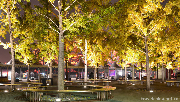
The tree array landscape on the west side has a bandwidth of 100 meters and a length of 2.4 kilometers. It runs from the south to the north of the Fourth Ring Road and from the north to Keyi Road. It is disconnected between the National Swimming Center and the east of the National Stadium to form a square. The trees in the tree array are 6 meters apart and arranged in matrix. The main tree species are native species in Beijing. Considering the cost, not all of them use Ginkgo biloba, but Pinus tabulaeformis, Populus tomentosa, Sophora japonica, Luan tree and other tree species are the main part of the array, and the array of Ginkgo biloba runs through both sides. Under the trees, from the hard permeable brick in the south to the regular hedge in the middle, eventually to the free greening in the north and gradually integrated into the forest.
The dragon-shaped water system on the east side is about 2.7 kilometers long and 20 to 125 meters wide. It covers a total area of 16.5 hectares. It rises to the south of the bird's nest and goes north to the Olympic Sea, a forest park. Although it is an artificial water system and the source of water is also the medium water produced in sewage treatment plants, the ecological balance is constructed artificially in order to achieve the effect of natural purification. Lakeside West Road on the West Bank is a non-motorized lane. A hydrophilic platform is set up beside the sunken garden, supplemented by steps, platforms, seats and other facilities. On the East coast, belt-shaped green space is set up. The vegetation planting on the west side is relatively short and sparse, and on the east side is called higher and denser. This will not only benefit the viewing of the central area from the east coast to the west, but also make the scenery of the central area look eastward with a sense of hierarchy.
In the three sections, the southern section of the Celebration Square is connected with the central axis square, providing space for the surrounding national stadium, swimming center and gymnasium for the gathering and distribution of large-scale events and outdoor activities during and after the competition. Water fountains are set up on both sides of the South and north. The sunken garden in the middle section is designed with the surrounding metro station and underground commercial facilities of more than 200,000 square meters. Seven courtyards are set up with the theme of "Open Forbidden City". They are arranged from south to North in turn. Different designs are adopted (courtyard 4 and 5 are separated by road and the same design is adopted), reflecting different Chinese traditional culture. Chemical elements. The leisure gardens in the northern section are naturally planted with vegetation . As a buffer zone for the transition from the central area to the forest, there is space in the middle of the vegetation for activities. The watchtower under construction is located in the leisure garden.
The underground circular corridor in the central area of Beijing Olympic Park is 9.9 kilometers long. The main road is 4.5 kilometers long. It is the longest urban tunnel in Asia. The direction of the circular corridor is roughly the same as that of the South Road, the East Lake Road, the North Road and the West Landscape Road in the central area of the Olympic Park. The east-west section is 13 meters from the ground and the North-South section is 7.8 meters from the ground. The main length of the passage is 4498.92 meters, with 1713.8 meters attached, the length of the outlet connected with the ground is 3719.06 meters, and the total length of the underground project is 9931.78 meters. The channel is 12.25 meters wide and has three lanes. The special feature of the passage is that it allows only one-way counterclockwise driving, and the speed limit is 30 kilometers per hour. 25 entrances and exits are connected to the surrounding road network. There is an average entrance and exit in the underground passage every two or three hundred meters, totaling 25. The dense entrances and exits are connected with nearly 10 municipal roads such as the North Fourth Ring Road, Chengfu Road, Datun Road, Keyi Road and Beichen Road around the central area of the Olympic Park. Among them, there are 6 entrances and 7 exits connected with ground roads, and 6 entrances and 6 exits connected with Datun Road Tunnel and Chengfu Road Tunnel. Underground corridors are also connected to underground garages in surrounding buildings, and 34 interfaces are reserved for buildings that are still on drawings and are not in operation. In addition, the underground passage is not simply a traffic passage, which has complete ancillary facilities, including five independent escape exits, a fire pump station, a monitoring center, exhaust fan room and supply fan room.

-
1.Mount Wuyi
Wuyi Mountain, Wuyi Mountain is located at the junction of Jiangxi and northwest Fujian Province. The southeastern foot of Wuyi Mountain has a total area of 999.75 square kilometers. It is a famous sc
Time 2018-10-28 -
2.qikongqigong
Qigong (qigong) is a traditional Chinese method of health care, health preservation and disease elimination. Ancient or "Dandao" is a kind of physical
Time 2018-11-13 -
3.Huaxia City Tourist Scenic Spot
Weihai Huaxia City Scenic Area belongs to Huaxia Cultural Tourism Group Co., Ltd. It is located in Weihai, a beautiful seaside resort city.
Time 2018-12-08 -
4.Ancient town of Tangqi
Tangqi Town, located in the northern part of Hangzhou City, borders Deqing County of Huzhou City, is about 20 kilometers away from the city centre and 13 kilometers away from Linping
Time 2019-02-13 -
5.Wuhan Haichang Polar Ocean World
Wuhan Haichang Polar Ocean Park is the first Ocean Park constructed by Haichang Group in central China. It is the fifth large-scale theme park covering the concept of polar and ocean
Time 2019-02-24 -
6.Xinyingtai Eco Spa Resort
Yingtai Eco-Hot Spring Resort (Eco-Park) is located on the parallel road of Tengzhou City, Shandong Province. It is a comprehensive service enterprise integrating eco-catering
Time 2019-02-26 -
7.Babao black rice porridge
Babao black rice porridge is a traditional snack and a food for Laba Festival. Purple and black, soft and waxy, sweet and fragrant. Developed from Babao glutinous rice porridge, it has the function of
Time 2019-03-25 -
8.Fengyang flower drum
Fengyang flower drum is also known as "flower drum", "beating flower drum", "flower drum gong", "double drum" and so on. Fengyang flower drum originated in Linh
Time 2019-04-29 -
9.Castawin Dance
Castawin Dance, a traditional dance in Heishui County, Sichuan Province, is one of the national intangible cultural heritage.
Time 2019-05-08 -
10.Five major tunes in southern Shandong
The five major tunes in southern Shandong, also known as Tan Ma Diao and Tan Ma Diao, are traditional folk song suites that are active in Tancheng County, Linyi City, Shandong Province, with Tan Town
Time 2019-05-15 -
11.Liao Song of the Zhuang Nationality
Liao Ge of Zhuang Nationality, folk literature of Pingguo County, Guangxi Zhuang Autonomous Region, is one of the national intangible cultural heritage.
Time 2019-08-16 -
12.Luocheng ancient town
Luocheng ancient town, known as "China's Noah Ark", is located in the northeast of Qianwei County, 60 kilometers away from Leshan City and 25 kilometers away from Qianwei county. There are seven ethnic groups, Han, Hui, Yi, man, Tibetan, Li and Miao.
Time 2020-10-15