Changbai Mountains
Changbai Mountains are the birthplace of the Yalu River, Songhua River and Tumen river. It is the birthplace of Chinese Manchu and the sacred mountain of Manchu culture. The word "Changbai" in the Changbai Mountains also has a beautiful moral, that is, to keep the appearance of the white head, represents people's yearning for loyalty and perfect love and praise. Changbai Mountain was first recorded in Chinese records more than 4,000 years ago. The Book of Mountains and Seas is called "Buxian Mountain", "Tutai Mountain" in the Northern Wei Dynasty, "Taibai Mountain" in the Tang Dynasty and "Changbai Mountain" in the Jin Dynasty.
The Changbai Mountains area covers a total area of 1964 square kilometers, the core area of 758 square kilometers, the highest peak of the Changbai Mountains is the General Peak in Korea, at an altitude of 2749 meters. The highest peak of Baiyun peak in China, 2691 meters above sea level, is the highest peak in Northeast China.
In a broad sense, Changbai Mountain refers to the main peak and main vein of Changbai Mountains, that is, the Changbai Mountains including the main peak of Changbai Mountains. Changbai Mountain in a broad sense refers to the eastern mountains of Liaoning, Jilin and Heilongjiang provinces in China, as well as the Russian Far East and the Korean Peninsula. The narrow sense of Changbai Mountain is located in the southeastern part of Baishan City, east longitude 127 degrees 40'- 128 degrees 16', north latitude 41 degrees 35'- 42 degrees 25', is the boundary between China and Korea.
The vertical vegetation landscape and volcanic landform landscape of Changbai Mountains are the first national natural heritage sites to be listed in the Preparatory List of China's National Natural Heritage and National Natural and Cultural Heritage. In 2010, it has been identified as the first batch of national nature reserves, the first batch of national 5A tourist attractions, the United Nations "man and biosphere" natural reserves and international A-level nature reserves. Changbai Mountain and its Tianchi, waterfalls, snow carvings, Lin Hai and so on, have been selected as the world's best record of "Guinness". Among them, there are ten famous mountains in China , five lakes in China, and ten forests in China . Changbai Mountain has outstanding universal value, outstanding natural quality and rich cultural connotation in many aspects such as ecology, biology, geology and history.
The Changbai Mountains is the highest mountain system on the eastern edge of the Eurasian continent, located in the southeastern part of Baishan City, near the border between China and Korea. The Changbai Mountains are the birthplaces of the Songhua River, Tumen River and Yalu River, of which the Songhua River originates from the Tianchi Lake in Changbai Mountain. In 1961, 2150 square kilometers of Changbai Mountain National Nature Reserve was established.
The Changbai Mountains, a famous mountain range in the eastern part of China and a famous historical and cultural mountain in China, strike northeast-southwest.
The broad sense of Changbai Mountain refers to the Changbai Mountains, China's Liaoning, Jilin, Heilongjiang Province, the east of the general name of the mountains, the narrow sense of Changbai Mountain refers to the Changbai Mountains near the main peak. Generally refers to the narrow sense of Changbai Mountain, that is, the main peak of the Changbai Mountains.
The broad sense of Changbai Mountain refers to the whole Changbai Mountains, that is, the eastern mountainous area of Northeast China. It is located between 38 [46'- 47], 121 [08'- 134], at the northern foot of the Wanda Mountains and the Laotieshan Mountains in the Qianshan Mountains. It is about 1300 kilometers long and about 400 kilometers wide in the East and west.
The narrow sense of Changbai Mountain refers to the main peak of the Changbai Mountains (127 degrees 40'- 128 degrees 16', 41 degrees 35'- 42 degrees 25')
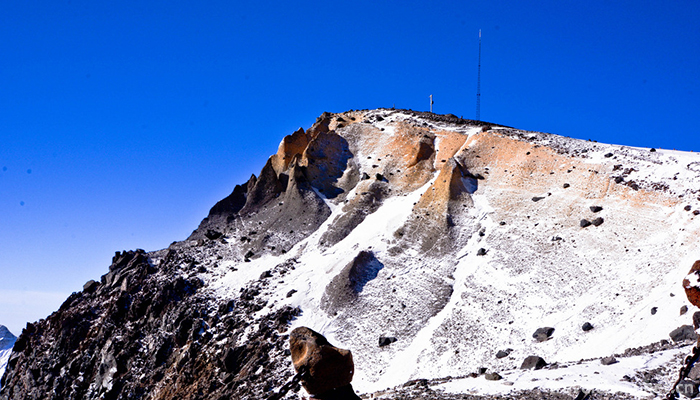
Changbai Mountain is a dormant volcano, a giant compound volcano. The outer lava plateau is slightly irregular and elliptical, with a long axis of about 140 km and a short axis of about 120 km. The primitive form of the early spraying has been destroyed, and the middle spraying constitutes the main body of the broad plateau. The late spraying is buried in the valley except Changbai Mountain. The total thickness of the three stage is about 500~600 meters, with a total area of 4500 square kilometers. Changbai Mountain was formed by the eruption of alkaline quartz trachyte in the late Pliocene. The Quaternary also has a large number of basic lava. According to records, Changbai Mountain erupted in 1597, 1668 and 1702. On the top of the mountain, the circular crater is the lake, which is the Tianchi Lake. Due to the unique geological structure of the Changbai Mountains, which is different from other mountain ranges, there are 16 peaks above 2500 meters above sea level and the main peak is 2750 meters above sea level. The highest peak in China is Bai Yunfeng, 2691 meters above sea level, the highest peak in China's Liaodong region.
Geological formation
About 4.5 billion years ago, when it was basically formed, there was a gap at a point in the eastern hemisphere, which is the entire Changbai Mountains region.
In about 25 million years, the Changbai Mountains region has undergone four volcanic eruptions. Basalt magma, starting from the upper mantle, has been upwelling along huge cracks in the earth's crust and spewing out of the earth's surface with tremendous energy. Magma with strong impact force, the original rock and magma in the early solidification of rock and ash, water vapor, etc. into the air, and then under the action of gravity and wind to fall around the crater or side, accumulated into a variety of volcanic landforms. Because of the low viscosity of basalt magma, the fast velocity of flow on the surface and the long distance of flow, a vast basalt platform has been formed. The base of Nangang Mountains, Changhongling Mountains, Yingbi Mountains and other Changbai Mountains are all basalt platforms formed in this period.
Before the eruption of the volcano, the surface of Changbai Mountains was relatively flat. About 2.77 million years ago, with Changbai Mountains as the center, great cracks appeared in the crust, which led to the earliest eruption of the volcano and formed the basalt platform. This is the present Changbai Mountains lava platform and Baimao lava platform. The thickness of the lava is 50-30. At that time, Changbai Mountain was situated at the top of shield platforms higher than other places because of lava vents. Later, volcanic activity was interrupted. A Second volcanic eruption occurred about 580,000 years ago and the viscous alkaline trachyte accumulated near the center of Changbai Mountain. The total thickness of the strata is more than 896.78 meters. About 440,000 years ago, the third volcanic eruption was still alkaline trachyte with strong viscosity, so it is difficult to move far away. It can only be newly accumulated in the original trachyte. The thickness of the strata reached 111 meters. The fourth volcanic eruption occurred 210,000 years ago, and the alkaline trachyte again. The deposit, 196 meters thick, was formed at the end of the eruption by sinking through the crater.
From about 600,000 to 15 million years ago (middle-late Pleistocene of Quaternary), Changbai Mountains experienced a period of crustal activity, geologically known as the Baitoushan Period. Four volcanic eruptions occurred during this period. The eruption pattern was characterized by a central type. Underground magma was upwelling along a tube-shaped passage formed at the intersection of deep faults, forming a volcanic cone landform on the surface.
The Changbai Mountains consist of multi northeastern southwest parallel fold fault mountains, basins and valleys. The west of Jilin Province is the Daheishan Mountains and the northward extension to the Daqingshan Mountains in Heilongjiang Province; the north of Zhonglie is the Zhangguangcai Mountains, and the territory of Jilin Province is divided into two branches: the Laoye Mountains in the west, the Hadaling Mountains in Jilin Province, the Weihuling Mountains in the East and the Longgang Mountains in the south, and the Wanda Mountains, the Laoye Mountains and the Changbai Mountains in the east. The area is about 280 thousand square kilometers.
Features
The southern part of the mountain belongs to the Sino Korean quasi platform, and the North belongs to the black belt. The Mesozoic Yanshan movement unified the direction of North South structure and formed the foundation of China to the mountain area. The Himalaya movement in the third movement also increased with massive flexure blocks, accompanied by massive basaltic eruption. Mountainous area is mainly composed of granite, basalt, gneiss and schist, and granite is the most widely distributed area. Basalt is mainly distributed in the Mudanjiang River Basin and around Changbai Mountain.
The Changbai Mountains are characterized by the distribution between the Equal Mountains and the broad Intermountain basins and valleys: the Mudanjiang Plain is located between the Wandashan, Laoyaoling and Zhangguangcai Mountains in the northern part of the Changbai Mountains; the Huifa River Valley is located between the Hadaling and Longgang Mountains in Jilin Province; the Yinma River and the Yitong River Valley plains are located between the Hadaling and Daheishan Mountains in Jilin Province. The main stream of Changbai Mountain is the Longgang Valley and the old river valley. The famous basins in the continuation of Changbai Mountain include Jilin, Dunhua, Yanji, Helong, Jiaohe, Hunchun and Huadian. At the same time, the lava plateau is vast, distributed in the southeast of the line from Fusong to Mishan, and the lava plateau is cut to form the lava landforms such as Fangshan and Guqiu. There are volcanic cones and crater lake and barrier lake on the lava plateau.
The mountain is mostly 500~1000 meters above sea level, only over a thousand kilometers. More than 2,000 meters are near Changbai Mountain, the highest peak of General Peak (on the Korean side) 2749.2 meters, one of the eastern mountains of the Asian continent. Zhongshan is mainly distributed in the east of Zhangguangcailing, Laoyaoling, Weihuling and Longgang Mountains, generally mountains are more than 1000 meters; low mountains and hills are the most widely distributed, including Wanda Mountains, Jilin Hada Mountains and Daheishan Mountains.
Volcano
In the geological history of hundreds of millions of years, the Changbai Mountain area has undergone changes. At first, it was swamped by the sea. Everywhere is a vast ocean, and then due to the rise of the earth's crust, the sea water withdraw, the surface re-emerged, in the sun, rain and climate change and other external forces, the surface of rock weathering and destruction, and finally Changbai Mountain also experienced volcanic eruptions and glacier sculpture, forming today's landscape. About 30 million years ago, in the Tertiary, the Earth entered a new period of activity, the geologic Himalayan orogeny. In about 25 million years, the Changbai Mountains region has undergone four volcanic eruptions. Basalt magma, starting from the upper mantle and continually upwelling along huge cracks in the earth's crust, spews out of the earth's surface with tremendous energy (geologically known as fissure volcanic eruptions). Magma with strong impact force, the original rock and magma in the early solidification of rock and ash, water vapor, etc. into the air, and then under the action of gravity and wind to fall around the crater or side, accumulated into a variety of volcanic landforms. Because of the low viscosity of basalt magma, the fast velocity of flow on the surface and the long distance of flow, a vast basalt platform has been formed. The base of Nangang Mountains, Changhongling Mountains, Yingbi Mountains and other Changbai Mountains are all basalt platforms formed in this period. During the period from 600,000 to 15 million years (Middle-Late Pleistocene of Quaternary), the Changbai Mountains experienced another period of crustal activity, which is called Changbai Mountain Period geologically. Four volcanic eruptions occurred during this period. The eruption pattern was characterized by a central type. Underground magma was upwelling along a tube-shaped passage formed at the intersection of deep faults, forming a volcanic cone landform on the surface.
The first volcanic eruption formed about 600,000 years ago, and the Second volcanic eruption lasted about 400,000 to 300,000 years. The Second volcanic eruption lasted for a long time, the rock layers were widely distributed and thick. The third volcanic eruption lasted about 200,000 to 100,000 years, and finally completed the Changbai Mountain Fire. Cone shape; the fourth eruption is about 80,000 years ago, mainly small-scale volcanic activity, and lava flows cover some parts of the cone. So far, the main peak of Changbai Mountain has been formed.
In the above 4 volcanic activities, each eruption of volcanic material increased the volcano by more than 200 meters. At the same time, some small volcanic craters were formed around the main fire pass. Since then, Changbai Mountain has entered a relatively stable period.
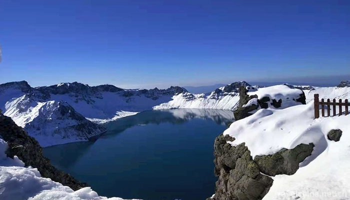
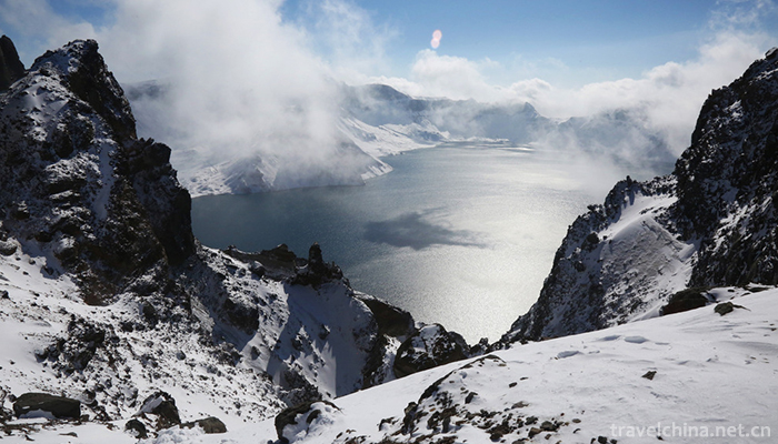
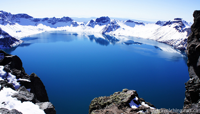
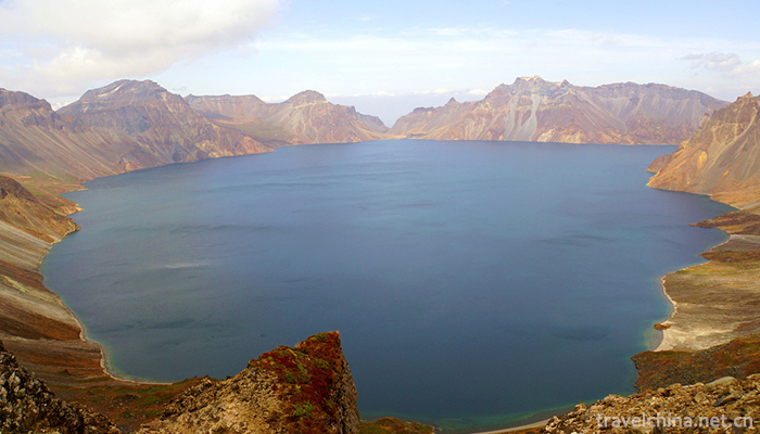
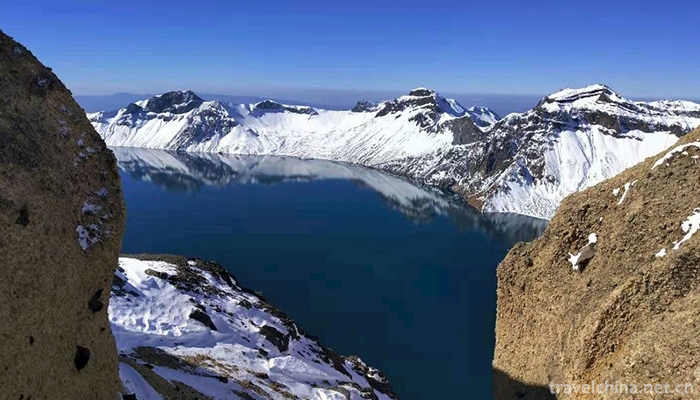
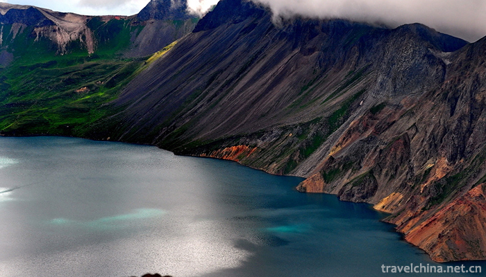
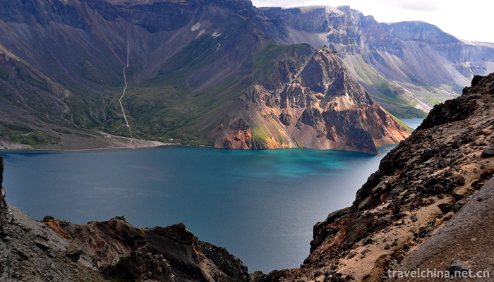
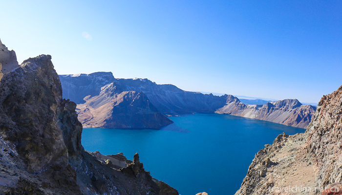
Before 11,000-15,000 (during the Quaternary Holocene), the volcano reactivated again, ejecting a large number of gray-yellowish pumice with a local thickness of 60 meters. The violent volcanic eruption collapsed the top of the cone and formed a funnel-shaped crater. As the eruption intensity and the temperature of the lava gradually decrease, the magma gradually condenses in the volcanic passage and blocks the passage. After the volcanism ceased, the crater receives the continuous recharge of atmospheric precipitation and groundwater, gradually impounding into lakes, forming crater lakes. This is the famous Tianchi Lake in Changbai Mountain.
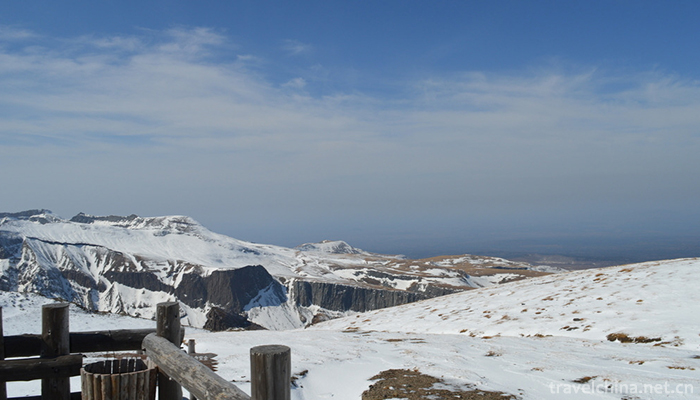
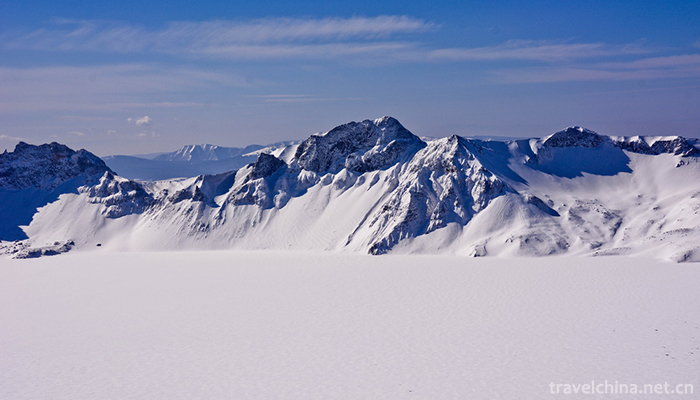
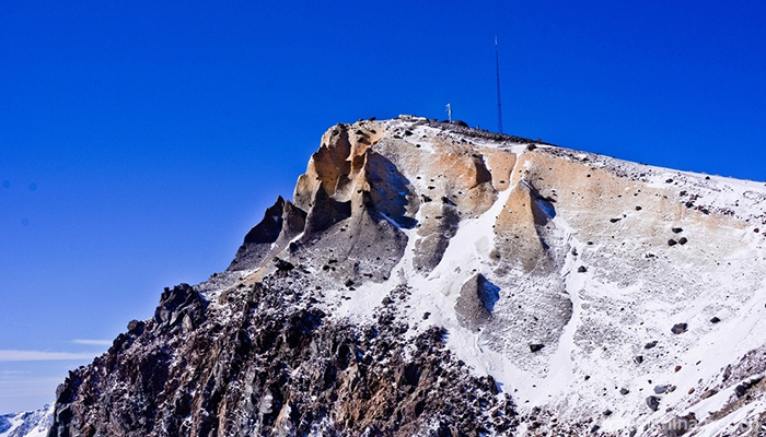
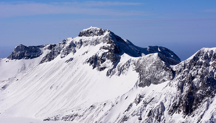
Around Changbai Mountain crater lake, there are 16 peaks which are more than 2500 meters high, and the other peaks are all above 2300 meters high. The summit is almost entirely composed of pozzolanic and yellowish pumice that erupted 12000 years ago. The mountains are steep and elegant, like lotus flowers and bamboo shoots, very spectacular, and the blue water of the Tianchi Lake, beautiful.
After the formation of the main body of Changbai Mountain, the area entered the intermittent period of volcanic eruption, and the crustal movement was relatively stable. However, in the long river of geological history (the earth formed at least 4.6 billion years ago, the crustal evolution of Changbai Mountains has also been about 3.2 billion years), the geological evolution history of Changbai Mountains is only a short moment. Changbaishan volcano eruption history is more brief, but has not died, but is in a dormant state, known as dormant volcano.
According to the documents of Korea and Japan, the eruption of Changbaishan volcano in 946 during the period of Koryo Dingzong was one of the largest eruptions in the world in the past two thousand years. The eruption index of Changbaishan volcano was 7 and the eruption was violent. At that time, it was recorded everywhere in Northeast Asia. The volcanic eruption produced about 83 to 117 cubic kilometres of ash and produced hot gas, forming a magma layer nearly 300 metres thick, with dust clouds 5 centimeters thick reaching Japan's Hokkaido and Kuril Islands, 1,046 kilometres away. The Emperor of Koryo heard thunder and let the prisoners go. The sound of Changbai Mountain eruption could be heard 450 kilometers south of Kaijing, the capital of Koryo. In addition, Kyoto in Japan, 1000 kilometers away from Changbai Mountain also heard a loud noise. 1100 km away, Nara, Japan has recorded 946 years of "white ash rain" (volcanic ash) incident.
Its vent radius of about 200 meters, volcanic ash straight into the sky, ash column as high as 25 km, umbrella-shaped top is 35 km high, ash column radius of 13 km. After the ash column collapsed, the volcanic debris flow spread for 60 kilometers, and the ash fell to 1,300 kilometers away in Japan, dropping 2-5 centimeters of ash. In the Sea of Japan, ash deposits were 16-10 centimeters thick, and sediments from the eruption were recently found 2,000 kilometers away. The eruption lasted for about 4-14.5 days, with a total of 76-116 cubic kilometers of ash and an estimated 20 million tons of sulphur. For seven years, the global temperature dropped by 1.2 degrees Celsius in the first three years of the outbreak, and the highest temperature drop in Eurasia exceeded 2.25 degrees Celsius.
According to historical records, Changbaishan volcano has experienced three small-scale intermittent activities since the twenty-fifth year of Wanli in the Ming Dynasty (1597).
The first eruption was in the twenty-five year of Ming Wanli (August 26, 1597). According to eyewitness records, there was "the sound of artillery, see the smoke Zhangtian, such as the number of boulders, folded out with smoke, flying over the mountains do not know where to go".
The second eruption occurred in the seventh year of Emperor Kangxi's reign in the Qing Dynasty (1668). A "rain ash" (volcanic ash) was deposited in the Changbai Mountains.
The third eruption was forty-one years in Qing Kangxi (April 14, 1702). According to historical records: "At noon, the world suddenly dark moth, sometimes red or yellow, with the smoke, smell full of room, if in the oven, people can not bear the heat. Four later disappeared, and to look at it, the rain and ashes everywhere, just like clamshell burners, "the same month, later, smoke clouds, suddenly from the northwest, dim, odorous dress. According to the "Changbai Mountains Jianggang Zhilue" records, there are "carbon cliffs" near Changbai Mountains, "a lot of charcoal out of the bottom of the cliff, hunters often think of cooking, local people because of its origin in the ground, so call it Shen charcoal,... After picking up a few pieces, the roast deer can be burned to the same extent as ordinary charcoal. But with two feet deep earth cliff, can produce charcoal, the big arch handle (two hands together, the author notes), the small one grip. Geologists have identified the charcoal as a result of the high-temperature molten material that baked and charred the trees during the volcanic eruption.
The Changbai Mountain volcano is in a dormant period. At an altitude of more than 2,000 meters, there are many hot springs constantly overflowing from the ground, which shows that the underground is still breeding tremendous energy. According to modern seismic observation, the crust of Changbai Mountain area is relatively stable. There is no sign of volcanic eruption.
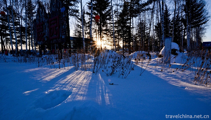
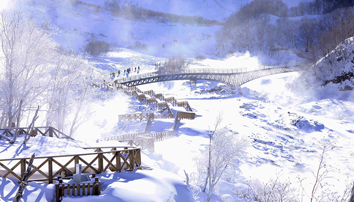
The main peak of Changbai Mountain, located in Baishan City, is a temperate continental mountain climate affected by monsoon. Besides the general mountain climate, it also has obvious vertical climate change. The general features are: long and bitter winter, short warm and cool summer, spring wind dry, foggy and cool autumn. The average annual temperature is between - 7 C and 3, the average temperature in July is less than 10, the coldest in January, the average monthly temperature is about - 20, the lowest temperature has appeared below zero 44. The sunshine duration is less than 2300 hours per year. The frost free period is about 100 days, and the peak is only about 60 days. The depth of snow is generally 50 centimeters, up to 70 centimeters in some places. The annual precipitation is between 700 and 1400 millimeters. From 6 to September, precipitation accounts for 60 to 70% of the annual precipitation. The main characteristics of Changbai Mountain's main peak climate are many clouds, large wind and low air pressure. Especially in summer, the winds and clouds are unpredictable and changeable. The number of gale days above 8 is 269 days, and the annual average wind speed is 11.7 M / s. In the year of rime for 165 days, the peak fog days were 265 days, with an average annual sunshine rate of only 100 days.
-
1.Yesanpo Scenic Area Laishui County Baoding
The Yesanpo Scenic Area of Laishui County, Baoding City, Hebei Province, is located in Laishui County, Baoding City. The Taihang Mountains and Yanshan Mountains
Time 2018-11-24 -
2.Mount Tianzhu Scenic Area
Tianzhu Mountain Scenic Spot, located in the west of Qianshan City, Anqing City, Anhui Province, is known as "the first mountain in the Yangtze River and Huaihe River" for its main peak
Time 2018-12-08 -
3.Longtan Park
Longtan Park is located opposite Longtan Beili District, Dongcheng District, Beijing (Chongwen District), and is currently a national 4A-level tourist park. Longtan Park
Time 2019-02-06 -
4.Dragon Pen Making Skills of White Shamao
The craftsmanship of the Dragon pen of Baishamao was originated by Chen Baisha, a famous calligrapher. It has a history of more than 500 years. Made of Maotao, a special product of Guifeng Mountain
Time 2019-04-03 -
5.Bian Embroidery
Bian embroidery, one of the traditional Chinese embroidery techniques, has a long history and is known as "national treasure". It is famous for its exquisite embroidery,
Time 2019-04-04 -
6.Construction Techniques of Tibetan Diaolou
Gabu Tibetan ancient building complex is located on the second terrace on the north-east Bank of Mako River, 3 kilometers northeast of Lighthouse Township, Banma County
Time 2019-04-05 -
7.Chinese character calligraphy
Chinese character calligraphy has been recognized by the world for its brilliant civilization of 5000 years and its incomparable rich written records. In this vast and profound history,
Time 2019-05-02 -
8.Jin men drum
Jinmen Fagu is a local traditional music and dance art in Tianjin, which appears in the form of performances of the Lao Hui or the Sacred Congregation. In June 2008,
Time 2019-05-07 -
9.Manchu Folk Stories
Liaoning is a region where Manchu people have formed, risen and grown up. It contains extensive and profound Manchu cultural relics and connotations. Manchu folktales originated from the Manchu people
Time 2019-05-18 -
10.Shulaibao
Shulaibao, a traditional Chinese folk art. Popular in northern China, the source is a means for beggars to ask for money. One or two people sing. Beat with a bamboo board or with a copper bell attache
Time 2019-06-15 -
11.Zhang Daqian
Zhang Daqian (Chang Dai-Chien, May 10, 1899 - April 2, 1983), formerly known as Zheng Quan, was renamed as yuan, Ji Yuan, Hao Da, alihao Dai Ju Shi, Xia Li Hong Kong people, Zhai Da Feng Tang. Sichuan
Time 2019-09-04 -
12.Stir fried pork with salted vegetables
Stewed pork with dried plum is a famous traditional flavor dish in Shaoxing, Zhejiang Province. The main raw materials are dried plum and streaky pork. Dried vegetables absorb meat fat to remove astri
Time 2020-03-18