Yulong Snow Mountain
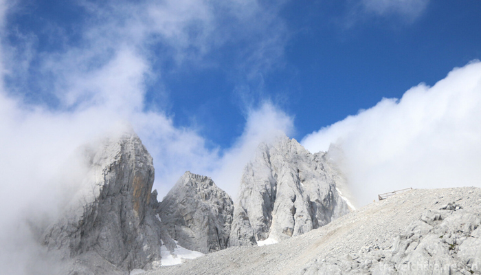
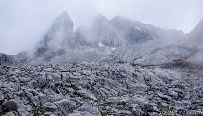
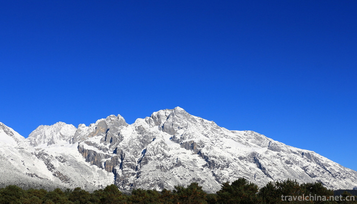
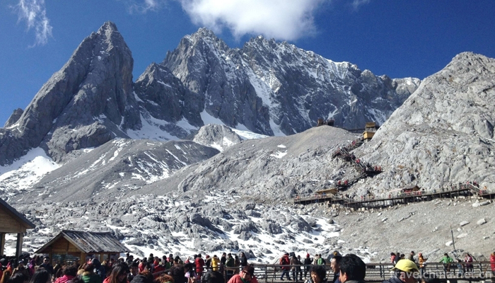
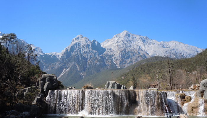
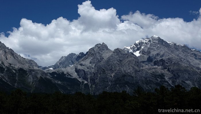
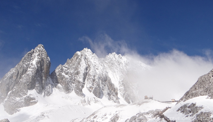
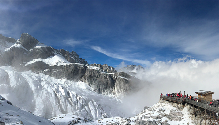
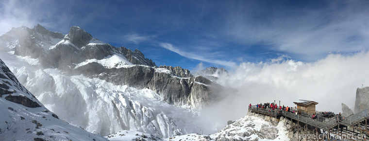
Yulong Snow Mountain is a snowy mountain group in Lijiang City, Yunnan Province. It is located between longitude 100 4 2 100 16 30 and latitude 27 3 2 and 27 18 57 in the north of Lijiang. It is about 15 km north of Lijiang. It is the nearest equatorial snow-covered mountain range in the Northern Hemisphere. It is adjacent to Snow Mountain in Jiangxi and Zhongdian, East and Mianshan Mountain in the north. Sanjiang mouth extends south to 27 degrees north latitude, such as fans, facing the ancient city. The 13 peaks of the mountain are arranged longitudinally from south to north. The steepest and highest elevation of the main peak fan is 5,596 meters. It is covered with snow all the year round. There are temperate oceanic glaciers near the equator in Eurasia.
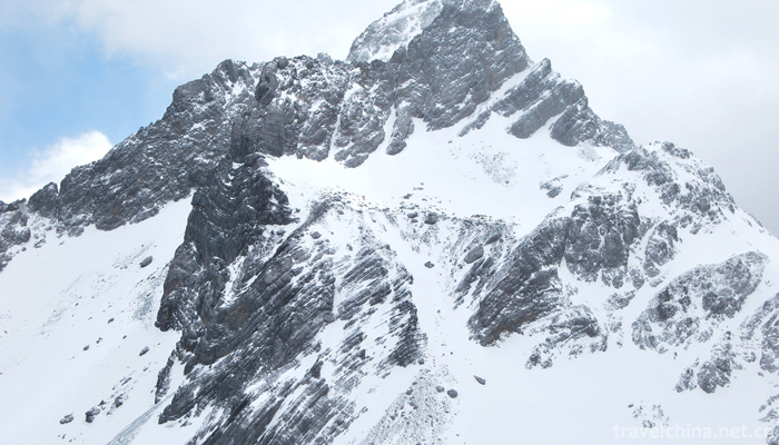
Jade Dragon Snow Mountain in the Naxi language is known as the "EU Lu", meaning the silver mountain rock. Its thirteen snow peaks are endless, just like a giant dragon flying over, so it is called "ERON". Because its lithology is mainly limestone and basalt, black and white, it is also known as "black and white snow mountain". It is the sacred mountain of Naxi people. It tells of the Naxi protector "more than 3" incarnation.
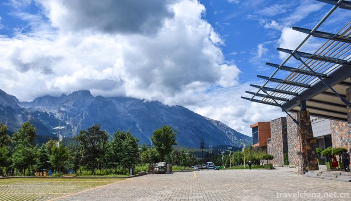
In 1984, Yunnan Jade Dragon Snow Mountain Provincial Nature Reserve was established. In 2001, Yulong Snow Mountain was rated as a 4A tourist attraction, and in May 2007 it became the first 5A tourist attraction in China.
Yulong Snow Mountain is located in Lijiang City, Yunnan Province, East Lijiang (Jiang) Ming (Yin) Highway, West Tiger Leaping Gorge Jianjian, South Yuhu, north to the Gap with Xiahu Tiger Leaping Gorge, east longitude 100 4 2 100 16 30, north latitude 27 3 2 27 18 57, snow line height between 4800 ~ 5000 meters.
Yulong Snow Mountain is located at the junction of Qinghai-Tibet and Yunnan-Guizhou plateaus, and at the junction of Hengduan Mountains in Northwest Yunnan and East Yunnan plateau. It is the main peak of Yunling Mountains in Hengduan Mountains and belongs to the young limestone fault-block fold mountain. Because of the uneven uplift of the earth's crust, the topography of high mountains, deep valleys and Intermountain basins is formed, which belongs to the cutting mountain canyon area of Hengduan Mountain System and the high mountain canyon sub-area of the northern section of Hengduan Mountain. Geological history is a part of the western Yunnan geosyncline, Paleozoic to Mesozoic has suffered several transgressions and regressions, Tertiary Himalayan orogeny continued to the Quaternary, Yulong Mountain was finally formed at this time.
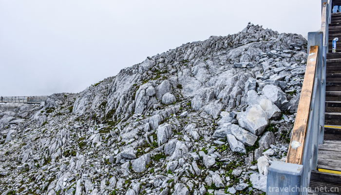
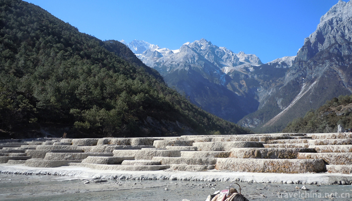
The strata of Jade Dragon Snow Mountain belong to the Yunnan Yunnan stratigraphic area. It is mainly carbonate rocks from Middle Devonian to Middle Carboniferous, followed by Permian basalt with limestone and Triassic limestone with sandy shale. There are Carboniferous, two fold basalt and interbedded limestone and other metamorphic rocks in the southern part of the mountain. The southern part of Baisha village is mainly composed of three fold strata. Permian basalt and basalt metamorphic green schist and greenstone are found in Hutiao gorge and Jinshajiang River Valley on the West slope. Ice deposits and ice water deposits in Quaternary glaciation can be seen at Dongpo and Piedmont.
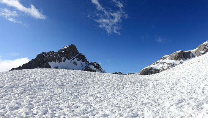
Yulong Snow Mountain is the southernmost modern monsoon-type glacier in Asia and Europe. According to the glacier catalogue published in 1994, Yulong Snow Mountain has 19 modern glaciers, 15 on the East slope, 4 on the West slope, with a total area of 11.6 square kilometers. Glacier No. 1 in Baishui is the largest glacier with a length of 2.7 kilometers and an area of 1.5 square meters. Kilometers, the balance line is about 4800 meters above sea level, and the terminal of the glacier is about 4200 meters above sea level.
Yulong Snow Mountain belongs to the south temperate plateau monsoon climate zone, with unique mountain monsoon characteristics. Because of the great difference between the valley and the top of the mountain and the vertical difference of climate, the mountain vertical climate zones from the valley to the top appear in turn, such as warm, warm, warm and cool north subtropical zone and cold and temperate zone.
Yulong Snow Mountain is located in the southeastern edge of the Qinghai-Tibet Plateau. It is located in the alternating control zone of westerly circulation, southwest monsoon and Southeast monsoon. The climate in this area has obvious difference between dry and wet seasons. Controlled by southwest monsoon and southeast monsoon, precipitation accounts for more than 90% of annual precipitation. From January to March of the following year, it was mainly controlled by the southern branch jet of the upper westerly circulation, with little precipitation and little glacier recharge. In April, the southern branch jet weakened, and the humid and hot southwest monsoon entered the area northward, and the wet season began.
According to the data of Lijiang Meteorological Station (17 km away from Yulong Snow Mountain), the annual precipitation in this area is 935 mm, and the rainy season is June to October. The precipitation in these five months is more than 90% of the annual precipitation, and the dry season is from November to May next year, with less precipitation. The annual average temperature is 12.79 degrees Celsius, the hottest month is July, the monthly mean temperature is 17.9 degrees Celsius, the most cold month is January, and the monthly mean temperature is 5.9 degrees. On the whole, the temperature changes are not dramatic, the seasons are mild and no summer.
Yulong Snow Mountain is affected by the southwest monsoon. The base level of Lijiang Basin (2415.9 meters above sea level) is a south temperate climate. The climate is characterized by dry and wet seasons, short summer temperature, sufficient sunshine in winter and spring, average annual sunshine hours of 2530 hours, and high radiation. Because of the great difference in height between the valley and the top of the mountain, the climate varies greatly vertically. For every 100 meters of elevation rise, the average temperature increases by 0.86 C. From the valley to the top of the mountain, the mountain vertical climatic zones of warmth, warmth and humidity, warmth and cooling, North subtropics and cold and temperature appear in turn.



-
2.Yanoda Tropical Rainforest Scenic Area
Yanuoda Tropical Rainforest Scenic Area is the only tropical rainforest located at 18 degrees north latitude in China. It is the concentration of five tropical rainforests in Hainan Island
Time 2018-12-12 -
3.Lao Leshan Tourist Scenic Spot
Lao Leshan is located in the south of Henan Province, 9 kilometers southwest of Zhumadian City and 8 kilometers west of Queshan County. National Highway 107
Time 2019-01-29 -
4.qingdao olympic sailing center
Qingdao Olympic Sailing Center Scenic Spot is located in Fushan Bay, Qingdao City, and Qingdao's landmark scenic spot - May 4th Square offshore, covering an area of about 45 hectares
Time 2019-02-07 -
5.Mount Tais Flower Age
Taishan Flower Age Scenic Area in Tai'an City, Shandong Province, is a large-scale agricultural tourism cultural project with five functions of entertainment, sightseeing, picking, catering
Time 2019-02-13 -
6.Xia Jin Old Yellow River Forest Park
The forest park scenic spot of the old Yellow River in Xiajin is the ruins of the old Yellow River. It is a national AAAA-level scenic spot. It is located in Xiajin County, Shandong Province
Time 2019-02-25 -
7.Weaving Techniques of Tibetan Bangdan and Kapa
The woolen apron commonly used by Tibetan people is called "Bangdian" in Tibetan, which has the functions of decoration and cold resistance. Jiedexiu Town, Gongga County, Shannan District, T
Time 2019-04-05 -
8.hubei drum
The original name of Hubei drum is "drum book", also known as "drum storytelling" and "drum Beijing tune", etc. It is a traditional rap art popular in Xiaogan
Time 2019-05-03 -
9.Shannan Menba Opera
Because Shannan Menba Opera directly adopts Tibetan scripts of Tibetan Opera, it is called "Menba Aguiram" by the people, that is, Menba Tibetan Opera. Legend has it that at the end of the 1
Time 2019-06-13 -
10.Needlework of Chinese embroidery
Category: random needling, straight needling, disc needling, trowel needling, grabbing needling, flat needling, scattered wrong needling, weaving embroidery, applying needling, auxiliary needling, variant embroidery
Time 2020-12-12 -
11.Deyang tertiary industry
In 2018, the annual real estate development investment in Deyang City was 14.98 billion yuan, an increase of 42.6% over the previous year. The construction area of commercial housing was 15.827 million square meters, an increase of 24.9%; the completed area
Time 2020-12-14 -
12.Geographical environment of Mianyang
Mianyang City is located in the northwest of Sichuan Basin, in the middle and upper reaches of Fujiang River, bordering Qingchuan county and Jiange County of Guangyuan City in the East, Shehong city and Daying County in Suining City in the south, Luojiang
Time 2020-12-14